
 Wild Rose Park
North Salt Lake
Overview
Wild Rose Park is an absolute gem in North Salt Lake. Tucked up into the foothills, this is a great family friendly park. The trailhead has toilets, picnic tables, and a playground for the kids, making it a good choice for a family picnic.
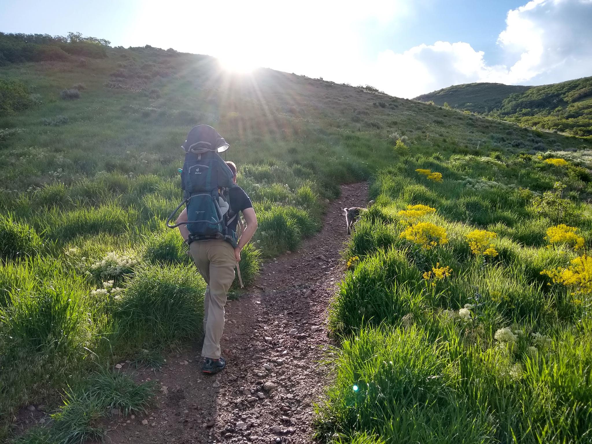
Those looking to get more energy out can hike one of several hikes that leave the picnic and playground areas, heading up into the foothills. There are a couple of loops that are about 2 miles each but can easily be done as an out and back if looking for something shorter. We have visited several times, and the trails are gentle enough our toddler enjoyed hiking them, and especially the post-hike playground session. The trails also satisfied Abby, the family dog, so a win for everyone!
Getting There
The trailhead is in North Salt Lake. Head south on Main Street in North Salt Lake to Eagle Ridge Drive. This turnoff is just a couple of blocks north of the large gravel pit.
Follow Eagle Ridge Drive, going straight at the first round-a-bout and continuing for 1.6 miles to Eaglepointe Drive. Go right on Eaglepointe Drive and follow it 0.3 miles to Sky Crest Lane. Turn left on Sky Crest Lane and follow it to its end at the trailhead.
Route Description
The trail begins at the back of the park and is well signed. After a short distance, it reaches a junction where different loop options are available. Each intersection has a map, making it easy to choose a loop or change plans mid-hike.
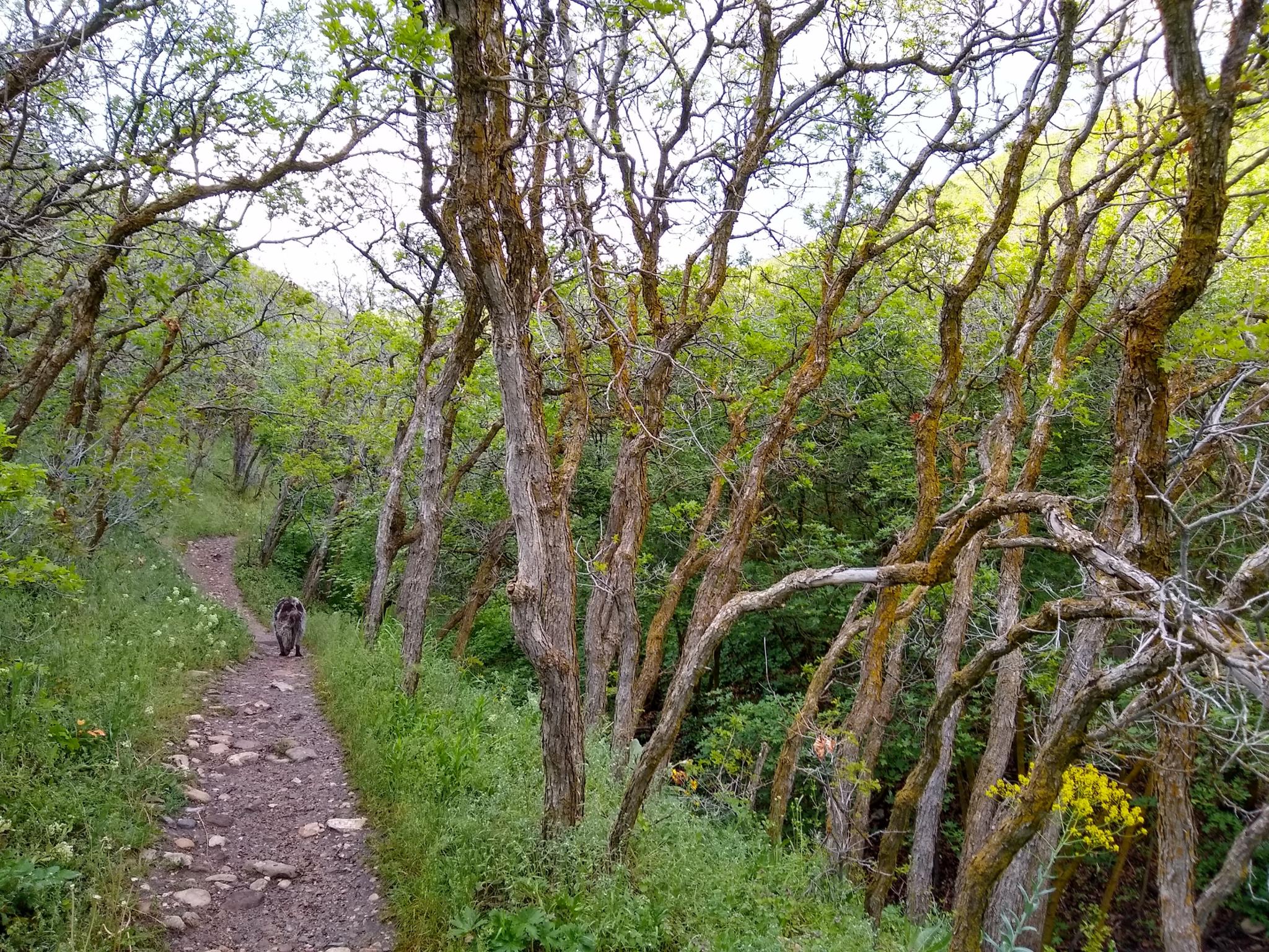
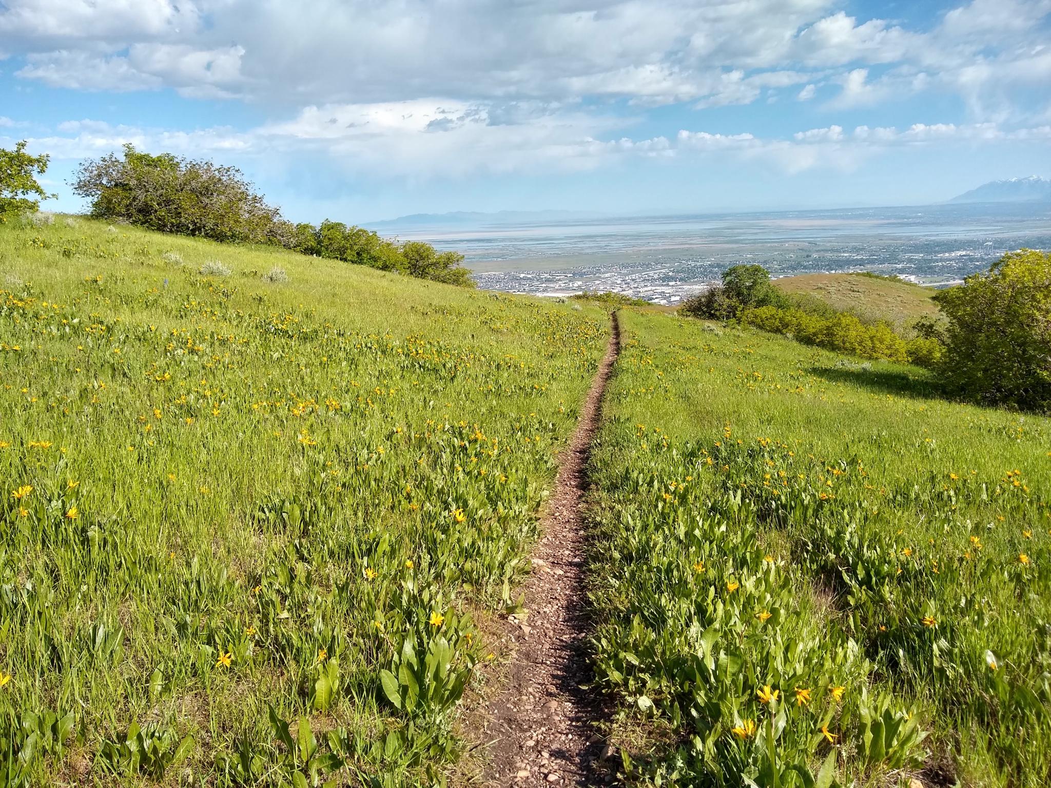
My favorite is the Wild Rose Loop to Sunset Point, particularly in a clockwise direction. The views are excellent, and the viewpoint a great place to take a break. Spring wildflowers on this section were particularly beautiful when we visited. About 2 miles in length, it had gradual enough switchbacks our two-year-old happily hiked to Sunset Point. The trail meanders through maple trees and open sections with stunning views, giving it good variety.
My second favorite is the viewpoint shown on the map to the southwest. There is a bench en route that provides excellent views to the west and of the Salt Lake Valley. This trail forms a much bigger loop, and motivated hikers can continue up the ridge to an overlook into City Creek, then loop back to Wild Rose Park. This section of trail has several steep sections. Our toddler needed to be carried up these, so a little less family-friendly than the shorter loops in the park proper.
The Chucker loop was not, just not one of my favorites. I enjoyed the views on the other two sections more.
Photos
Maps

12T 424420E 4519835N
40°49'34"N 111°53'47"W
12T 424554E 4519765N
40°49'32"N 111°53'41"W
12T 424645E 4519678N
40°49'29"N 111°53'37"W
12T 424717E 4519953N
40°49'38"N 111°53'34"W
12T 424584E 4519486N
40°49'23"N 111°53'40"W
12T 424725E 4519436N
40°49'21"N 111°53'34"W