 Hiking
Mt. Elliot
Hiking
Mt. Elliot
Book Cliffs
Overview
If you have drive between Price and I-70 on highway 6, you have likely noticed Mount Elliot. The peak is a high point on Book Cliffs near the ghost town of Woodside. The summit is particularly stunning at sunset. Though tantalizingly close to the highway, reaching the peak is a bit of an adventure.
A Bit of History: If you look at maps, a dirt road snakes its way up from the highway to within 1/2 mile or so of the summit of Mount Elliot. From near the summit, the road then snakes around a couple of canyons and heads east across Elliot Mesa to a dead end. This road was built in the 1970s for oil exploration. The well was unproductive, and the road quickly abandoned — the cost and effort required to make the road must have been immense.
Since the 1970s, the BLM has done some occasional maintenance, but the road became impassable to all but dirt bikes, ATVs, and hikers. For hikers, this meant at least a 16-mile hike, and often a 21-mile trek depending on how far your vehicle could make it, and the road condition.
I had wanted to do the hike for a long time, but it never seemed to bubble to the top of the list. Finally, in the winter of 2019, I had an opportunity to do the hike. It turns out in the summer of 2018 the BLM put substantial effort into maintaining the road to the rim (a short distance past Mount Elliot). By the end of summer 2018, it was possible to drive a full-size pickup to near Mount Elliot.
If you are visiting by ATV, the trail is now easily passable. If visiting in a vehicle, I would recommend a high clearance four-wheel drive. The road is currently good, but very prone to rockfall and washouts in a few places. It may or may not be passable for long depending on rock fall and further maintenance.
Getting There
The trailhead is just north of the now abandoned "town" of Woodside. If traveling from I-70, go north on UT-6 toward Price for about 22 miles to milepost 278.1. A dirt road goes off of UT-6 here heading east.
If coming from the north, this spot is about 31 miles south of Wellington. If you cross the Price River, you have gone too far.
Once off the highway, follow the dirt road east. It is, initially, a good road passable by most 2wd vehicles except when wet.
5.1 miles from UT-6 the BLM has placed large boulders next to the road and signed it as a dead end.
At 5.4 miles there is a large pullout area on the right. The road beyond this pullout is prone to washouts and rock fall.
7.7 miles - The road reaches the river. Check the crossing thoroughly before committing. It would be no fun to spend the day freeing a vehicle instead of visiting Mount Elliot. The rest of the hike is described below since many may be walking from here.

Route Description
To A Glimpse of Elliot
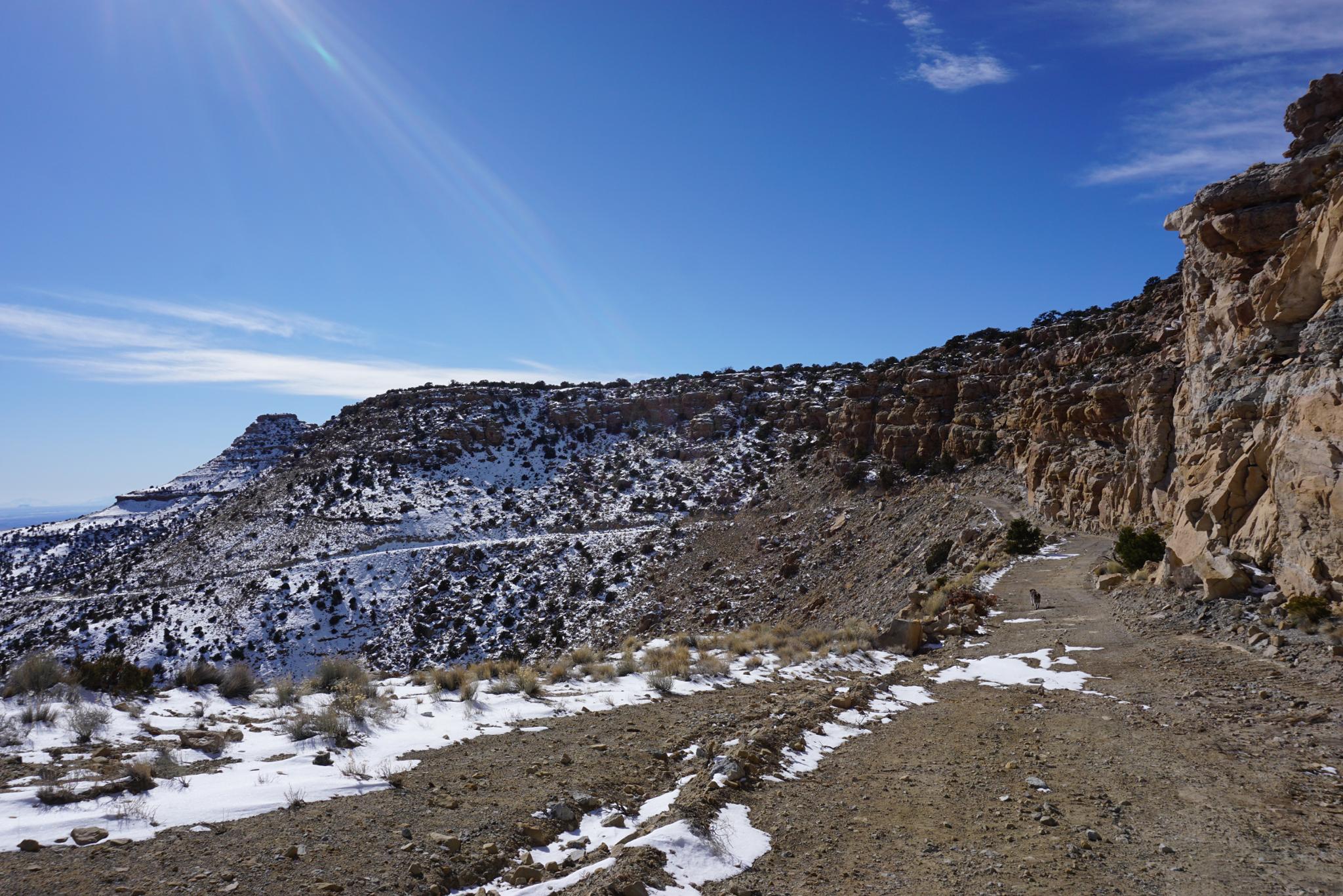
From the river crossing, the road quickly and steeply climbs a couple of switchbacks. The section of road through the steep switchbacks is one of the spots I marvel at the cost and effort to build. Wow!
Once up the first set of switchbacks, the road heads south for a mile or so before beginning a second steep set of switchbacks. About 3.5 miles from the river crossing, the road eases as it reaches the plateau. Mt Elliot makes its first appearance here, as the small peak in the distance to the southwest.
To Mt. Elliot
Once on the plateau, the steepness eases, and it is easy going, but deceptively long as the road meanders a bit en route to the rim. The road follows along the edge of Long Canyon in many spots, making for excellent views. Just over 2 miles from the top of the second switchbacks, the road descends a road cut and heads south. Once the saddle of Mt Elliot is above, leave the road. If driving, park where the road makes a hard left and starts heading east away from the peak.
Summit
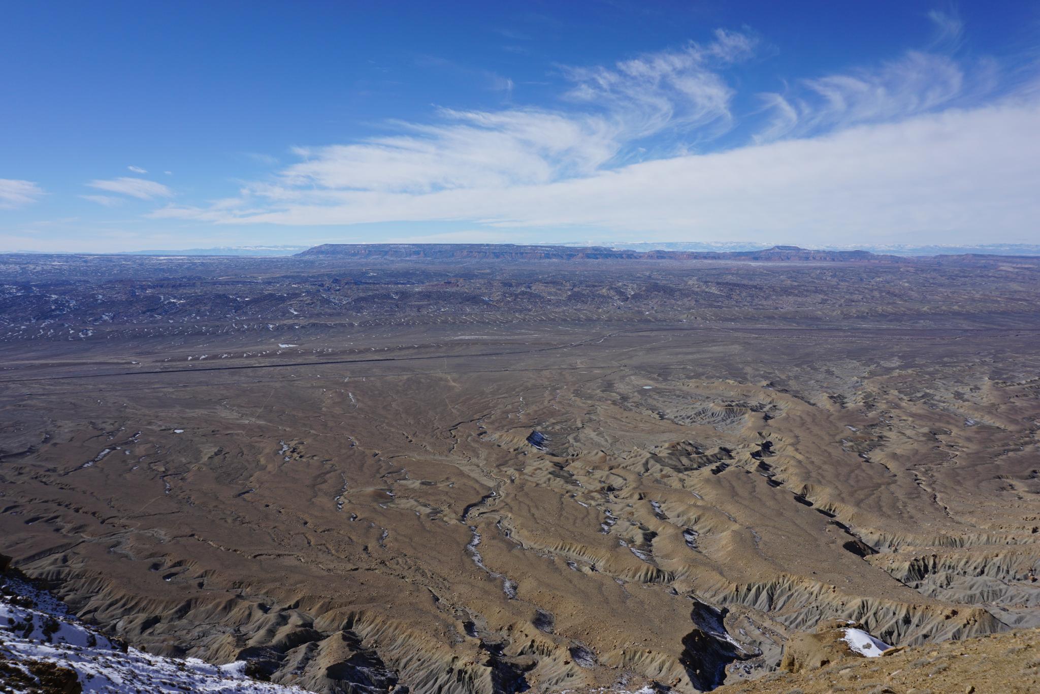
From the road, follow the path of least resistance to the saddle north of Mt. Elliot. The path from the road to the saddle is straightforward. The saddle gives the first big views west into the San Rafael Swell and Cedar Mountain areas.
From the saddle, hike south up to the summit proper using the path of least resistance. The easiest route requires a bit of route finding but is no harder than class 3 if you look around a bit. The last bit to the summit is through the notch that might require a touch of scrambling but is very straightforward.
The summit affords views of the San Rafael Swell to the west, the Henry Mountains far to the south, Robbers Roost Country to the south, and the La Sal Mountains to the southeast. An excellent viewpoint!
Return the same way.
Photos
Maps

")
")
12S 556550E 4346806N
39°16'08"N 110°20'40"W
12S 563501E 4344465N
39°14'50"N 110°15'51"W
12S 565998E 4343705N
39°14'25"N 110°14'07"W
12S 560859E 4337758N
39°11'13"N 110°17'43"W
12S 560438E 4337302N
39°10'58"N 110°18'01"W