Castle Lake | Western Uintas

Hiking Castle Lake - Western Uintas Hiking Castle Lake

Western Uintas

Overview

Sun Snow showers before noon, then snow showers and a chance of thunderstorms. Cloudy, with a high near 31. South southwest wind 9 to 14 mph. Chance of precipitation is 100%. New snow accumulation of 3 to 7 inches possible.
31° | 26°
Mon Snow showers before noon, then snow showers and a chance of thunderstorms. Cloudy, with a high near 30. Chance of precipitation is 100%. New snow accumulation of 2 to 4 inches possible.
30° | 20°
Tue Snow showers likely before noon, then snow showers likely and a slight chance of thunderstorms. Mostly cloudy, with a high near 33. New snow accumulation of less than half an inch possible.
33° | 18°
Wed A slight chance of snow showers before noon, then a chance of snow showers and a slight chance of thunderstorms. Partly sunny, with a high near 38. New snow accumulation of less than half an inch possible.
38° | 21°
Thu A chance of snow showers before noon, then a chance of snow showers and a slight chance of thunderstorms. Partly sunny, with a high near 38. New snow accumulation of less than half an inch possible.
38° | 23°
RATING: Easy Hike
MAPS: MIRROR LAKE, UT; HAYDEN PEAK, UT
SEASON: Summer, Fall
GEAR: Standard Hiking Gear
WATER: Filterable at the lake.
Sun Snow showers before noon, then snow showers and a chance of thunderstorms. Cloudy, with a high near 31. South southwest wind 9 to 14 mph. Chance of precipitation is 100%. New snow accumulation of 3 to 7 inches possible.
31° | 26°
Mon Snow showers before noon, then snow showers and a chance of thunderstorms. Cloudy, with a high near 30. Chance of precipitation is 100%. New snow accumulation of 2 to 4 inches possible.
30° | 20°
Tue Snow showers likely before noon, then snow showers likely and a slight chance of thunderstorms. Mostly cloudy, with a high near 33. New snow accumulation of less than half an inch possible.
33° | 18°
Wed A slight chance of snow showers before noon, then a chance of snow showers and a slight chance of thunderstorms. Partly sunny, with a high near 38. New snow accumulation of less than half an inch possible.
38° | 21°
Thu A chance of snow showers before noon, then a chance of snow showers and a slight chance of thunderstorms. Partly sunny, with a high near 38. New snow accumulation of less than half an inch possible.
38° | 23°
Bald Mountain (left) and Reids Peak (right)

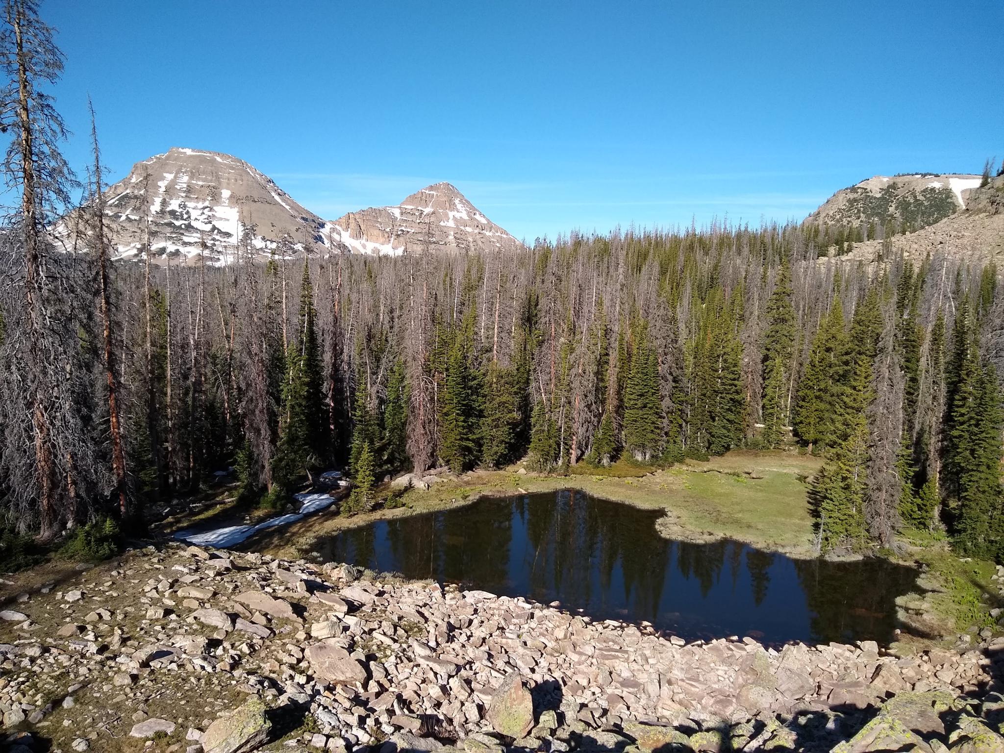
Tucked just off the Mirror Lake highway near Hayden Pass, Castle Lake sees less visitors than more of the lakes in the area. Typical of many high Uinta’s lakes, Castle Lake is a charming little lake tucked up against a rocky hillside. With views of Bald and Reid peaks on the hike to the lake, it is a pretty hike to do and a nice morning or evening stroll. There were signs of anglers on our trip, though the lake does not have the use trails and trampled feel of many in the area. It is a quiet place to get away from the campground crowds along Mirror Lake Highway.

Though a short hike, getting to Castle Lake requires good navigation skills. GPS and/or good map skills are needed. The hike, being off trail, is through dense trees at times and a bit rough going in spots. Our toddler resolutely made it most of the way but was carried through a few particularly rough sections.

Castle Lake
Castle Lake

Getting There

Note: The Mirror Lake highway that is used to access this hike is closed in the winter. The gate is typically open from Memorial Day until late October, but if planning this hike on the shoulder season, call the forest service to see if it is open. ((801) 466-6411)

The trailhead is off of the Mirror Lake Highway at milepost 34.1. This is 34.1 miles out of Kamas, UT on UT-150, just after Butterfly Lake Campground. You can park on the curve on the right, or there is a small parking are on the left on the shore of Butterfly Lake.

The pond before Castle Lake and cliffs behind Castle Lake

Route Description

From the trailhead, walk into the campground and follow the road to the end of the loop. At the western end of the loop, strike out between campsites.

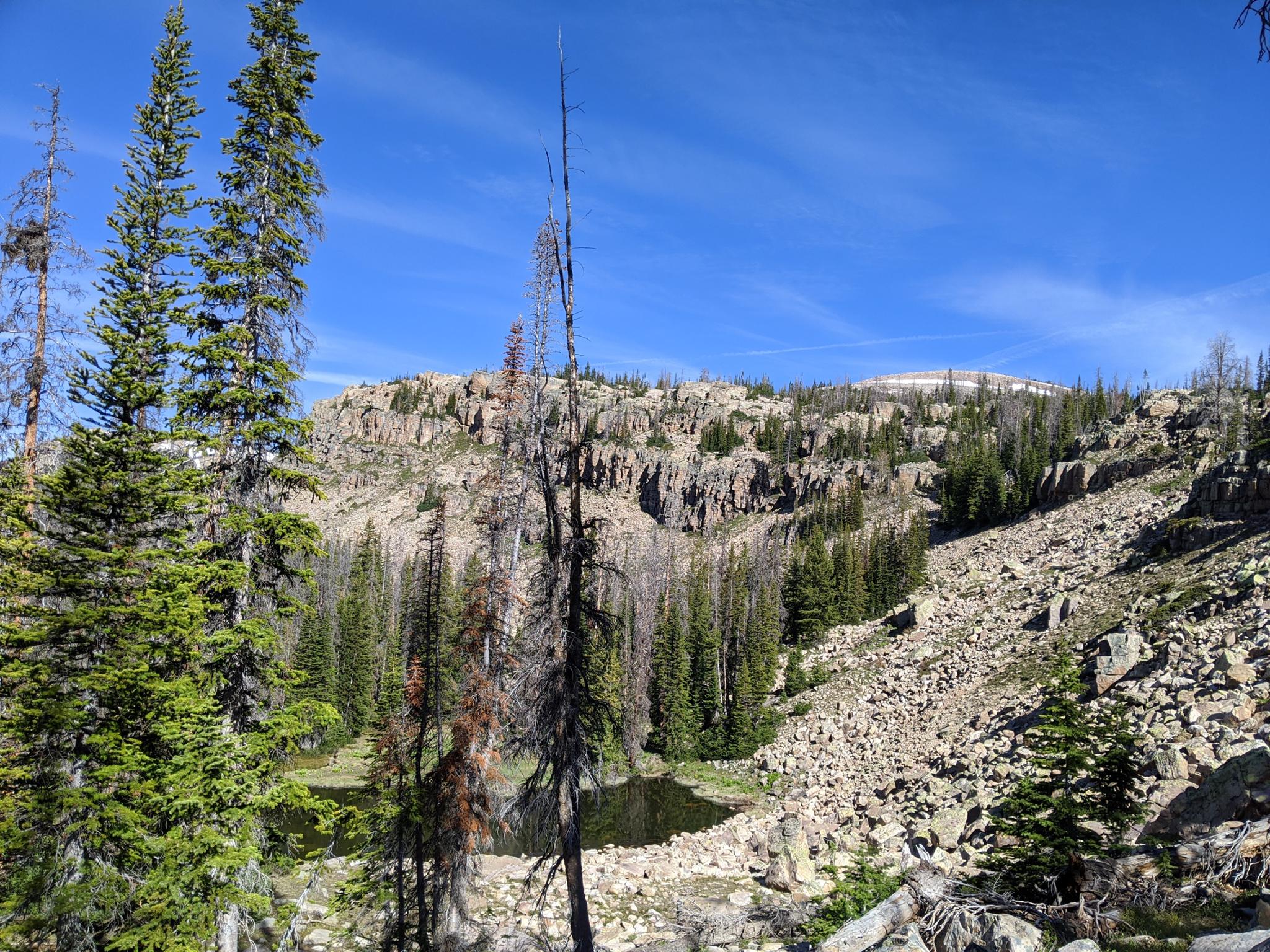
The easiest path seemed to be to head south and uphill for a few minutes to a more open ridge with views down onto the Mirror Lake Highway. From here, we found intermittent cairns, but they can be easy to miss. Head west for just a few minutes, then more north west. The lake is at the base of the mountain to the north, but if you head to the base too soon, it becomes a boulder field. There is a mix of intermittent use and game trails in the area.

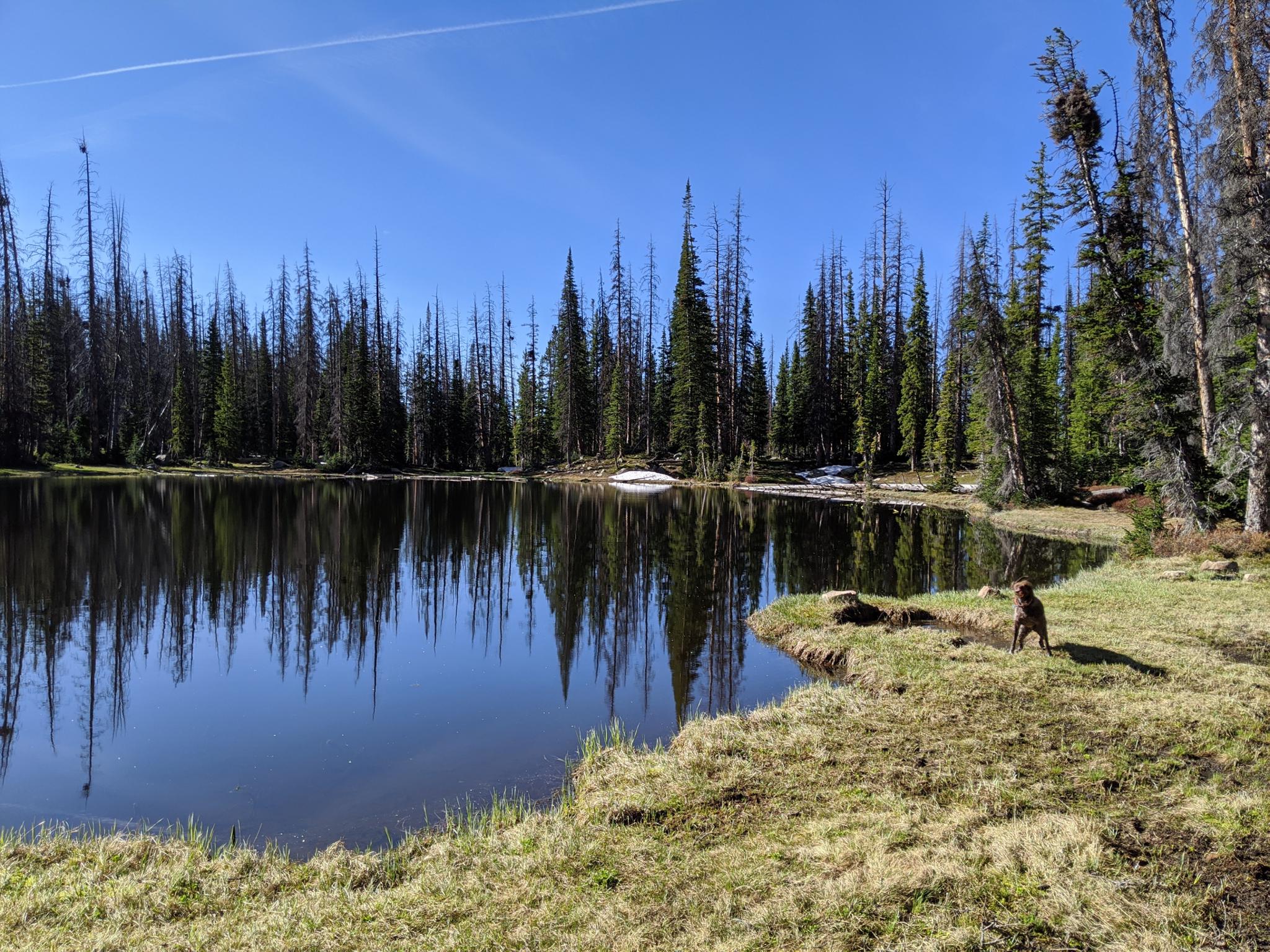
If your navigation skills were spot on, you will reach a small pond at the base of the mountain below a large boulder field. Continue due west a few more minutes to find Castle Lake hiding in the trees.


Photos

Maps

Route / 1.50 miles / Elevation Range 10,321 - 10,390 ft.
Printable Maps:

Trailhead Parking
12T 511334E 4507827N 40°43'17"N 110°51'57"W
Campground
12T 511236E 4507758N 40°43'14"N 110°52'01"W
Castle Lake
12T 510467E 4507966N 40°43'21"N 110°52'34"W

Comments