
 Cathedral Gorge
Panaca
Overview
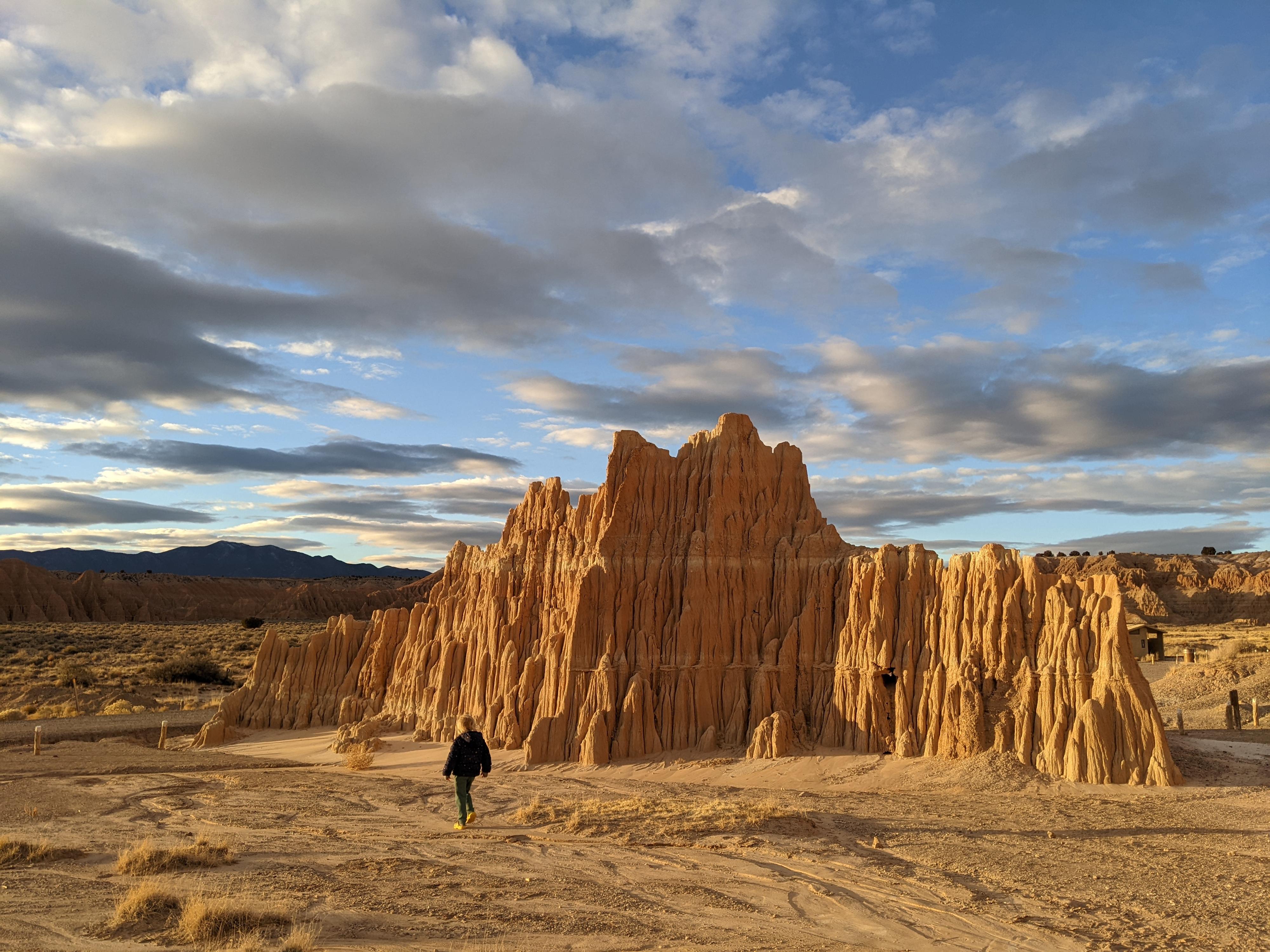
Cathedral Gorge State Park is a great place to stop for an hour to scramble through narrow slots or to spend a half day exploring the park trails. If you can, come near dawn or dusk when the eroded rock spires have deep shadows and are bathed in golden light. This state park is located in eastern Nevada outside the small town of Panaca. Despite being in a remote part of Lincoln County (population 5500) and over an hour from the nearest major town, the area is popular enough to attract some visitors, but definitely not crowded.
The park was named Cathedral Gulch in the 1890s by Mrs. Earl Godbe, a resident of a nearby mining camp, due to the resemblance of the rock formations to cathedrals. The canyons were later explored by two teenage boys from Panaca, Nephi and Elbert Edwards, who built ladders to allow them passage through the twisting slots. The Edwards family led the movement to protect the area, leading to its designation as one of Nevada’s first state parks in 1935.
Things to Do
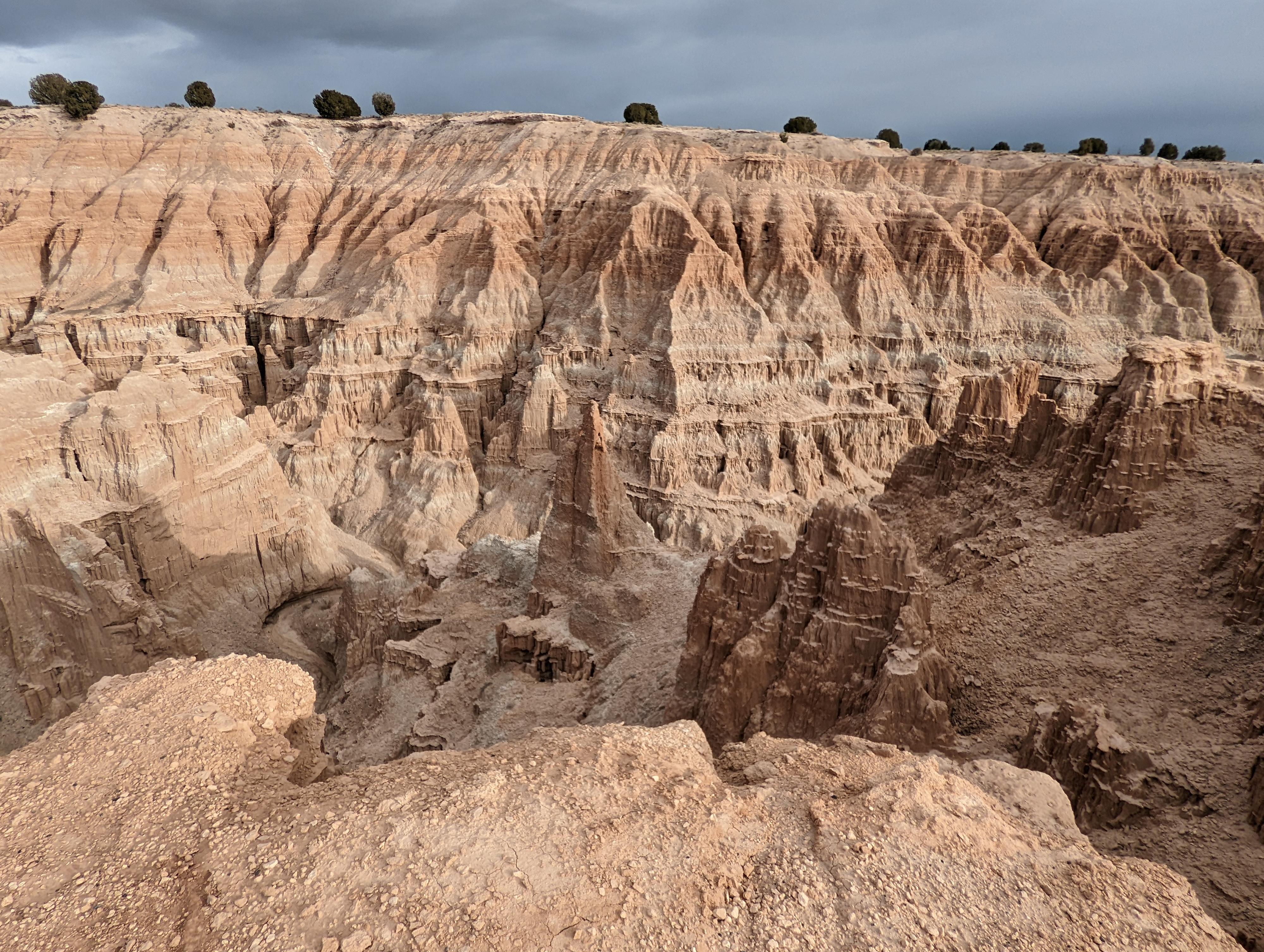
If you are limited on time, spend it all exploring Moon Caves, Canyon Caves, and Cathedral Caves on the east side of the park. These “caves” are actually slots in the rock formations that are sometimes so narrow that they appear to be cave-like. There are an endless number of passageways to check out, some leading to dead-ends and some becoming so narrow it doesn’t seem wise to continue. You may need to crawl, squeeze, and climb to get around. While in the area, you can view the water tower and picnic area built by the Civilian Conservation Corps in the 1930s.
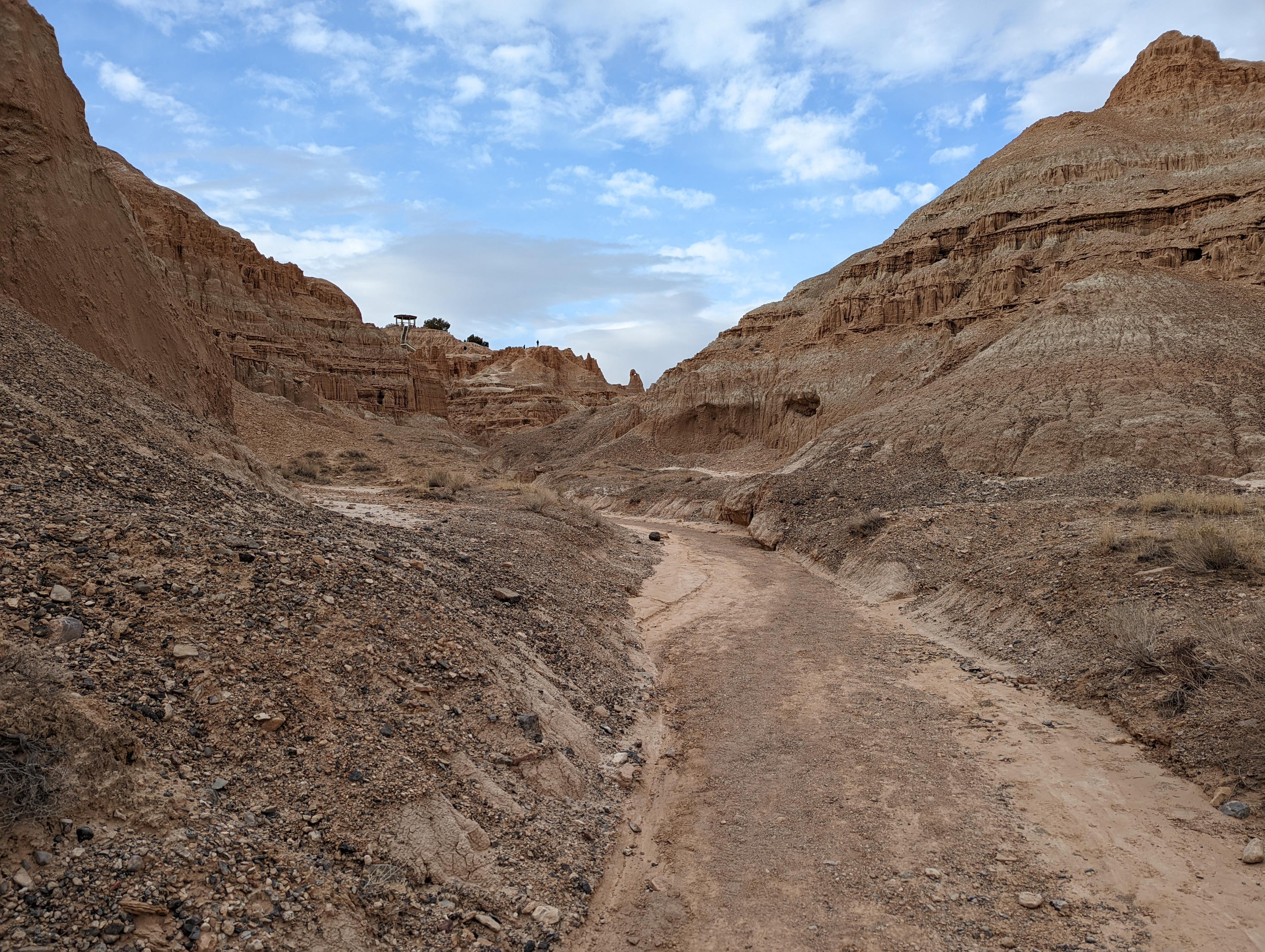
There are a number of options for hikes from the CCC picnic area. All the trails in the park that I explored were well-marked, with rocks along the trail edges, frequent markers, and clear signs at every junction. There is a short (0.5 miles) Nature Loop that leads to the campground and back with informational signs about the park’s plants and wildlife. There is a slightly longer out-and-back trail (0.8 mile round trip) that heads up a sandy canyon bottom and then up a series of stairs to the Miller Point overlook, offering fine views of the formations (there is also a parking area at the overlook). And you can enjoy the longer but still mellow Juniper Draw Loop that takes you to the park campground, up a wash and down along a series of formations before looping back to the CCC picnic area (3.25 miles round trip). If time allows, I would recommend doing the following: hike from the CCC picnic area on the Nature Loop trail to the Juniper Draw Loop, detour to Miller Point overlook when you reach that junction, return the way you came to complete the Juniper Draw Loop and then explore the slots around the parking area to your heart’s content.
Getting There
From the small town of Panaca Nevada, head west out of town to the junction of NV-319, the road through Panaca, and US-6, the road going north south.
Head north on US-6 for about a mile to the signed Cathedral Gorge State Park on the left. Follow the entrance road to a pay kiosk, then into the park,
Route Description
Nature Loop (about a half mile roundtrip)
You can start this trail at the campground, next to the CCC water tower, or from several pull-offs near the slots. If starting at the CCC water tower, walk north along the road until you reach the northernmost section of the loop. Follow this trail west to the campsite, then walk south along the road to the southern section of the loop. Head east until you return to where you started.
Miller Point (a little less than a mile rountrip)
From the picnic area, head north on a well-marked trail lined with boulders. After less than a quarter mile, you will reach the signed junction for the Juniper Draw Loop; stay to the right at the intersection. The trail will join a wash bottom around this point and soon enter an open canyon. Stay in the wash bottom until you reach a set of stairs on the left. From here, head up stairs and dirt ramps until you reach the overlook. Enjoy the views, read about the park’s history and geology at the interpretive signs and then return the way you came.
Juniper Loop Trail (about 3.25 miles round trip)
From the CCC Day Use Picnic Area, head west on either of the sections of the Nature Loop trail to head towards the campground. Once at the campground, find the bathrooms and head north on the well-signed trail located behind the bathrooms. You will be heading towards a sandy badlands formation that rises up out of the surroundings. Once you pass this feature, you will quickly come to the junction for the Hawk’s Ridge Trail heading off to the left; continue straight. The trail soon enters a wash bottom with a wall of badlands features to both the east and the west. Hike north in the wash until you reach the furthest north point of the trail, where the trail turns to loop down to the south. In this section of trail, you are often only a few hundred feet from the section of trail that parallels the one you are on.
The trail heads east at the end of the rock formation and then reaches a junction with the Miller Point Trail. Optionally take a detour onto the Miller Point Trail to view the overlook and then return to the junction. Head south to stay on Juniper Draw Trail and then you will soon reach the picnic area in the main park of the state park. If you haven’t already, take some time to explore the “caves” and slot canyons in this part of the park.
Photos
Maps

11S 727940E 4188978N
37°49'11"N 114°24'37"W
11S 727812E 4189082N
37°49'15"N 114°24'42"W
11S 727707E 4189233N
37°49'20"N 114°24'46"W
11S 727663E 4189341N
37°49'23"N 114°24'48"W
11S 727700E 4189382N
37°49'24"N 114°24'47"W
11S 727705E 4189693N
37°49'35"N 114°24'46"W
11S 727644E 4190056N
37°49'46"N 114°24'48"W
11S 727365E 4190586N
37°50'04"N 114°24'59"W
11S 727021E 4189645N
37°49'34"N 114°25'14"W