Rainbow Vista Trail |

Valley of Fire

Hiking Rainbow Vista Trail - Valley of Fire Hiking Rainbow Vista Trail

Valley of Fire

Overview

RATING: Easy hike
MAPS: VALLEY OF FIRE WEST, NV

Wed

Sunny. High near 87, with temperatures falling to around 85 in the afternoon. South wind 6 to 17 mph, with gusts as high as 25 mph.

87 | 62

Thu

Sunny, with a high near 82. South southwest wind 8 to 14 mph, with gusts as high as 20 mph.

82 | 58

Fri

A chance of showers and thunderstorms after 11am. Mostly sunny, with a high near 75. Chance of precipitation is 40%.

75 | 58

Sat

Sunny, with a high near 78.

78 | 53

Sun

Sunny, with a high near 83.

83 | 56

View Full Weather Details
SEASON: Any, though summers can be hot.
GEAR: Standard Hiking Gear
WATER: None.

Wed

Sunny. High near 87, with temperatures falling to around 85 in the afternoon. South wind 6 to 17 mph, with gusts as high as 25 mph.

87 | 62

Thu

Sunny, with a high near 82. South southwest wind 8 to 14 mph, with gusts as high as 20 mph.

82 | 58

Fri

A chance of showers and thunderstorms after 11am. Mostly sunny, with a high near 75. Chance of precipitation is 40%.

75 | 58

Sat

Sunny, with a high near 78.

78 | 53

Sun

Sunny, with a high near 83.

83 | 56

View Full Weather Details
Ruby taking in the overlook

Ruby taking in the overlook

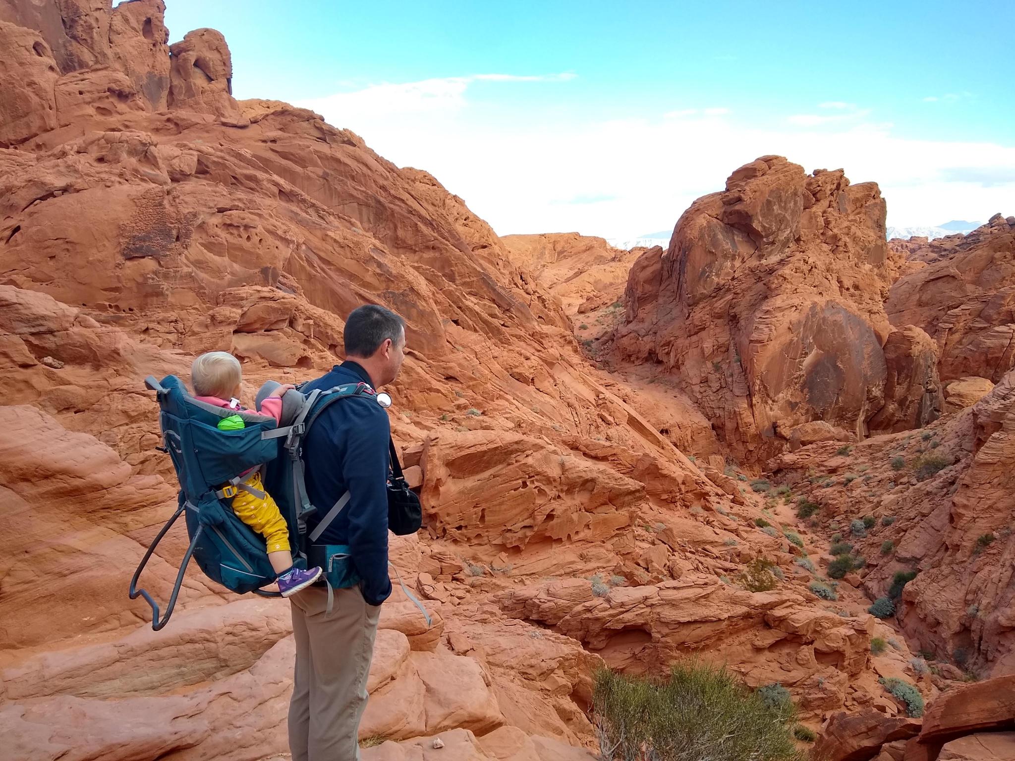
Rainbow Vista hike is an excellent family-friendly hike with beautiful views. The standard loop goes to an overlook of Fire Canyon, then circles back taking in another view of Fire Canyon before crossing an open area back to the trailhead. The hike gets its name from the incredible colors of the rock seen along the trail. It is a popular trail, and for a good reason!

Note: This hike can be done any time of year, but can be brutally hot in the summer. If visiting in the summer, I think an evening hike would provide excellent lighting for photos and cooler temperatures.
Heading to the viewpoint.

Heading to the viewpoint.

Getting There

Reach the park visitor center by taking exit 93 from I-15 if coming from the east ,or exit 75 if coming from the west (Las Vegas). From the highway, the route to the park is well signed. There is a fee to enter the park ($10 as of 2018 for day use).

From the Visitor Center, go north on the Mouse's Tank Rd/White Domes Rd for 1.7 miles to a signed parking area on the right that is the trailhead.

Fake(?) rock art. Interesting though, at the trailhead.

Fake(?) rock art. Interesting though, at the trailhead.

Route

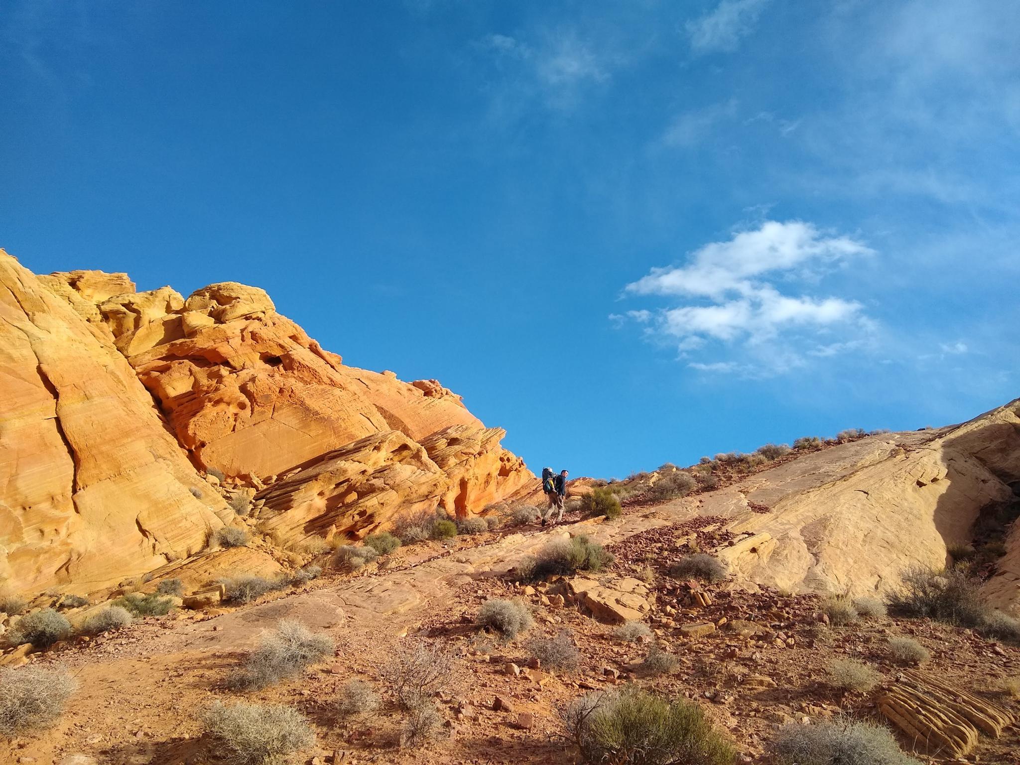
From the trailhead, follow the well-worn trail as it heads west. It braids as it crosses the open area, generally stay on the most used path on the right. After just a few minutes, the out-and-back junction for the Fire Canyon Overlook is reached. The Fire Canyon Overlook is a nice side trip and recommended. The side trail ends at a dryfall overlooking Fire Canyon below. Return the back to the junction when complete.

The trail loops back on the north side of the open area. Be sure to follow the social trail up the slickrock near the Fire Canyon Junction to a viewpoint.


Maps

Route / 1.26 miles / Elevation Range 2,025 - 2,173 ft.
Printable Maps:
Trailhead

11S 722672mE 4036824mN

N36° 27' 03" W114° 30' 55"

Fire Overlook

11S 723299mE 4036384mN

N36° 26' 48" W114° 30' 31"

Viewpoint

11S 723015mE 4036742mN

N36° 27' 00" W114° 30' 42"

Comments

Want to make a comment? Login and let yourself be heard.