Slickrock Bench Trail | Torrey

Hiking Slickrock Bench Trail - Torrey Hiking Slickrock Bench Trail

Torrey

Overview

RATING: Easy hiking
MAPS: Grover, UT;

Sat

A chance of showers and thunderstorms after noon. Mostly sunny. High near 82, with temperatures falling to around 78 in the afternoon. West northwest wind around 6 mph. Chance of precipitation is 30%.

82 | 57

Sun

A slight chance of showers and thunderstorms after noon. Mostly sunny, with a high near 83. West southwest wind 3 to 7 mph. Chance of precipitation is 20%.

83 | 59

Mon

A slight chance of showers and thunderstorms after noon. Mostly sunny, with a high near 81.

81 | 59

Tue

A slight chance of showers and thunderstorms after noon. Mostly sunny, with a high near 82.

82 | 57

Wed

A slight chance of showers and thunderstorms after noon. Mostly sunny, with a high near 83.

83 | 57

View Full Weather Details
SEASON: Spring, Fall, Winter if no snow
GEAR: Standard Hiking Gear
WATER: None.

Sat

A chance of showers and thunderstorms after noon. Mostly sunny. High near 82, with temperatures falling to around 78 in the afternoon. West northwest wind around 6 mph. Chance of precipitation is 30%.

82 | 57

Sun

A slight chance of showers and thunderstorms after noon. Mostly sunny, with a high near 83. West southwest wind 3 to 7 mph. Chance of precipitation is 20%.

83 | 59

Mon

A slight chance of showers and thunderstorms after noon. Mostly sunny, with a high near 81.

81 | 59

Tue

A slight chance of showers and thunderstorms after noon. Mostly sunny, with a high near 82.

82 | 57

Wed

A slight chance of showers and thunderstorms after noon. Mostly sunny, with a high near 83.

83 | 57

View Full Weather Details
Slickrock at the turn around.

Slickrock at the turn around.

It is a rare day that I recommend a hike that is along an ATV trail. Slickrock Bench Trail, near Capitol Reef, is a hike I will make an exception for. The hike is fairly unremarkable, but the destination is pretty, and I think well worth the hike. Even though this is an ATV trail, is it a rough one, and didn't seem particularly well traveled. If hiking in the off season, you are likely to have it to yourself. We visited on a late fall Saturday and saw no signs of recent travel and didn't see anyone on our trip. The end of the hike makes a great lunch spot.

Note: This hike is outside of the National Park, so dogs are allowed. There is no water on the hike, however, so bring all that will be needed.
Basalt and Sandstone, what a combo.

Basalt and Sandstone, what a combo.

Getting There

From the east side of Torrey, head south on highway 12, toward Boulder/Escalante. Follow highway 12 for 7.1 miles. Just past the small town of Grover, the Miners Mountain Road takes off on the left and is signed.
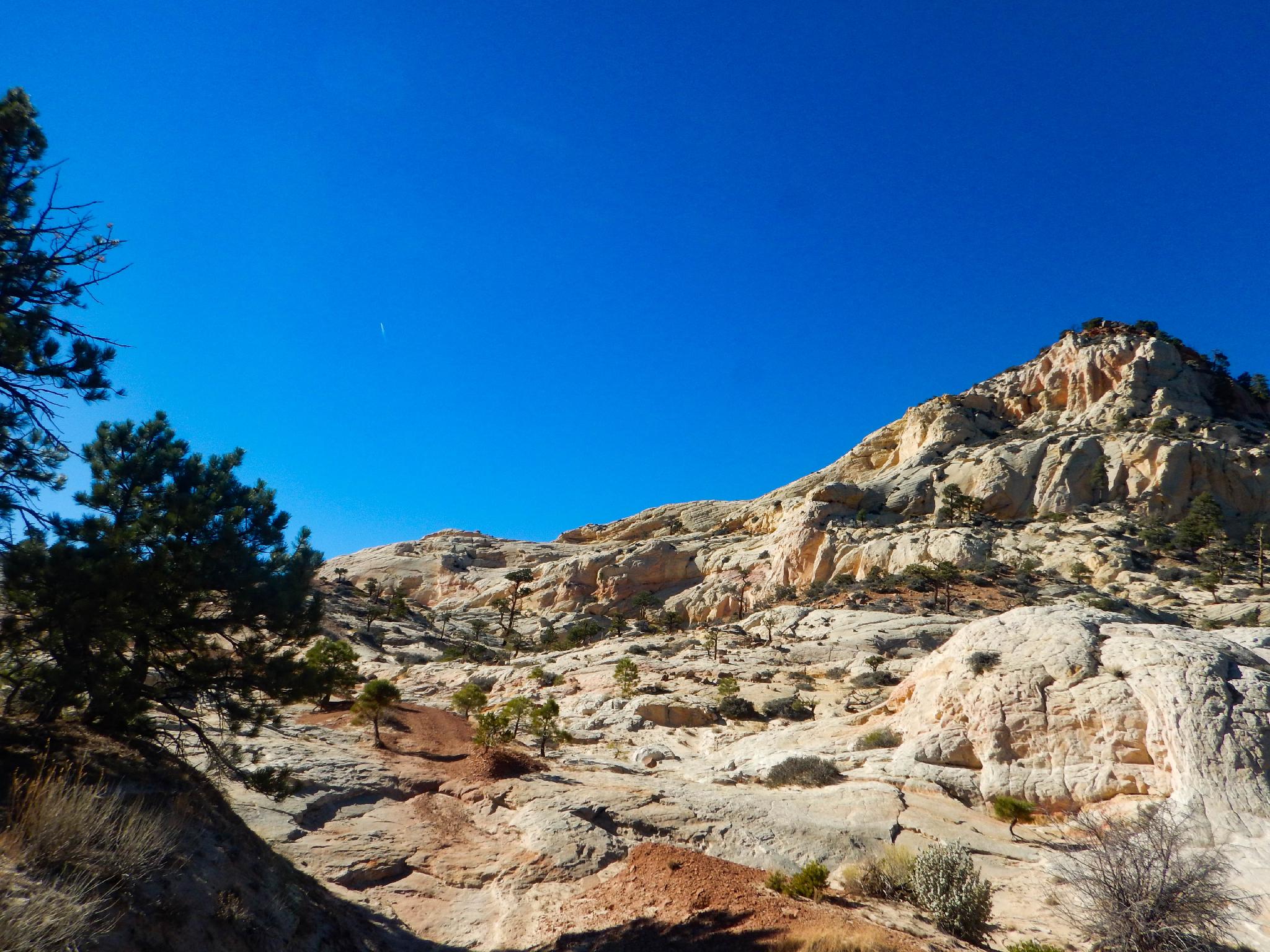
  • Reset your odometer as you turn onto the Miners Mountain Road off of highway 12. ( 12S 470020E 4230475N / 38°13'18"N 111°20'33"W )
  • Follows the road as it winds through a few houses and fields. At the junction at 1.2 miles, stay left on the main road. ( 12S 471194E 4229254N / 38°12'39"N 111°19'45"W )
  • At 2.3 is a Y junction. Go right here, an addition 0.1 miles and park anywhere convenient in the large open area. ( 12S 472324E 4228142N / 38°12'03"N 111°18'58"W )
  • Trailhead ( 12S 472338E 4227957N / 38°11'57"N 111°18'57"W )
Volcanic boulders dotting the landscape.

Volcanic boulders dotting the landscape.

Route

From the open parking area, follow the rough jeep/ATV trail south as it steeply climbs a very rocky hill. In 5 minutes is a signed trail junction. Go right here, as the trail flattens a little and becomes a bit less rocky.

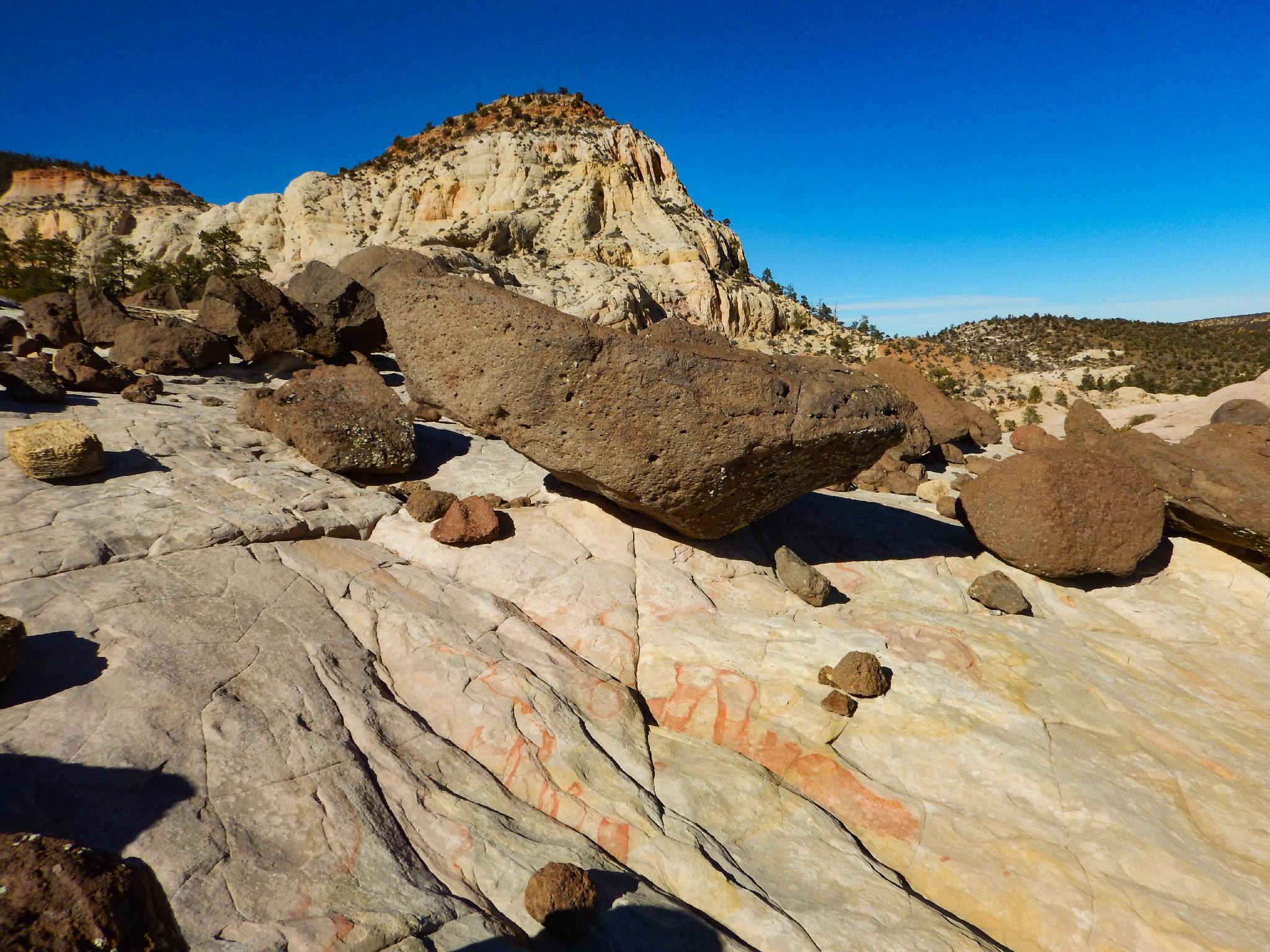
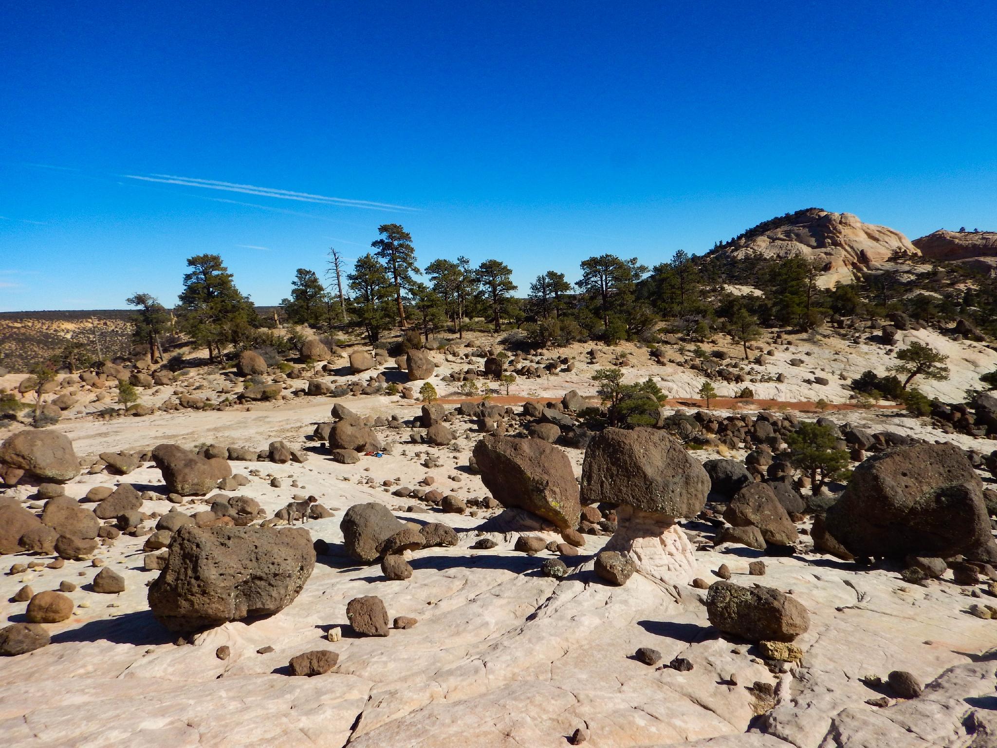
In 30 minutes, a minor side road takes off on the right. Stay on the main trail (Left). The trail meanders in and out of small drainages and over ridges. At about 1.5-2 hours (3.25 miles from the trailhead), the trail climbs onto slickrock and rounds a point; this is the recommended destination.

The point has massive volcanic boulders dotting the landscape and creates a dramatic contrast of black rock on white sandstone. To the east is Capitol Reef National Park, with the Henry Mountains visible in the far distance past the park.

Note: The trail continues on past the point, but is not particularly interesting. This used to be used as an old road between Grover and Boulder.


Maps

Route / 6.49 miles / Elevation Range 7,394 - 7,684 ft.
Printable Maps:

Trailhead

12S 472338E 4227957N

38°11'57"N 111°18'57"W

Junction, go right.

12S 472373E 4227722N

38°11'49"N 111°18'56"W

Forest Boundary

12S 471868E 4227750N

38°11'50"N 111°19'17"W

Junction, go left.

12S 471730E 4227268N

38°11'34"N 111°19'22"W

Corner and Views

12S 472614E 4225282N

38°10'30"N 111°18'46"W

Comments

Want to make a comment? Login and let yourself be heard.