 Roadside Attraction
Sego Canyon Rock Art
Roadside Attraction
Sego Canyon Rock Art
Thompson
Overview
Thu

91°
|
67°
Fri
96°
|
70°
Sat
98°
|
71°
Sun
98°
|
72°
Mon
98°
|
73°
RATING:
Roadside Attraction
LENGTH:
1-2 hours
MAPS:
Thompson Springs, UT
SEASON:
Any
WATER:
None.
Thu
91°
|
67°
Fri
96°
|
70°
Sat
98°
|
71°
Sun
98°
|
72°
Mon
98°
|
73°
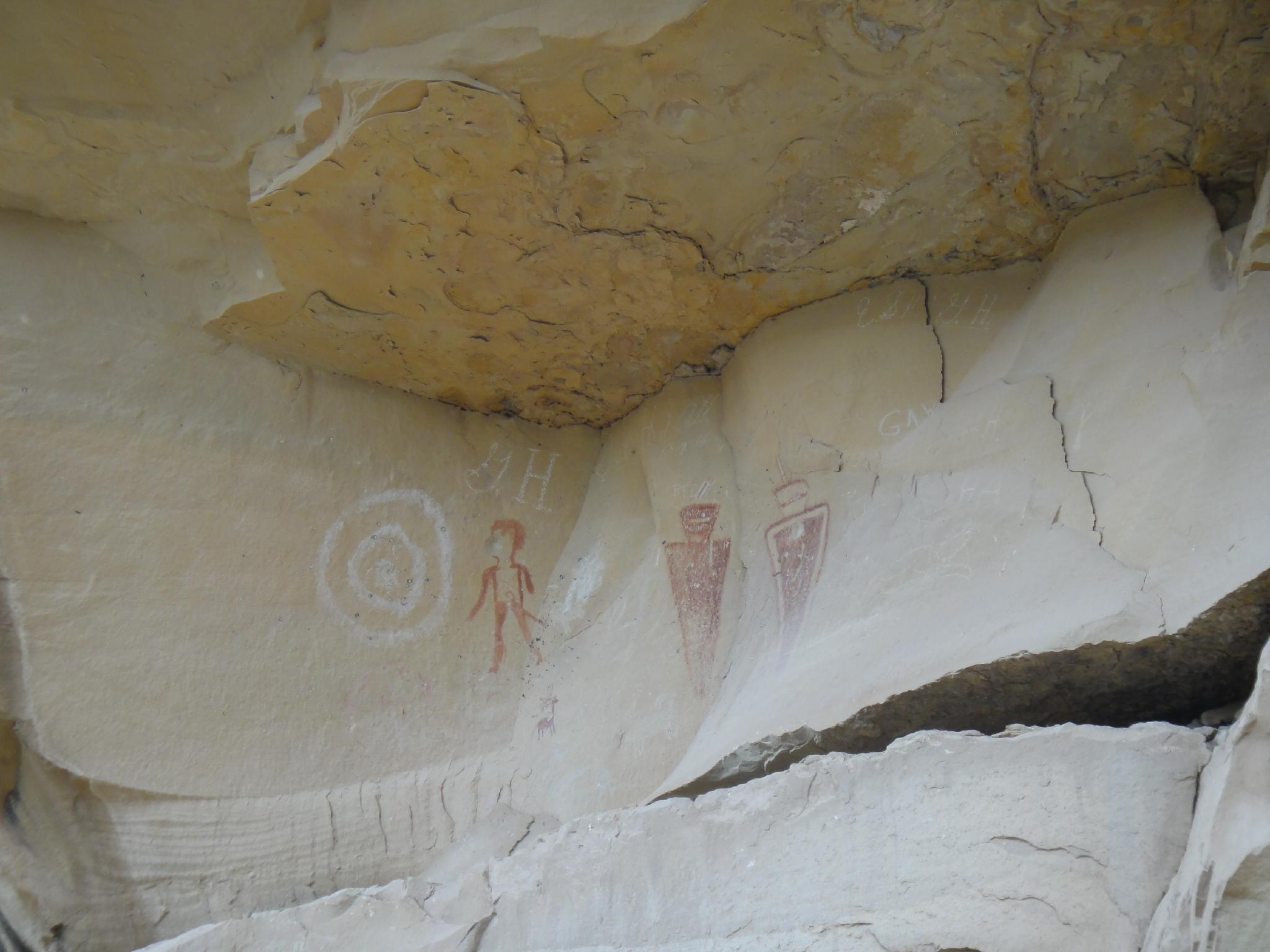
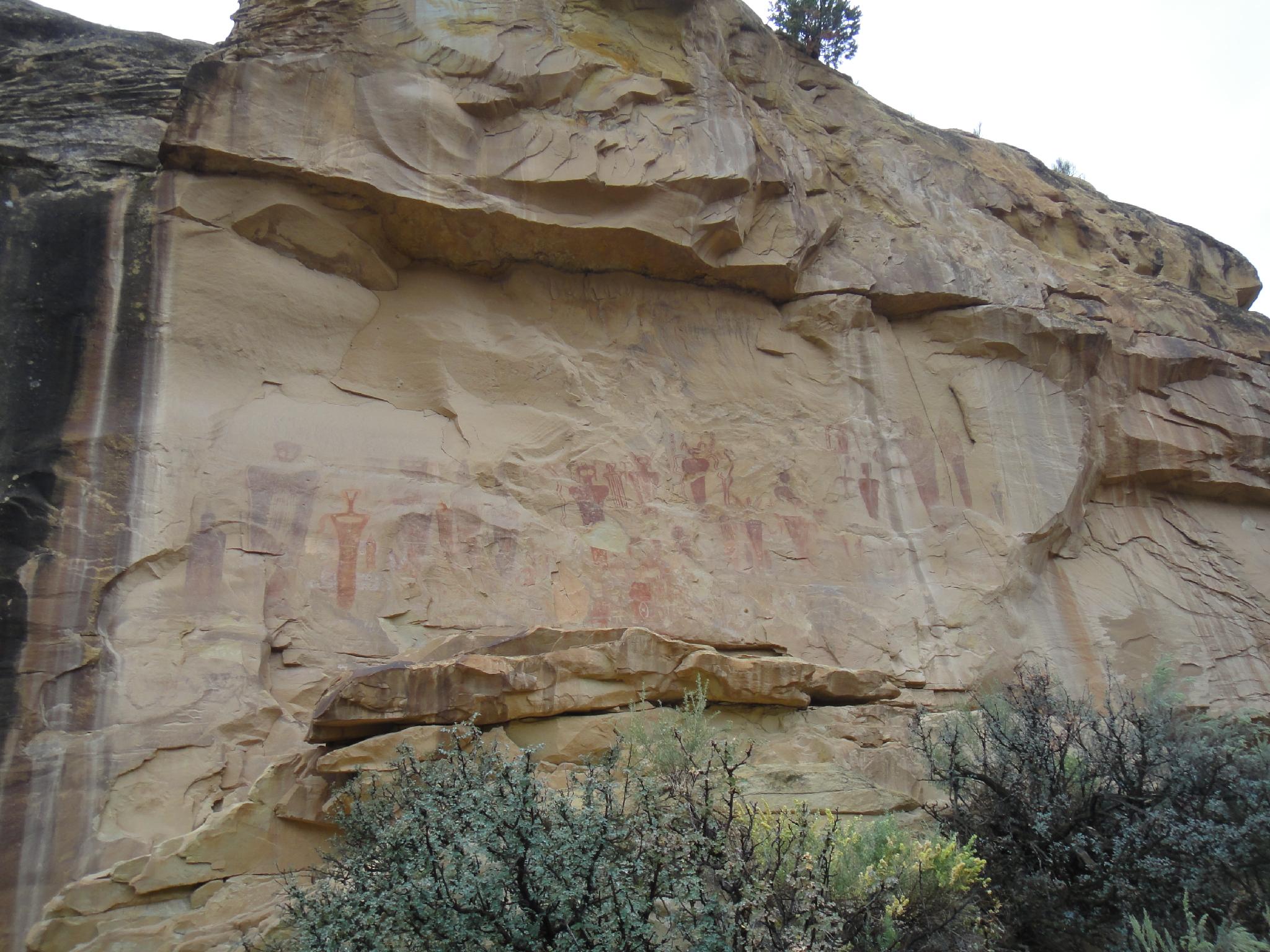
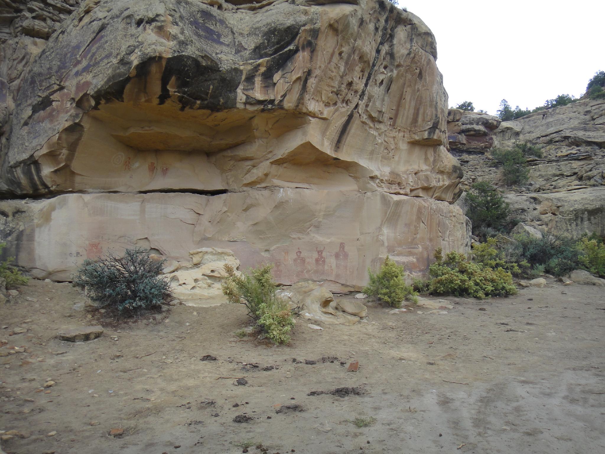
One of the better, more accessible panels around, the Sego art panel is a must visit if passing through on I-70. This is one I recommend to friends and have visited many times over the years. The canyon contains rock art from several peoples; Fremont, Ute and Barrier-style.
Barrier style are the oldest, dating back to 2000 BC, while the Ute style are the most recent, dating back to 1300-1600 AD. Clearly this was an area frequently inhabited by ancient people for thousands of years. The history and different panel styles are very diverse and interesting to see. There are many panels to visit, plan on spending at least an hour or two.
Barrier style are the oldest, dating back to 2000 BC, while the Ute style are the most recent, dating back to 1300-1600 AD. Clearly this was an area frequently inhabited by ancient people for thousands of years. The history and different panel styles are very diverse and interesting to see. There are many panels to visit, plan on spending at least an hour or two.
Getting There
Reaching Sego involves first reaching Thompson, which is east of Crescent Junction (The junction to Moab.) Take the Thompson exit (#187) off of I-70. Go north on UT-94 N/Thompson Canyon Rd toward. Stay on this for 4.6 miles. It passes through the town of Thompson, crosses the railroad tracks, then continues into the Book Cliffs. The Sego rock art panel is on the left at about 4.1 miles with a large pullout and information signs.
Note: The road is generally accessible to all vehicles.
Note: The road is generally accessible to all vehicles.
Route Description
Rock Art and Historic Site Etiquette
Rock art and historic sites are fragile, non-renewable cultural resources that, once damaged, can never be replaced. To ensure they are protected, please:
Rock art and historic sites are fragile, non-renewable cultural resources that, once damaged, can never be replaced. To ensure they are protected, please:
- Avoid Touching the Petroglyphs: Look and observe, BUT DO NOT TOUCH!
- Stay on the Trails: Stay on the most used trails when visiting sites, and don't create new trails or trample vegetation.
- Photography and Sketching is Allowed: Do not introduce any foreign substance to enhance the carved and pecked images for photographic or drawing purposes. Altering, defacing, or damaging the petroglyphs is against the law -- even if the damage is unintentional.
- Pets: Keep pets on a leash and clean up after them.
- Artifacts: If you happen to come across sherds (broken pottery) or lithics (flakes of stone tools), leave them where you see them. Once they are moved or removed, a piece of the past is forever lost.
Be sure to visit the information sign, then wander along the cliff band to the panels. There are several panels across the road and up stream, near the fenced area that are also worth wandering over to visit.
Maps
Printable Maps:


Sego Panel
12S 611644E 4319582N
39°01'05"N 109°42'37"W
Cemetery
12S 611594E 4320178N
39°01'25"N 109°42'39"W
Main Ghost Town
12S 612230E 4321325N
39°02'02"N 109°42'12"W