Old Ephraim's Grave |

Logan Canyon

Roadside Attraction Old Ephraim's Grave - Logan Canyon Roadside Attraction Old Ephraim's Grave

Logan Canyon

Overview

RATING: Roadside
LENGTH: 1+ hours

Fri

A slight chance of snow showers after noon. Mostly cloudy. High near 41, with temperatures falling to around 39 in the afternoon. Southeast wind 3 to 8 mph. Chance of precipitation is 20%.

41 | 23

Sat

Snow showers. Cloudy, with a high near 41. Southwest wind around 14 mph. Chance of precipitation is 90%. New snow accumulation of 1 to 3 inches possible.

41 | 30

Sun

Snow showers. Cloudy, with a high near 41. Chance of precipitation is 90%. New snow accumulation of 3 to 5 inches possible.

41 | 30

Mon

A chance of snow showers. Partly sunny, with a high near 42.

42 | 26

Tue

Sunny, with a high near 48.

48 | 26

View Full Weather Details
SEASON: Summer, Fall
NOTES: The approach road is rough. High clearance vehicles are generally passable. The road is muddy/snowy often until very late spring or early summer.

Fri

A slight chance of snow showers after noon. Mostly cloudy. High near 41, with temperatures falling to around 39 in the afternoon. Southeast wind 3 to 8 mph. Chance of precipitation is 20%.

41 | 23

Sat

Snow showers. Cloudy, with a high near 41. Southwest wind around 14 mph. Chance of precipitation is 90%. New snow accumulation of 1 to 3 inches possible.

41 | 30

Sun

Snow showers. Cloudy, with a high near 41. Chance of precipitation is 90%. New snow accumulation of 3 to 5 inches possible.

41 | 30

Mon

A chance of snow showers. Partly sunny, with a high near 42.

42 | 26

Tue

Sunny, with a high near 48.

48 | 26

View Full Weather Details
Beautiful fall colors at Old Ephraim's Grave

Beautiful fall colors at Old Ephraim's Grave

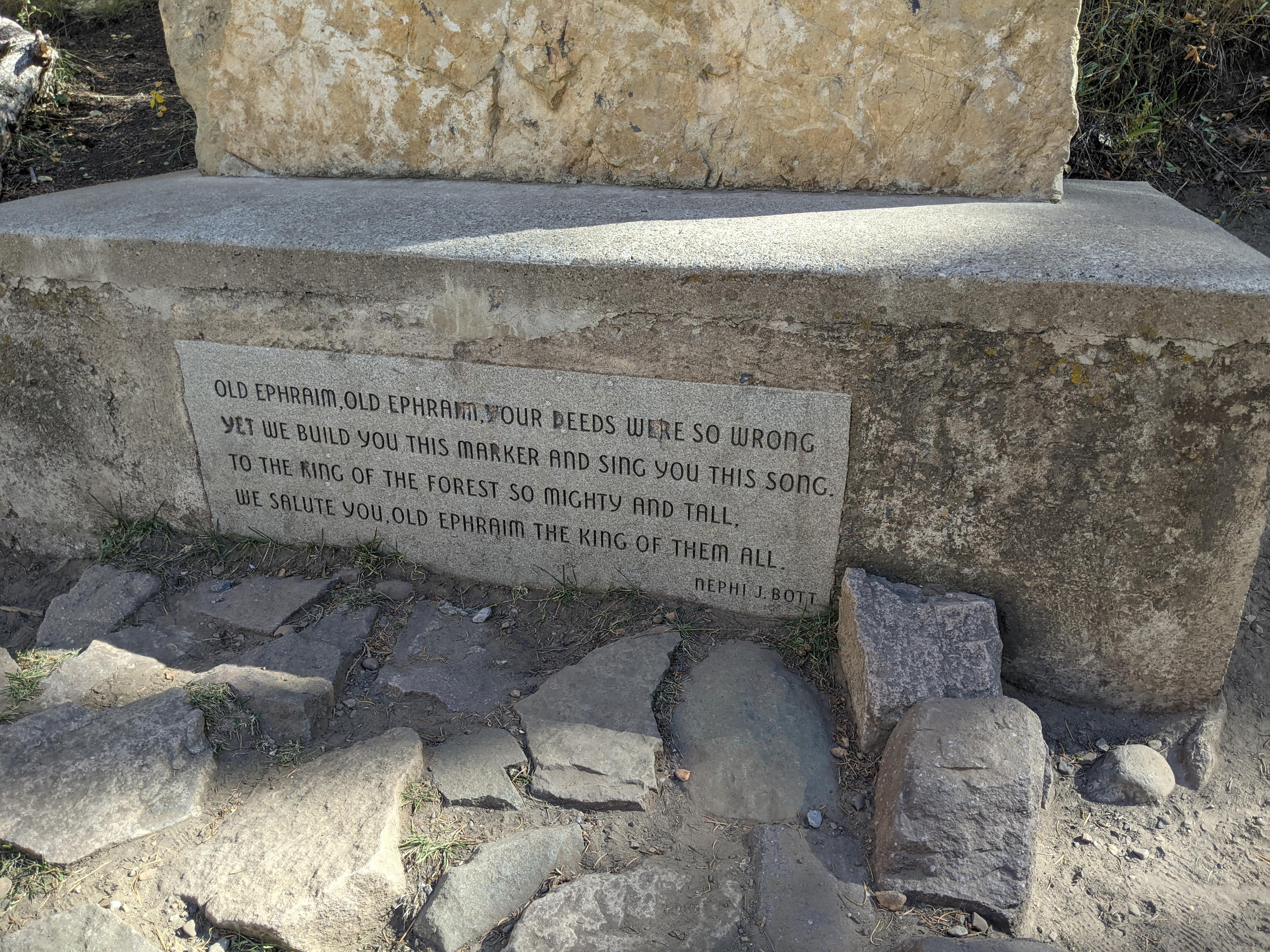
The grizzly bear known as Old Ephraim is legendary in the Cache Valley. The bear had a toe deformity and left distinctive tracks. During the early 1900’s, sheepherders were frustrated at the number of sheep killed by bears each year in the mountains. Frank Clark, a part owner of the Ward Clark Sheep Company, set out to kill the largest most well-known of the bears, Old Ephraim. For almost 10 years Clark made attempts to kill Old Ephraim. The bear evaded all traps and continued killing sheep.

Finally, in 1923, Clark caught Old Ephraim in a trap near his camp. When Clark heard roaring in the night, he went to investigate. The bear, caught in a trap Clark had placed, had pulled the stake holding the trap in place out of the ground and began charging Clark who shot the bear several times. Clark’s dog charged the bear as well, giving Clark a chance to escape. It must have been a harrowing scene.

In the morning, Clark found the bear dead, having finally succumbed to his wounds. Old Ephraim was skinned and buried. It was estimated that Old Ephraim was 10’ tall and weighed over 1,100 pounds! Clark, in later years, expressed remorse at having to kill the creature. Old Ephraim was later exhumed, and his skull sent to the Smithsonian Musem.

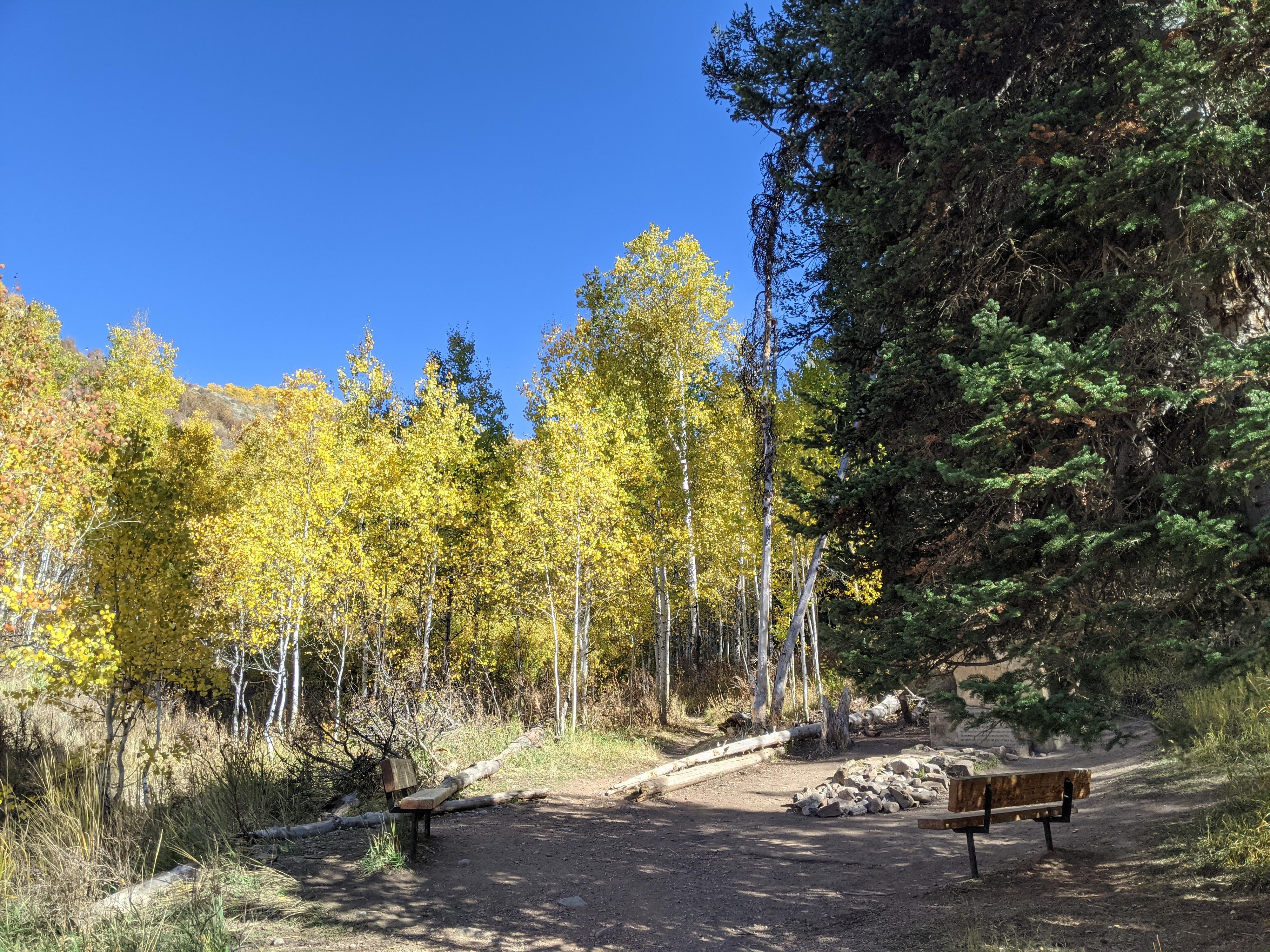
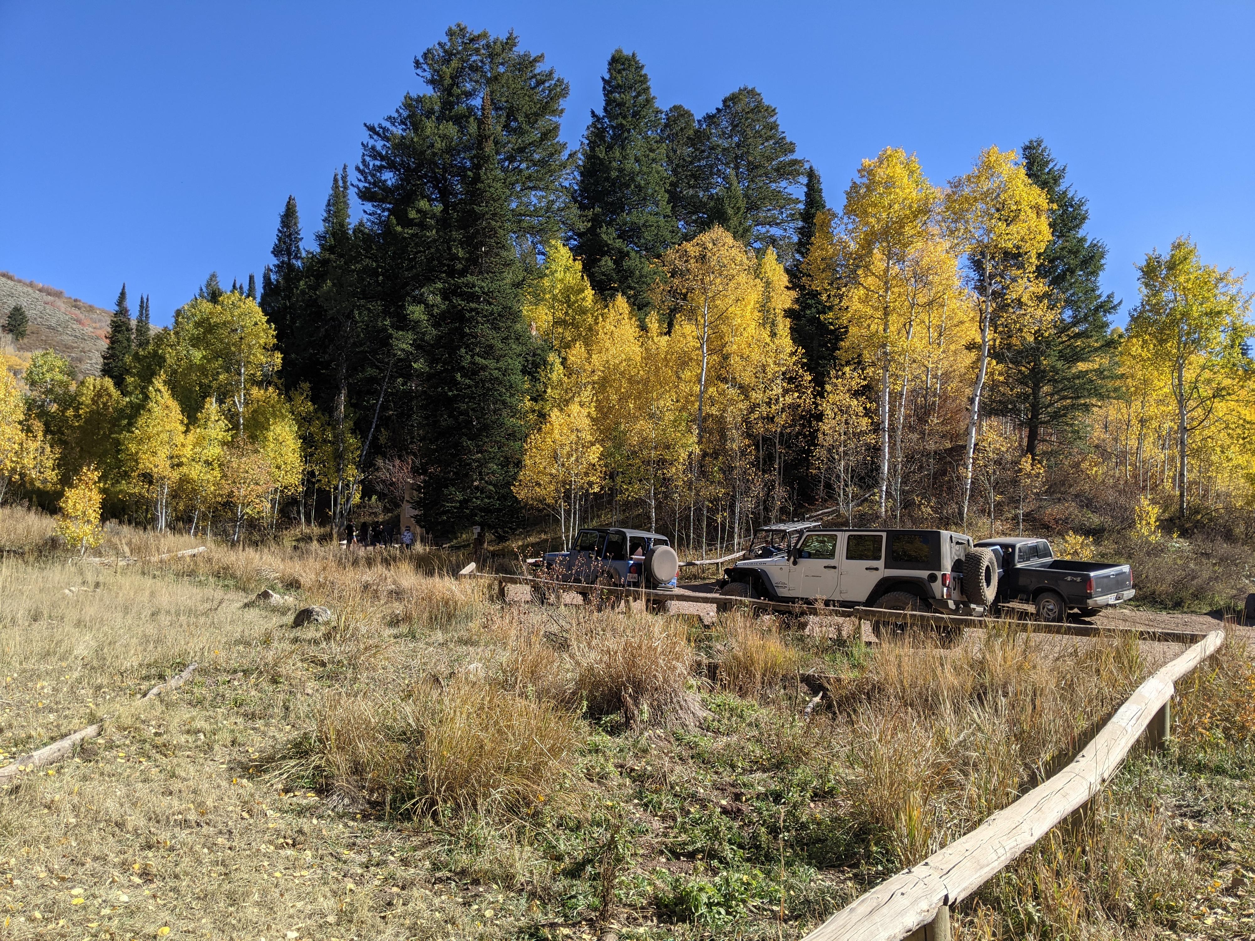
Today, a wooden sign marks the original location of the grave, with a newer monument placed across the road. Reaching the grave is usually done either as a long hike up Right Fork, mountain bike, or by rough dirt road. The description here is for the rough dirt road approach. On our visit the road was easily passable by any high clearance vehicle, though I would recommend a 4-wheel drive. The road is quite rough!

Note: This is an excellent fall outing when the leaves are changing, with excellent foliage views. I recommend going up Temple Fork and making a loop down Right Fork. If you want to minimize rough dirt road, go up Temple Fork and return the same way. From the grave out Right Fork was a much rougher road on our visit.
The base of the new Old Ephraim's monument.

The base of the new Old Ephraim's monument.

Getting There

The adventure begins at Temple Fork in Logan Canyon. From Logan, go east up US-89 about 14.5 miles to Temple Fork on the right.

  • Turn up Temple Fork and Reset Your Odometer ( 12T 450731mE 4631675mN / N41° 50' 08" W111° 35' 36" )
  • 1.0 miles - Temple Fork Trailhead on the left. Stay right on FR-007. Once the road climbs up out of Temple Fork, there are many excellent primitive campsites. Stay on the main road. ( 12T 451951mE 4630860mN / N41° 49' 41" W111° 34' 43" )
  • 4.7 miles - Side road on the right. Stay straight on the main road. ( 12T 453378mE 4627492mN / N41° 47' 53" W111° 33' 40" )
  • 6.4 Lesser side road on the right. Stay straight. ( 12T 454153mE 4626958mN / N41° 47' 35" W111° 33' 06" )
  • 7.0 miles - Major junction. Go right. ( 12T 455007mE 4626923mN / N41° 47' 34" W111° 32' 29" )
  • 9.8 miles - Old Ephraim's Grave Parking ( 12T 454783mE 4623705mN / N41° 45' 50" W111° 32' 38" )
  • Old Ephraim's Grave ( 12T 454794mE 4623703mN / N41° 45' 50" W111° 32' 38" )
  • Return the same way, or follow the mileages below to exit via Right Fork
  • 12.4 miles - Major junction, go right. ( 12T 453930mE 4620451mN / N41° 44' 04" W111° 33' 14" )
  • 17.5 miles - Major junction. Go right, then. past a corral. ( 12T 448775mE 4619549mN / N41° 43' 34" W111° 36' 57" )
  • 17.6 miles - Major junction. Go straight. The road begins descending into Right Fork. ( 12T 448676mE 4619621mN / N41° 43' 36" W111° 37' 02" )
  • 22.7 miles - US-89 at Right Fork ( 12T 446744mE 4625995mN / N41° 47' 02" W111° 38' 27" )
Trailhead on a fall day.

Trailhead on a fall day.

Route

The monument is a short stroll from the parking area, complete with benches to sit and enjoy the area. Across the road from the new monument, a short trail visits the old wooden sign and original grave site.


Maps

Printable Maps:
Old Ephraim's Grave

12T 454795mE 4623703mN

N41° 45' 50" W111° 32' 38"

Comments

Want to make a comment? Login and let yourself be heard.