
 Crater Island
Silver Island Mountains
Overview
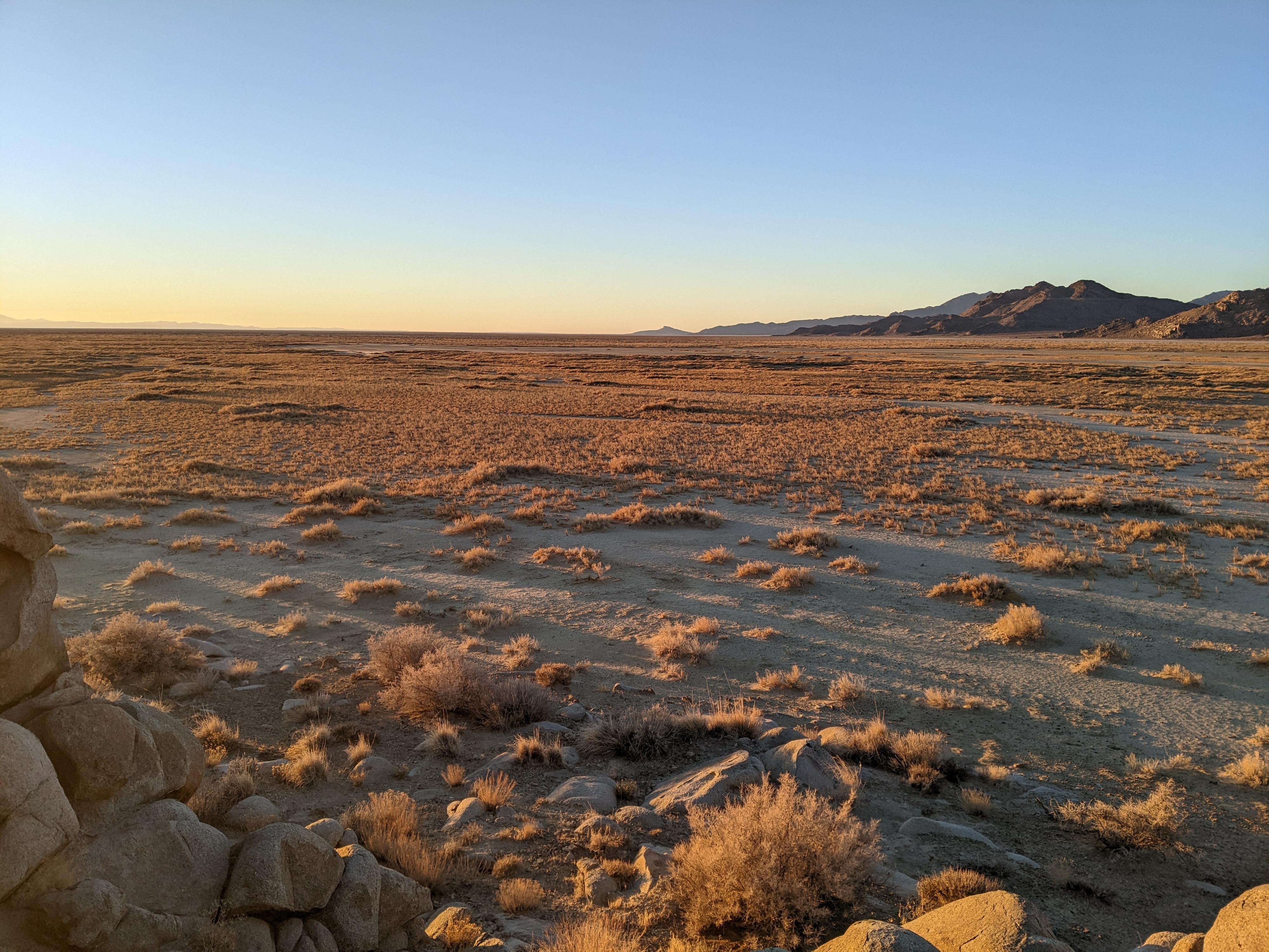
North of the main Silver Island Mountains is the remote Crater Island. The island is an area of stark hills surrounded by mudflats on three sides, with a peninsula connecting the island to the main Silver Island Mountains. This is a very infrequently visited area. Did I mention it is a remote area? A great place to go if you want to get away from the world and don't mind miles and miles of dirt road.
When I visited Crater Island, I was intrigued by several small blobs out in the mudflats just north of the island and wanted to visit the northern tip of the island and also these outcroppings. Wandering the mudflats and island has a very an "other worldly" feel. A few rabbit tracks and a howling coyote in the early morning hours were the only signs of life I saw on my visit.
The area is open terrain with many ridgelines and small summits to visit and wander. The island saw mining activity in the early 1900s, and even now (2022), exploratory core sampling is actively being done on the island, though the driller I talked to indicated not much had been found so far.
In my wanderings of the area, two hikes stuck out and are described below. Be sure when venturing out this far you have plenty of extra fuel, water, food, a spare tire, etc... The roads beyond where core drilling was occurring showed very little signs of use. If you broke down out here, it would be a very long way to help.
Getting There
Reaching Crater Island starts from the northern end of the Silver Island Scenic Byway. To reach the northern end of the scenic byway:
Go north off I-80 at exit 4. The exit is a few miles east of Wendover, UT, and about 115 miles west of Salt Lake City.
Once off the freeway, reset your odometer on the north side of the freeway and head north toward Bonneville Salt Flats.
1.2 miles - left onto a paved road.
1.95 miles - Right onto a dirt road. This is the Silver Island Mountain Byway/Eastside. Stay on this main dirt road as it travels north along the base of the Silver Island range. After 32.6 miles, Donner-Reed Pass is reached with a sign on the left. Just past this is the Crater Island access road at 32.85 miles. Reset your odometer as you turn right onto the Crater Island road.
Route Description
Northern Island Hike
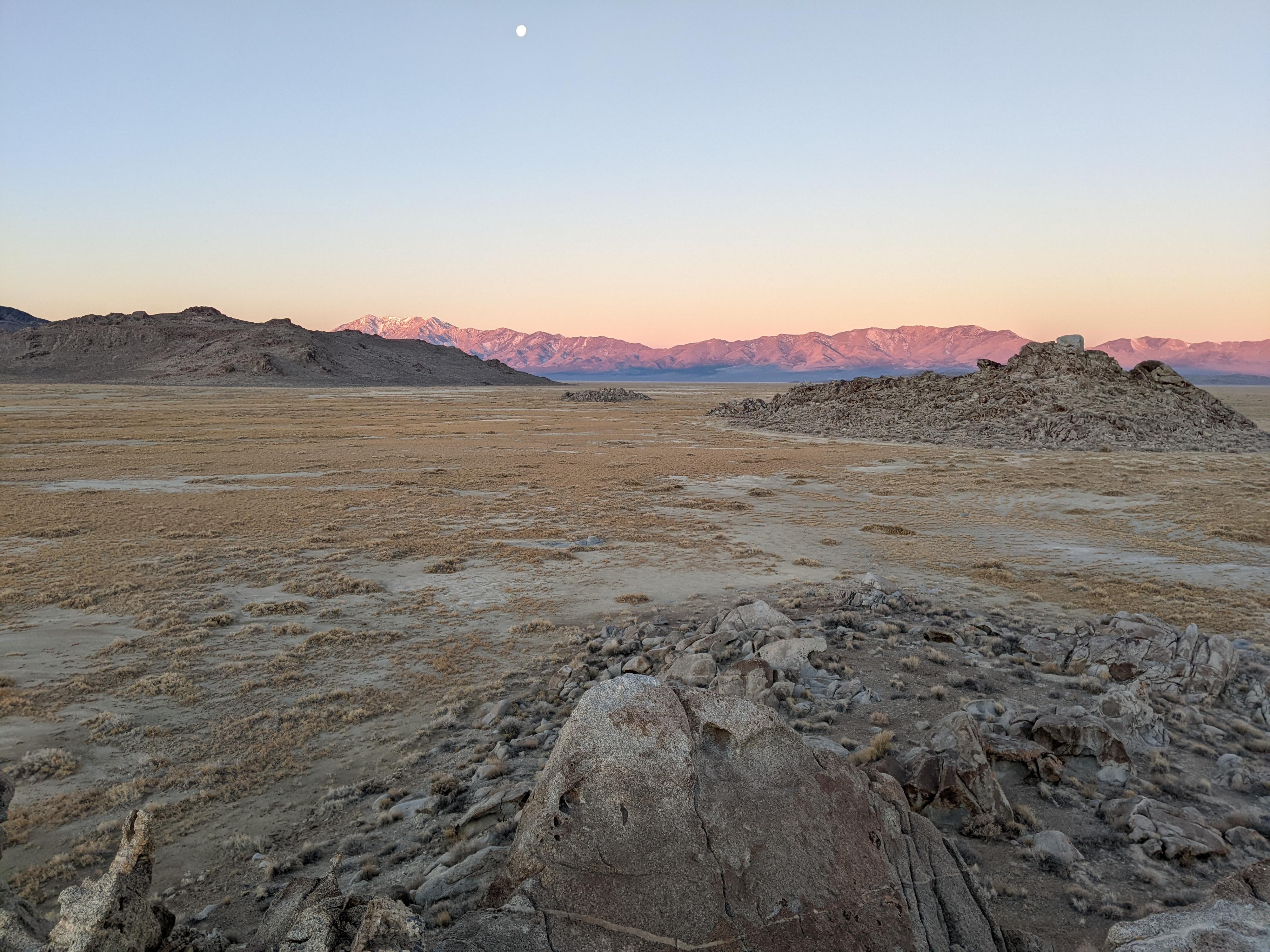
This was my favorite hike on the island. From the last pass, hike down to the mudflats. After rains and in wet seasons, the mudflats might be difficult even for walking. In the winter and drier times, the mudflats have a nice firm feel and are fast walking. I headed north on the mudflat, around the northern point of Crater Island, and to the 3 rock blobs. These are piles of granite boulders and large rocks. From there, going back across the mudflats and hiking up the highest summit on the north part of the island gives excellent views of the mudflats and Pilot Range to the west. Easy cross country hiking south leads back to the trailhead in a nice loop.
Highpoint Hike
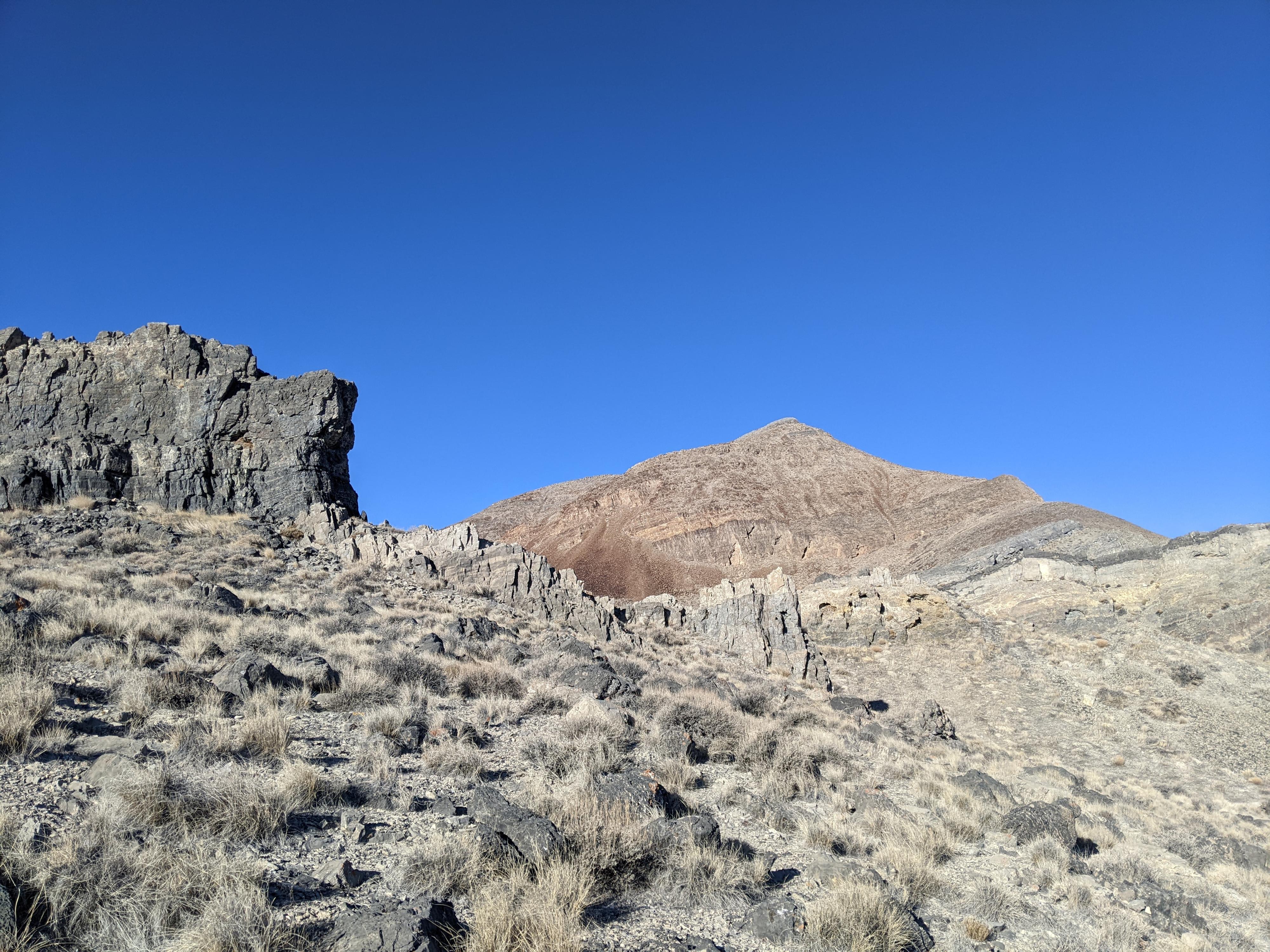
Being a bit of a peak bagger, I couldn't resist visiting the high point of the island. It is a short hike but is steep and a little loose in spots. From the trailhead, the peak is the high point to the west. Head toward it, crossing the first ridge before reaching the base of the peak. Work up the peak using good route finding. There are sections of steep and loose rock, but with a little route finding, this is pretty easy going. Return the same way from the summit. There was not a register that I could find on my visit, but a couple of large cairns and some rebar marked the summit. I wish there was a register, I would be interested to know how often it gets visited.
Photos
Maps

12T 267026E 4546621N
41°02'15"N 113°46'18"W
12T 266720E 4547288N
41°02'36"N 113°46'32"W
12T 268078E 4552199N
41°05'17"N 113°45'40"W
12T 269466E 4557032N
41°07'55"N 113°44'47"W
12T 270538E 4557892N
41°08'24"N 113°44'03"W
12T 267071E 4548457N
41°03'15"N 113°46'18"W
12T 269155E 4551957N
41°05'10"N 113°44'54"W
12T 269118E 4552925N
41°05'41"N 113°44'57"W
12T 268362E 4555320N
41°06'58"N 113°45'32"W
12T 268400E 4555098N
41°06'51"N 113°45'30"W