
 Independence Rock
Central Wyoming
Overview
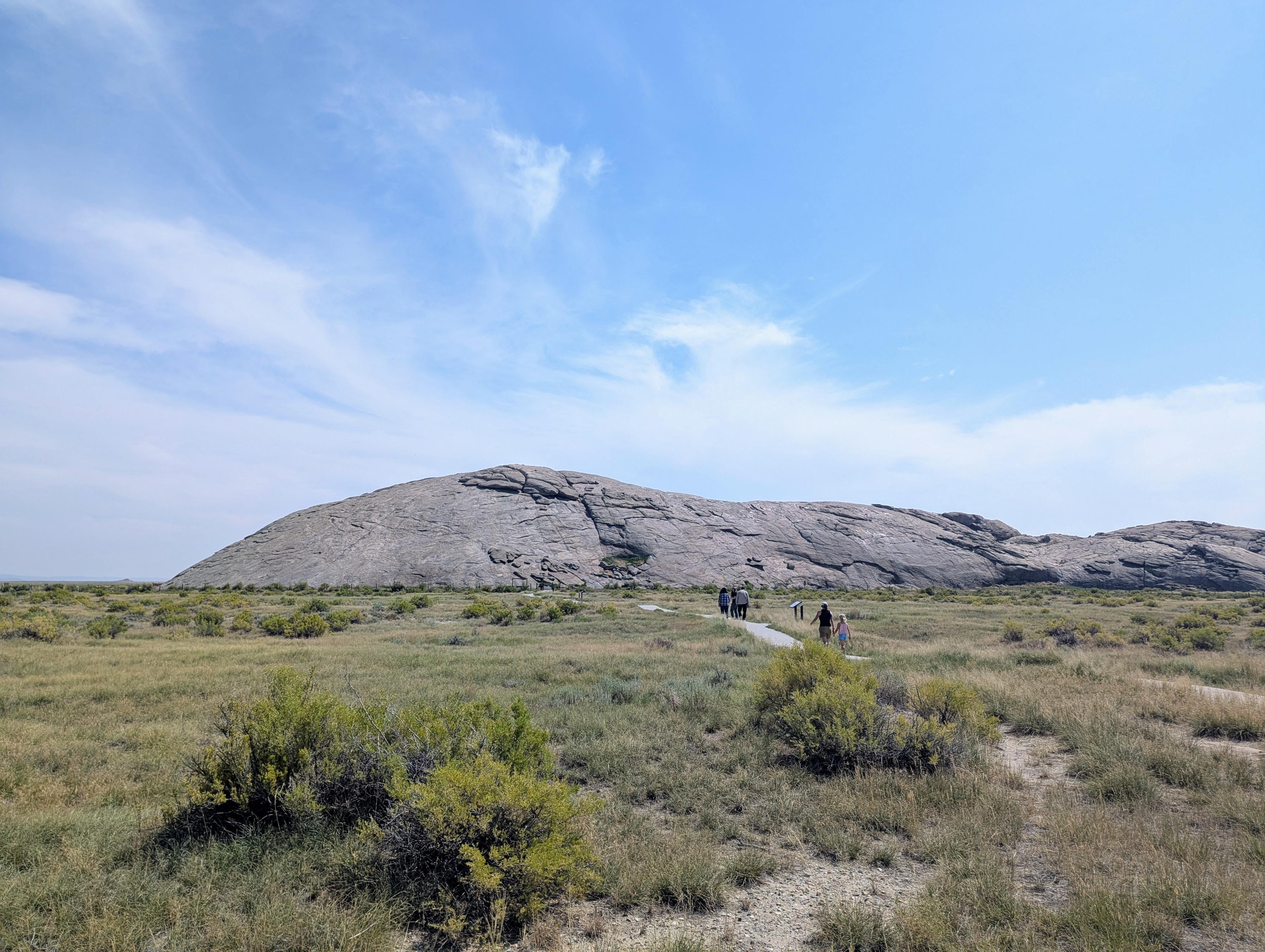
Independence Rock, often called the “Great Register of the Desert,” is one of the most famous landmarks along the emigrant trails of the American West. Located in central Wyoming, this massive granite outcrop rises about 130 feet high and stretches nearly 2,000 feet in length. For thousands of years, it served as a landmark for Native peoples, hunters, trappers, and later, tens of thousands of emigrants traveling the Oregon, California, and Mormon Trails. The rock’s distinctive rounded shape and prominent position on the Sweetwater River made it an unmistakable marker on the long journey across the plains and mountains.
The name “Independence Rock” seems to have two different stories behind it. Some say it comes from a party of fur trappers who camped and celebrated Independence Day near the rock on July 4, 1830. Others say it had to do with the emigrants that made their way west in the mid-1800s. Emigrants heading west aimed to reach this point by July 4th so they could stay on schedule to cross the mountains before snow blocked the passes. If a wagon train arrived later in the season, they risked becoming trapped by early snows in the Sierra Nevada or the Cascades. This urgency gave the rock symbolic importance, turning it into both a calendar and a milestone of progress for pioneers. Many emigrants celebrated Independence Day at the site with gatherings, games, and patriotic ceremonies, reinforcing its connection to national identity.
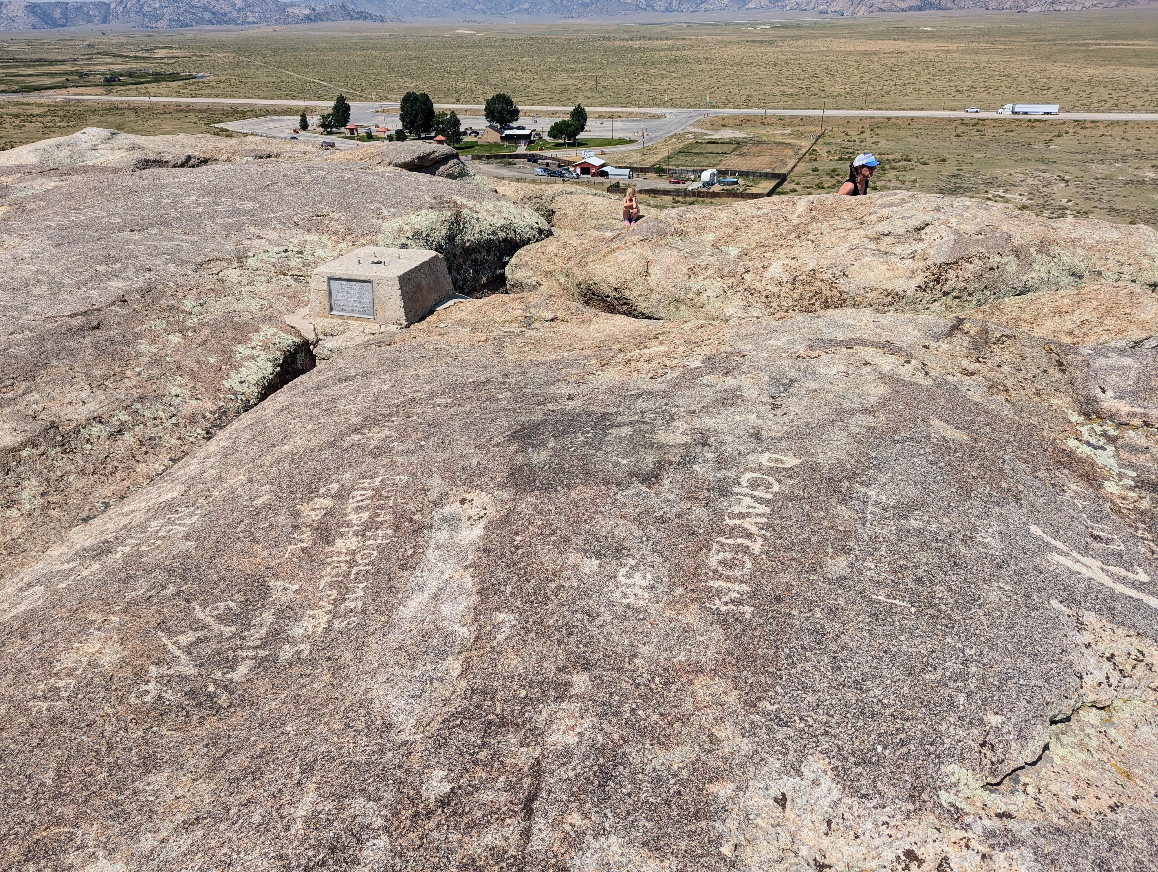
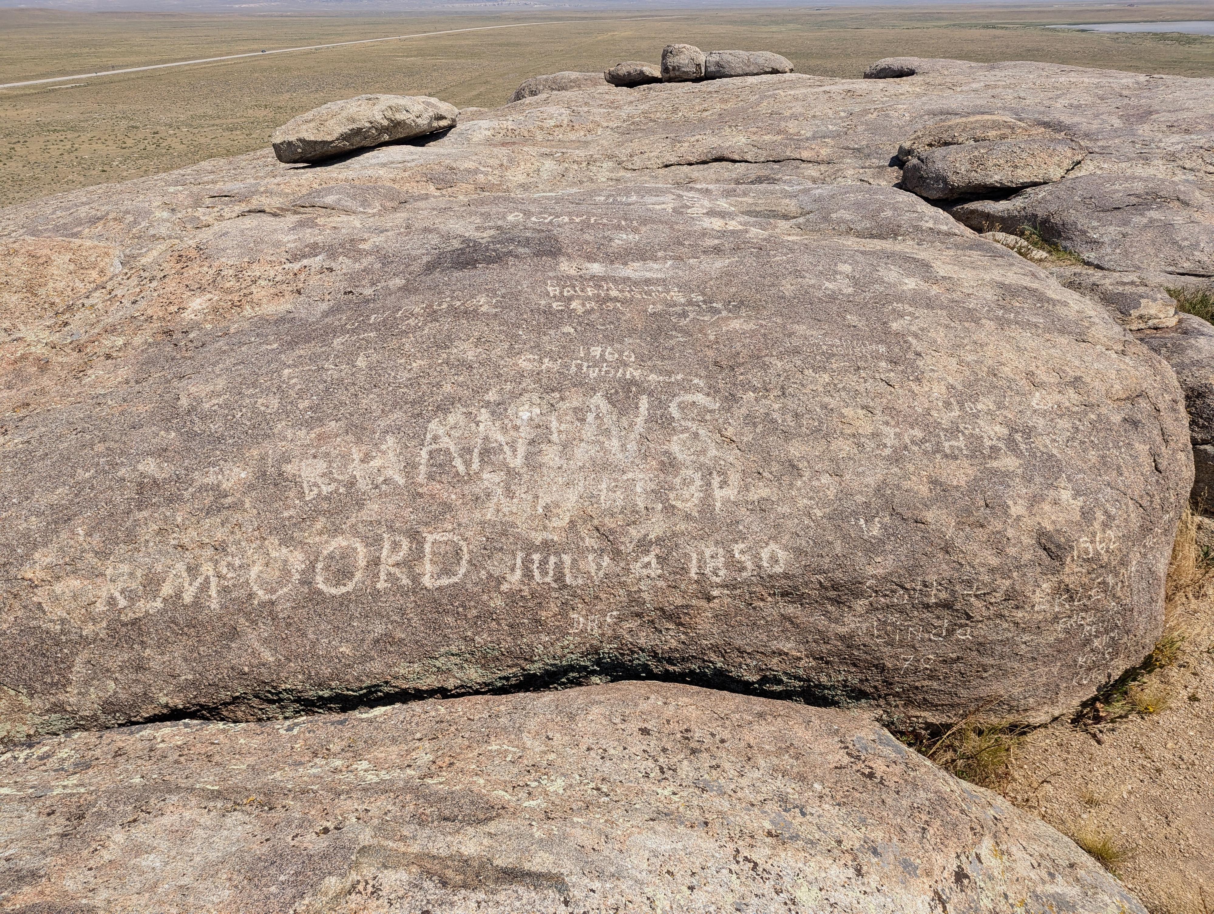
Over time, thousands of travelers carved their names into the rock’s granite surface. These inscriptions, some dating back to the early 1820s with fur traders, became a record of the migration era. Many pioneers used axle grease, tar, or tools to etch their names and dates into the stone, creating a vast collection of signatures that still survives. Because of this, Independence Rock has often been described as a giant emigrant register - a reminder of the hopes, struggles, and determination of those who moved westward.
By the late 19th century, as railroads replaced wagon trails, Independence Rock became less important as a practical landmark but grew in symbolic and historic significance. It was designated a National Historic Landmark in 1961, and today it is preserved as part of the Independence Rock State Historic Site. It is an excellent stop if passing through the area.
Getting There
The site is in central Wyoming, usually reached from I-80 to the south or from Casper to the north.
From Rawlins, head north on US-287 toward Muddy Gap/Casper. About 40 miles from Rawlins is a junction with WY-220. Go right on WY-220 toward Casper for another 19 miles to Independence Rock on the right.
From Casper, head south on WY-220 toward Rawlins. About 58 miles from Casper, Independence Rock is on the left side of the road.
Route Description
From the parking area, the rock is just a short-distance away. Walking up to the base or taking the trail around its base is a good way to visit. For the more adventurous, hiking to the top is highly recommended!
If hiking to the top, be careful to pick a route you are comfortable with both going up and coming back down. The west side, just north of where the trail reaches the base of the rock, seems popular and one of the easier routes up. This is where we climbed up and back down. There are both views to be had and names carved into the rock to be seen on top.
Photos
Maps

13T 324427E 4706734N
42°29'35"N 107°08'11"W