 Canyoneering
Deadeye Dick Canyon
Canyoneering
Deadeye Dick Canyon
Zion East Side
Overview
Deadeye Dick reminded me of a shorter, not quite as good Birch with a much bigger pain of an approach. That being said, it is a lovely short canyon with a stunning exit up the narrows and one that I would recommend doing once. My recommendation would be contingent on doing Mighty Mouse Canyon along the way and doing the approach from Dakota Hill as described below. There are other approaches, but they would be thrashy, steep, and not much fun.
Being outside Zion National Park boundaries, the canyon does not currently require a permit. It also does not hold water, making it a good choice for cooler times of the year. The canyon itself is beginner friendly, though there is some navigation required on the approach.
Getting There
The trailhead is off the North Fork road, which starts 2.2 miles east of the east entrance of Zion National Park on highway 9. It is signed.
Route Description
Approach (90 minutes)
From the trailhead, follow the jeep road as it descends along the hillside. After 1 mile, it turns sharply south and descends quickly. Leave the jeep road here and follow a social trail along the ridge west to Dakota Hill. The trail is becoming easy to follow, but if in doubt, it generally stays close to the ridge line.
Once on Dakota Hill, Deadeye Dick is to the north and west. Follow the ridge line due north. A trail comes and goes, but staying on or near the ridgeline is easy. The ridge drops steeply to a small flat area that has large ponderosa pines. Deadeye Dick is on the other side of the small flat area.
Descend into the canyon from the flat area down a steep dirt/rock slope, the first rappel is just a minute or two down canyon.
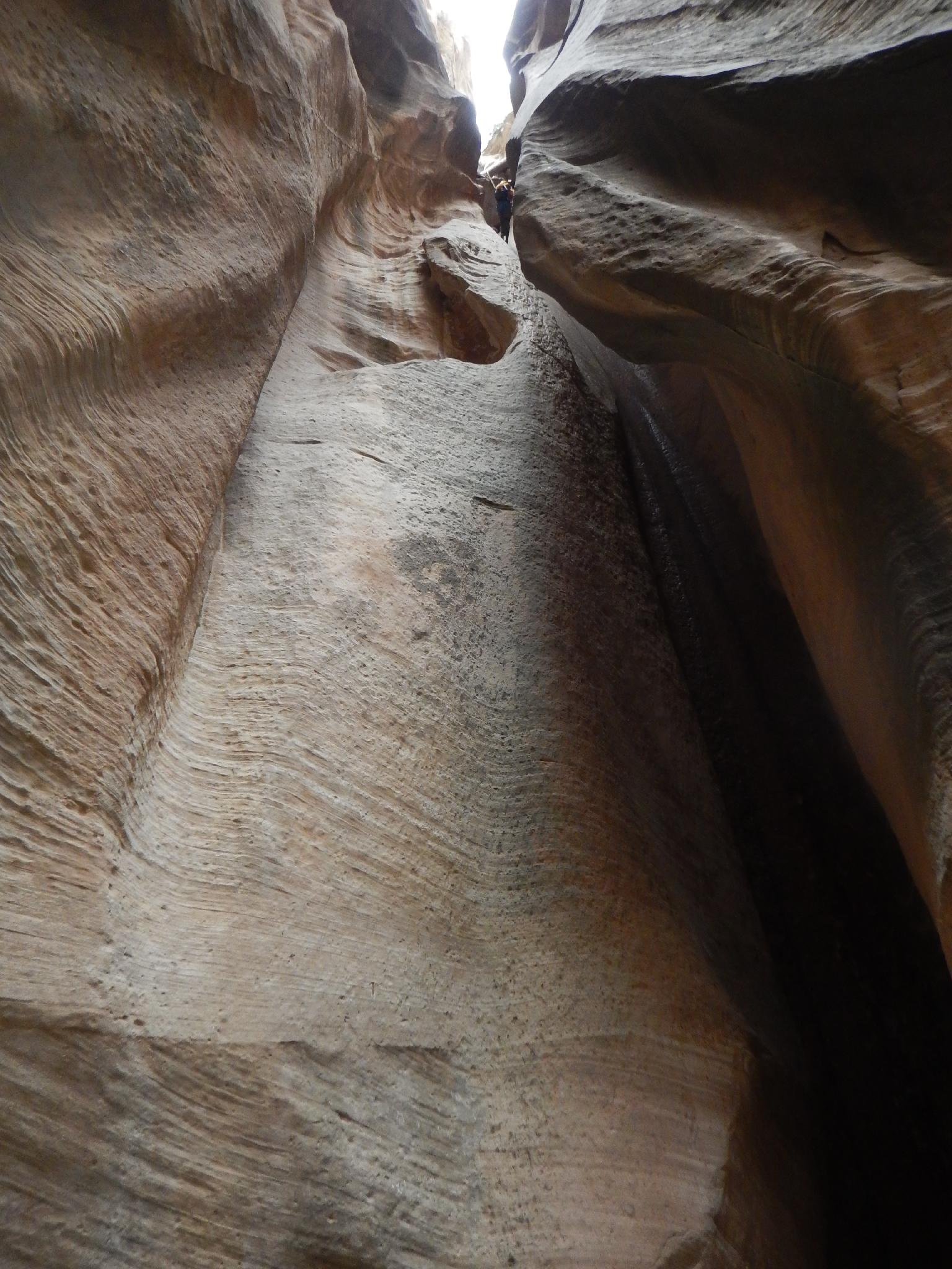
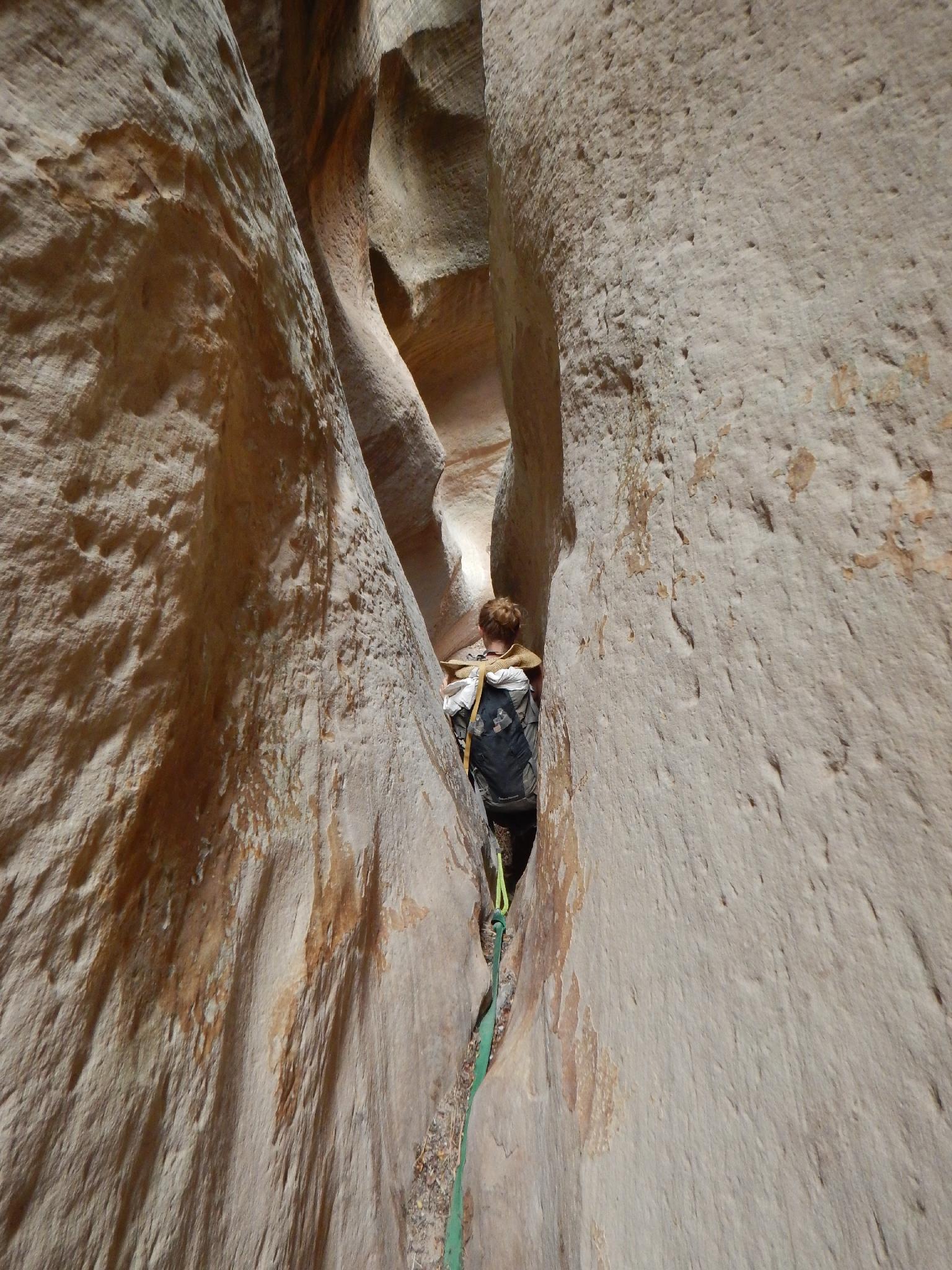
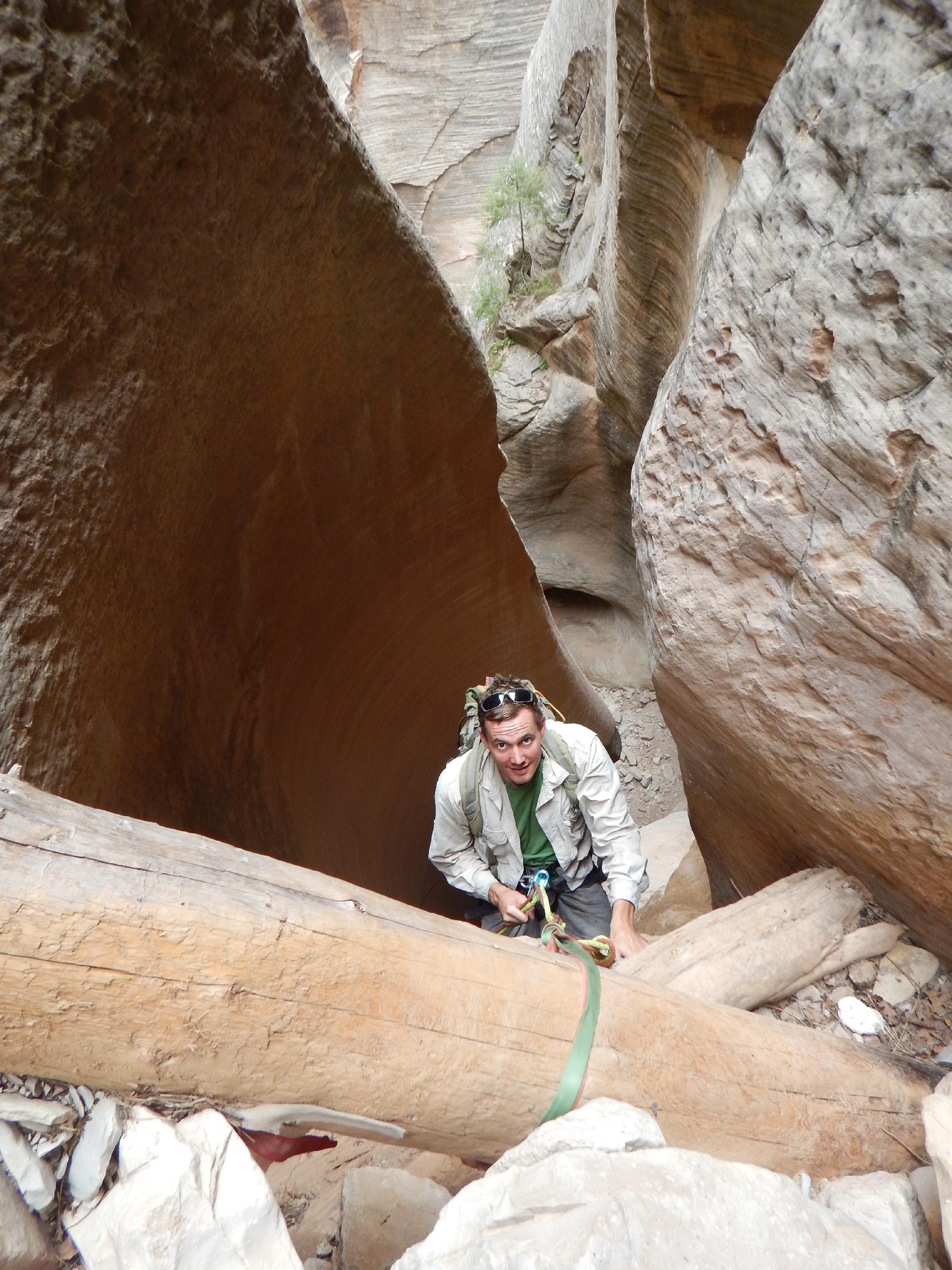
The Canyon
Rappel 1 (6 m ( 20 ft. )) - This rappel is generally done off a tree on the left side.
Rappel 2 (22 m ( 73 ft. )) - Rappel down into a short section of slot, then the canyon opens briefly.
Rappel 3 (18 m ( 60 ft. )) - The canyon slots up and drops here. Rappel 3 is followed immediately by rappel 4.
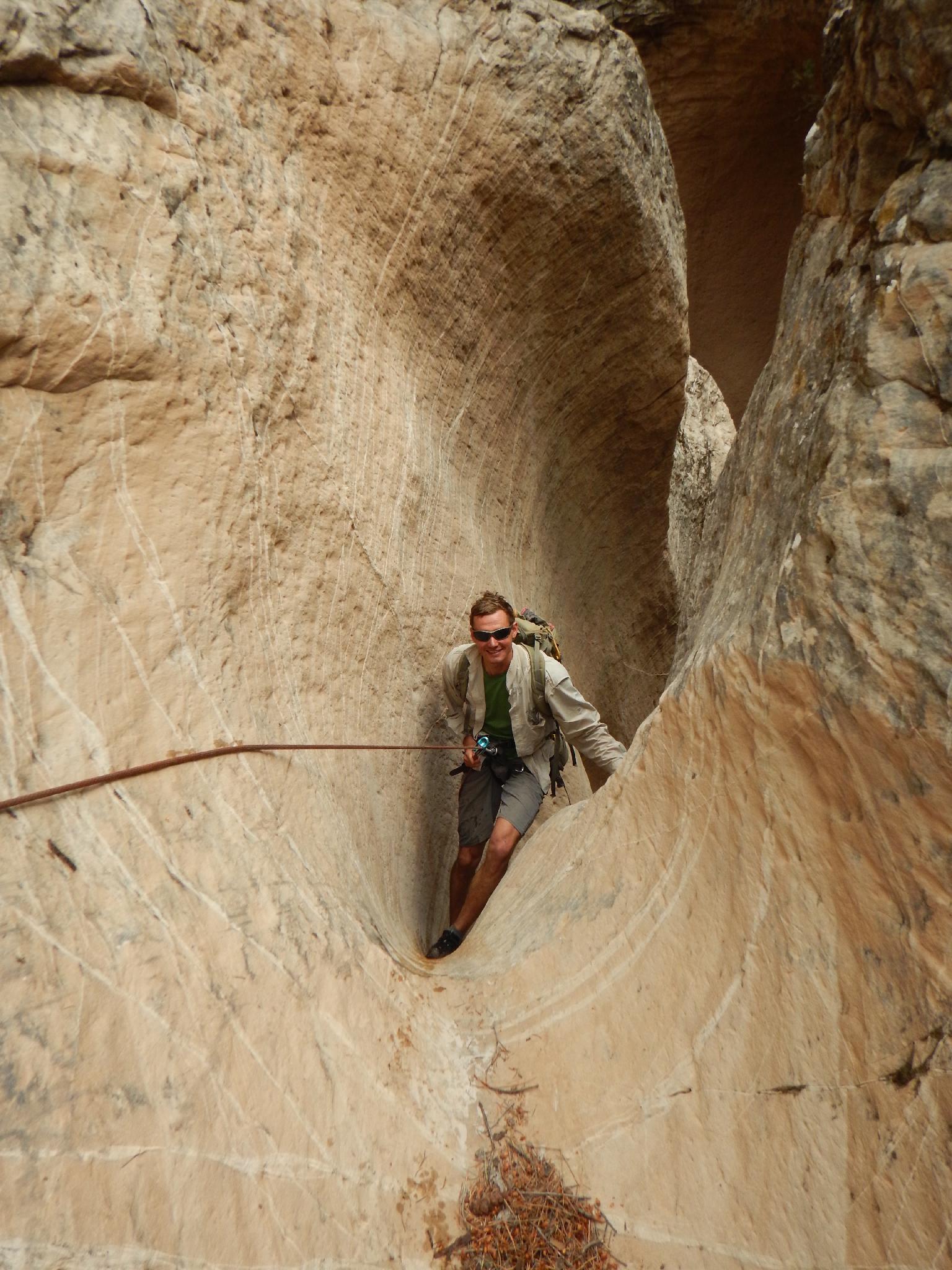
Rappel 4 (25 m ( 83 ft. )) - This can be done as a 3 stage rappel, however the second and third stages are relatively easy to downclimb and make for a better rope pull. If rappelling on 3 stages, it is about 25 m ( 83 ft. ).
Rappel 5 (15 m ( 50 ft. )) - Just down from rappel 4 is rappel 5. It can be anchored off a deadman, or lower down off a chockstone requiring a bit more finesse to rig and get on rappel.
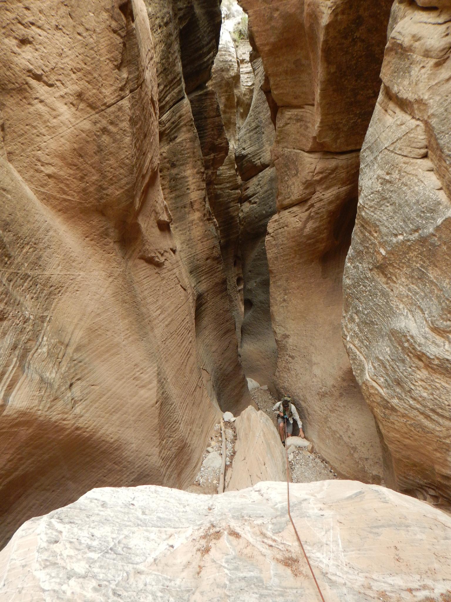
Rappel 6 (30 m ( 99 ft. )) - All too soon the final rappel is encountered. A beautiful smooth walled flute.
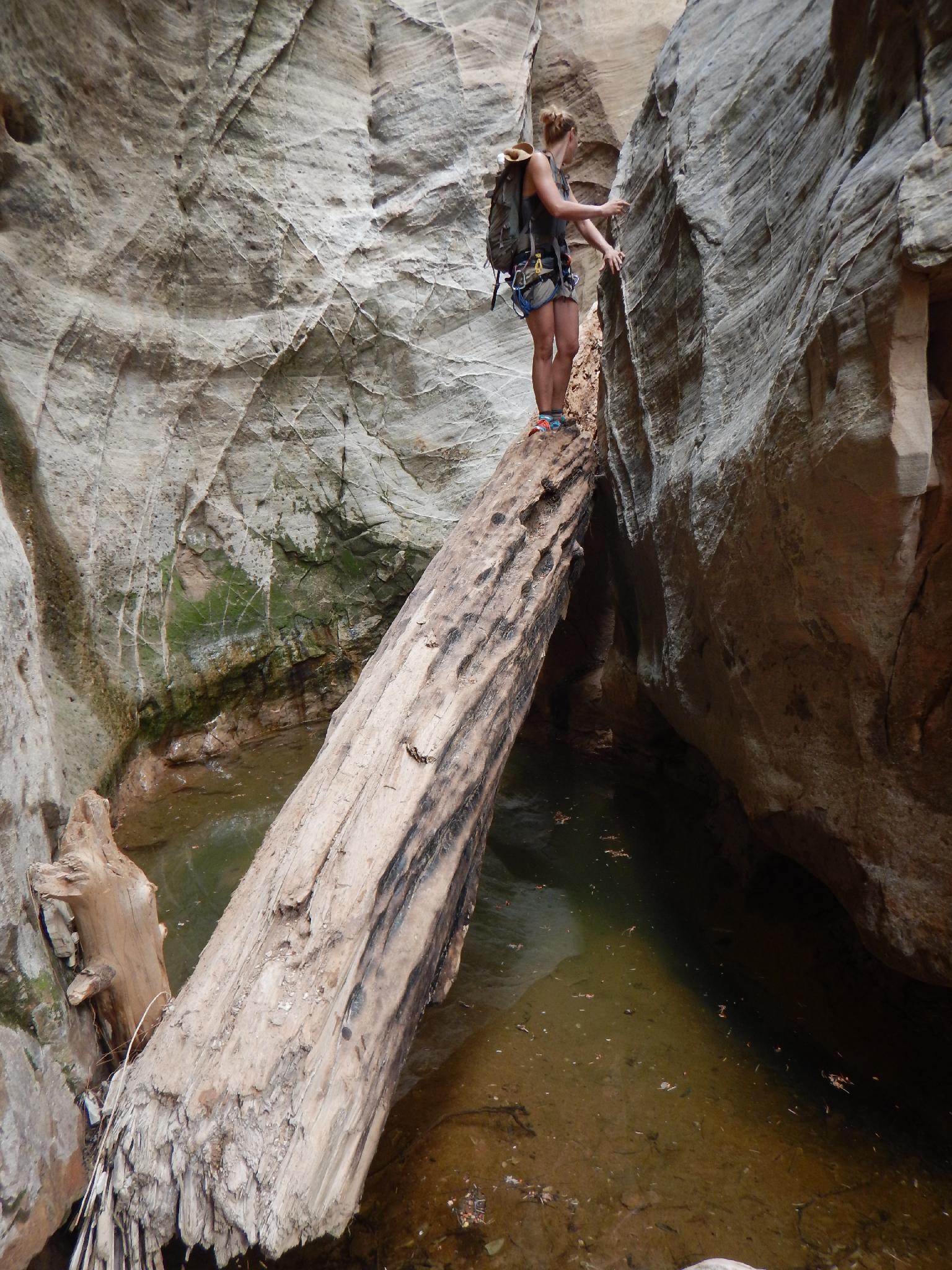
Below rappel 6, the canyon makes a hard left with a couple of down climbs before reaching the Virgin River less than 10 minutes from the final rappel. The second down climb en route to the river is a bit tricky, use team work and spot the last man down,
Up The Narrows (4.5 miles / 1.5-2 hours)
Turn right and head up stream. If doing Mighty Mouse, it will be coming in on the left in 5-10 minutes. Otherwise, continue up stream on the well used trail, criss-crossing the river endlessly. This section is quite beautiful, with towering walls and vivid colors.
After a couple of miles, the trail turns to an old road. Continue on it, passing Bullock's Cabin, then a farm building before reaching the Chamberlain Ranch trailhead and your (hopefully) spotted exit vehicle.
Maps

12S 335172E 4135634N
37°21'10"N 112°51'40"W
12S 333300E 4135989N
37°21'20"N 112°52'56"W
12S 332309E 4137074N
37°21'55"N 112°53'37"W
12S 332234E 4137528N
37°22'10"N 112°53'41"W
12S 332674E 4137683N
37°22'15"N 112°53'23"W
12S 332906E 4137573N
37°22'11"N 112°53'13"W
12S 334710E 4137672N
37°22'16"N 112°52'00"W
12S 335879E 4138357N
37°22'39"N 112°51'13"W
12S 337204E 4139203N
37°23'07"N 112°50'20"W