 Hiking
Buffalo Scaffold Canyon Trail
Hiking
Buffalo Scaffold Canyon Trail
Antelope Island
Overview
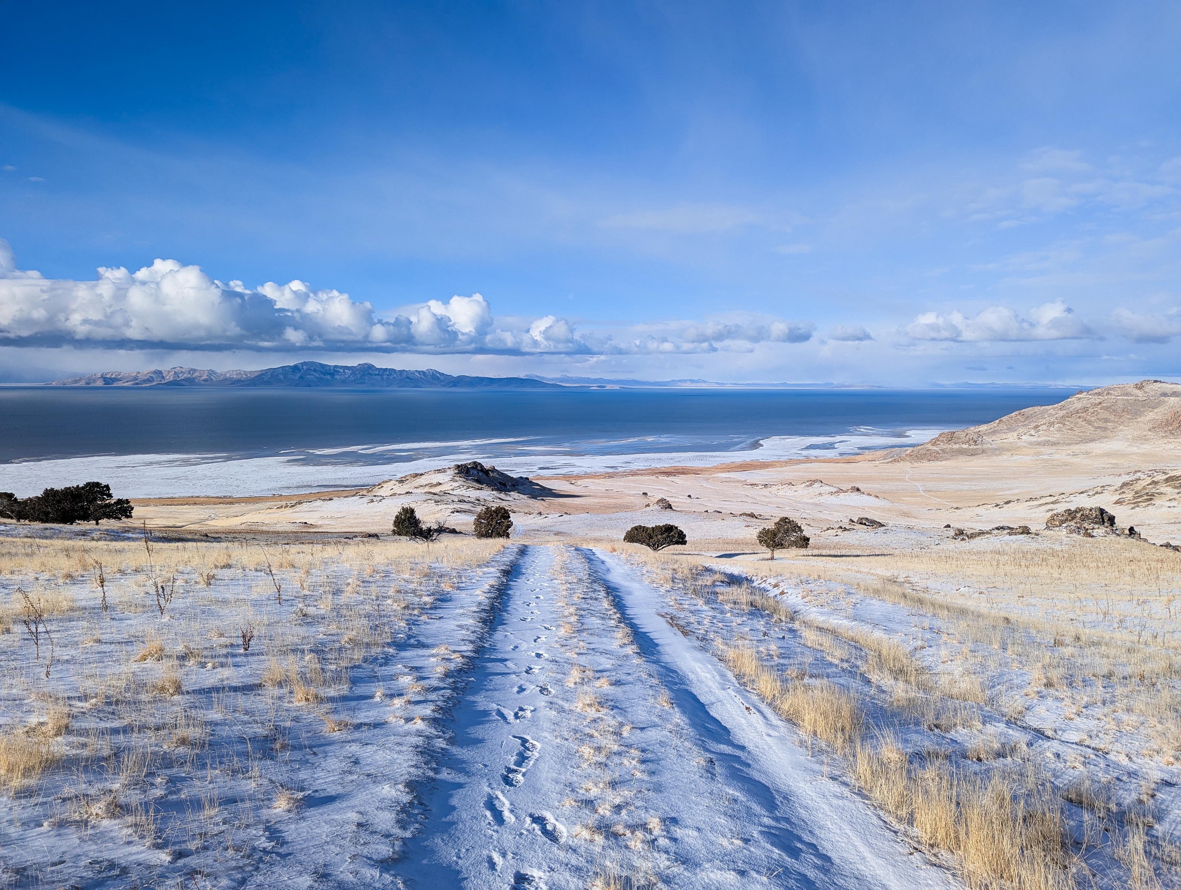
West Side Trail / Buffalo Scaffold Canyon Trail is a long, remote trail that traverses from the east side of the island to the west side, then follows the western shore north to meet with the Split Rock Loop trail. This trail doesn't see as much use as many of the trails in the park. If you are looking for solitude, this is an excellent choice. Some bikers use this trail as part of a long loop from White Rock Bay, but usage is minimal. For hikers, this is an out-and-back, so you can choose your length based on motivation. From the trailhead to Split Rock Loop Trail is about 16 miles roundtrip, see Split Rock Loop Trail for details on even longer outings.
Getting There
The trailhead is reach by first getting to Antelope Island. This is off I-15, west of Layton. Take exit 332 off I-15, and head west on Antelope Drive. About 7 miles from the freeway is the entrance to the park.
From the entrance to the park, cross the causeway and go left at the first junction after the causeway. Shortly after take the next left, staying on Antelope Road that is signed for Frary Peak. Follow this road about 11.3 miles to the trailhead that is signed, with a parking area on the left side of the road. The first 10.7 miles are paved, the last part is good, graded dirt road.
Route Description
Fielding Garr Trailhead
If hiking in the winter when the road is closed, and starting from the Fielding Garr Trailhead, head south on the road which turns to dirt at the gate, and follow it for 0.6 miles to the Sentinel Trailhead.
Sentinel Trailhead
The trail, a two-track dirt road, heads west from the trailhead. About 0.9 miles from the trailhead, a spur road goes north to Mushroom Springs. The springs are 1 of about 40 springs on the island that provide freshwater to the island's wildlife.
Stay on the main trail as it gets steeper and switchbacks up.
About 1.9 miles from the Sentinel Trailhead, the road splits. This is the loop junction for the Sentinel. If you have time, making the loop around the Sentinel is a nice side trip, but otherwise, go right. The trail climbs to the ridge, with Sentinel Peak to the south and the western side of the island now visible.
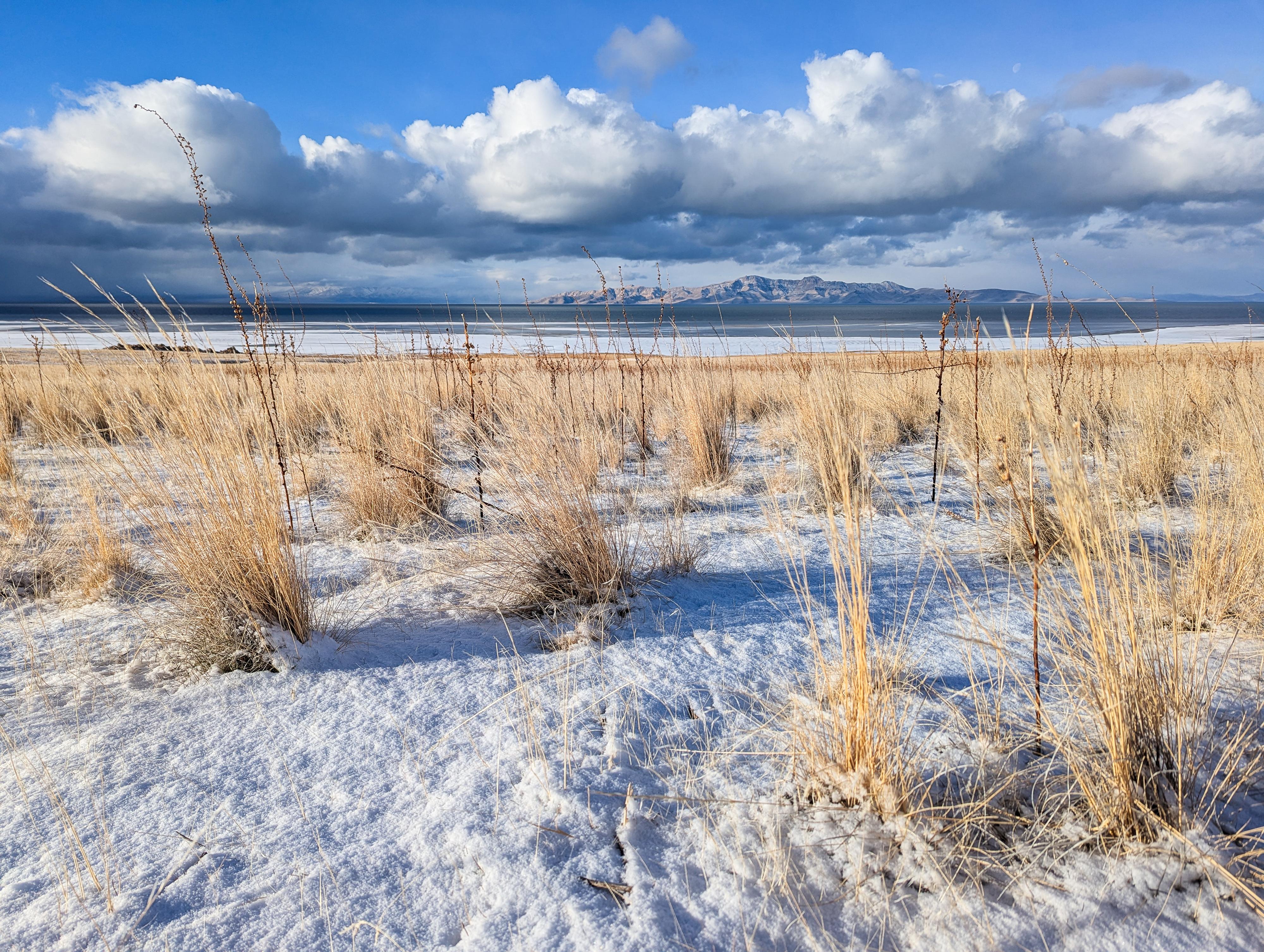
Stay on the two-track road as it begins to descend the west slope of the island. Once it has dropped most of the elevation to the lake, it heads north.
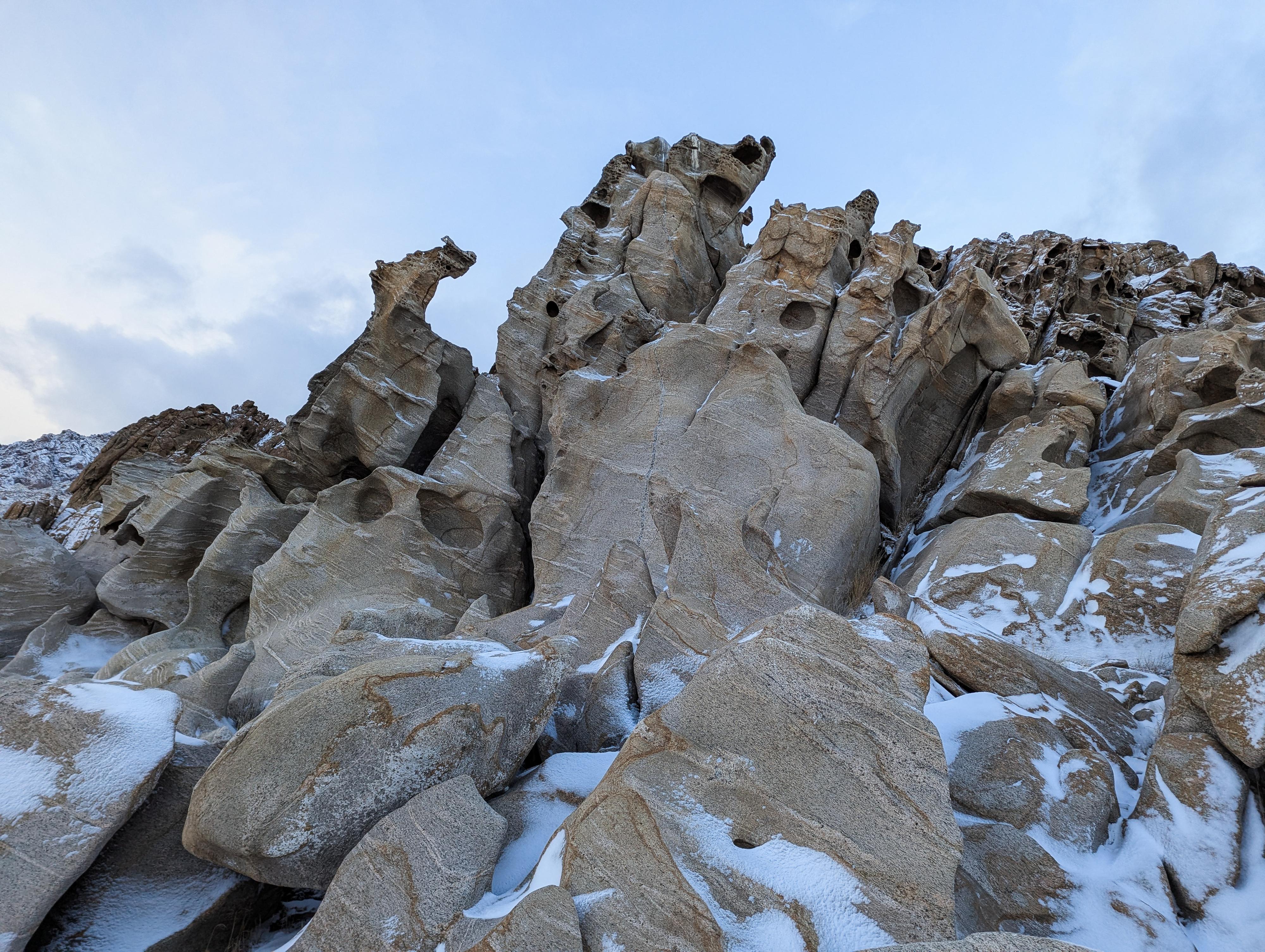
As the road nears the lake, it passes near some fascinating weathered rocks and cliffs. It is a beautiful spot. The road has a short section of deep sand and gravel as it passes near the lake, then begins to climb away from the shore a bit again and continue north. About 1.5 miles north of the weathered rocks and cliffs, a steep climb up the north side of Red Rocks Canyon leads to the junction with the Split Rock Loop trail.
Return the same way whenever motivation starts to dwindle. I think where the trail passes next to the weathered rocks and cliffs makes a good turnaround spot for most.
Photos
Maps
")
")
12T 401526E 4531304N
40°55'37"N 112°10'10"W
12T 401555E 4531185N
40°55'33"N 112°10'09"W
12T 401263E 4530341N
40°55'06"N 112°10'21"W
12T 399612E 4530371N
40°55'06"N 112°11'32"W
12T 399030E 4529868N
40°54'49"N 112°11'56"W
12T 398949E 4530917N
40°55'23"N 112°12'00"W
12T 399152E 4530226N
40°55'01"N 112°11'51"W
12T 395243E 4532298N
40°56'06"N 112°14'40"W
12T 395362E 4536066N
40°58'09"N 112°14'37"W