 Hiking
Grassi Lakes
Hiking
Grassi Lakes
Canmore Canada
Overview
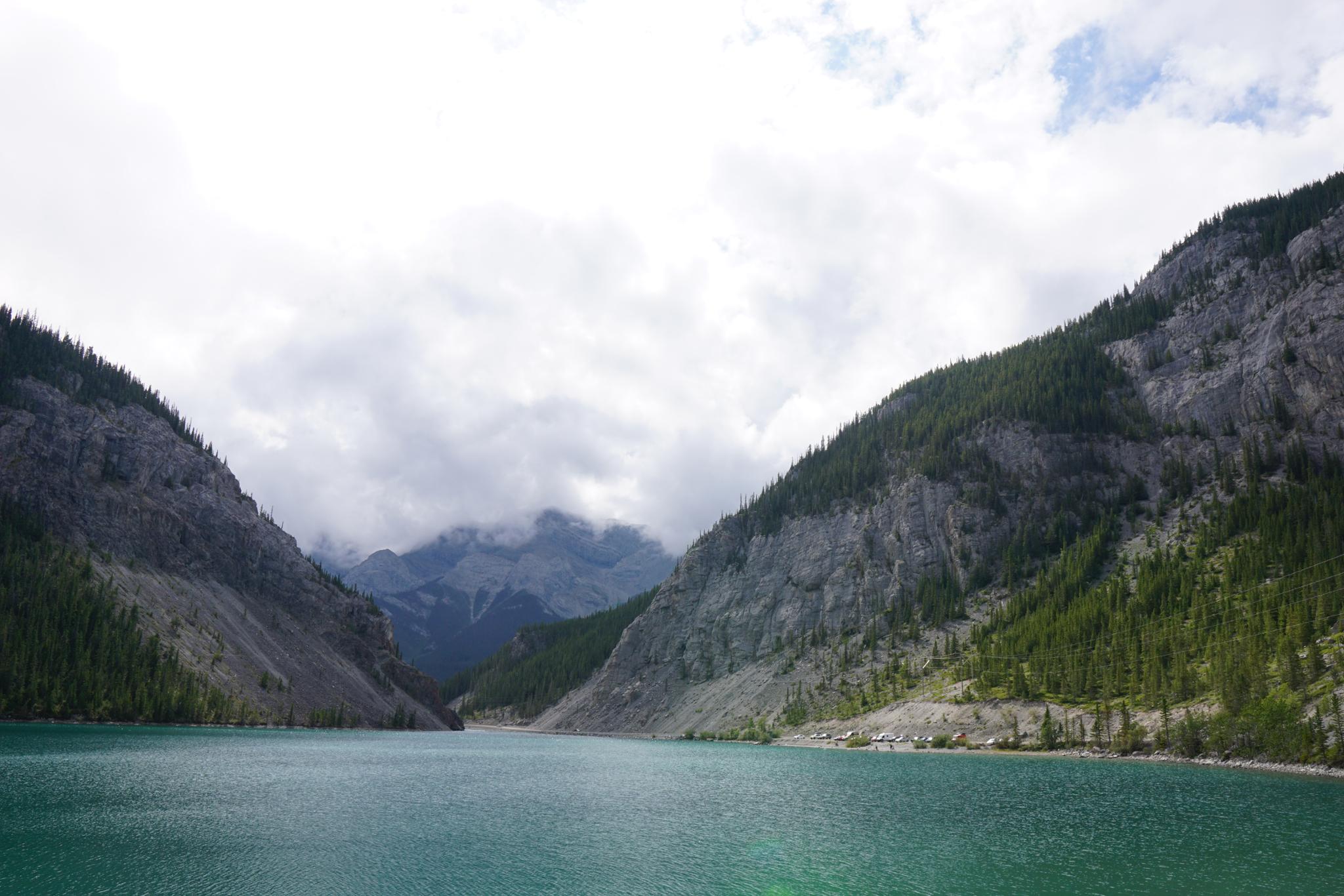
Two of the most beautiful lakes I have seen, Grassi Lakes, is an exceptional place to visit if in the Canmore area. The clear turquoise water is stunning to behold. The cliffs and rock are around the lakes are the icing on the cake for a nice half-day (or less) outing.
This route visits the lakes by hiking to them from above. The more common approach is to hike up from below. This route, from above, is shorter, but it is steep! Not particularly family-friendly with very young, though carrying a toddler in a backpack worked for us.
Getting There
The trailhead is Whitemans Pond. The road is partially dirt but well maintained and passable by most vehicles.
From Canmore, go south on Bridge Road, cross the Bow River, then the road becomes Rundle Drive. Continue on Rundle Drive 500m to Three Sisters Drive. Turn left on Three Sisters Drive. After 650m, stay right on Spray Lakes Rd/Three Sisters Pkwy/AB-742, and follow it an additional 6.3km to Whitemans Pond. There is a parking area on the left a hundred meters or so past the dam. This parking area is the trailhead.
Route Description
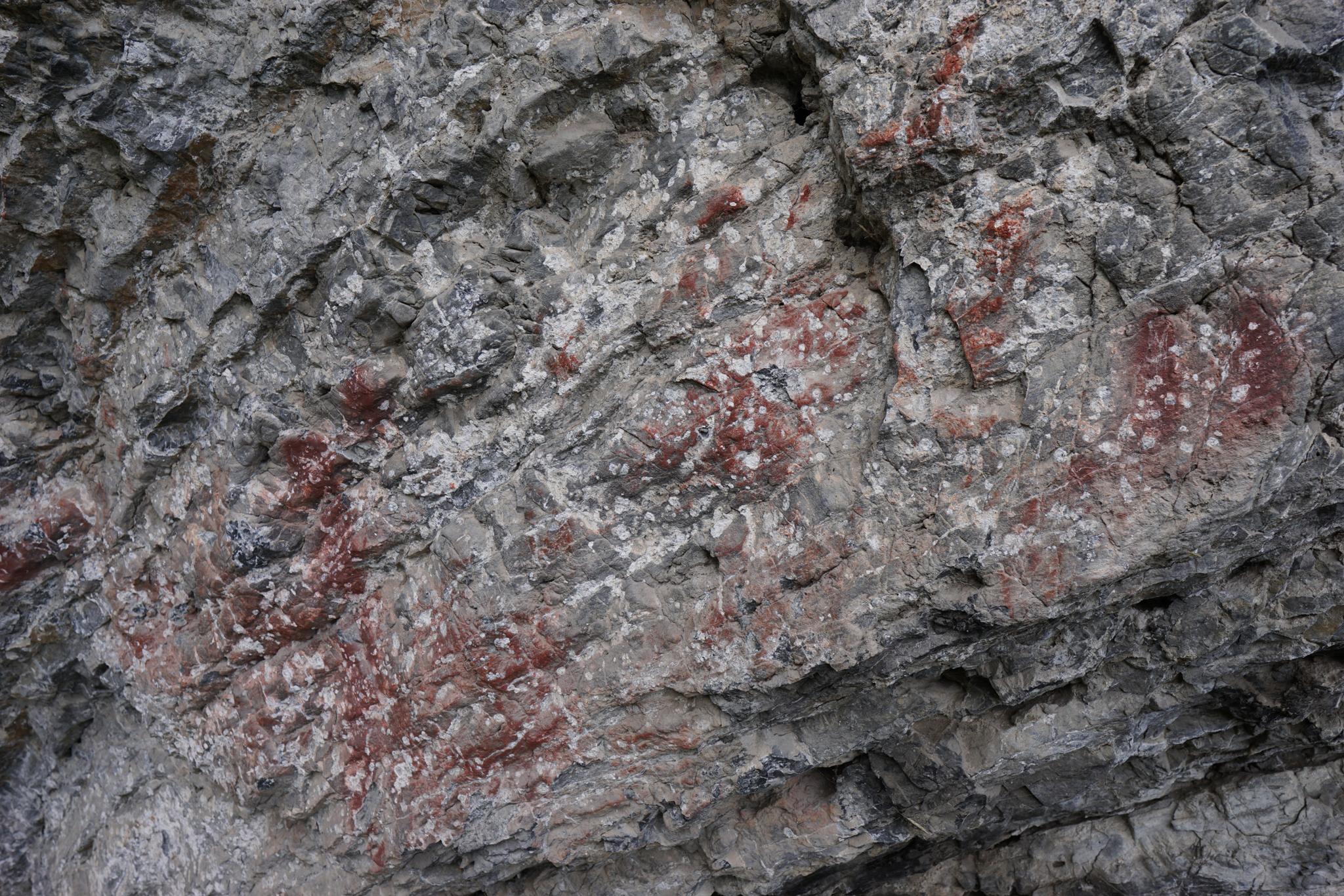
Rock art and historic sites are fragile, non-renewable cultural resources that, once damaged, can never be replaced. To ensure they are protected, please:
- Avoid Touching the Petroglyphs: Look and observe, BUT DO NOT TOUCH!
- Stay on the Trails: Stay on the most used trails when visiting sites, and don't create new trails or trample vegetation.
- Photography and Sketching is Allowed: Do not introduce any foreign substance to enhance the carved and pecked images for photographic or drawing purposes. Altering, defacing, or damaging the petroglyphs is against the law -- even if the damage is unintentional.
- Pets: Keep pets on a leash and clean up after them.
- Artifacts: If you happen to come across sherds (broken pottery) or lithics (flakes of stone tools), leave them where you see them. Once they are moved or removed, a piece of the past is forever lost.
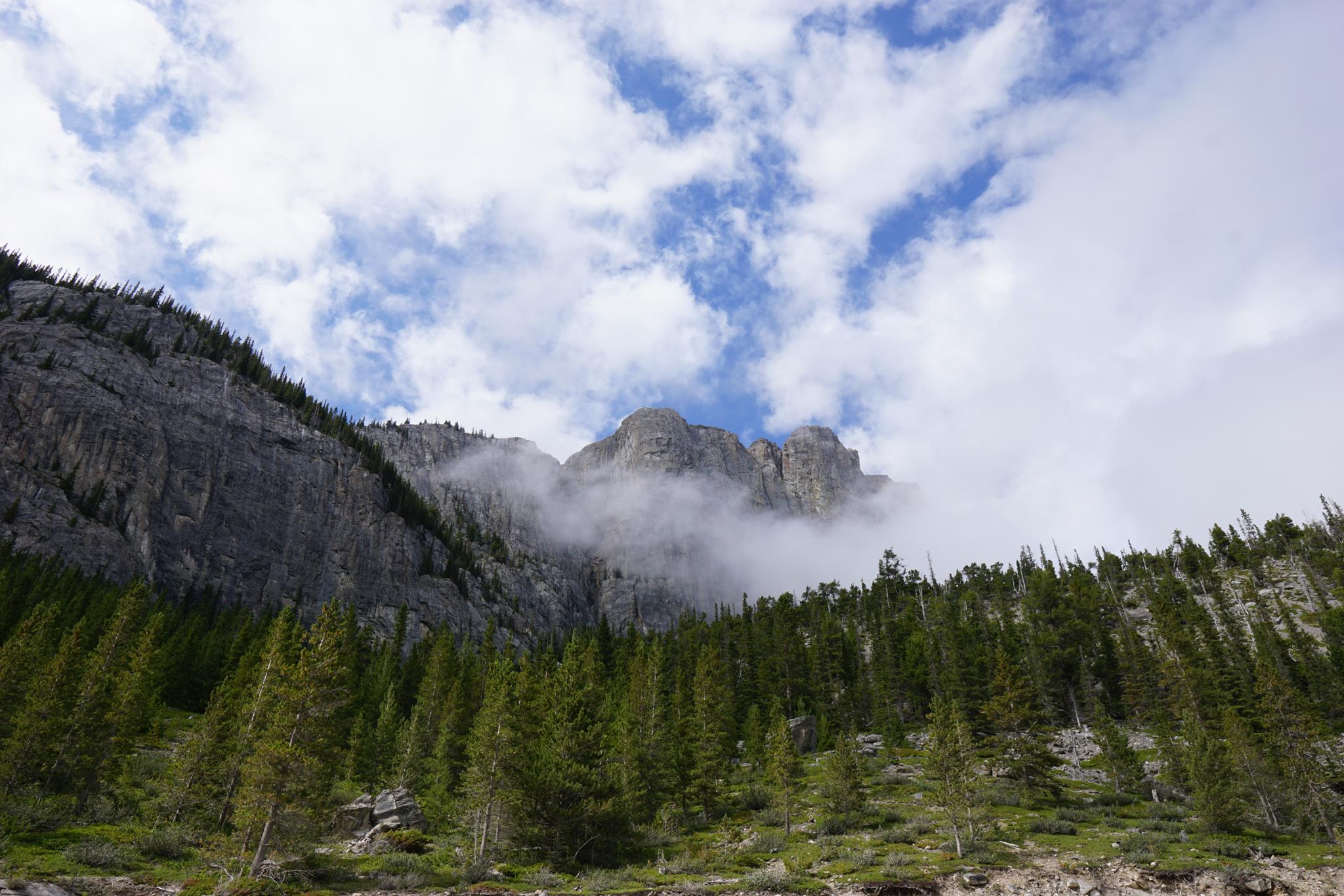
From the trailhead, go to the Whitemans Pond dam. Once around the gate, the Grassi Lakes trail immediately leaves on the left. The trail quickly and steeply descends along the cliffs. Climbers frequent these cliffs and are fun to watch.
Just before the first Grassi Lake, on the left under an overhang, are remnants of old pictographs. These are believed to have been painted by the Kutenai. The second Grassi Lake is just beyond the first. The trail is on the east side of the first pond to get to the second pond.
Maps

11U 611096E 5658777N
51°04'11"N 115°24'52"W
11U 611613E 5659070N
51°04'20"N 115°24'25"W