 Hiking
Moonshine Wash
Hiking
Moonshine Wash
San Rafael Desert
Overview
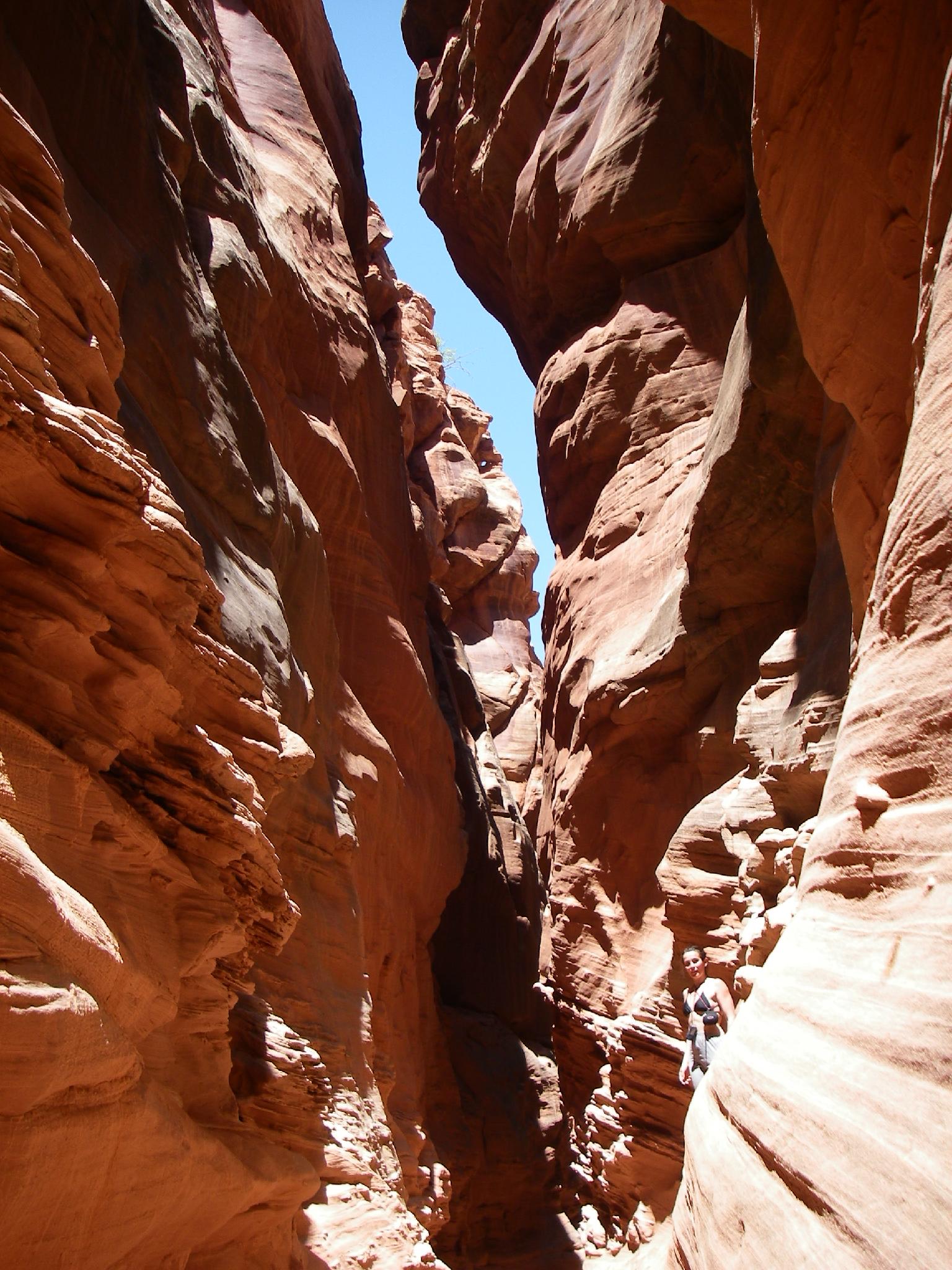
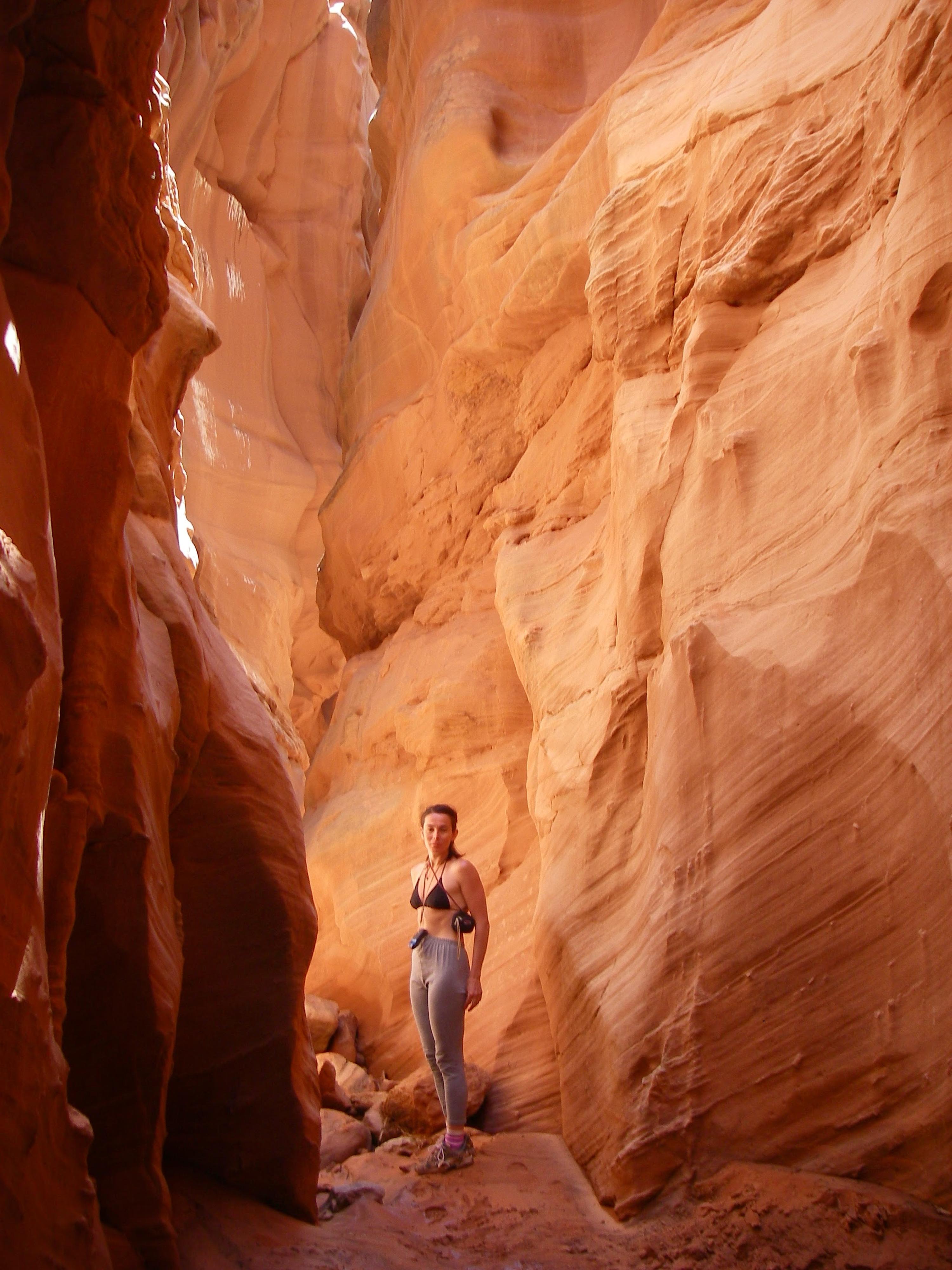
Moonshine Canyon is one of my favorite non-technical canyons. I've visited it a half dozen times or so over the years, and never tire of it. The route is easy, and well within most hikers abilities, while the scenery, history, and old sheep bridge make the hike outstanding. For hikers looking for a narrow canyon experience, this is very highly recommended.
This area of the San Rafael desert is not often visited, so expect much solitude and exquisite scenery. There is great primitive camping throughout the area, but please practice Leave No Trace Principles when camping in the area. Three Canyon, just across the road from Moonshine, and Chaffin Ranch Cold Water Geyser also provide interesting diversions while in the area.
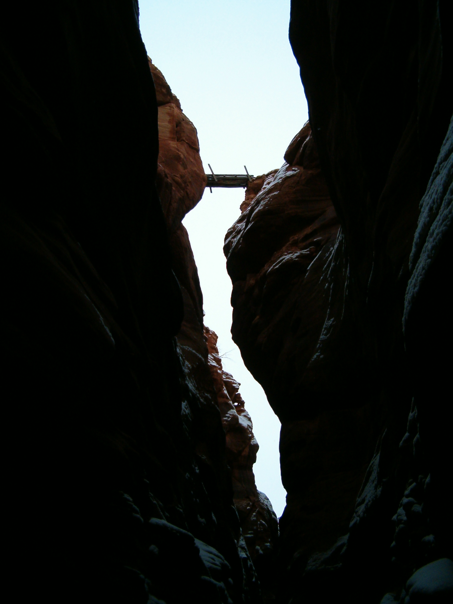
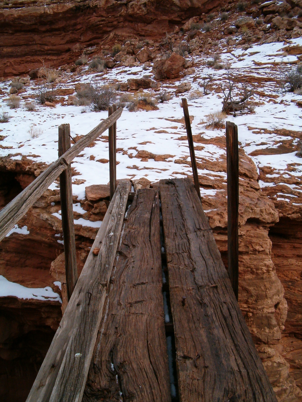
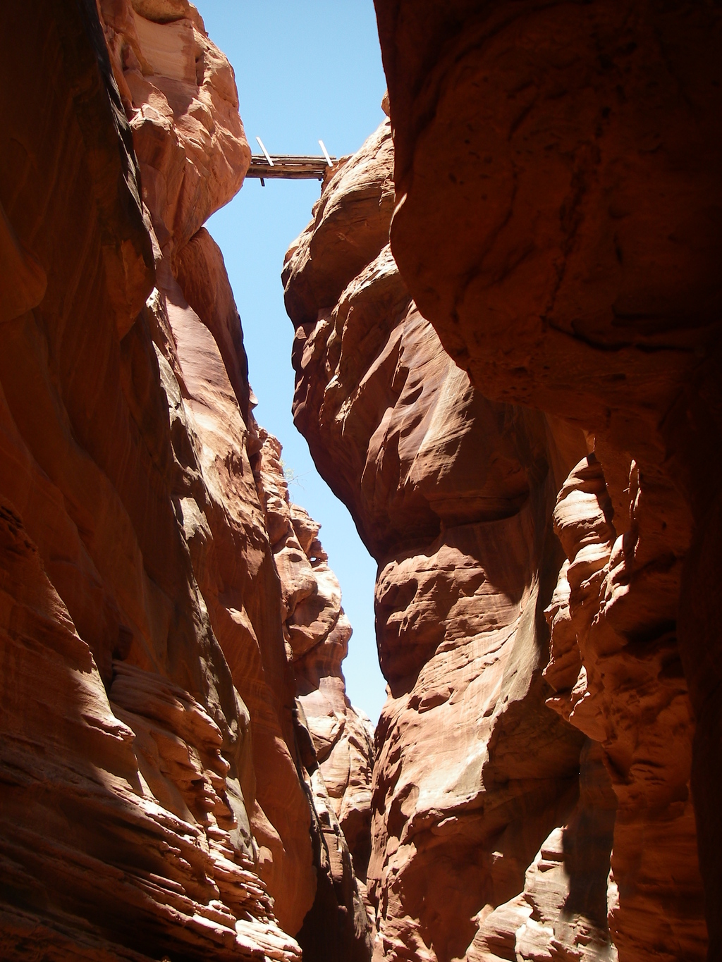
The area was popular with bootleggers during prohibition (hence its name). The west fork contains a few remnants of the old stills built during this time. The sheep bridge, however, likely pre-dates the bootleggers. As of 2009, it is in poor shape, yet still standing proudly over the canyon. It's common sense, but do not try to use the sheep bridge. It is no longer stable but is fascinating to view and try and image ranchers moving sheep over such a narrow bridge.
Getting There
From downtown Green River, follow the main road to the airport sign (Long Street). Go south on Long Street several blocks until its junction with Green River Avenue. Go left (east) on Green River Avenue a block to the junction with Airport Road. Follow Airport Road over the railroad tracks, and under the highway. Reset your odometer on the other side of the highway, as you cross the cattle guard.
Route Description
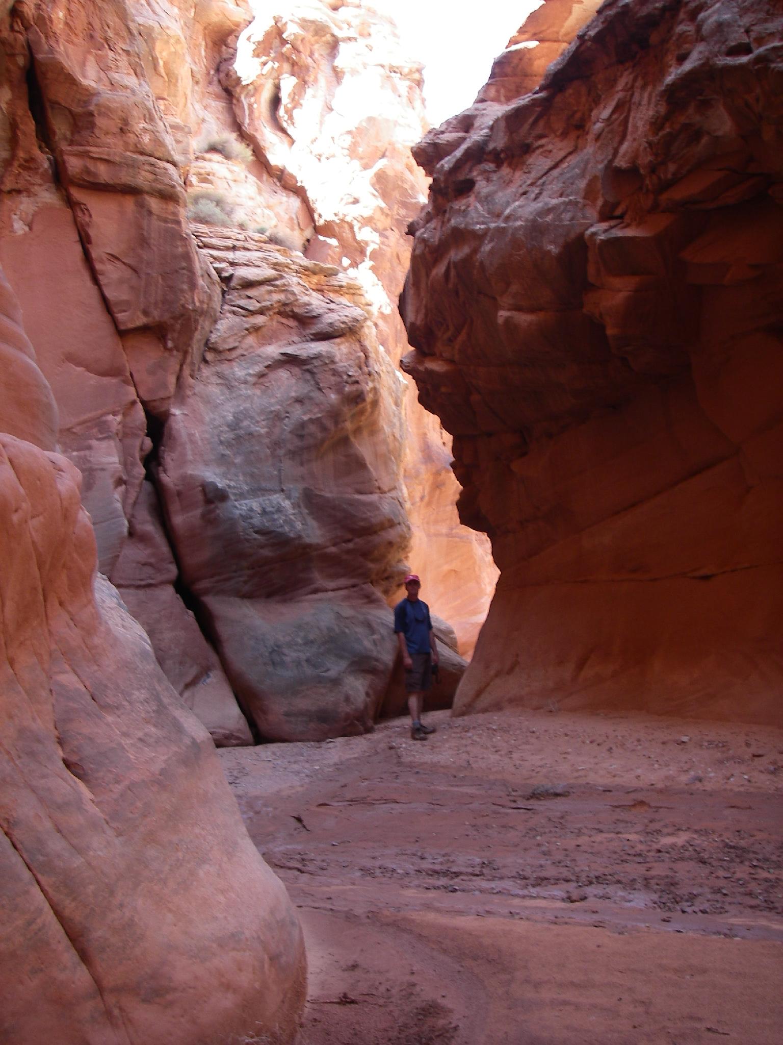
From the 4x4 trailhead, follow the ATV trail as it winds its way down the wash to join Moonshine proper in 15 minutes or so. Once in Moonshine, head down the canyon. The canyon quickly begins to narrow and deepen. There are a few boulders in this section to climb over and around. None are particularly difficult, especially with a little teamwork. Once in the depths of Moonshine, easy walking takes you to it's narrowest point, underneath the sheep bridge. Turning around at this point and returning makes a great short hike for those just wanting to see the narrows. (2-3 hours round trip)
If you are looking for a longer hike, continue down the canyon as it begins opening and getting wider. A little over a mile from the sheep bridge (30-40 minutes), the West Fork comes in on the left (looking down canyon). Heading up the West Fork provides an interesting challenge. Just up from the junction is a 10-12m / 35-40 ft. dryfall. This can be climbed by most with little risk, it is fairly easy and very secure climbing. The pool beneath the dryfall, however, changes with every flood and can be shallow or fairly deep.
Above the dryfall the slot has a few more relatively easy boulder sections before opening up. Again, however, this section seems to change a bit with each flood. Keep following the West Fork up to the ruins of an old concrete vat used for moonshine production. Just past the vat the canyon forks. A short visit up the right fork will take you to Moonshine spring. To visit, got up the right fork until it forks again. Here, go west into the vegetated fork a short distance to the spring in an alcove.
Continue up the west fork of Moonshine. When you reach another prominent junction, go right (up the west fork) climbing a couple of short dryfalls in the process. Once the canyon opens up, travel due east to reach the east fork of Moonshine at about the spot you started. Return up the ATV trail you came in on.
Photos
Maps

12S 573062E 4282599N
38°41'20"N 110°09'36"W
12S 572178E 4282116N
38°41'05"N 110°10'12"W
12S 571322E 4281896N
38°40'58"N 110°10'48"W
12S 571543E 4284020N
38°42'07"N 110°10'38"W
12S 569756E 4281912N
38°40'59"N 110°11'53"W