 Hiking
Right Fork From the Bottom
Hiking
Right Fork From the Bottom
Zion West Side
Overview
If you are a canyoneer, I would highly recommend doing the Full Right Fork of North Creek from the top. It visits much more of the Right Fork and is quite amazing. For the hiker, Right Fork offers a pleasant hike in a much less visited area of the park than most.
The hike leaves the Kolob Terrace Road, descends to the bottom of the Right Fork, and follows it upstream. It is a 10-mile round trip, so a bit long. Many do this as an overnight backpack, but it does require a permit if backcountry camping. The initial portion of the hike is very sunny and hot, get an early start if doing this in the summer! There is filterable water along most of the hike.
Unfortunately, just when the Right Fork starts becoming very interesting and pretty, Barrier Falls lives up to its name and blocks upstream travel. The Grand Alcove is tantalizingly close above Barrier Falls, but out of reach of hikers.
Getting There
From the Zion Visitor center, head west on UT-9 for about 12 miles until you reach the town of Virgin. The Kolob Reservoir Road goes off on the right as you enter town. Follow the Kolob Reservoir Road north for 6.9 miles to the signed Right Fork Trailhead on the right side of the road. There is a parking area here.
Route Description
Follow the trail southeast a few minutes (0.25 miles) to where it drops off the mesa and down to North Creek. Follow the trail down, paying attention to its path as it can be a little tricky to find on the way out. Especially when close to North Creek, the trail braids incessantly. Follow the main path when you can find it.
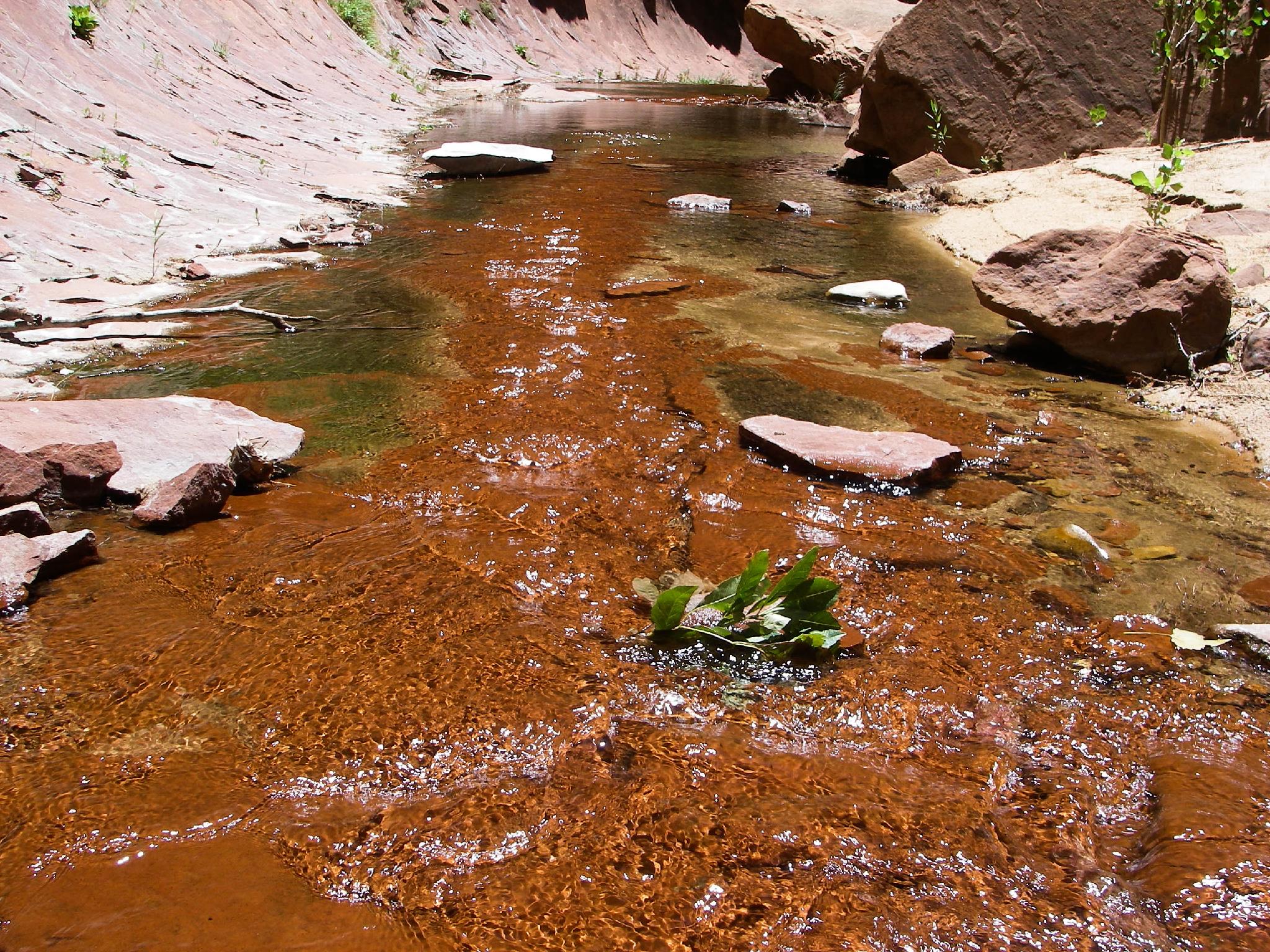
From the bottom, go up North Creek about 10 minutes (0.6 miles) to where Right Fork comes in on.. well.. the right of course. Follow the social trail up Right Fork. Though easy at first, it gets a bit rougher the further you go. Stay on the main path when possible. In many sections, it is easiest to be on the streambank. You'll be crossing quite a bit, and likely to have wet feet.
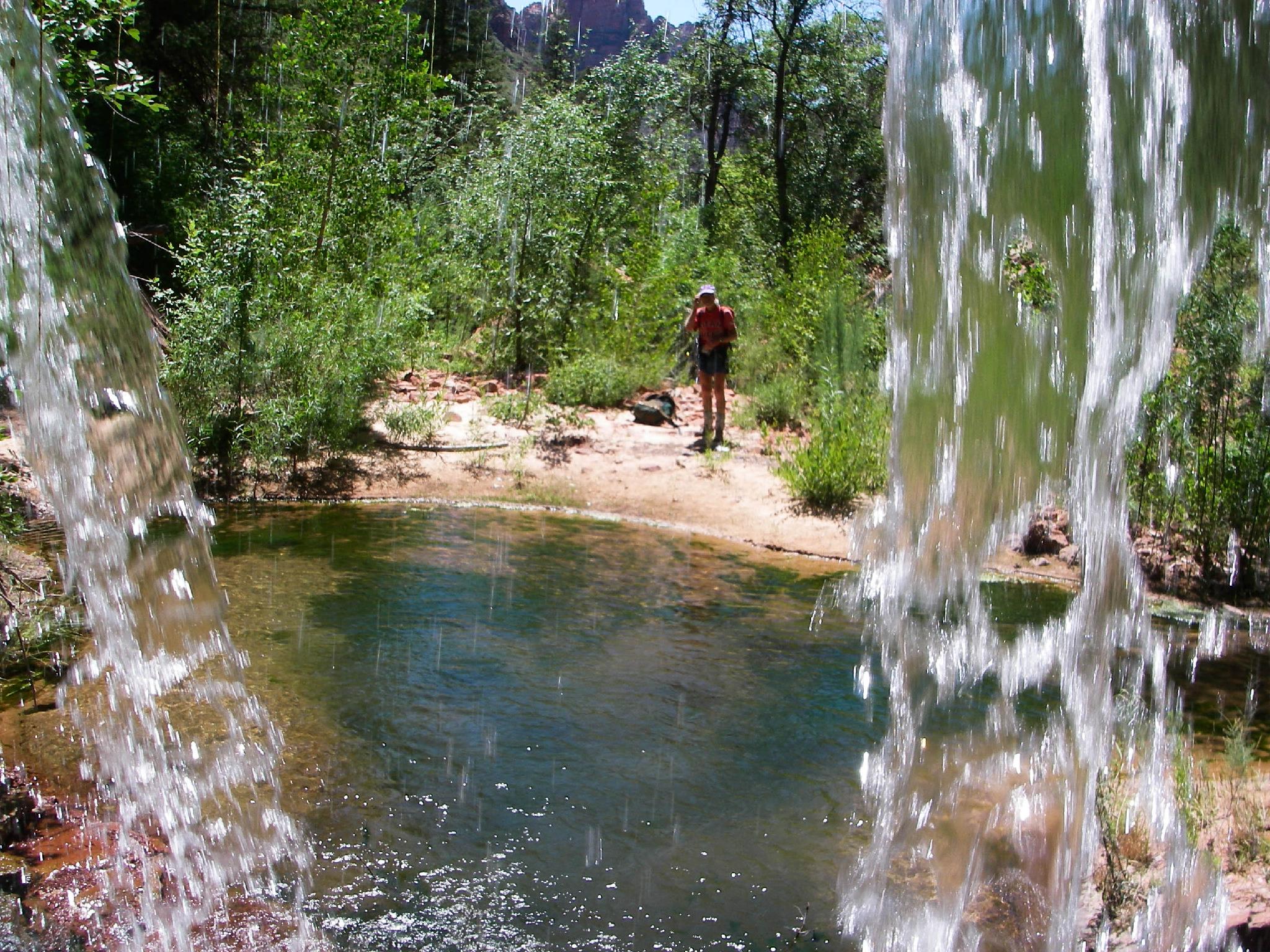
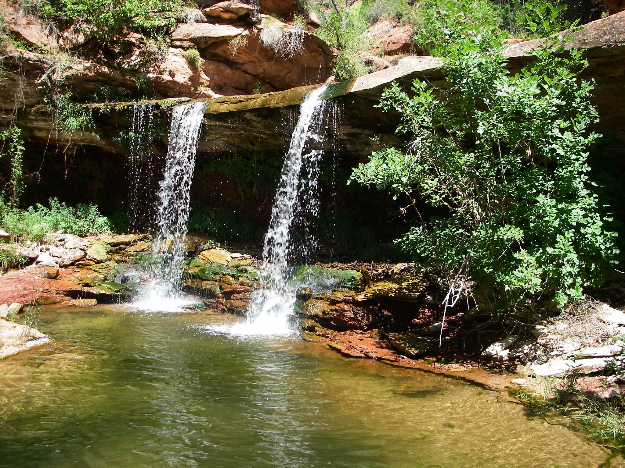
It is about 4.3 miles from the confluence of Right/Left Forks to Double Falls and excellent respite from the heat. A quarter of a mile or so past Double Falls is Barrier Falls and the end of the road for hikers. Return the same way.
Maps

12S 313527E 4126986N
37°16'15"N 113°06'11"W
12S 313880E 4126795N
37°16'09"N 113°05'57"W
12S 320570E 4127986N
37°16'52"N 113°01'26"W
12S 320895E 4128209N
37°16'60"N 113°01'13"W
12S 321399E 4128593N
37°17'13"N 113°00'53"W