Headquarters Canyon |

Notom Road

Hiking Headquarters Canyon - Notom Road Hiking Headquarters Canyon

Notom Road

Overview

RATING: Easy Hiking
MAPS: The Post, UT;

Fri

A slight chance of rain showers before noon, then showers and thunderstorms likely. Mostly cloudy, with a high near 65. West southwest wind 6 to 20 mph. Chance of precipitation is 60%.

65 | 47

Sat

A chance of rain showers before noon, then a chance of showers and thunderstorms. Mostly cloudy, with a high near 61. Chance of precipitation is 50%.

61 | 42

Sun

Sunny, with a high near 67.

67 | 41

Mon

Sunny, with a high near 76.

76 | 44

Tue

Sunny, with a high near 81.

81 | 49

View Full Weather Details
SEASON: Any, hot in the summer
GEAR: Standard Hiking Gear
WATER: None.
FLASHFLOOD: Low

Fri

A slight chance of rain showers before noon, then showers and thunderstorms likely. Mostly cloudy, with a high near 65. West southwest wind 6 to 20 mph. Chance of precipitation is 60%.

65 | 47

Sat

A chance of rain showers before noon, then a chance of showers and thunderstorms. Mostly cloudy, with a high near 61. Chance of precipitation is 50%.

61 | 42

Sun

Sunny, with a high near 67.

67 | 41

Mon

Sunny, with a high near 76.

76 | 44

Tue

Sunny, with a high near 81.

81 | 49

View Full Weather Details
Beautiful sky in Headquarters Canyon

Beautiful sky in Headquarters Canyon

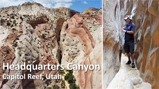
Short and sweet, this is a family friendly canyon I would highly recommend if passing through the area. It, in my opinion, is quite a bit prettier and more interesting than its very near neighbor Surprise Canyon. A short approach and nice narrows make it a good outing most of the year, though will be brutally hot during the day in peak summer.

View from the trailhead.

View from the trailhead.

Getting There

Travel east out of Capitol Reef National Park on highway 24. Just past the park, 0.25 miles, is the well signed Notom road.

  • Turn south onto Notom Road and reset your odometer. ( 12S 488763mE 4237262mN / N38° 17' 00" W111° 07' 43" )
  • At 13.6 miles, is the Sandy Creek Junction. Stay right on the Notom road here. ( 12S 493913mE 4217290mN / N38° 06' 12" W111° 04' 10" )
  • At 13.9 miles, is the second Sandy Creek Junction. Stay right on the Notom road here. ( 12S 494104mE 4216858mN / N38° 05' 58" W111° 04' 02" )
  • 21.2 miles to the Cedar Mesa Campground on the right (west) side of the road. ( 12S 492760mE 4206611mN / N38° 00' 26" W111° 04' 57" )
  • Burr Trail junction is at 32.5 miles. Stay straight, heading toward Bullfrog. ( 12S 498890mE 4189788mN / N37° 51' 20" W111° 00' 45" )
  • 34.3 miles from highway 24, the Surprise Canyon trailhead is a small turn out on the right (west) side and is signed. ( 12S 500983mE 4187875mN / N37° 50' 18" W110° 59' 20" )
  • 34.8 miles - Headquarters Canyon trailhead parking is on the left. The Post side road is off on the right. This goes 0.5 miles to the Halls Creek/Lower Muley Twist Trailhead. ( 12S 501614mE 4187295mN / N37° 49' 59" W110° 58' 54" )
Headquarters Canyon Slot Section

Headquarters Canyon Slot Section

Toward the end of Headquarters

Toward the end of Headquarters

Route

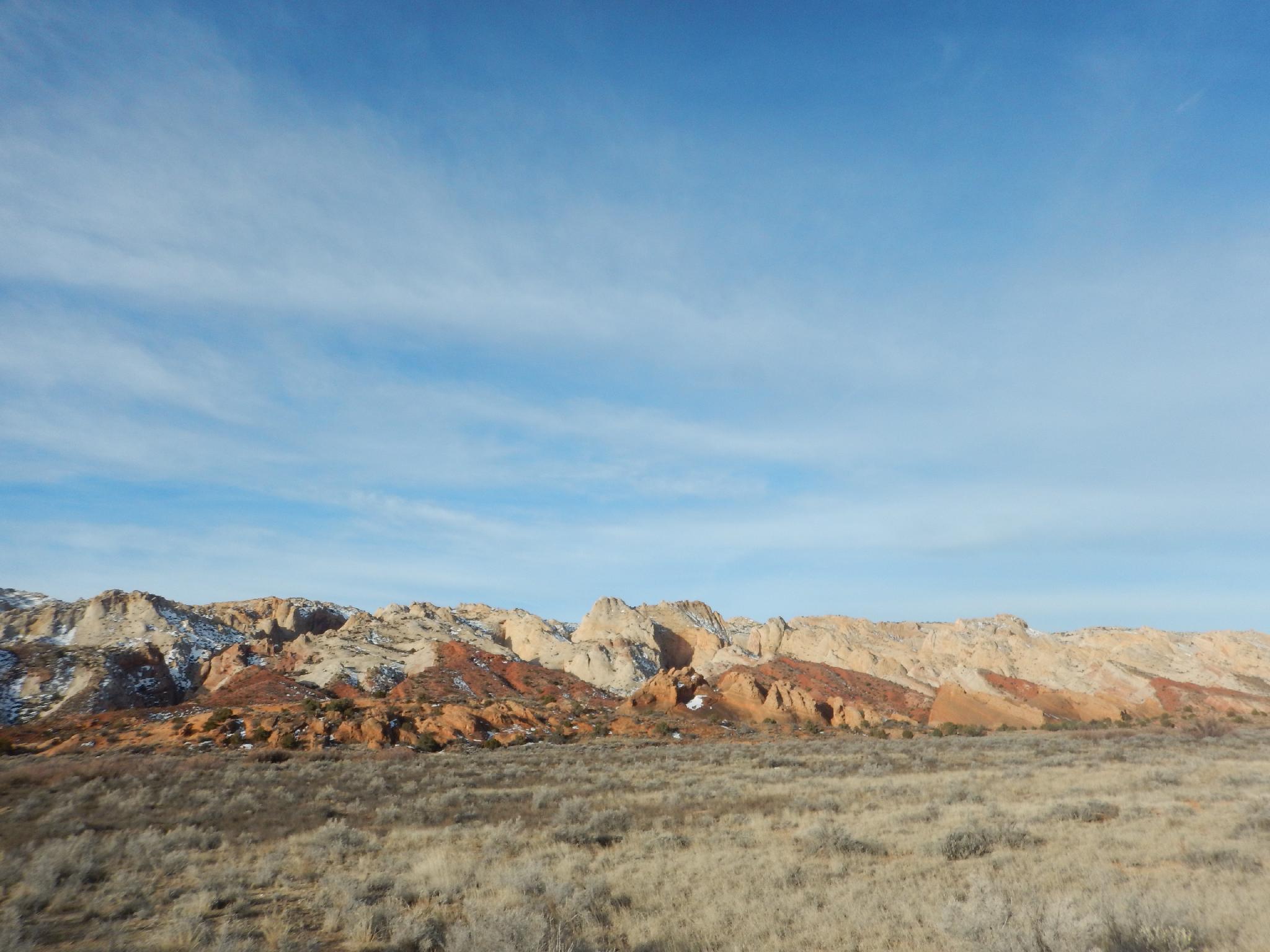
From the small parking area, head west on the trail toward the reef. Headquarters Canyon is the pink striped canyon visible almost due west of the trailhead. The trail crosses the valley bottom to the base of the sandstone dome, then cuts slightly south over a low ridge and down to the wash bottom.

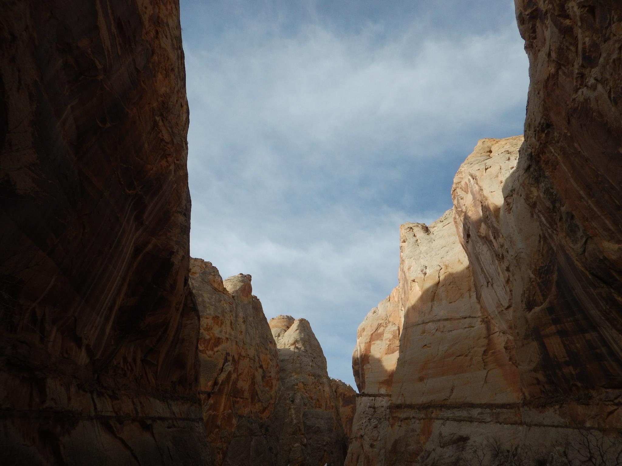
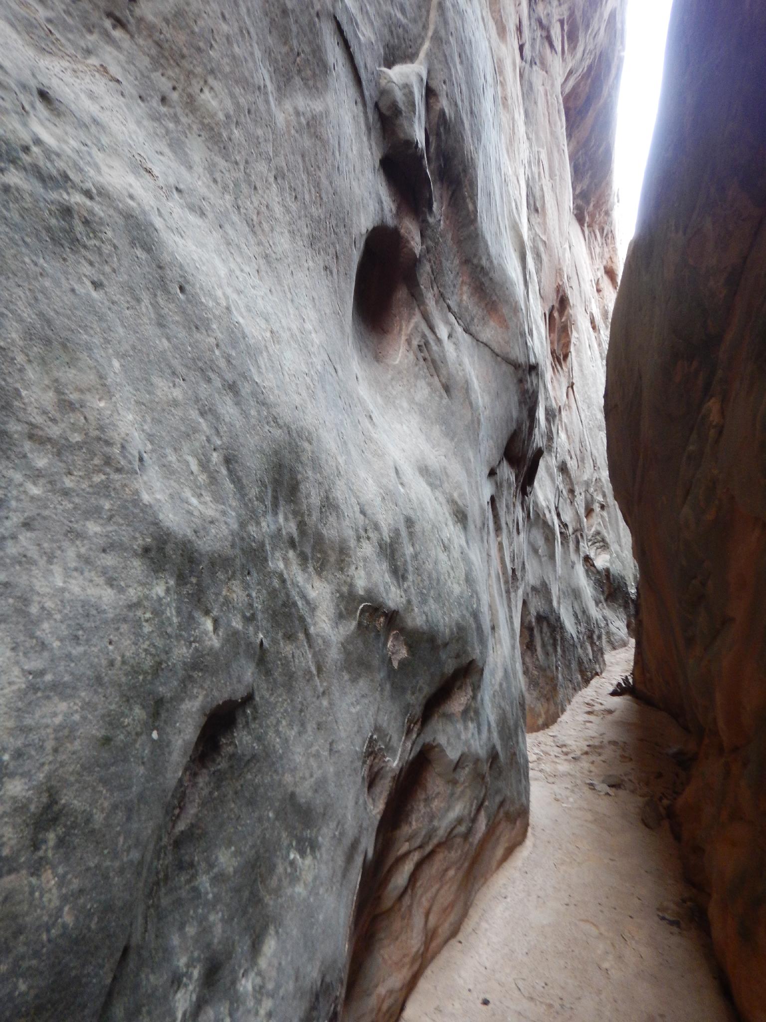
In the wash bottom, go right (north) and follow the wash. It soon snakes around and enters a reef via a deep and sinuous short section of slot canyon. Beautiful!

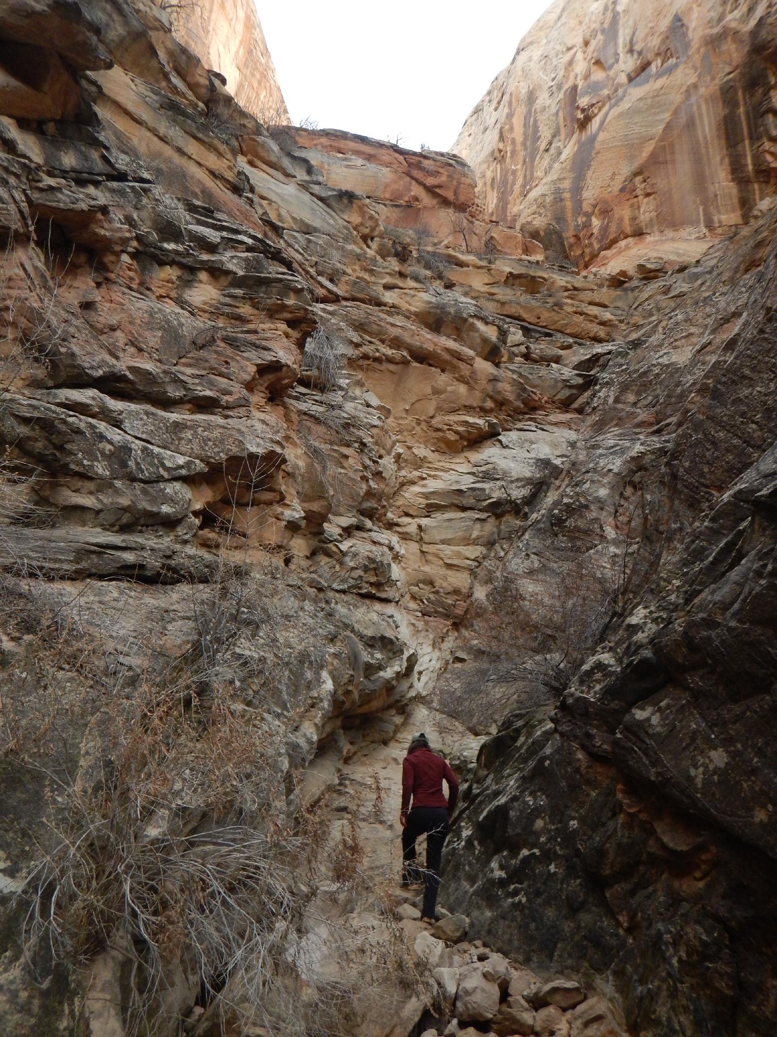
Above the slot, the canyon opens. Continuing up, the canyon narrows again after a few bends at an interesting steep section with a sandstone floored bottom. At the top of this short section is a moderately difficult upclimb, then the canyon ends at a steep cliff. Return the same way.


Videos

Headquarters Canyon richardpattison

Maps

Route / 2.32 miles / Elevation Range 4,882 - 5,327 ft.
Printable Maps:
Trailhead

12S 501615mE 4187294mN

N37° 49' 59" W110° 58' 54"

Wash Bottom

12S 501240mE 4186753mN

N37° 49' 42" W110° 59' 09"

Narrows

12S 500904mE 4186749mN

N37° 49' 41" W110° 59' 23"

Comments

Want to make a comment? Login and let yourself be heard.