Bald Mountain |

Uinta Mountains

Hiking Bald Mountain - Uinta Mountains Hiking Bald Mountain

Uinta Mountains

Overview

RATING: Easy Hiking
MAPS: Mirror Lake, UT;

Sat

Snow showers likely before noon, then snow showers and a slight chance of thunderstorms. Cloudy, with a high near 32. North wind 6 to 13 mph. Chance of precipitation is 90%. New snow accumulation of 2 to 4 inches possible.

32 | 23

Sun

A chance of snow showers before noon, then snow showers likely and a slight chance of thunderstorms. Mostly cloudy, with a high near 34. Chance of precipitation is 60%. New snow accumulation of less than half an inch possible.

34 | 23

Mon

A slight chance of snow showers before noon, then a chance of snow showers and a slight chance of thunderstorms. Mostly sunny, with a high near 39. New snow accumulation of less than half an inch possible.

39 | 19

Tue

A chance of snow showers. Mostly sunny, with a high near 42.

42 | 23

Wed

A slight chance of snow showers after noon. Sunny, with a high near 45.

45 | 25

View Full Weather Details
SEASON: Summer, Fall
GEAR: Standard Hiking Gear
WATER: None.

Sat

Snow showers likely before noon, then snow showers and a slight chance of thunderstorms. Cloudy, with a high near 32. North wind 6 to 13 mph. Chance of precipitation is 90%. New snow accumulation of 2 to 4 inches possible.

32 | 23

Sun

A chance of snow showers before noon, then snow showers likely and a slight chance of thunderstorms. Mostly cloudy, with a high near 34. Chance of precipitation is 60%. New snow accumulation of less than half an inch possible.

34 | 23

Mon

A slight chance of snow showers before noon, then a chance of snow showers and a slight chance of thunderstorms. Mostly sunny, with a high near 39. New snow accumulation of less than half an inch possible.

39 | 19

Tue

A chance of snow showers. Mostly sunny, with a high near 42.

42 | 23

Wed

A slight chance of snow showers after noon. Sunny, with a high near 45.

45 | 25

View Full Weather Details
Sunrise on Bald Mountain from Moosehorn Campground on its eastern base.

Sunrise on Bald Mountain from Moosehorn Campground on its eastern base.

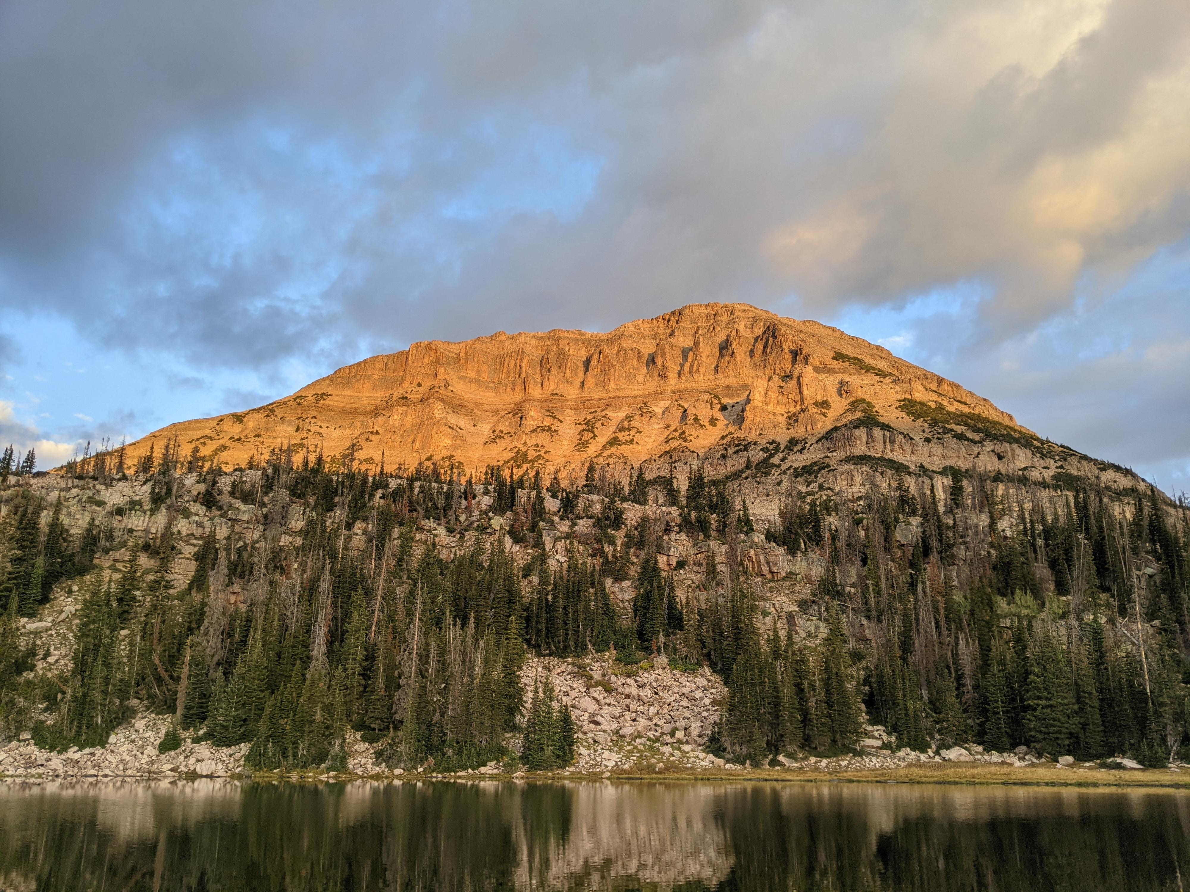
If there is one peak I would consider a must do in the Uinta Mountains, Bald Mountain would be it. This is an excellent family friendly hike to a very dramatic summit that offers perspective on the enormity of the Uinta Mountain Range. The Uinta Mountains have more contiguous area above timberline than any other area in the lower 48!

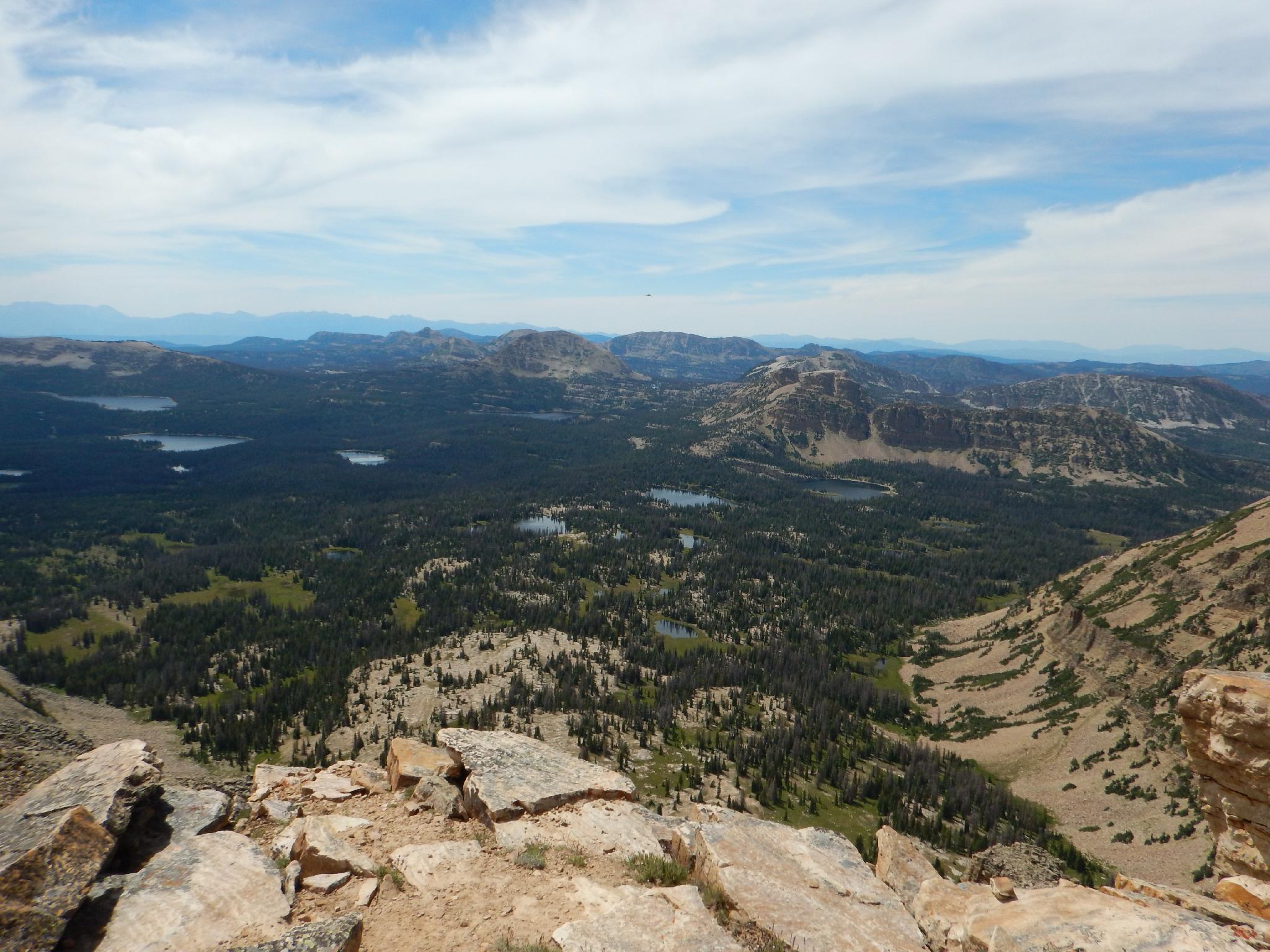
From its lofty summit, much of the high Uinta Wilderness comes in to view, as well as the lakes dotting the area near the Mirror Lake highway. In the far distance, even Mount Timpanogos and the back of the Wasatch Range are visible. The summit feels like a lofty perch.

The bad? Well, a trip to the summit might quite possibly ignite a passion for hiking in the Uinta's, and consume your weekends..

Like all mountains, this one is not recommended if thunderstorms are building or expected (quite common in the summer). The summit is very exposed. On my first trip up, we ran up after work with dark clouds threatening. By the time we summited, lighting was crashing so close we were waiting to be struck any second! In retrospect, very foolish. Don't make my mistake!

Hayden Peak from Bald Mountain

Hayden Peak from Bald Mountain

Getting There

Note: The Mirror Lake highway that is used to access this hike is closed in the winter. The gate is typically open from Memorial Day until late October, but if planning this hike on the shoulder season, call the forest service to see if it is open. ((801) 466-6411)

The trailhead is at mile post 29.1, which is 29.1 miles from Kamas Utah on highway 150, or about 48 miles south of Evanston Wyoming on highway 150. The Mirror Lake highway is closed from late fall to about Memorial Day. The trail would likely be very snowy until late June in most years.

The trailhead has a pit toilet and a large parking area. It is well signed.

The many lakes to the west of the Mirror Lake Highway

The many lakes to the west of the Mirror Lake Highway

Route

From the trailhead, follow the marked trail 1 minute to a junction. Go right here, on the signed Bald Mountain trail. It climbs steeply to the west, then eases a bit as some of the first big views become visible. A less steep section crosses to the north side of the mountain and offers incredible views before switch backing steeply up to the summit. The final section follows a bit of a narrow ridge on rock stairs to the incredible summit.

The views:

To the south, in the far distance, is Mount Timpanogos and the backside of the Wasatch Range to the west.

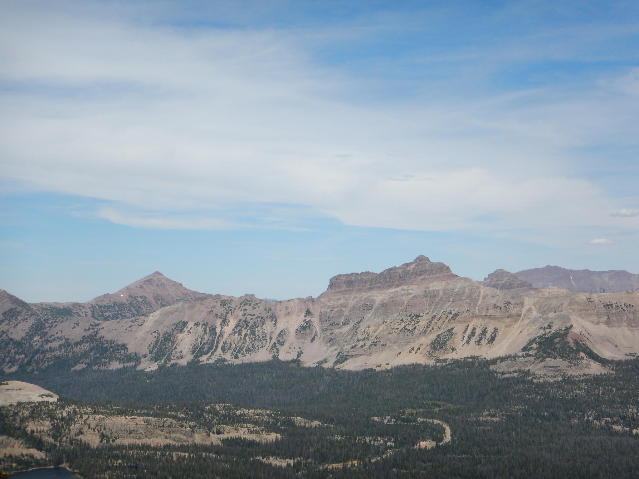
To the north and east is the cliff covered slope of Hayden Peak. More east is a shallow pass, Rocky Sea Pass, that allows access to the highest regions of the Uinta High Mountain Wilderness. Just before Rocky Sea Pass, tucked back mostly out of site, is Naturalist Basin.


Maps

Route / 2.76 miles / Elevation Range 10,759 - 11,954 ft.
Printable Maps:
Trailhead

12T 508118mE 4504248mN

N40° 41' 21" W110° 54' 14"

Junction right

12T 508072mE 4504289mN

N40° 41' 22" W110° 54' 16"

Summit

12T 508186mE 4505347mN

N40° 41' 56" W110° 54' 11"

Comments

Want to make a comment? Login and let yourself be heard.