 Hiking
Notch Peak
Hiking
Notch Peak
Delta
Overview
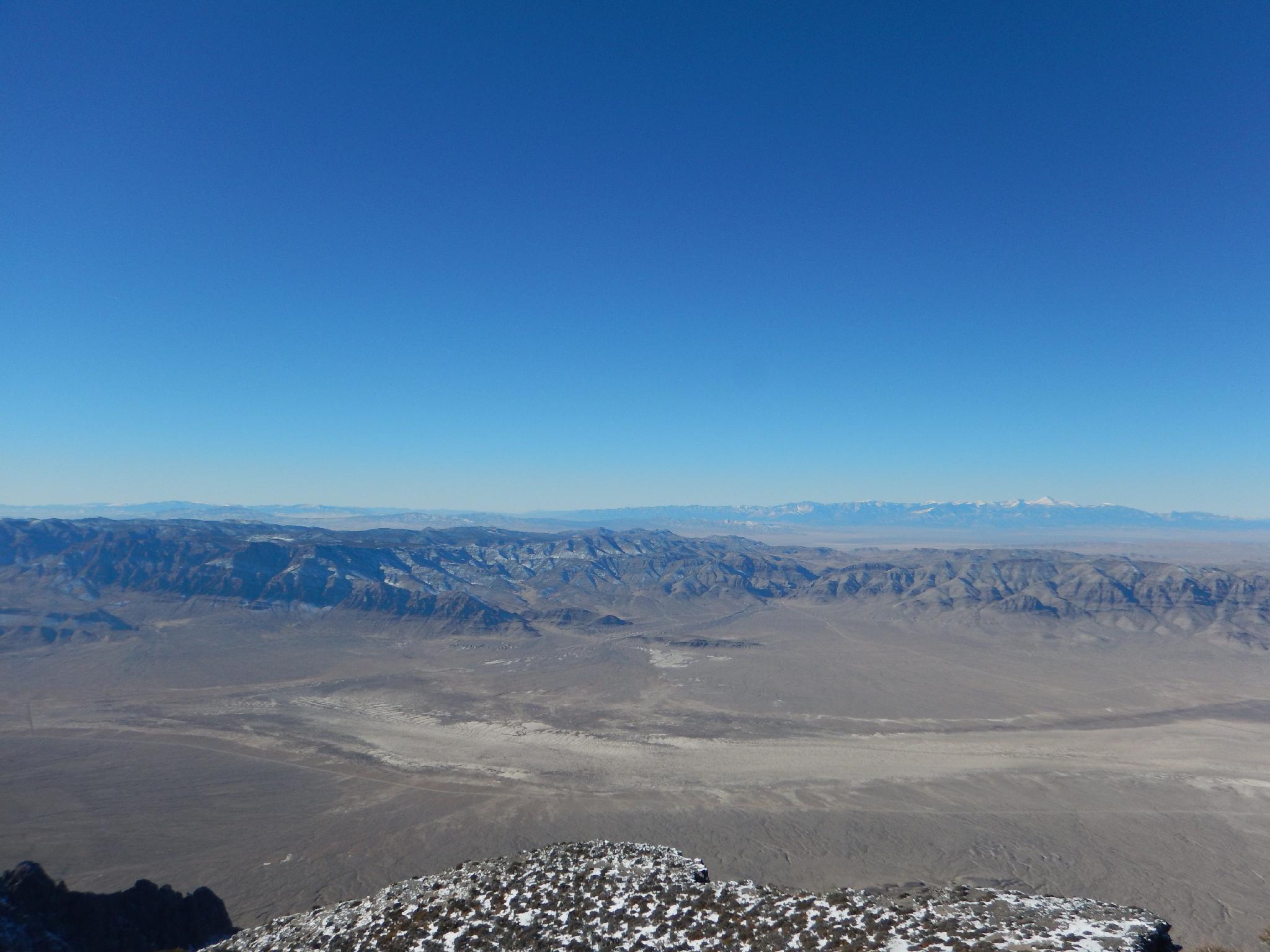
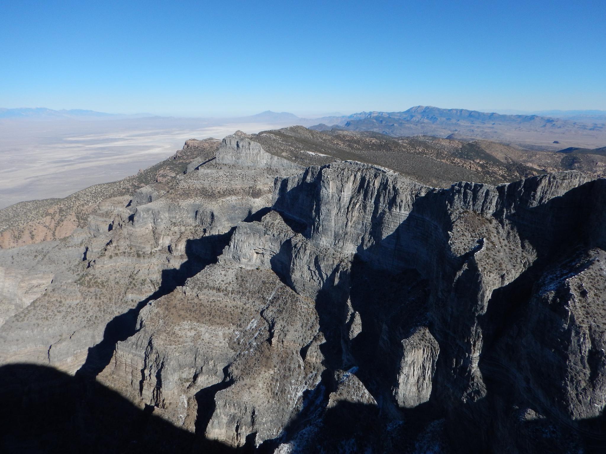
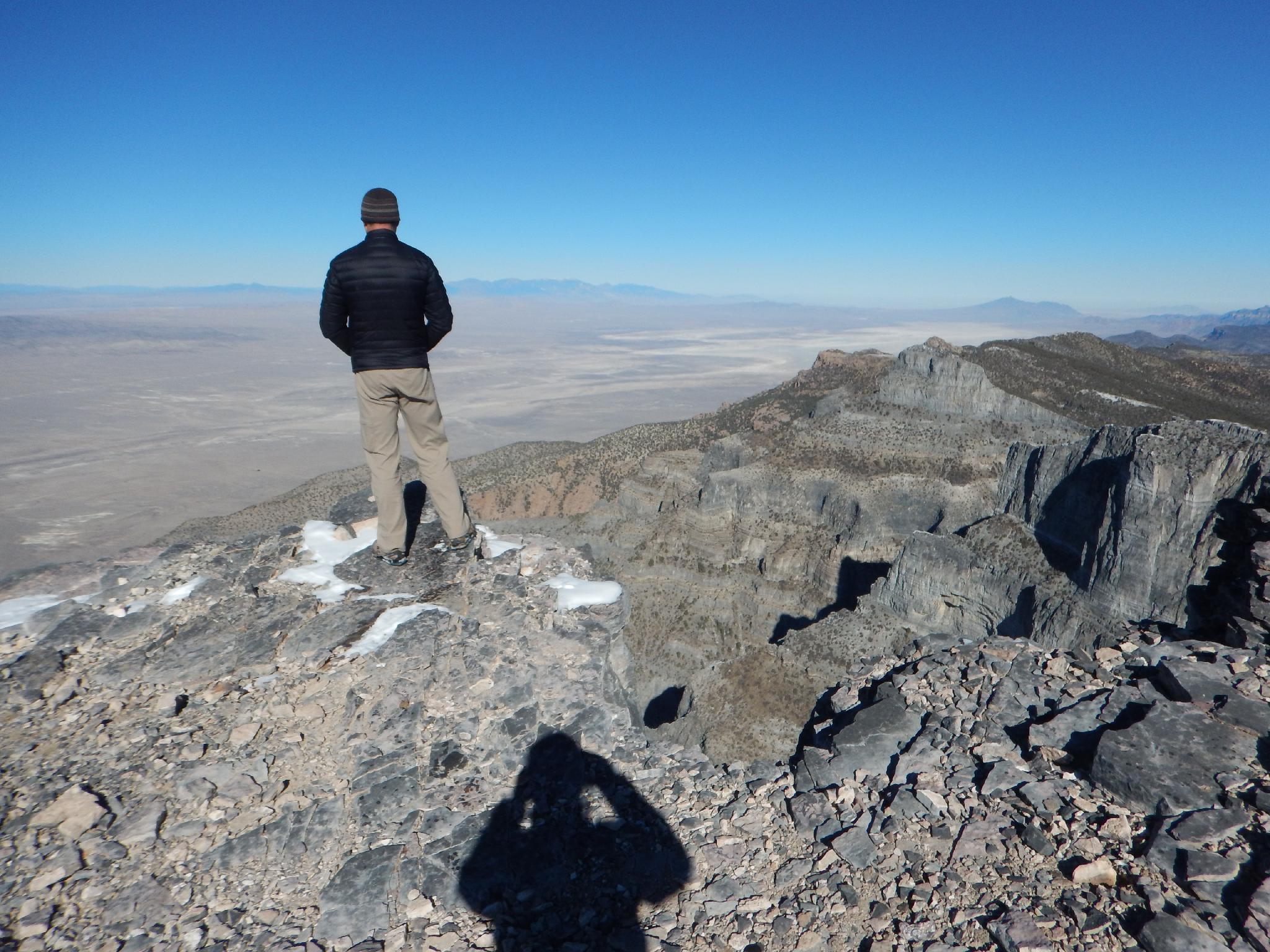
Notch Peak is considered by most to be a Utah classic. The hike is quite casual, but the summit offers jaw dropping exposure down the second highest vertical drop in the United States. (The first is El Capitan in Yosemite.) Some debate the second highest drop status depending on how you define pure vertical drop, but it is a stunning drop to stand on top of, and a hike I would strongly recommend. The views of the west desert from its summit give some perspective on the lonely western side of the state and how isolated and expansive it is.
Be aware the hike is located in the very wild and unpopulated west desert of Utah. Services, people, and help are a long ways away when visiting the area. Given the remoteness, I would rate this as an intermediate hike. Be sure to have a mechanically reliable car, spare tire, and extra food and water in case of trouble.
There is good primitive camping at and near the trailhead though no water is available in the area.
Getting There
From Delta, head west on US-50/US-6 for about 40 miles to just after mile post 48. The side road is on the north side of the road:
Route Description
From the trailhead, begin hiking up Sawtooth Canyon. A towering wall on the left offers a good preview of the immense walls that surround much of Sawtooth Canyon. After just a few minutes, a major junction is reached. Stay left. The trail is an old ATV trail. Follow it up Sawtooth, keeping an eye out for the many arches that dot the walls both high and low. We saw three on our trip.
The ATV trail gives way to a use trail, still staying along the bottom of Sawtooth Canyon. At a steep ledgy section, the trail ascends left, crosses the canyon, ascends out of Sawtooth Canyon on a well-defined social trail, then re-enters Sawtooth above a few small falls. The canyon becomes more shallow here.
At a prominent junction as the canyon becomes more of a wide valley, follow the social trail left and up to a saddle. At the saddle, the hike changes from a canyon hike to a jaw-dropping ridge hike! The views from the saddle are excellent and the reason to do this hike. From the saddle, hike west up class 2 slopes to the true summit of Notch Peak.
Return the same way.
Photos
Videos
Notch Peak
Maps

12S 295741E 4333606N
39°07'40"N 113°21'47"W
12S 294848E 4334258N
39°08'00"N 113°22'25"W
12S 294040E 4334104N
39°07'54"N 113°22'58"W
12S 293746E 4334137N
39°07'55"N 113°23'10"W
12S 292912E 4334391N
39°08'03"N 113°23'45"W
12S 292447E 4334510N
39°08'06"N 113°24'05"W
12S 292266E 4334914N
39°08'19"N 113°24'13"W
12S 291776E 4335426N
39°08'35"N 113°24'34"W