 Hiking
Lower Old Woman Wash
Hiking
Lower Old Woman Wash
Eastern Reef
Overview
The eastern San Rafael Reef is riddled with deep canyons, tall spires, and old ruins from both of the mining era and early Native American occupants. Old Woman Wash is a great example of the beauty and diversity of the area.
The hike starts at an old chimney left from the mining days when Uranium was king and miners flocked to the San Rafael Swell to try and strike it rich. From there the route meanders into an ever-deepening canyon and to a small petroglyph/pictograph panel. Families or the less motivated can call it a day and return from here, though this first panel isn't particularly impressive.
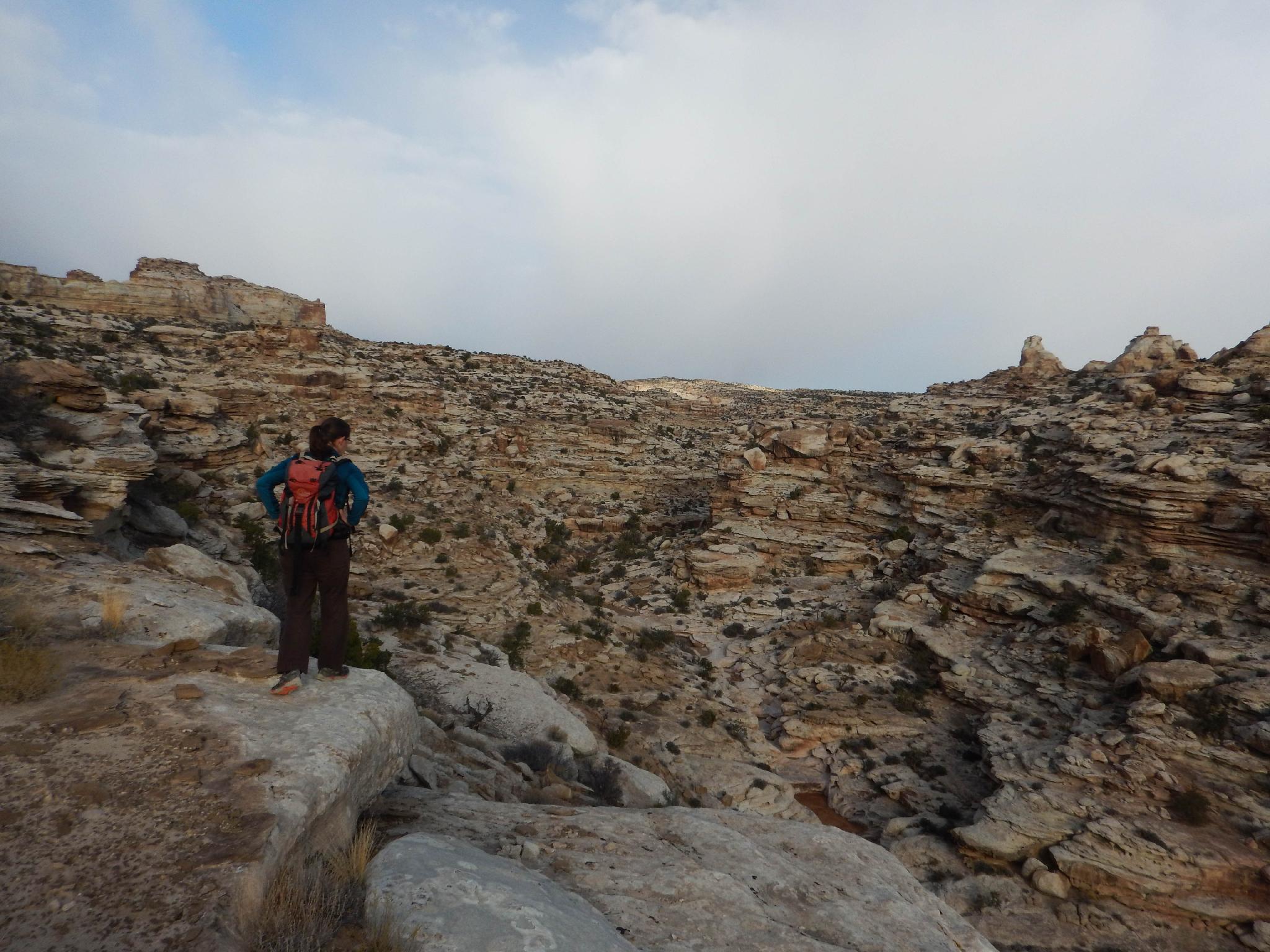
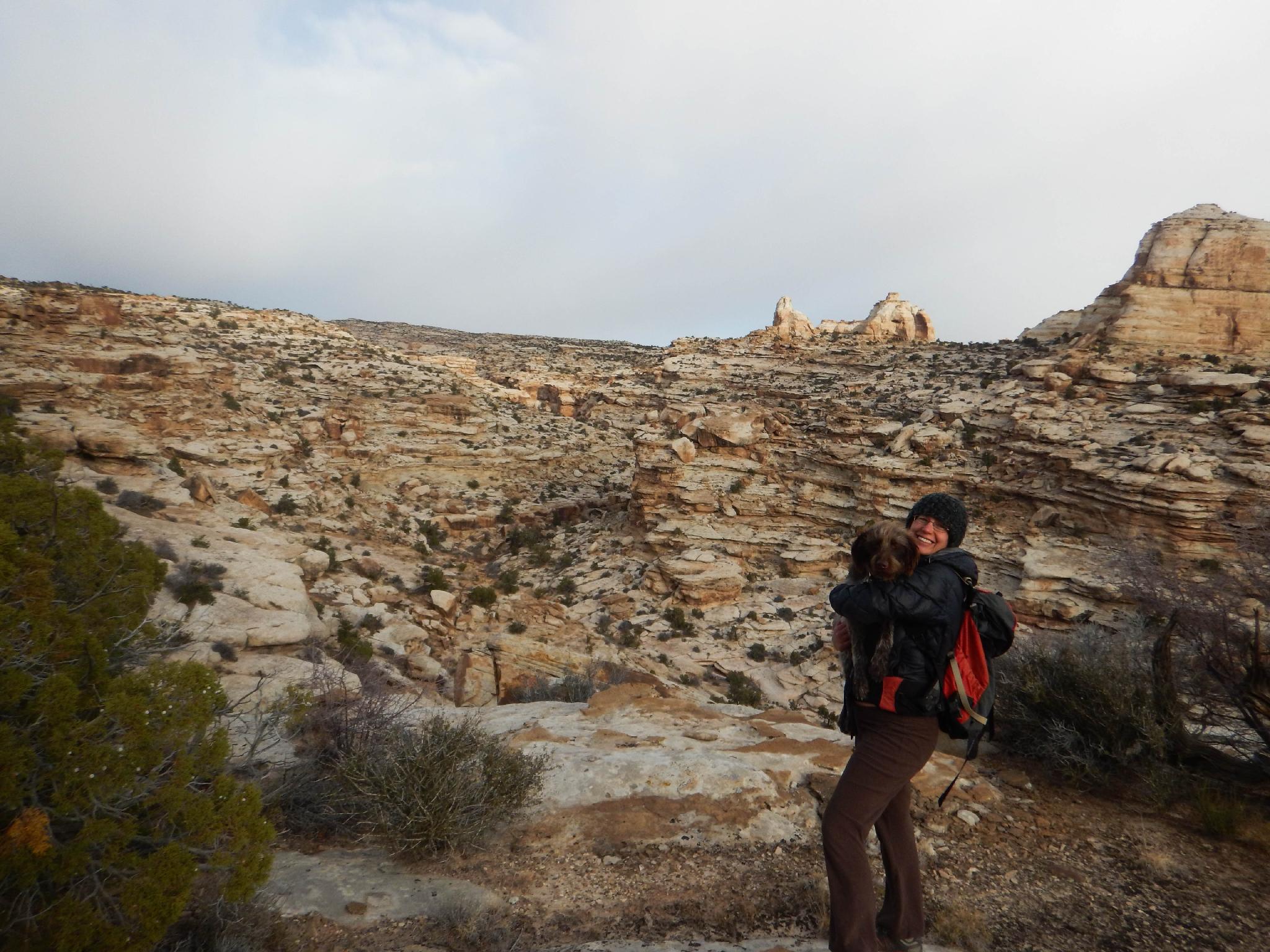
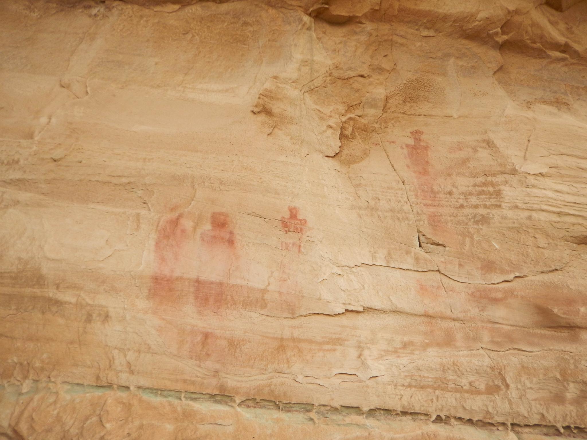
Motivated hikers can continue on a scenic loop that gives big views of Old Woman Wash before looping back via a quite impressive pictograph panel and a few petroglyphs. This is my strongly recommended loop, and it packs a lot of good stuff in a fairly short hike.
Getting There
The trailhead is at milepost 138.9 on UT-24. This is the highway that runs between I-70 to the north, and Hanksville to the south.
From the north (I-70) is it about 21 miles south after leaving I-70. From the south, the side road to the trailhead is about 23 miles north from the intersection of UT-24 and UT-95 on the east side of Hanksville.
Route Description
Rock art and historic sites are fragile, non-renewable cultural resources that, once damaged, can never be replaced. To ensure they are protected, please:
- Avoid Touching the Petroglyphs: Look and observe, BUT DO NOT TOUCH!
- Stay on the Trails: Stay on the most used trails when visiting sites, and don't create new trails or trample vegetation.
- Photography and Sketching is Allowed: Do not introduce any foreign substance to enhance the carved and pecked images for photographic or drawing purposes. Altering, defacing, or damaging the petroglyphs is against the law -- even if the damage is unintentional.
- Pets: Keep pets on a leash and clean up after them.
- Artifacts: If you happen to come across sherds (broken pottery) or lithics (flakes of stone tools), leave them where you see them. Once they are moved or removed, a piece of the past is forever lost.
To The Panel (1.0 mile / 30 minutes)
From the trailhead, walk west up Old Woman Wash. It quickly enters the Navajo Sandstone layer and begins deepening. Follow it to a very prominent side canyon that comes in on the left, with a tall prow separating the main and side canyon. The first panel is on the right (north) side here on the vertical wall. It is faded, and a bit hard to see from a distance. Some old shepherd signatures are also on this wall.
The Loop (1.5 miles / 1 hour)
For the loop, continue up Old Woman Wash, the main canyon. It soon reaches minor dry falls and pools. Leave the bottom of Old Woman Wash and walk along its rim on the left (south) side, gaining elevation as you go. There is an old mining track you can follow here, as well as a social trail that follows higher and closer to the cliff wall on the left. In 10-15 minutes past the panel, the walls open up on the south (left).
Hike south along the big wall that is to the east now, and begin descending down the wide drainage. An old mining road is visible across the canyon.
Staying close to the wall, an impressive pictograph and petroglyph panel become visible on the left (north) as the canyon starts to bend and head back to Old Woman Wash. This panel is quite a bit more interesting that the first panel!
From the panel, hike to the shallow canyon bottom and follow the canyon as it drops quickly to the junction with Old Woman Wash. There are no major obstacles in this side canyon.
Return (1 mile / 30 minutes)
Once at Old Woman Wash, follow it east back to the trailhead.
Photos
Maps

12S 537219E 4281009N
38°40'37"N 110°34'20"W
12S 535815E 4281539N
38°40'54"N 110°35'18"W
12S 535291E 4281597N
38°40'56"N 110°35'39"W
12S 535071E 4281948N
38°41'08"N 110°35'48"W