Little Egypt |

North Wash

Roadside Attraction Little Egypt - North Wash Roadside Attraction Little Egypt

North Wash

Overview

RATING: Roadside Attraction / Short Hike
LENGTH: 1+ hours
MAPS: RAGGY CANYON, UT

Fri

A slight chance of rain showers before noon, then showers and thunderstorms likely. Mostly cloudy. High near 64, with temperatures falling to around 62 in the afternoon. South southwest wind 7 to 23 mph. Chance of precipitation is 60%.

64 | 46

Sat

Rain showers likely before noon, then showers and thunderstorms likely. Mostly cloudy, with a high near 62. West northwest wind 6 to 10 mph. Chance of precipitation is 60%.

62 | 42

Sun

Sunny, with a high near 66.

66 | 41

Mon

Sunny, with a high near 75.

75 | 45

Tue

Sunny, with a high near 79.

79 | 50

View Full Weather Details
SEASON: Any, hot in the summer
GEAR: Standard Hiking Gear
WATER: None

Fri

A slight chance of rain showers before noon, then showers and thunderstorms likely. Mostly cloudy. High near 64, with temperatures falling to around 62 in the afternoon. South southwest wind 7 to 23 mph. Chance of precipitation is 60%.

64 | 46

Sat

Rain showers likely before noon, then showers and thunderstorms likely. Mostly cloudy, with a high near 62. West northwest wind 6 to 10 mph. Chance of precipitation is 60%.

62 | 42

Sun

Sunny, with a high near 66.

66 | 41

Mon

Sunny, with a high near 75.

75 | 45

Tue

Sunny, with a high near 79.

79 | 50

View Full Weather Details
Little Egypt - North Wash

Little Egypt - North Wash

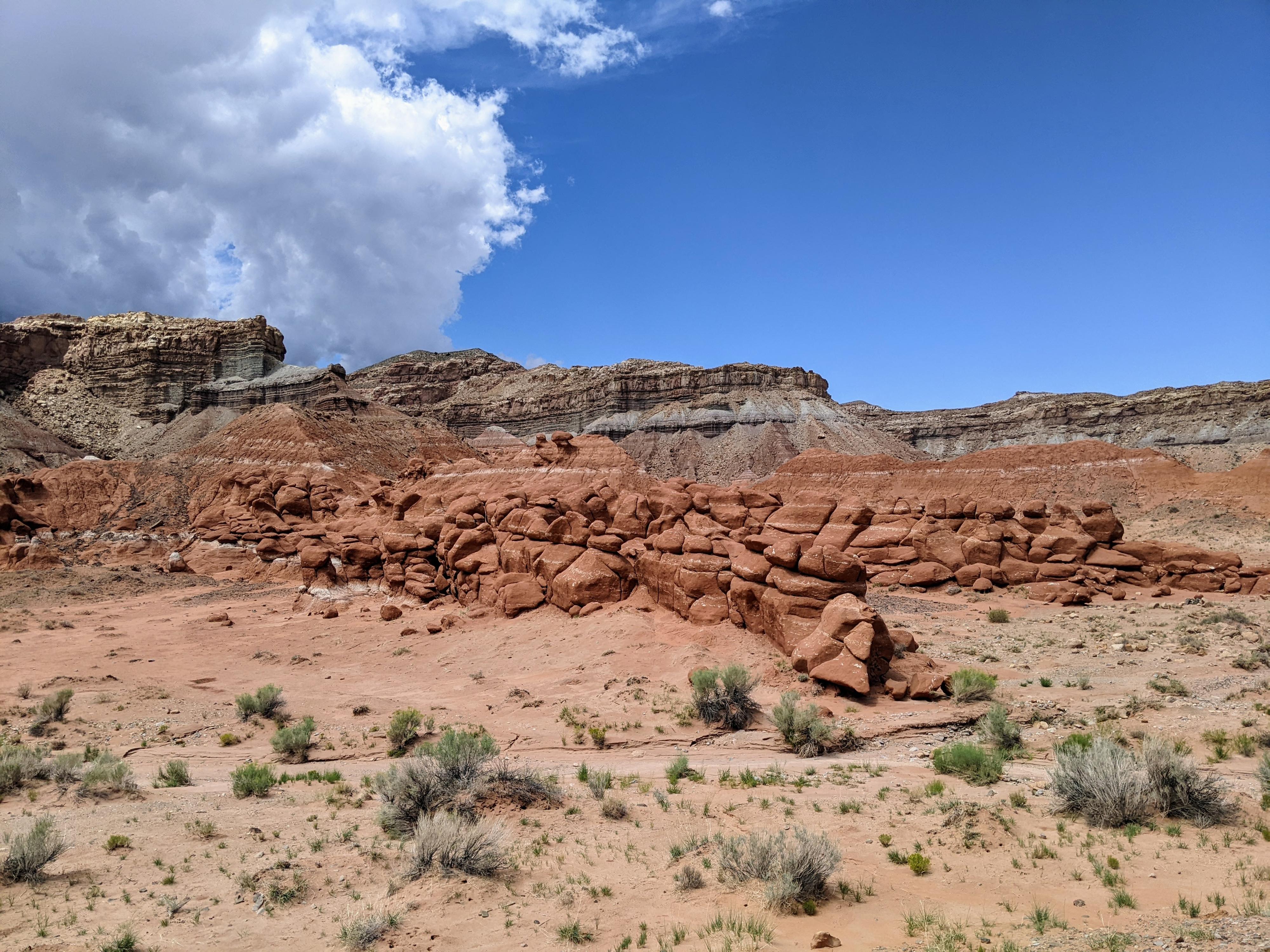
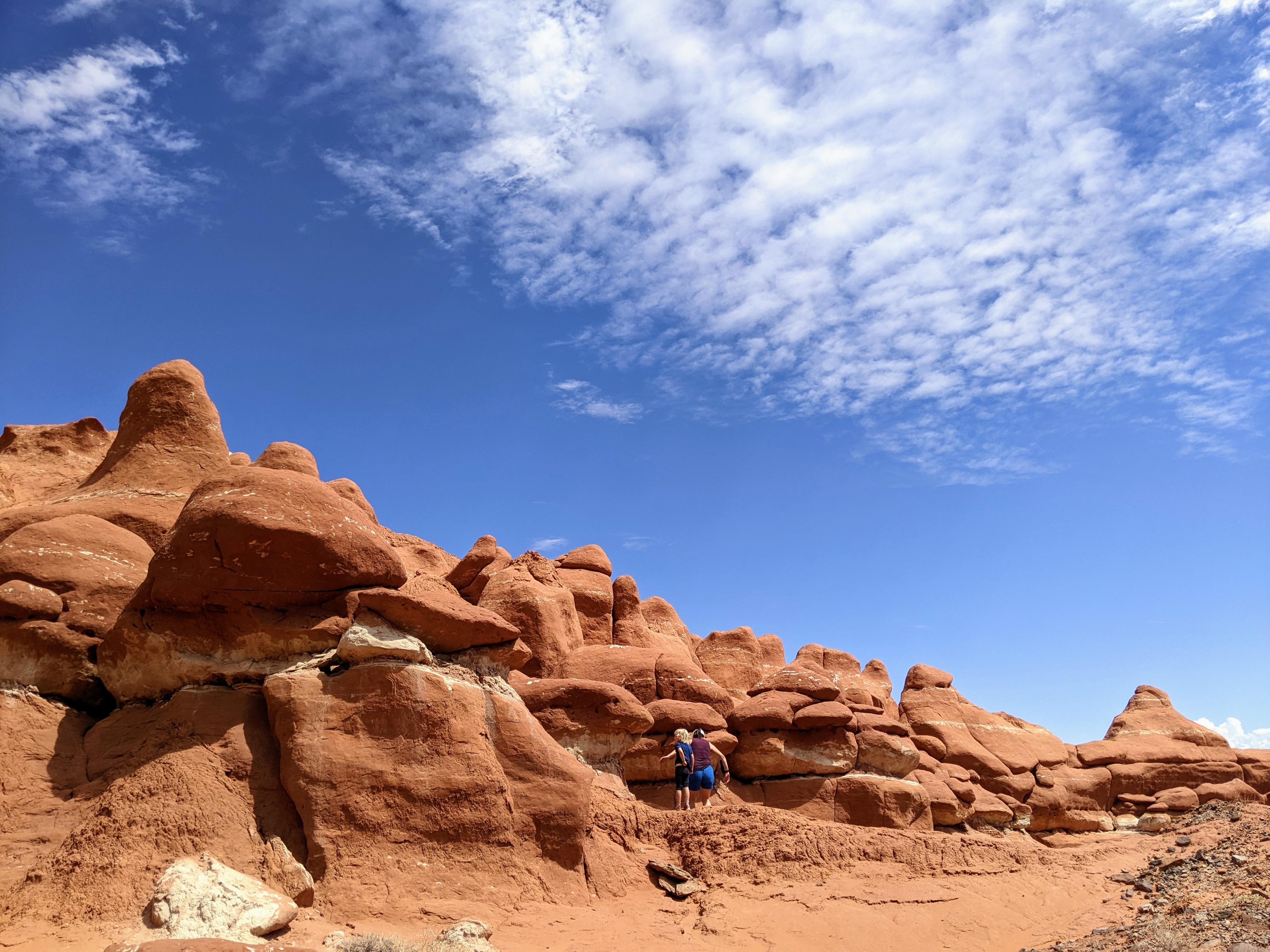
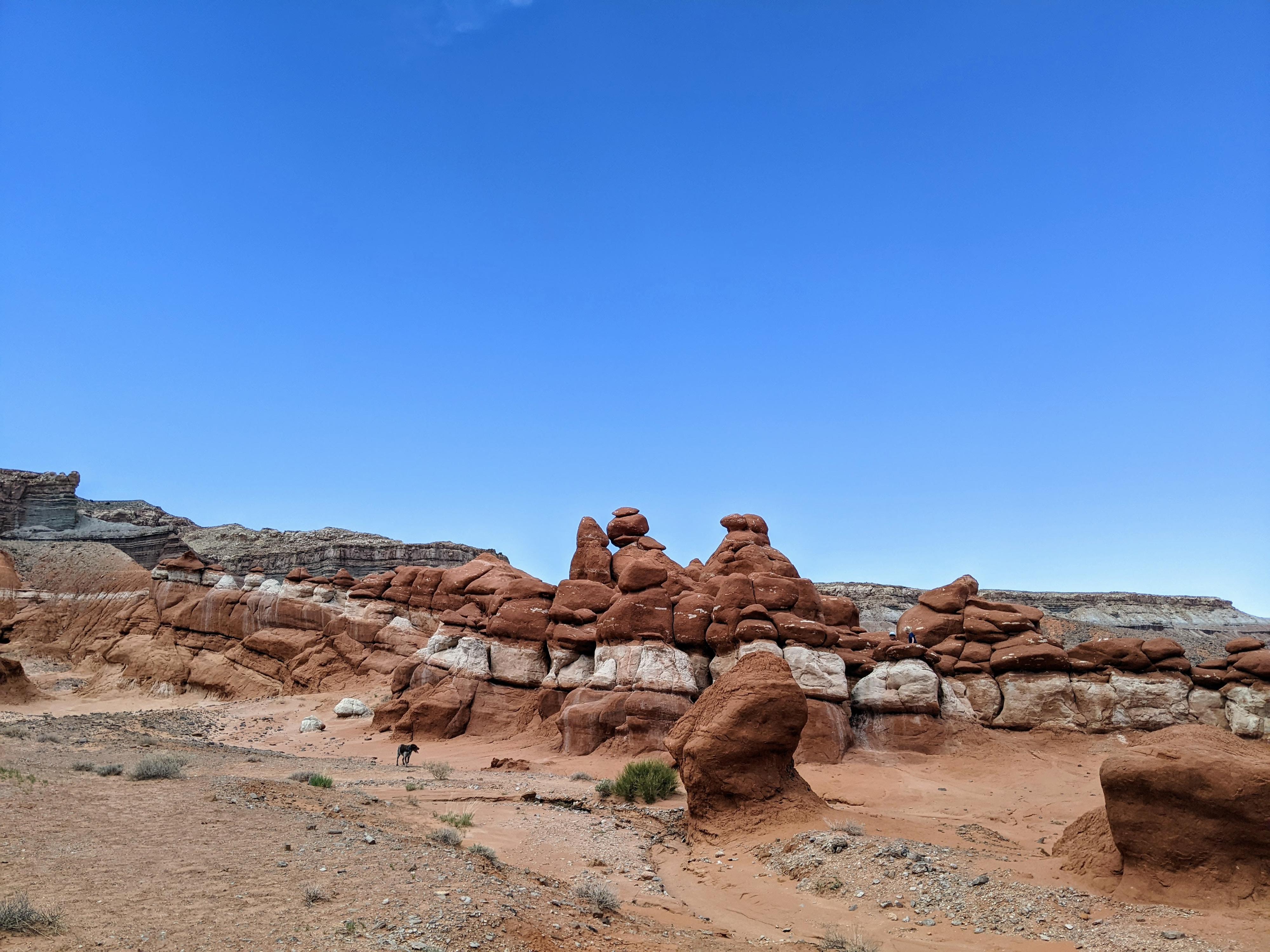
At the base of the Henry Mountains, in the transition zone between desert and mountains, lies the Little Egypt Geologic Site. The site is an exposed Entrada Sandstone area that has eroded into hoodoos, passages and small towers. This is the same layer that makes up Goblin Valley in the San Rafael Swell, and is quite reminiscent of the goblins found there.

The area is fun for families or those that are young at heart to wander around and climb on the many formations. I am not sure who had more fun on our visit, myself or my 5-year-old as we ran from “castle” to “castle” checking out all the secret passages and entrances.

Geology Note: Being a geologic site, it seems reasonable to describe a bit of the geology that makes up the area. The sandstone layer is Entrada Sandstone. The Entrada layer sits on a shale and siltstone layer of rock that provides the flat base of the area. Fractures in the original Entrada layer allowed for the weather process to begin. The corners and edges of the fractures weather more quickly because of their increased volume, creating the unique hoodoo shapes.

Most interesting to me, the white layer you see interspersed is actually Entrada sandstone that has had the hematite remove from it via chemical reaction from groundwater. This effectively bleaches the layer the ground water interacted with. I would have assumed it was a separate type of sandstone!
Diane and Ruby checking out Hoodoos

Diane and Ruby checking out Hoodoos

Getting There

From Hanksville, travel south on highway 95 until mile marker 20.3. Here a dirt road comes in on each side of 95. Turn right (west), and travel 1.5 miles on this main dirt road. It heads west briefly, then heads south. 1.5 miles from UT-95 is a side road on the right that is signed for Little Egypt Geologic Site. The side road ends in a couple of hundred feet at a large flat parking area.

Camping Note: The trailhead is often used for primitive camping. If camping in the area, be sure to clean up all trash and leave the area better than you found it.
The bleached layer in Little Egypt

The bleached layer in Little Egypt

Route

From the parking area, it is a short walk down to the valley of Entrada hoodoos. Wandering around the whimsical area and exploring its many outcroppings can take an hour or all day, depending on your energy level.


Maps

Printable Maps:
Trailhead

12S 532645mE 4214791mN

N38° 04' 49" W110° 37' 40"

Spire

12S 532225mE 4214789mN

N38° 04' 49" W110° 37' 57"

Comments

Want to make a comment? Login and let yourself be heard.