Horseshoe Bend |

Glen Canyon Dam

Hiking Horseshoe Bend - Glen Canyon Dam Hiking Horseshoe Bend

Glen Canyon Dam

Overview

RATING: Easy hiking
LENGTH: 1 hour (1 mile)
MAPS: None needed.

Tue

Mostly sunny, with a high near 65. East wind 3 to 7 mph.

65 | 42

Wed

Sunny, with a high near 71. Northwest wind 5 to 13 mph.

71 | 42

Thu

Sunny, with a high near 74. West wind 5 to 15 mph, with gusts as high as 21 mph.

74 | 45

Fri

Sunny, with a high near 74. Southwest wind 6 to 10 mph.

74 | 46

Sat

Sunny, with a high near 72. Southwest wind 7 to 21 mph, with gusts as high as 31 mph.

72 | 46

View Full Weather Details
SEASON: Any
GEAR: Standard Hiking Gear

Tue

Mostly sunny, with a high near 65. East wind 3 to 7 mph.

65 | 42

Wed

Sunny, with a high near 71. Northwest wind 5 to 13 mph.

71 | 42

Thu

Sunny, with a high near 74. West wind 5 to 15 mph, with gusts as high as 21 mph.

74 | 45

Fri

Sunny, with a high near 74. Southwest wind 6 to 10 mph.

74 | 46

Sat

Sunny, with a high near 72. Southwest wind 7 to 21 mph, with gusts as high as 31 mph.

72 | 46

View Full Weather Details
Horseshoe Bend

Horseshoe Bend

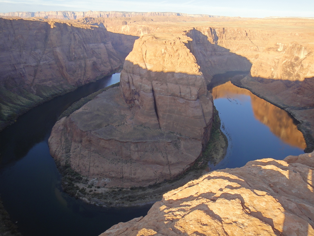
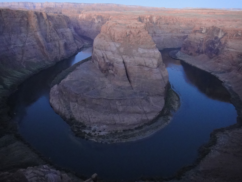
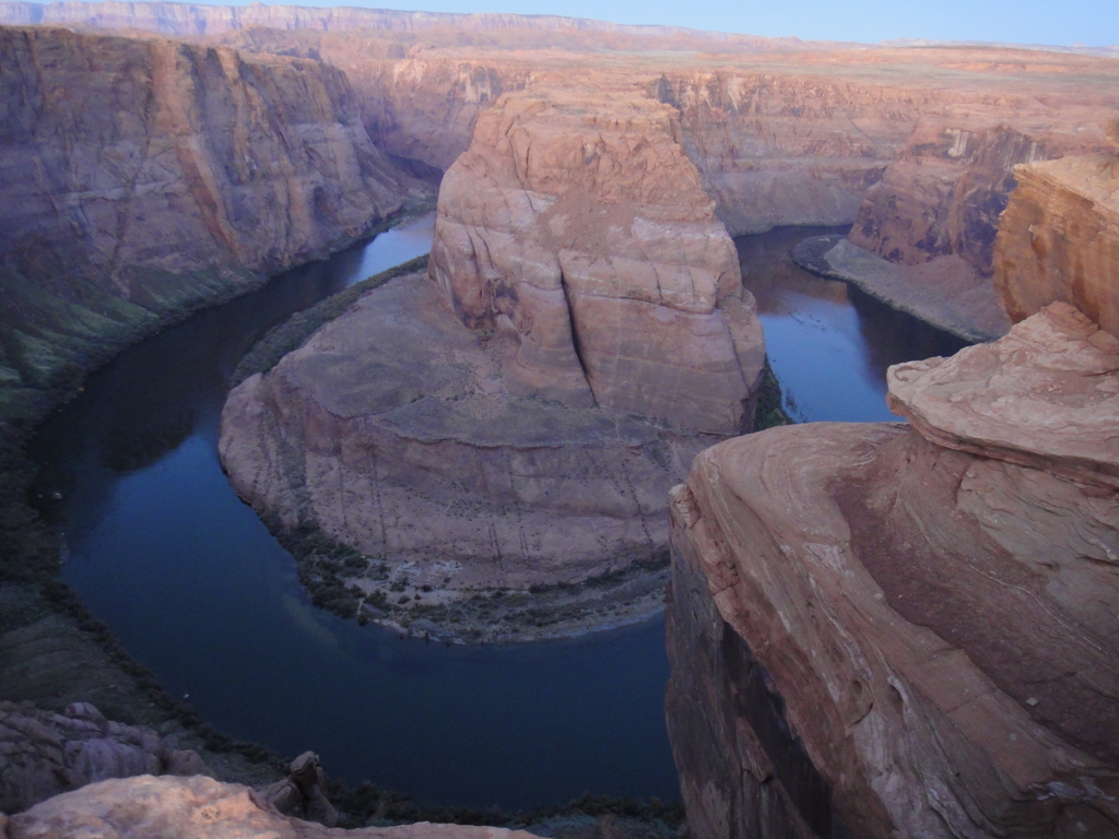
Horseshoe Bend is exceedingly popular with photographers. After visiting the place, you will begin to notice its image all over, from magazines to calendars.

It is an incredible sight to behold, and well worth the short hike to visit. The trail is wide, well-traveled, and very easy. The hike is suitable for most, and a good family friendly outing. If taking children or pets, watch them at the end of the hike. The cliffs would be an easy place to stumble accidently off of.

Horseshoe Bend at dawn

Horseshoe Bend at dawn

Getting There

Go south out of Page for a couple of miles on Highway 89 to mile marker 544.8. The Horseshoe Bend trailhead is clearly marked on the west (right) side of the road, and is a large parking area.

Horseshoe Bend at dawn

Horseshoe Bend at dawn

Route

From the trailhead, follow the wide, well-defined trail to the top of the small knoll. Some way wish to stop here at the covered pavilion viewpoint, but it is well worth continuing the additional 10-15 minutes to the actual overlook. It is a bit sandy, and can be hot in the summer, so take water.

As the sign at the trailhead warns, this is a big drop to the river. Be sure to keep an eye on kids and pets. The contrast of red cliff walls with the crystal blue waters of the Colorado River is stunning.

Note: For best pictures, go just before sunrise. As the sun begins coming up, seems to be the best time and lighting for photos. You are likely to see dozens of people there on a busy summer sunrise.


Photos

Maps

Route / 0.98 miles / Elevation Range 4,119 - 4,365 ft.
Printable Maps:
Trailhead

12S 455197mE 4081309mN

N36° 52' 36" W111° 30' 10"

Comments

Want to make a comment? Login and let yourself be heard.