 Hiking
Pfeifferhorn Peak
Hiking
Pfeifferhorn Peak
Little Cottonwood Canyon
Overview
The Pfeifferhorn, or Little Matterhorn as it used to be known by, is the fifth-highest peak in the Wasatch Range and one of the more stunning and dramatic non-technical hikes in the area. Charles Pfeiffer's ashes were spread on the peak in 1939, and many started referring to it as the Pfeifferhorn. In 2013, it was made official and the name to be changed on maps. The summit reaches a breath taking 11,362 feet.
This is a dramatic hike featuring almost 4000' of elevation gain, steep slopes, knife edge ridges, and big views. One of the more sought after hikes in the Wasatch, this is one for intermediates or advanced hikers. Beginners will find the elevation gain and scrambling a challenge. The route commands a bit of respect, and is not for the unprepared. For those up to the challenge, this is a very rewarding day not far from Salt Lake City, yet that feels a world away.
Getting There
Little Cottonwood Canyon is on the east side of the Salt Lake City Valley. Get there by following I-215 to the east, taking exit 6 off the interstate and heading east toward the mountains.
Follow 6200 South which becomes Wasatch Blvd for 1.8 miles to the stop light and signs for Big Cottonwood Canyon. Continue south (straight) through the light an additional 2.3 miles to a junction and light. Stay left here, reaching the mouth of Little Cottonwood Canyon in an additional 1.6 miles.
From the mouth of Little Cottonwood, travel up the canyon 5.3 miles to the signed White Pine Trailhead on the south side of the road. This is about a mile up the canyon from the Tanners Flat Campground.
Route Description
The hike shares most of the same approach as Red Pine Lake .
To White Pine Junction (1 mile)
From the trailhead, follow the well used White Pine/Red Pine trail as it descends from the trailhead, crosses a bridge, and begins its ascent from the valley floor. After about 20-30 minutes, the first junction is reached. Left goes to White Pine, right is signed for Red Pine. Go right, with the trail climbing for a couple of minutes before crossing the stream on a bridge and heading west.
To Red Pine Junction (1.6 miles from White Pine Junction)
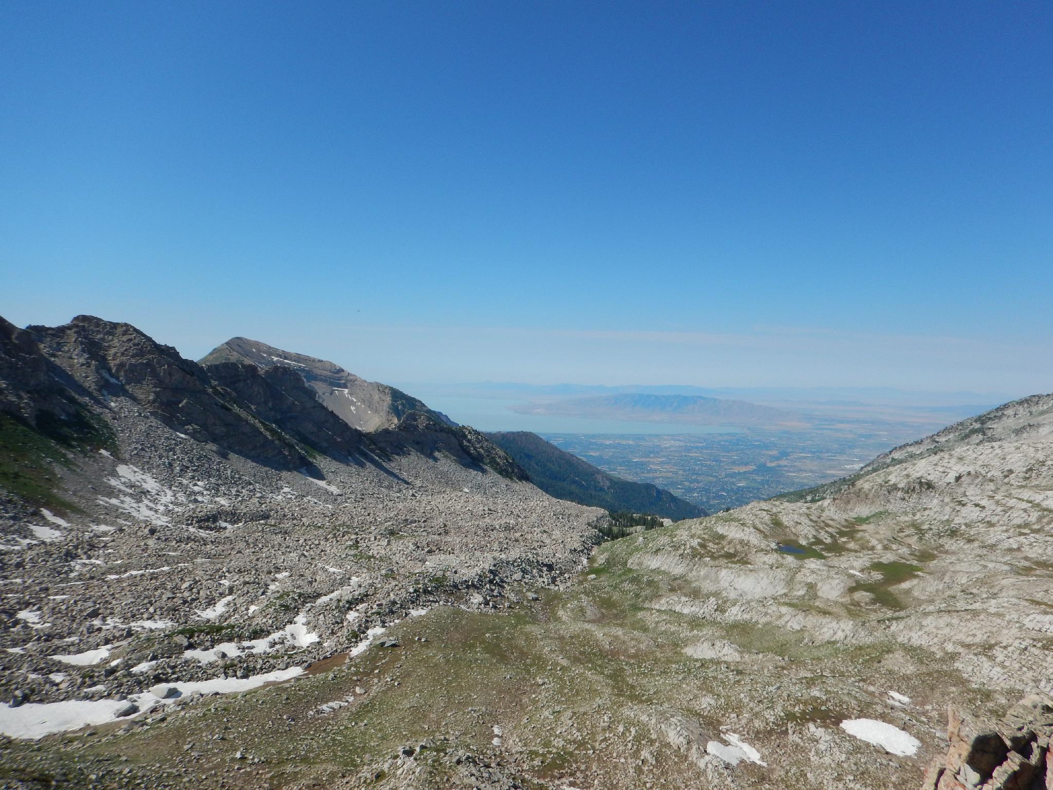
The trail gradually climbs as it traverses around the ridge into the Red Pine drainage. Just as the trail turns up Red Pine, a stunning overlook of the lower canyon and Salt Lake City comes into view. The trail then begins climbing more steeply before reaching the junction to Maybird Gulch. In summer of 2015, this junction was easy to find, but not signed for Maybird Gulch. Stay left at this junction.
To Red Pine Lake (0.6 miles)
2 minutes past the Maybird Gulch junction, an old mine in passed on the left and the trail begins climbing steeply up the rocky slope to Red Pine Lake in about 25 minutes and 500' of elevation gain.
To Upper Red Pine Lake (0.5 miles)
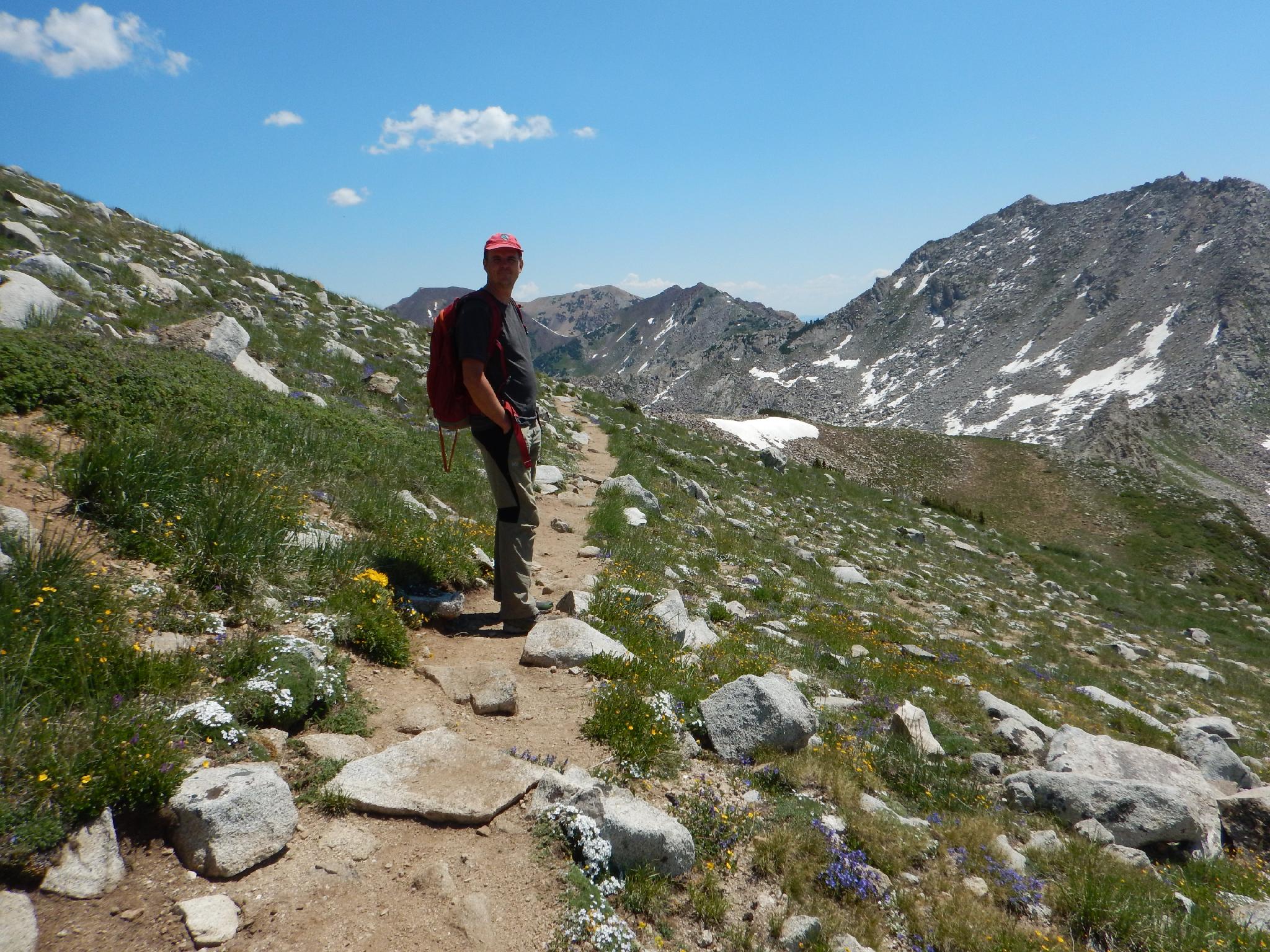
From Red Pine Lake, the official trail ends, however social trails continue up to Upper Red Pine Lake. A good social trail is on both the east and west side of the cascading stream coming down from Upper Red Pine Lake. Either gets you there, however the east side trail offers better views, the west side seems generally easier and more well traveled.
Upper Red Pine Lake is a stunning high mountain lake right at tree line. Thunder Mountain and high ridges surround this lovely area. If you need water, filter and fill up here.
To The Ridge
There are 2 options from Upper Red Pine Lake. The first is the ridge to the west, just west of a small pond. This has the most used social trail and is the fastest/easiest way to the ridge. Recommended for most groups.
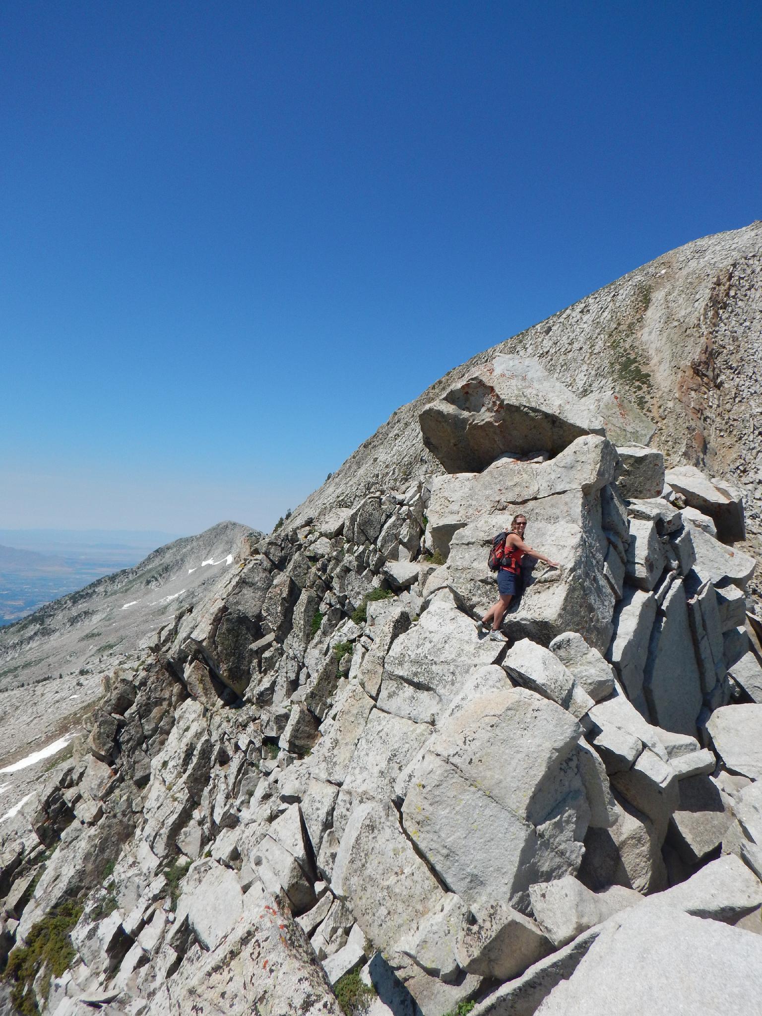
Alternatively, and recommended to those with scrambling experience, going south up to the ridge from the upper lakes offers a great section of knife edge ridge scrambling and is a lot of fun.
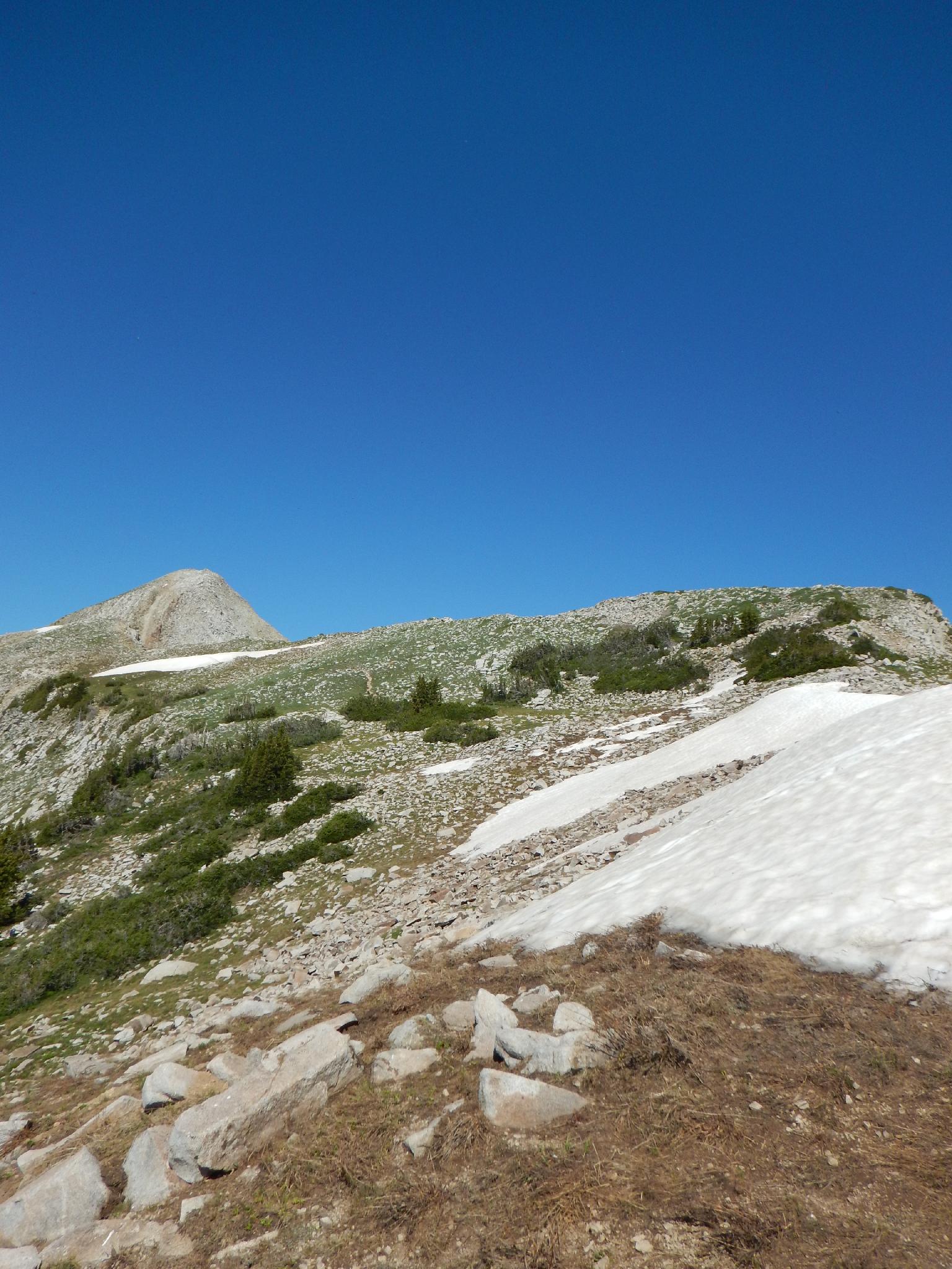
From the Ridge To The Summit
However you go to the ridge, follow the trail west as it bypasses a minor summit on the south before reaching a knife edge ridge to the base of the Pfeifferhorn. While scrambling across the ridge, there are nice views north into Maybird Gulch. Once across the ridge, it is a steep, but straightforward hike up the dirt/rock to the summit proper.
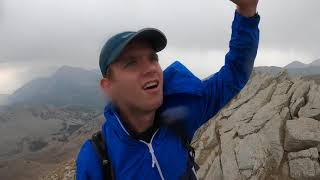
From the summit, there are lofty views in all directions:
- To the south, the impressive peak in the foreground is Box Elder Peak. The large mountain more distance is Mount Timpanogos.
- To the south west is Utah Valley and Utah Lake.
- Due west is Lone Peak, the notched peak farthest in the distance.
- Looking north are the obvious Twin Peaks that tower over the ridge between Little and Big Cottonwood Canyons. Just right of Twin Peaks is O'Sullivan Peak and the more well known Dromedary Peak that is visible from many areas of the Salt Lake Valley.
Return the same way.
Photos
Videos
The pfeifferhorn
Maps

12T 442344E 4491861N
40°34'32"N 111°40'52"W
12T 441644E 4490823N
40°33'58"N 111°41'22"W
12T 441114E 4489406N
40°33'12"N 111°41'44"W
12T 441302E 4488450N
40°32'41"N 111°41'35"W
12T 441657E 4487922N
40°32'24"N 111°41'20"W
12T 440275E 4487234N
40°32'01"N 111°42'19"W