Bloomington Lake |

Bear Lake

Hiking Bloomington Lake - Bear Lake Hiking Bloomington Lake

Bear Lake

Overview

RATING: Easy Hike
MAPS: PARIS PEAK, ID

Tue

Sunny. High near 50, with temperatures falling to around 41 in the afternoon. West wind 5 to 10 mph.

50 | 25

Wed

Sunny, with a high near 48. West wind 7 to 13 mph, with gusts as high as 20 mph.

48 | 25

Thu

A chance of rain after noon. Partly sunny, with a high near 47. Chance of precipitation is 30%.

47 | 28

Fri

A chance of rain after noon. Partly sunny, with a high near 47. Chance of precipitation is 30%.

47 | 27

Sat

Snow. Mostly cloudy, with a high near 42. Chance of precipitation is 80%. New snow accumulation of around one inch possible.

42 | 29

View Full Weather Details
SEASON: Late spring, summer, fall
WATER: Filterable at the lake.

Tue

Sunny. High near 50, with temperatures falling to around 41 in the afternoon. West wind 5 to 10 mph.

50 | 25

Wed

Sunny, with a high near 48. West wind 7 to 13 mph, with gusts as high as 20 mph.

48 | 25

Thu

A chance of rain after noon. Partly sunny, with a high near 47. Chance of precipitation is 30%.

47 | 28

Fri

A chance of rain after noon. Partly sunny, with a high near 47. Chance of precipitation is 30%.

47 | 27

Sat

Snow. Mostly cloudy, with a high near 42. Chance of precipitation is 80%. New snow accumulation of around one inch possible.

42 | 29

View Full Weather Details
Bloomington Lake

Bloomington Lake

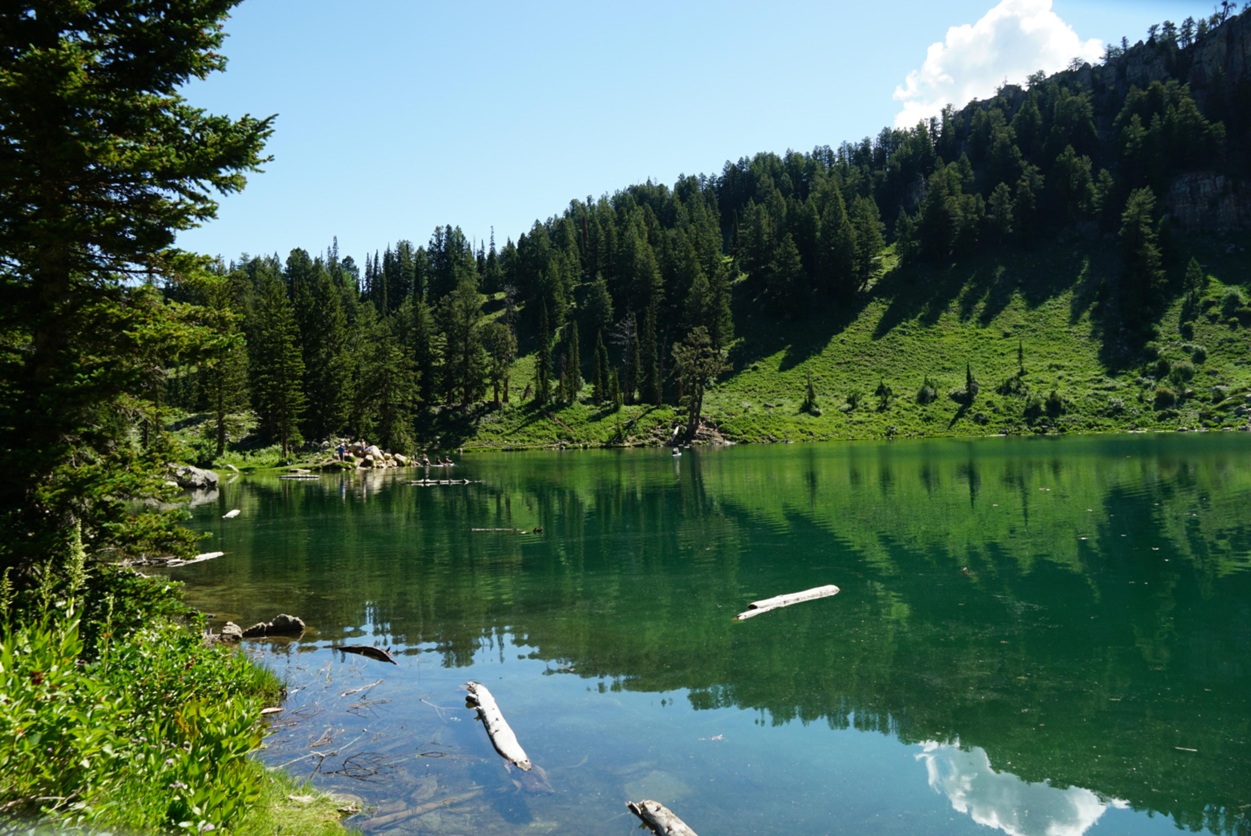
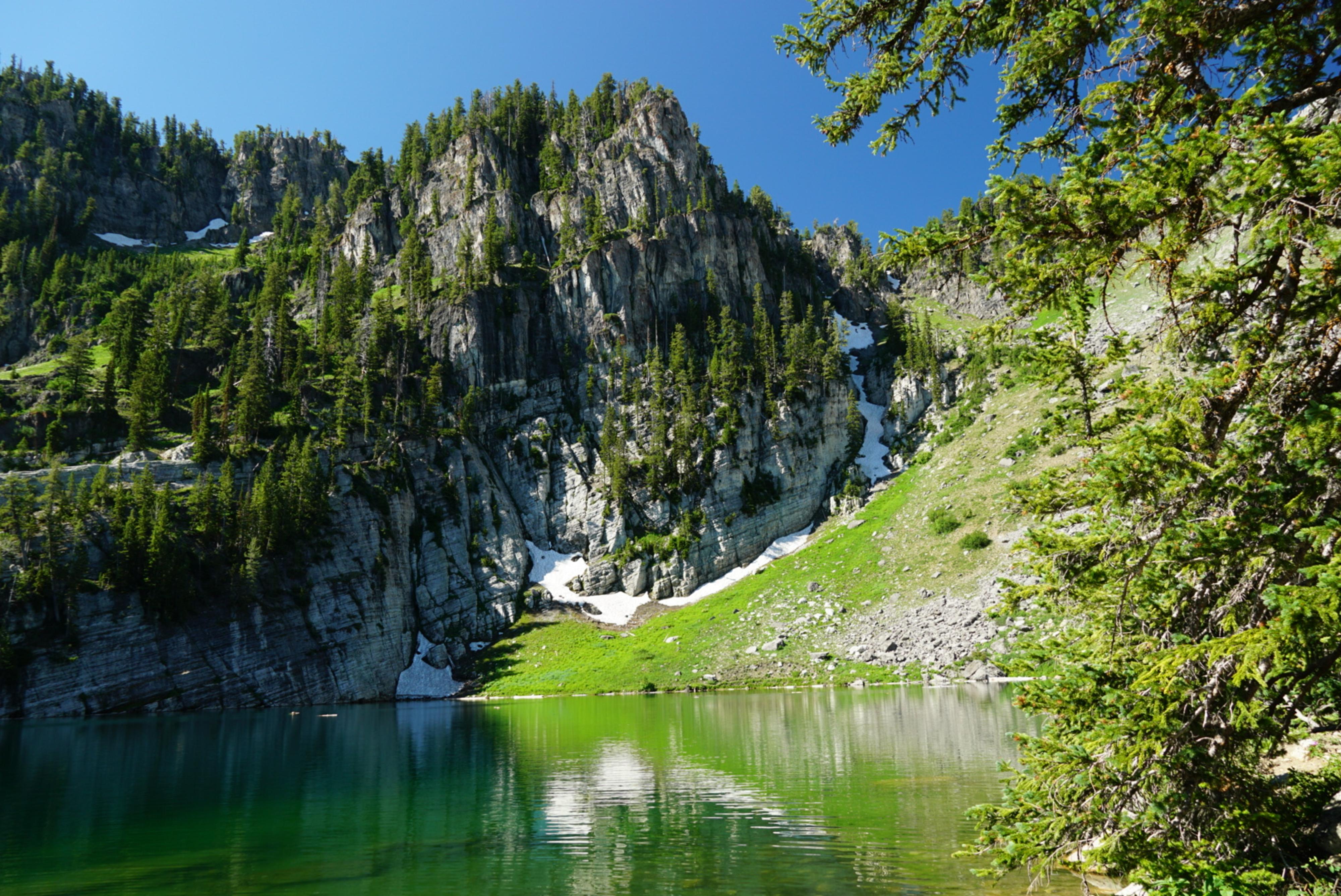
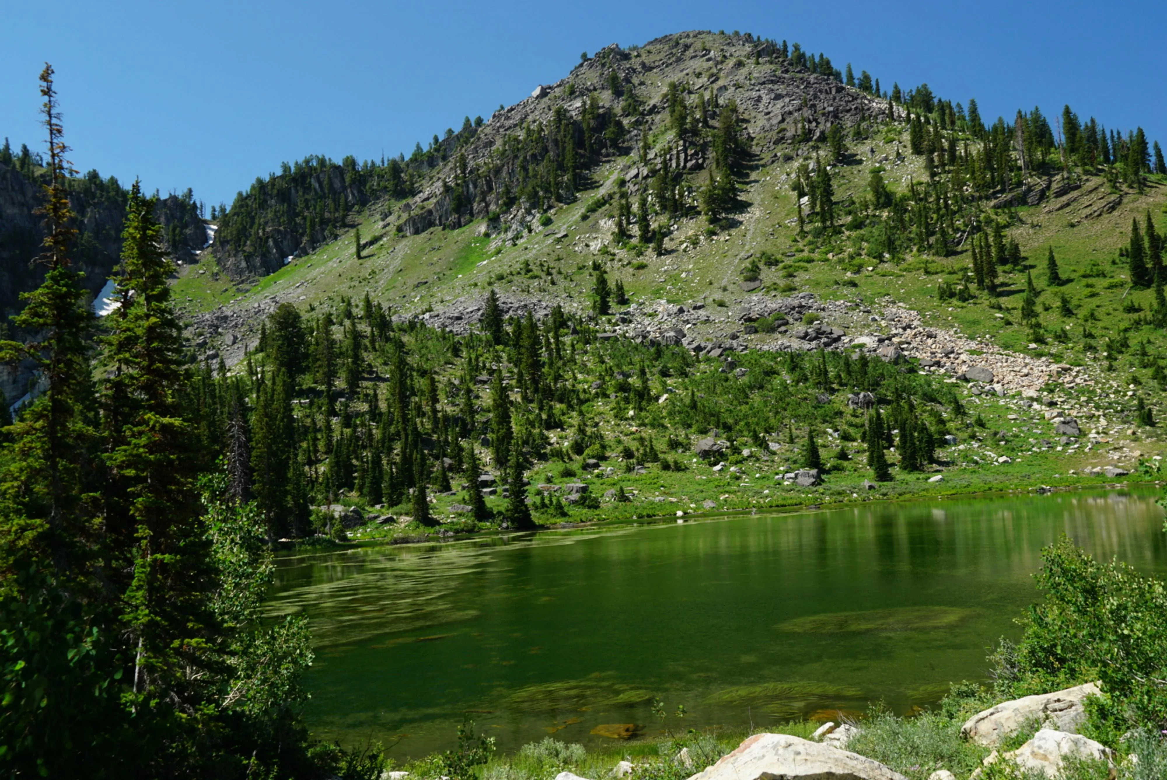
Bloomington Lake must be one of the best short hikes around Bear Lake. The short, immensely popular hike leads to a stunning high alpine lake surrounding by jagged ridgelines. I first visited in the mid-90's while attending Utah State University and remember it as being dramatic and lovely. When I re-visited it more recently, I was pleasantly surprised to find it still lived up to my expectations as far as scenery goes. It is an amazing lake!

The hike to the lake is just a little over a half mile, and suitable for most. On a sizzling summer weekend, you are likely to see quite a crowd making the trek to the lake. Because it is short, many carry in inflatable rafts, paddle boards, and even full-size camp chairs into the lakes shore. It can be quite a scene! If solitude is what you are after, look elsewhere! We found going early in the morning worked best to avoid the crowds. By noon, as we headed out, the trail and lake short were beginning to get quite crowded.

Bring a bathing suit and towel, the clear cool water can be irresistible to swimming!

Note: There is no camping at the trailhead. The trailhead does, however, have a pit toilet and picnic tables.
Note: This is a fee area. As of 2021, it is $5 to use the area. There is a fee envelop station signed on the right a mile or so before you reach the trailhead.
Rugged peak along the shore of Bloomington Lake

Rugged peak along the shore of Bloomington Lake

Getting There

Note: The road to the trailhead is a bit rough. Sedans had made it to the trailhead on our visit, but it is likely too rough for most. Something with a little clearance recommended.

The trailhead is reached from Bloomington Idaho. On the south end of town, turn west on Canyon St.

  • Reset your odometer as you turn west off of ID-89. ( 12T 466838mE 4670710mN / N42° 11' 16" W111° 24' 06" )
  • 8.0 miles - Major junction. Go left. ( 12T 454628mE 4669954mN / N42° 10' 50" W111° 32' 58" )
  • 8.3 miles - Major junction. Go right. ( 12T 454668mE 4669727mN / N42° 10' 42" W111° 32' 56" )
  • 10.4 miles - Major junction, go right. ( 12T 452155mE 4667693mN / N42° 09' 36" W111° 34' 45" )
  • 11.25 miles - End of road / Trailhead ( 12T 451786mE 4666527mN / N42° 08' 58" W111° 35' 01" )
The first pond reached, before Bloomington Lake

The first pond reached, before Bloomington Lake

Route

From the trailhead, follow the signed trail on south side of the parking lot. It climbs briefly as it heads west, then descends past a stunning clear unnamed pond. This first pond makes a good, and usually uncrowded, place for a picnic or to hang out as well.

Just past the pond, the trail braids a bit. All major social trails end up at Bloomington Lake. My preference is to stay on the more easterly trails as they reach the northern narrow end of Bloomington Lake first. At the lake proper, there is usually a rope swing hanging from a tree on the northeast side for the adventurous and many great spots to play along most of the northern shore.

Return the same way.


Maps

Route / 1.39 miles / Elevation Range 8,198 - 8,313 ft.
Printable Maps:
Trailhead

12T 451756mE 4666515mN

N42° 08' 57" W111° 35' 02"

Bloomington lake

12T 452398mE 4665995mN

N42° 08' 41" W111° 34' 34"

Comments

Want to make a comment? Login and let yourself be heard.