 Hiking
Lost Spring Area
Hiking
Lost Spring Area
Northern Henry Mountains
Overview
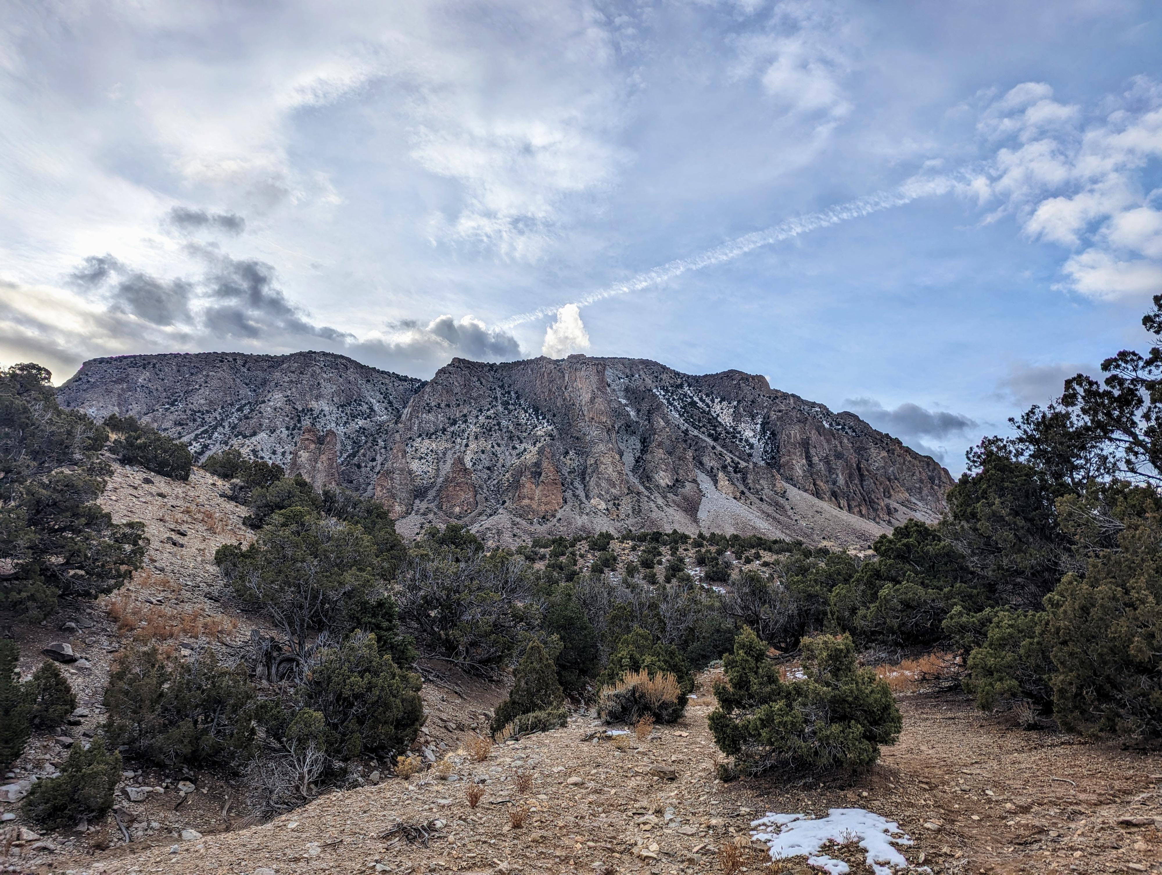
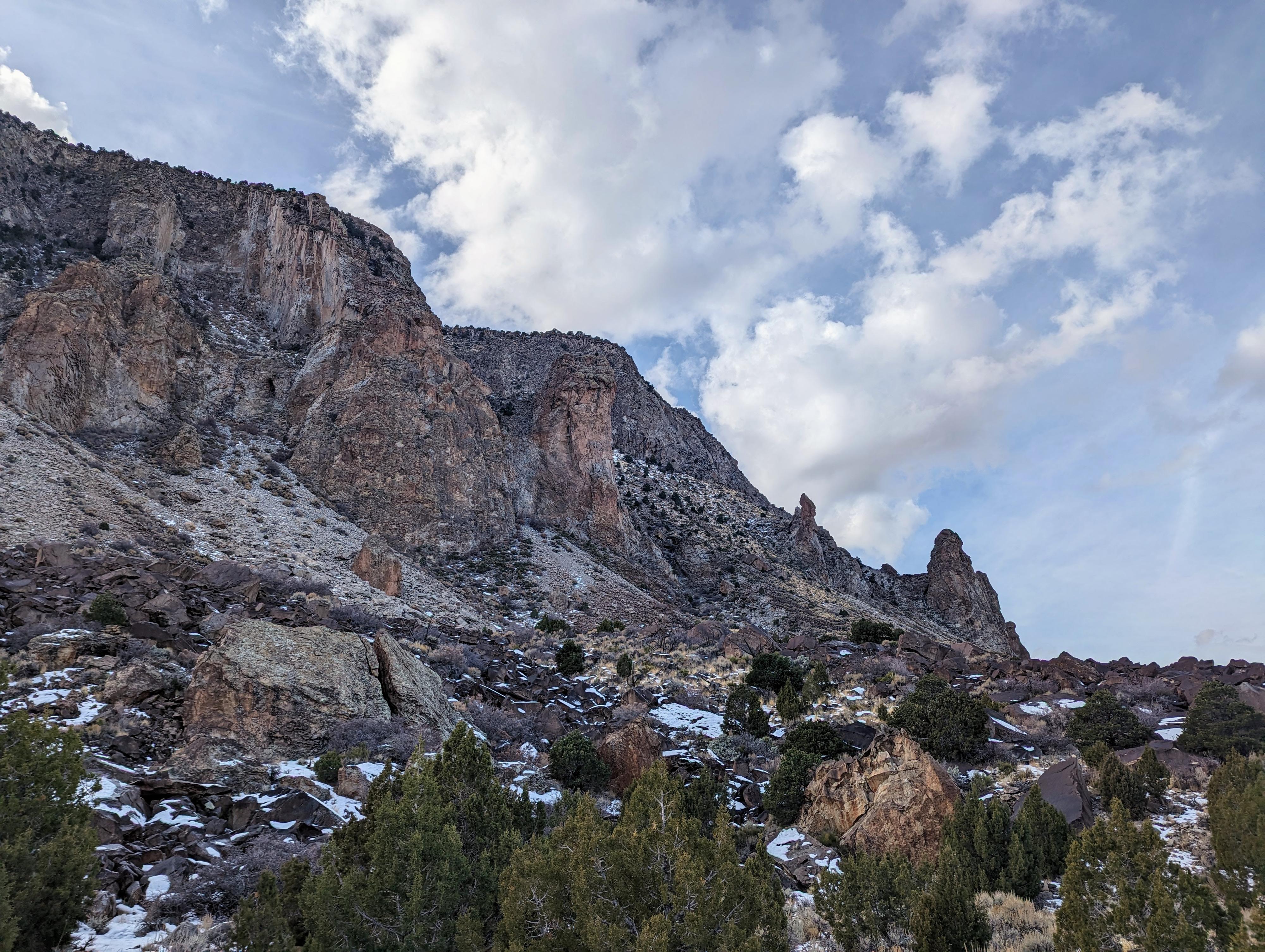
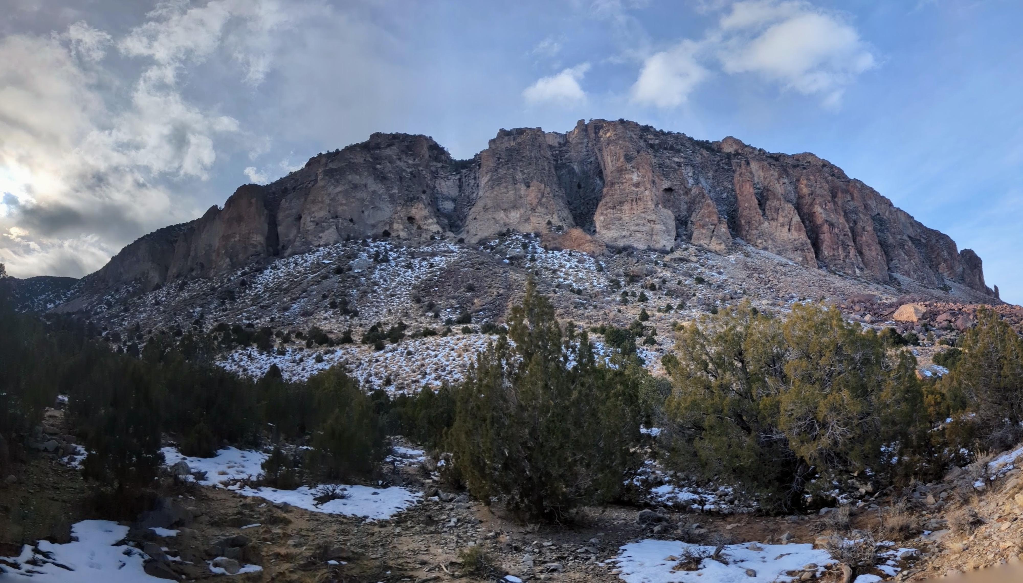
Table Mountain on the northern end of the Henry Mountains has always intrigued me, its craggy slopes are studded with pillars and towers that look quite dramatic from a distance. When I finally visited Table Mountain via Lost Springs, I wasn't disappointed. The spires and towers are even more dramatic up close, and the views from the area of the badlands to the north and Capitol Reef National Park to the west are quite dramatic.
The higher elevation of this hike makes it a great one to do in the summer, when trying to escape the desert heat of the lower elevations. There is ok primitive camping in the area, though they do run cows around the springs.
The hike described has two different sections that start from the same trailhead. The first heads south, mostly along cow trails. This is shorter, but gets closer to the base of Table Mountain. The second option follows an old trail, likely used when moving cattle in the area, east along the base of the mountain. The second option is longer and probably my favorite.
Getting There
Access requires driving across the Fremont River, which is generally quite low. After recent heavy rains or for a brief time during spring run-off, the crossing may be impossible. Current flow is available at USGS ( https://waterdata.usgs.gov/monitoring-location/09330000/#parameterCode=00065 ) At 80 CFS, it was easily passable in Subaru type vehicles. Likely passable up to 100 CFS or a bit more depending on the vehicle.
Reaching the trailhead starts in the ghost town of Giles. This is about 7.5 miles west of Hanksville on UT-24, or about 40 miles east of Torrey on UT-24. At milepost 106.9 is the turn off on the south side of UT-24. This is signed Giles/Blue Valley.
Route Description
Shorter South Option (1.5 miles round-trip)
From the trailhead, head east just a minute or two on an old road until it crosses a drainage. Go up this drainage. Once you get a short distance up, there are well-defined cow trails to follow. The cow trails go up to Willow Spring, a lush spring area. I continued up from Willow Spring about 1/4 of a mile, trending left at junctions, to get to the talus field at the base of Table Mountain and close-up views of the jagged base. Return the same way.
Longer Old Trail Option (up to about 4 miles round-trip)
From the trailhead, follow the old road as it heads east. In spots, on my visit, this showed ATV trails for a short distance, then settles into more of a cow trail. In general, it is east to find and follow.
After about a mile, it begins to get closer to the base of Table Mountain and climb a drainage that becomes deeper and more defined.
About 1.9 miles from the trailhead, it reaches what appears to be an old, closed road. The road doesn't show on USGS maps, but has clearly seen traffic. I assume it goes over to Birch Creek. The old road was my turnaround spot, as the hike is past the most interesting part of Table Mountain and now more forested.
Return the same way.
Maps

12S 513310E 4226299N
38°11'04"N 110°50'53"W
12S 515804E 4225186N
38°10'28"N 110°49'10"W
12S 513427E 4226242N
38°11'02"N 110°50'48"W
12S 513173E 4225186N
38°10'28"N 110°50'59"W