 Hiking
Canyon Overlook Trail
Hiking
Canyon Overlook Trail
Zion Main Canyon
Overview

As a kid, when we passed through Zion National Park on vacation, the Canyon Overlook Trail was the first stop we made. The Canyon Overlook Trail is a short and family friendly hike that offers a birds-eye view of the lower end of the park. Recommended for most, it has amazing views.
This is suitable most times of the year, but not recommended if there is snow on the ground. The path can become quite slick when snow and ice are on it.
Getting There
From the park entrance, follow highway 9 into the park. Continue past the junction with the main Zion Canyon. Continue up the switchbacks and through the tunnel. Just on the other side of the tunnel is a small parking area on the right. This is the Pine Creek trailhead, continue a few hundred feet past to other parking for the Canyon Overlook Trail. The trail starts on the north (left) side of the highway and is well signed.
Route Description
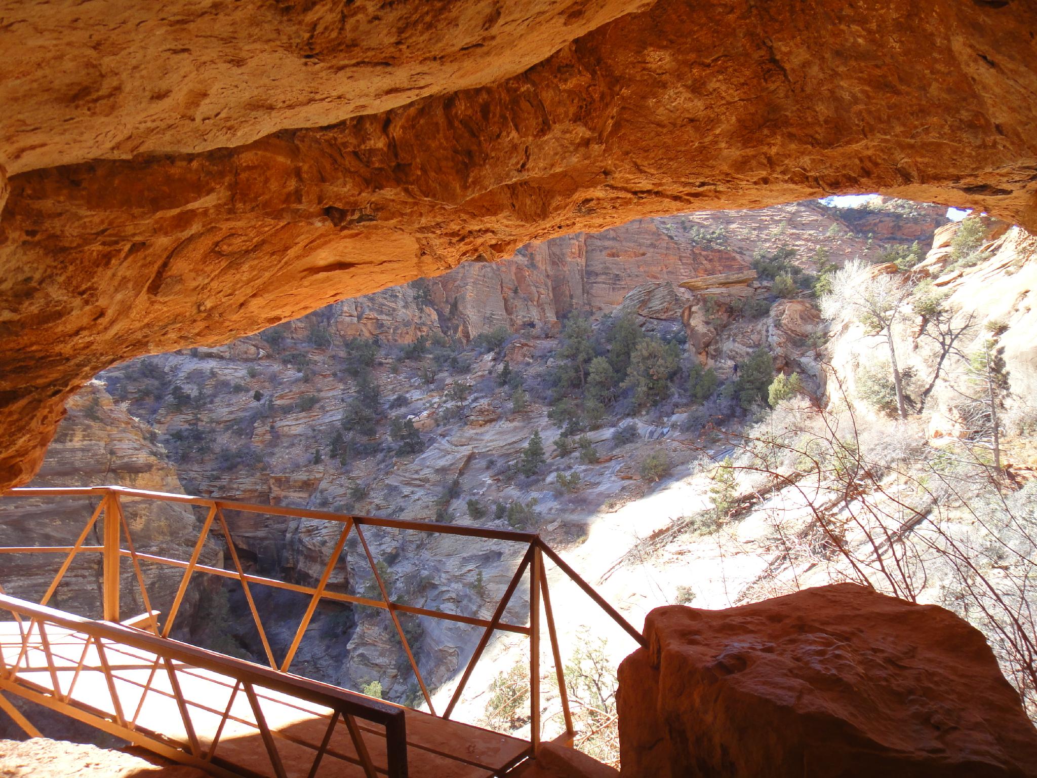
The trail starts on the north side of the road and is easy to follow. As you meander out to the viewpoint, the deep gorge to the left is Pine Creek Canyon , a very popular canyoneering adventure. You are likely to hear groups descending the sinuous slot in warmer times of the year.
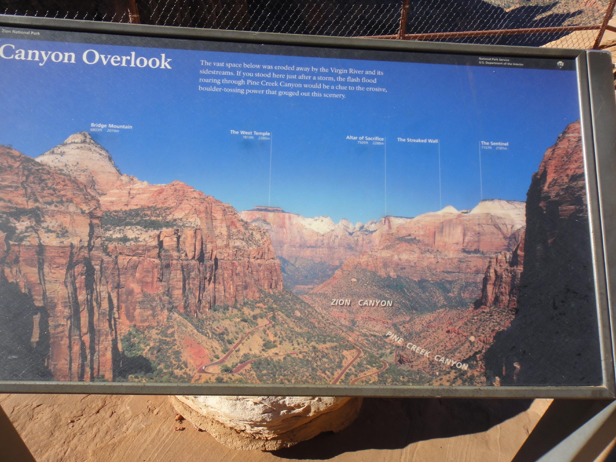
As the trail nears its end, the Great Arch wall is visible to your right, with the large open area of the southern portion of Zion National Park visible straight ahead. An orientation sign at the overlook points out the major peaks visible to the west and main features. Return the same way.
Maps

12S 327809E 4120326N
37°12'49"N 112°56'26"W
12S 327352E 4120310N
37°12'48"N 112°56'45"W