 Hiking
Rings Trail
Hiking
Rings Trail
Mojave National Preserve
Overview
If there is one do-not-miss trail in the Mojave Preserve, this is it! The Rings Trail at Hole-in-the-Wall brings together stunning scenery, rock art, and a touch of adventure in a family friendly 1-mile loop.
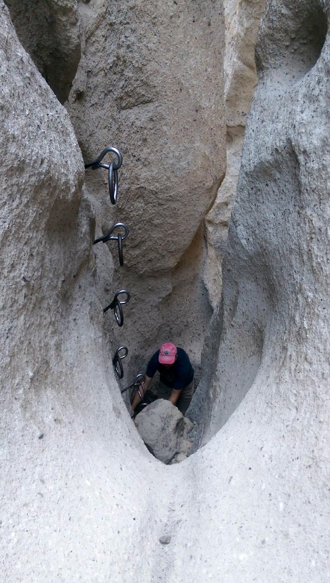
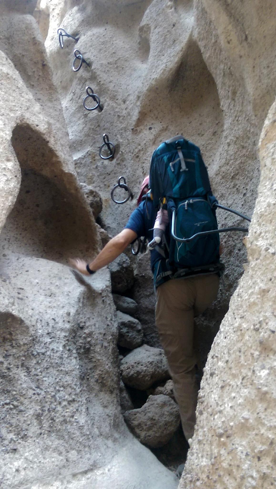
The route has two short climbing sections with fixed metal rings for assistance. If you can climb a ladder, you probably won't have a problem here. Young children may struggle a bit. Though both obstacles are short and relatively easy to spot/boost, dogs will find the route impossible without being carried up the obstacles. Not recommended unless your dog is used to being carried and you feel comfortable climbing a ladder with a dog in your arms.
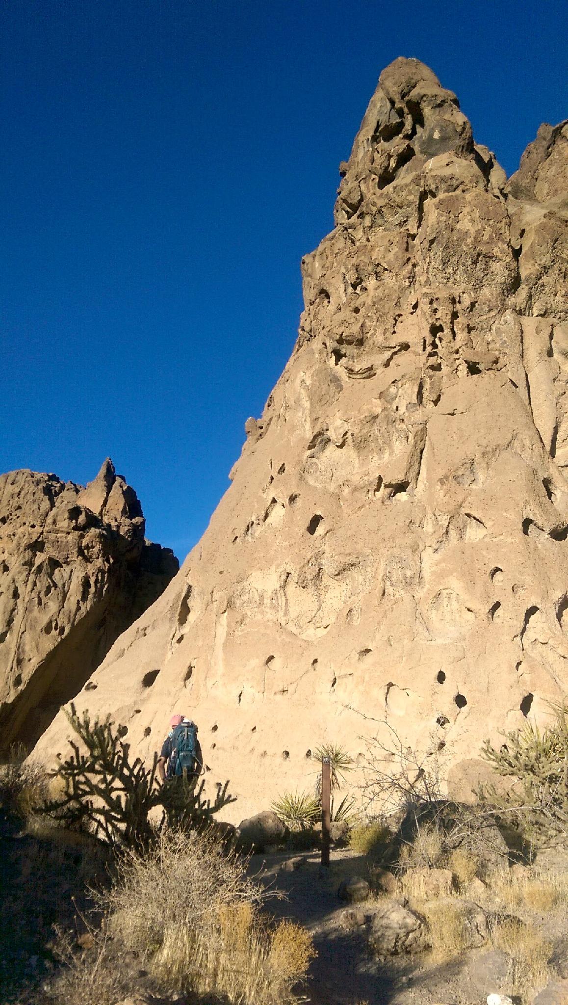
We visited late in the afternoon on a cool December day. Lighting in Banshee Canyon was stunning!
Getting There
Hole-In-The-Wall Information Center is the trailhead. This is a long way into the interior of the park with about 15 miles of dirt road involved in reaching the trailhead. The road can be a bit washboard but is passable by all vehicles.
From Baker, CA, head south into the Preserve by taking exit 246 off of I-15 and heading south on Kelbaker Road. Follow this paved road 34.5 miles to Kelso, an old railroad station that now serves as a visitor center. If you have time, it is a great stop.
Go left just BEFORE the railroad crossing in Kelso. (Kelso Cima Rd) Follow this paved road northeast for 14.3 miles to a signed road on the right for Hole-In-The-Wall. Take this road. It quickly turns to dirt.
At 6 miles a junction is reached. Go right, for an additional 9.5 miles to a signed junction to the Information Center on the right. There is a parking area at the Information Center that is also the trailhead.
Route Description
Rock art and historic sites are fragile, non-renewable cultural resources that, once damaged, can never be replaced. To ensure they are protected, please:
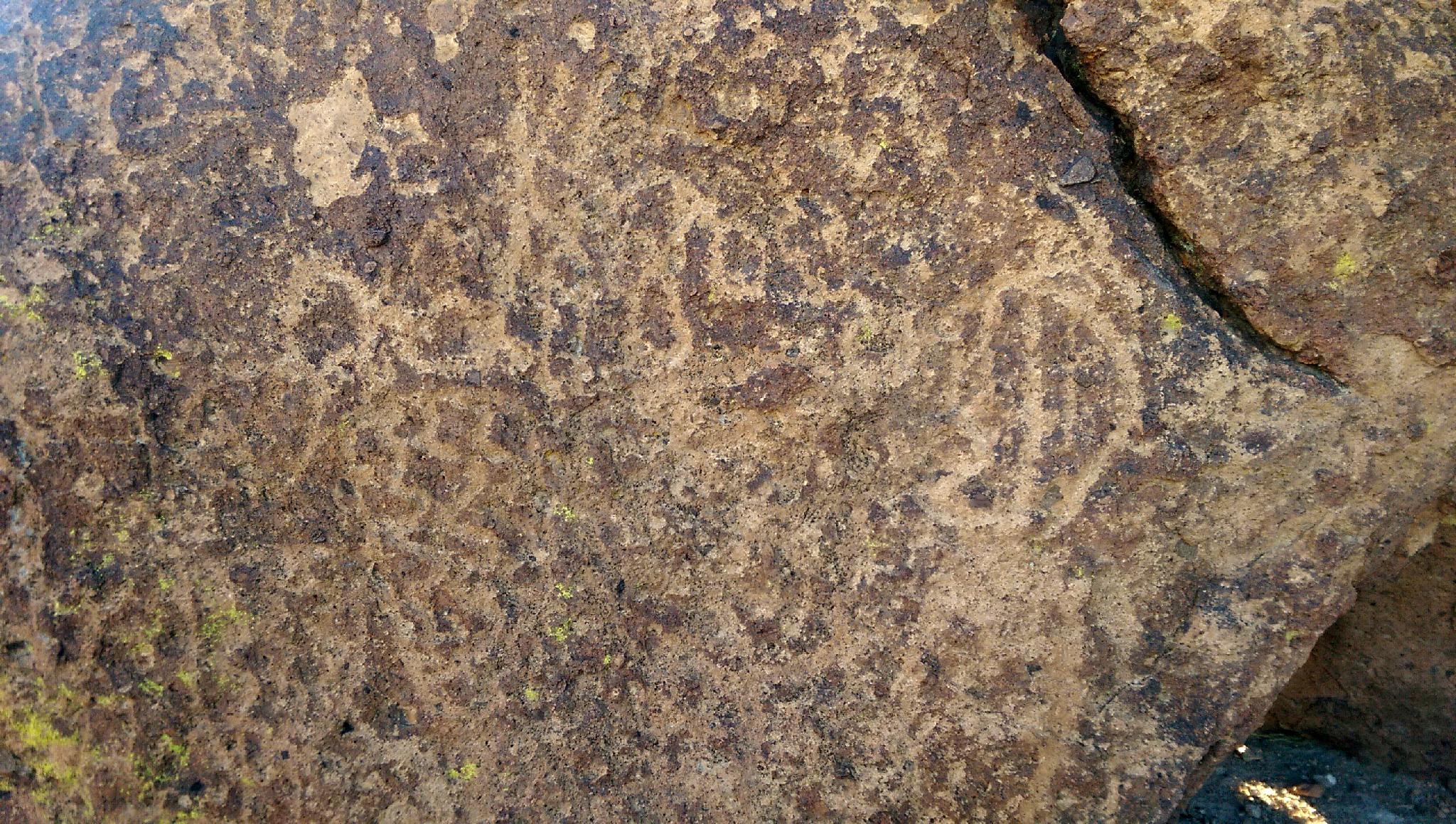
- Avoid Touching the Petroglyphs: Look and observe, BUT DO NOT TOUCH!
- Stay on the Trails: Stay on the most used trails when visiting sites, and don't create new trails or trample vegetation.
- Photography and Sketching is Allowed: Do not introduce any foreign substance to enhance the carved and pecked images for photographic or drawing purposes. Altering, defacing, or damaging the petroglyphs is against the law -- even if the damage is unintentional.
- Pets: Keep pets on a leash and clean up after them.
- Artifacts: If you happen to come across sherds (broken pottery) or lithics (flakes of stone tools), leave them where you see them. Once they are moved or removed, a piece of the past is forever lost.
From the trailhead, follow the trail south along the hillside. In just a few minutes, when the trail begins rounding the hill and turning west, an impressive array of rock art dots the boulders next to the trail.
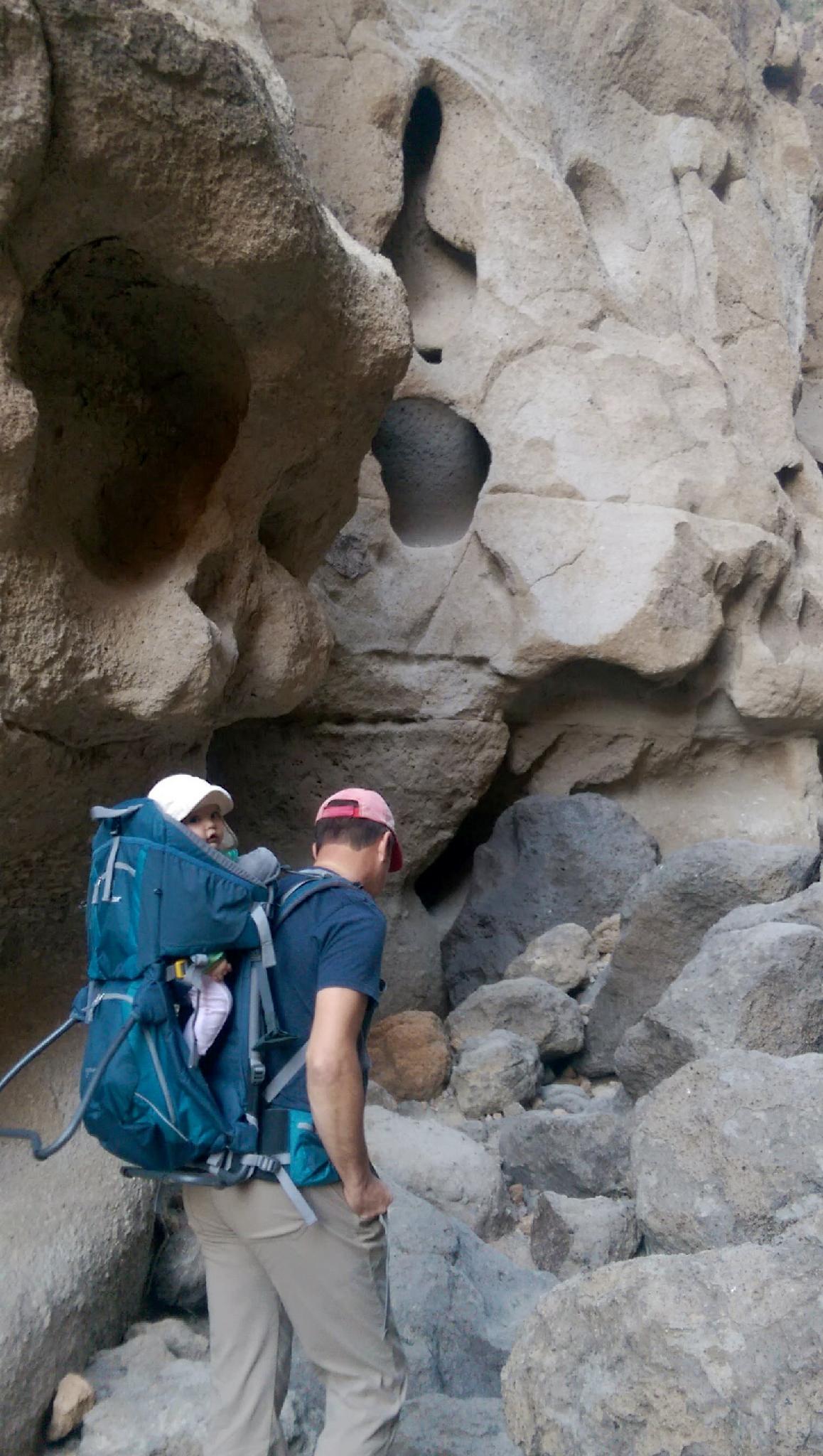
Continue on the trail as it turns north and begins heading to Banshee Canyon and the incredible cliffs. There is a trail junction just before Banshee Canyon. Go right here, quickly entering a land of towering cliffs that resemble swiss cheese.
As the trail ascends Banshee Canyon, the two short climbing sections are encountered in quick succession. The namesake rings make great hand and footholds. Above the short obstacles, a few more minutes reaches the campground and end of the exciting route.
Follow the campground road back to the visitor center and trailhead.
Maps

11S 646383E 3878879N
35°02'31"N 115°23'42"W
11S 646519E 3878480N
35°02'18"N 115°23'37"W
11S 645936E 3878951N
35°02'34"N 115°23'60"W
11S 646099E 3879095N
35°02'38"N 115°23'53"W