The Grotto |

Gold Butte National Monument

Hiking The Grotto - Gold Butte National Monument Hiking The Grotto

Gold Butte National Monument

Overview

RATING: Easy Hike
MAPS: Devil's Throat, NV;

Wed

Sunny, with a high near 77. South southwest wind 2 to 7 mph.

77 | 51

Thu

Mostly sunny, with a high near 80.

80 | 54

Fri

Sunny, with a high near 80.

80 | 55

Sat

Mostly sunny, with a high near 76.

76 | 56

Sun

A slight chance of rain showers between 11am and 5pm. Mostly sunny, with a high near 68.

68 | 50

View Full Weather Details
SEASON: Fall, Winter, Spring (Hot in summer)
GEAR: Standard Hiking Gear
WATER: None

Wed

Sunny, with a high near 77. South southwest wind 2 to 7 mph.

77 | 51

Thu

Mostly sunny, with a high near 80.

80 | 54

Fri

Sunny, with a high near 80.

80 | 55

Sat

Mostly sunny, with a high near 76.

76 | 56

Sun

A slight chance of rain showers between 11am and 5pm. Mostly sunny, with a high near 68.

68 | 50

View Full Weather Details
The delightful Grotto canyon.

The delightful Grotto canyon.

Dark side canyon.

Dark side canyon.

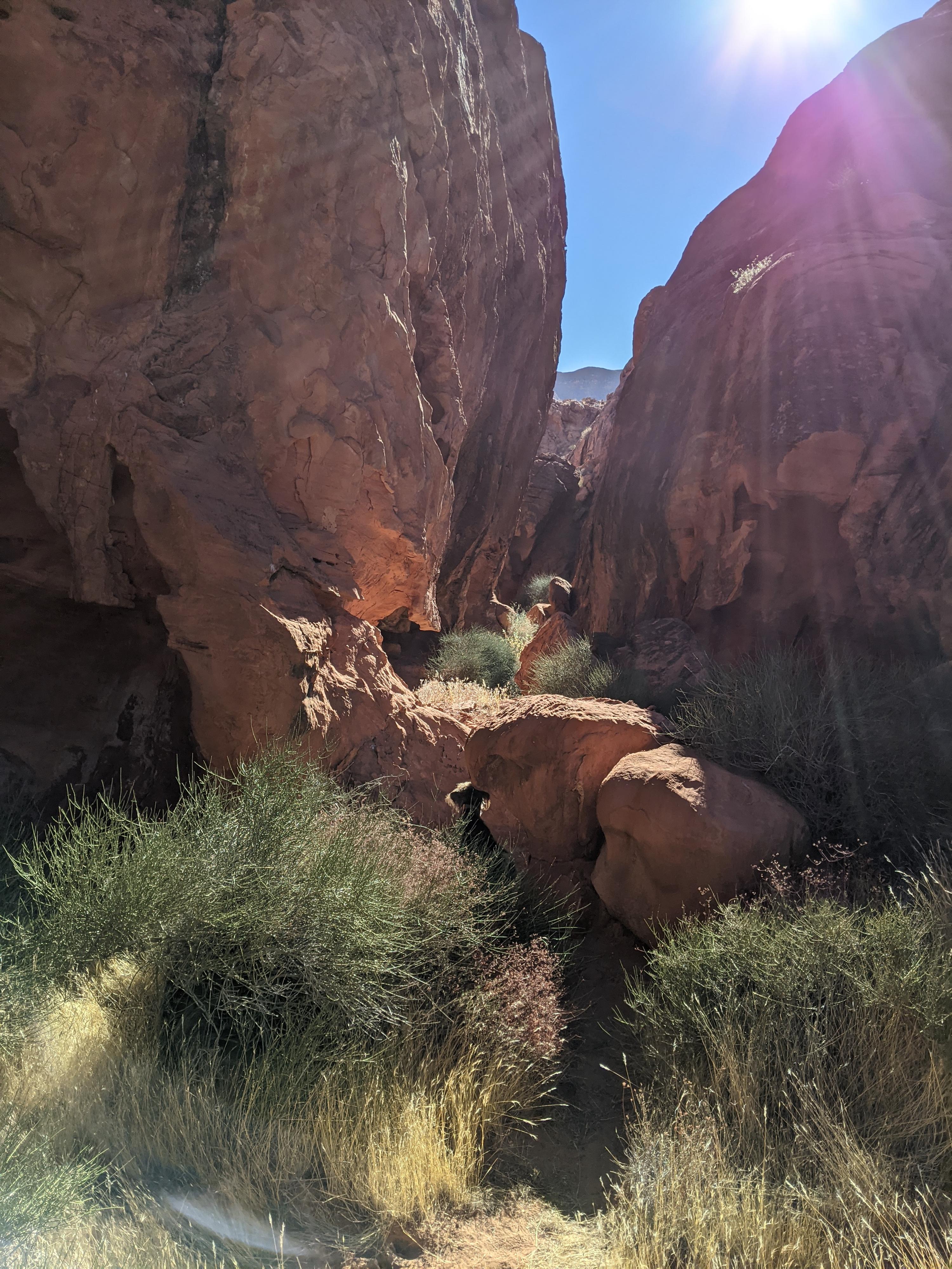
Driving through Gold Butte, we came across a small pullout and a sign saying simple TRAIL. Well, you cannot overlook that! Armed with no information, we wandered along the old road that was now relegated to being a trail. The Grotto ended up being a short hike, but a more fun than I would have expected. Somewhat like Seven Keyholes, the path visits a couple of small side canyons. These canyons are short, but unique and beautiful.

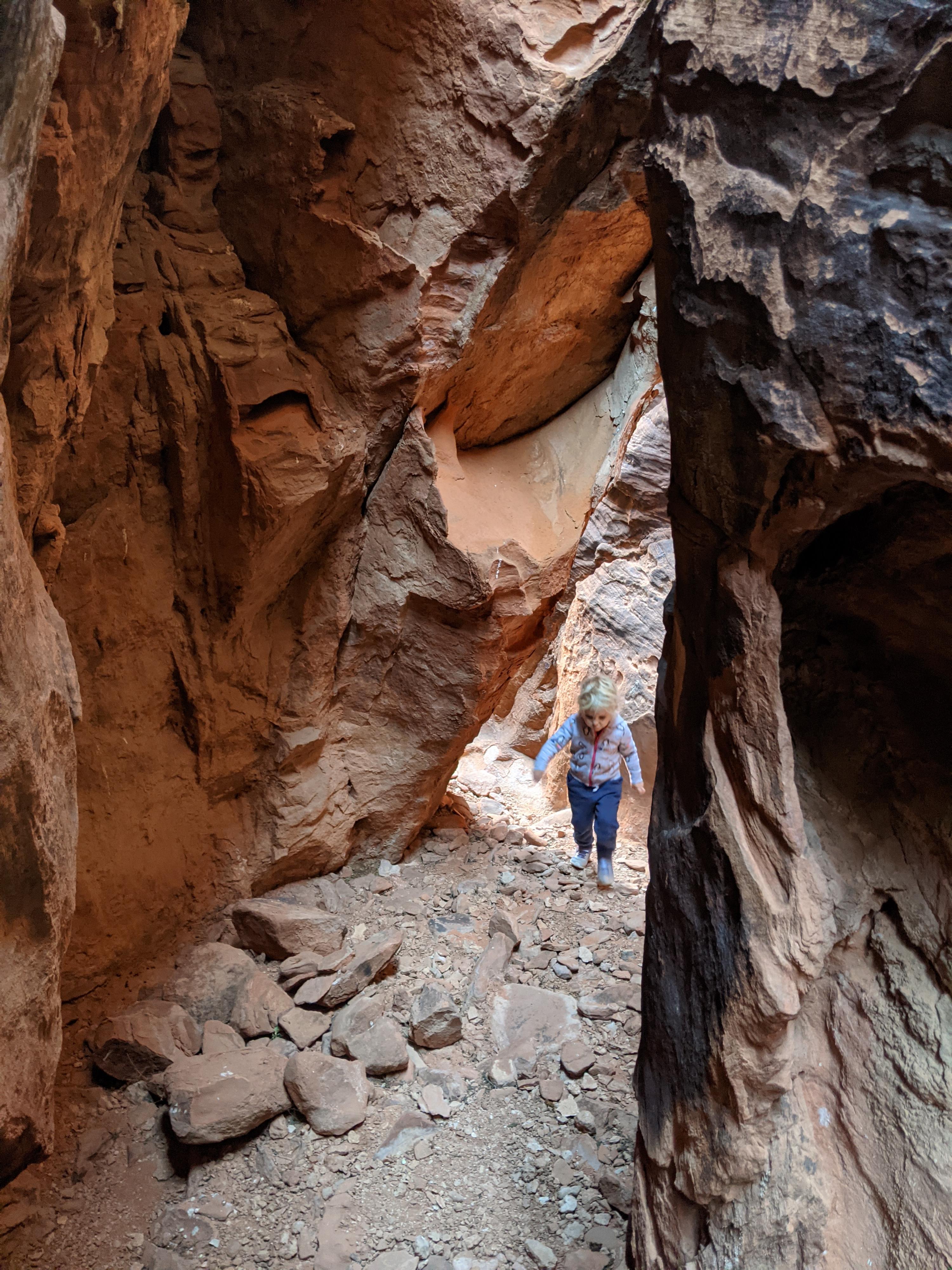
I am not sure who enjoyed this short hike more, my preschooler, or me! This is one not to miss if in the area. Incredibly fun!

Heading into the side canyon.

Heading into the side canyon.

Narrow passages in the grotto.

Narrow passages in the grotto.

Getting There

Reaching Gold Butte starts by taking exit 112 off Interstate 15. This is about 70 miles east of Las Vegas, or 10 miles west of Mesquite Nevada. From exit 112, head south for 3.1 miles on NV-170 toward Riverside. Just after the road crosses the Virgin River, turn right onto Gold Butte Road.

  • Reset your odometer as you turn west onto Gold Butte Road. This is an old paved road that is a bit rough and gravel in sections, but passable by all vehicles in most conditions. ( 11S 748409mE 4068726mN / N36° 43' 54" W114° 13' 05" )
  • Black Butte Side Road - 21 Goats Trailhead ( 11S 751104mE 4043169mN / N36° 30' 03" W114° 11' 47" )
  • 19.9 miles - Side road on the right to a couple of good primitive camping spots. ( 11S 754383mE 4046395mN / N36° 31' 45" W114° 09' 32" )
  • 21.1 miles - Whitney Pocket. Good camping on the right. ( 11S 756034mE 4045904mN / N36° 31' 27" W114° 08' 26" )
  • 21.15 miles - Major junction. Large parking/camping area on the right. A good road goes left (east) along the base of Whitney Pocket. This is the Whitney Pass Rd. Stay straight and reset your odometer. ( 11S 756076mE 4045807mN / N36° 31' 24" W114° 08' 24" )
  • From Whitney Pocket - 3.9 miles - North Mud Wash Side Road to Little Finland, Seven Keyholes, etc... Go right here onto the side road. ( 11S 754067mE 4040421mN / N36° 28' 32" W114° 09' 51" )
  • Mud Wash Side Road - Jct of Mud Wash Road and North Mud Wash Road. Both about 3.0 miles from the main road. Reset your odometer here. ( 11S 752017mE 4036817mN / N36° 26' 37" W114° 11' 18" )
  • Mud Wash Side Road - 0.74 miles - Side road on the right. This is the Mud Wash Dunes side road to the Lollipop/Dunes Trailhead. ( 11S 751014mE 4036361mN / N36° 26' 23" W114° 11' 59" )
  • Mud Wash Side Road - 0.75 miles - The road comes close to a sandstone wall along the wash. This is the Mud Wash Panel. ( 11S 750916mE 4036284mN / N36° 26' 20" W114° 12' 03" )
  • Mud Wash Dunes Side Road - 0.5 miles - Lollipop / Dunes Trailhead, end of road. ( 11S 751000mE 4037053mN / N36° 26' 45" W114° 11' 58" )
  • Mud Wash Side Road - 1.35 miles - Easy to miss junction. Right (the wash) continues to Little Finland. Left leaves the wash, makes a quick turn, and climbs up to higher ground. This is the Cutoff Road. Go LEFT here, leaving Mud Wash. Reset your odometer as you turn onto the Cutoff Road. ( 11S 750313mE 4036001mN / N36° 26' 12" W114° 12' 27" )
  • Cutoff Road - 0.3 miles - Small parking area and trail (old road) on the left. This is the grotto trailhead. ( 11S 750134mE 4036026mN / N36° 26' 13" W114° 12' 34" )
Sunny open area in the middle.

Sunny open area in the middle.

Exploring the grotto.

Exploring the grotto.

Route

From the trailhead, follow the old road south. As It nears the sandstone outcropping, it heads a bit southeast. The road ends next to a sandstone wall, clearly an old campsite before the road was closed.

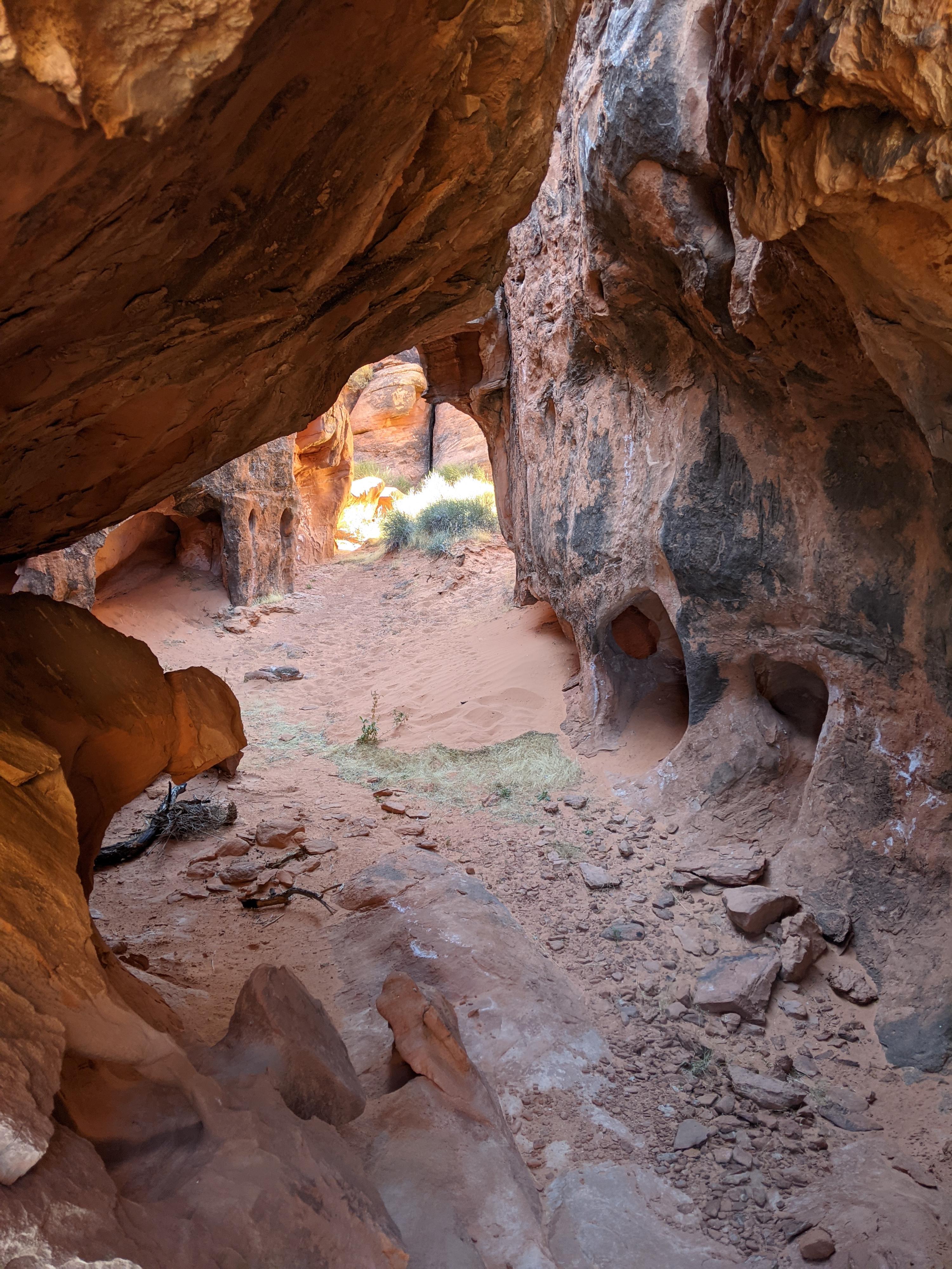
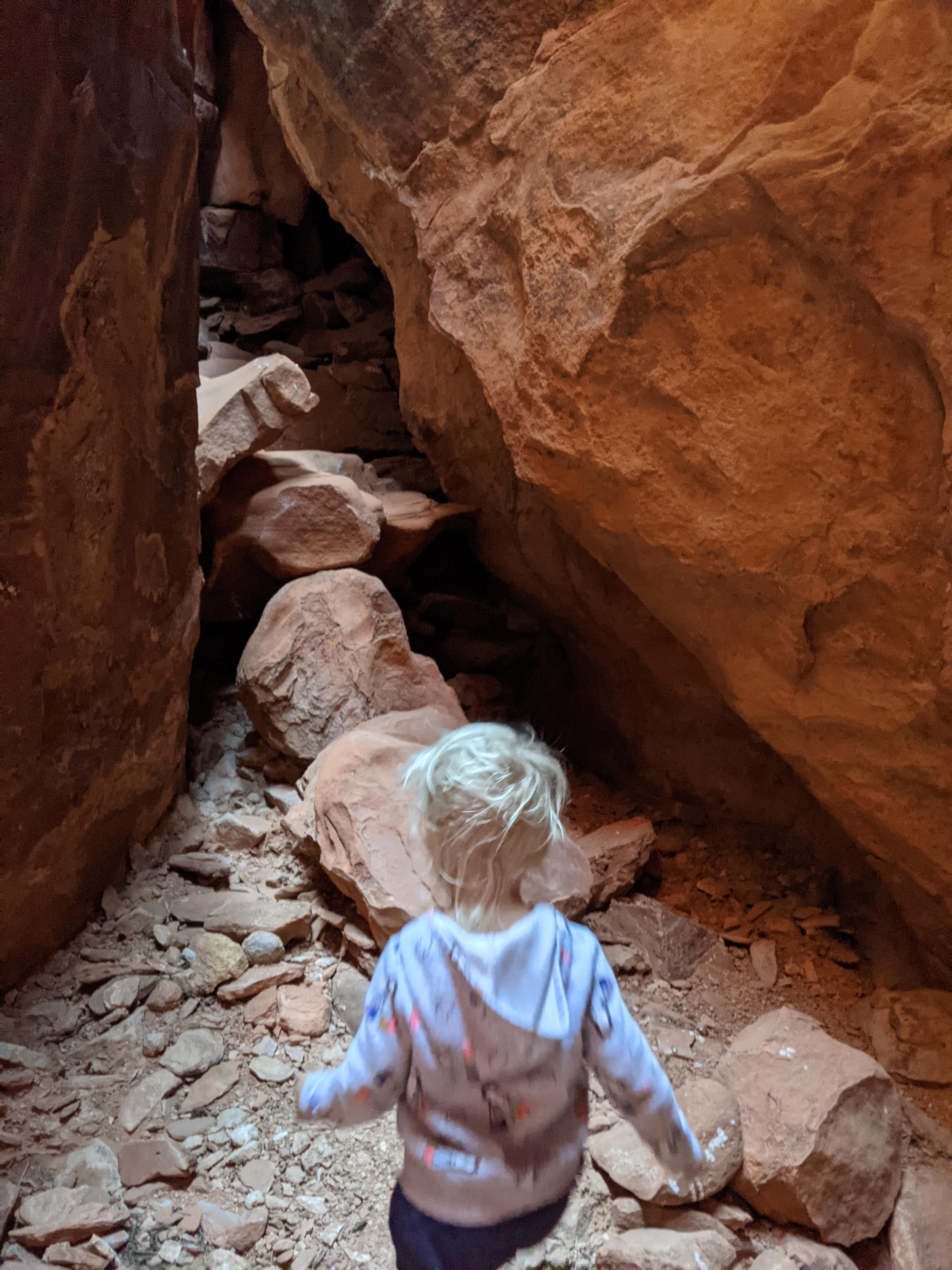
Just before the road reaches the sandstone wall, look for a small social trail leaving the road on the right. It goes west a minute or two, then climbs up a small drainage to some boulders. Go over (or under) the boulders to enter the grotto beyond!

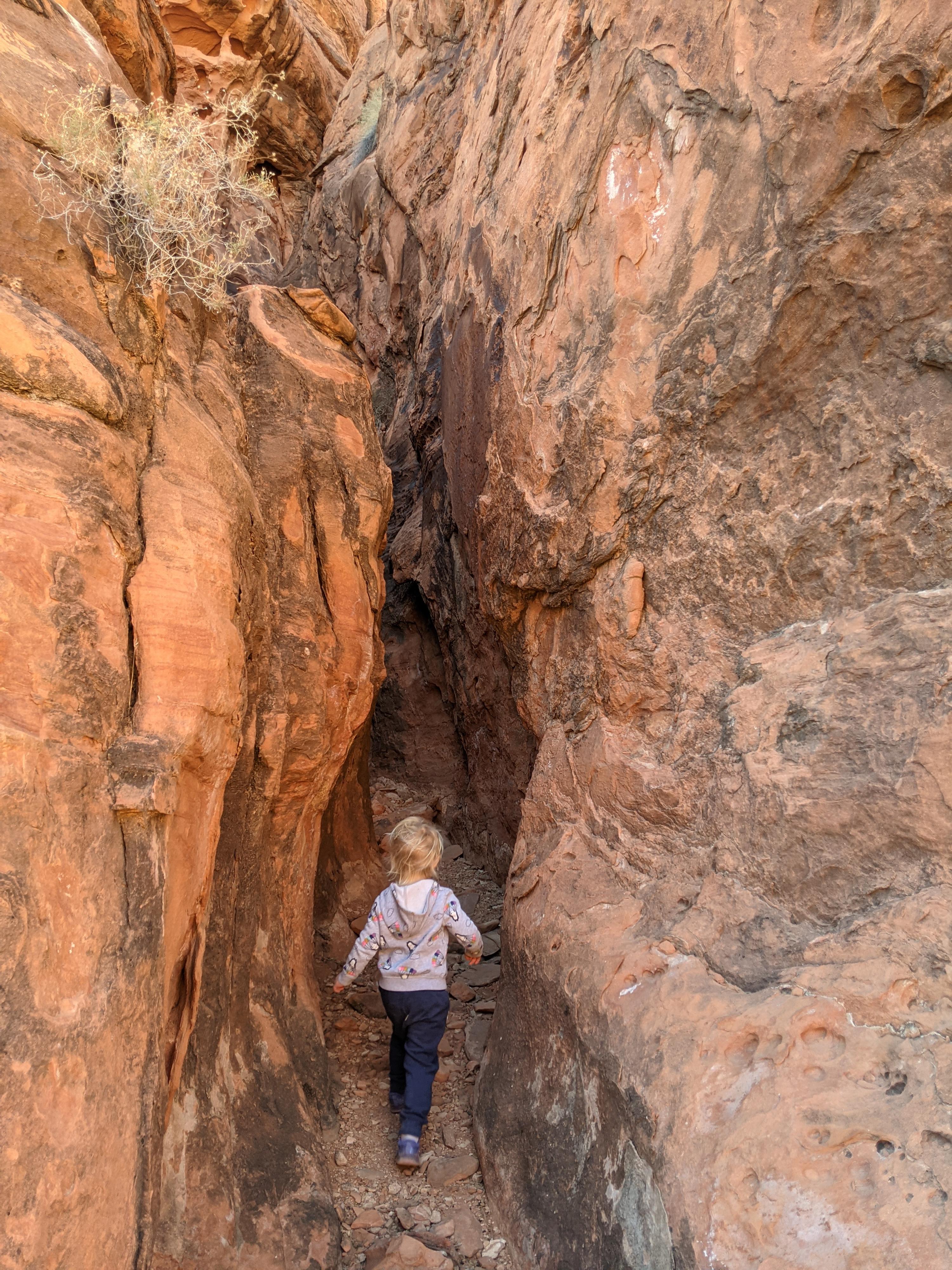
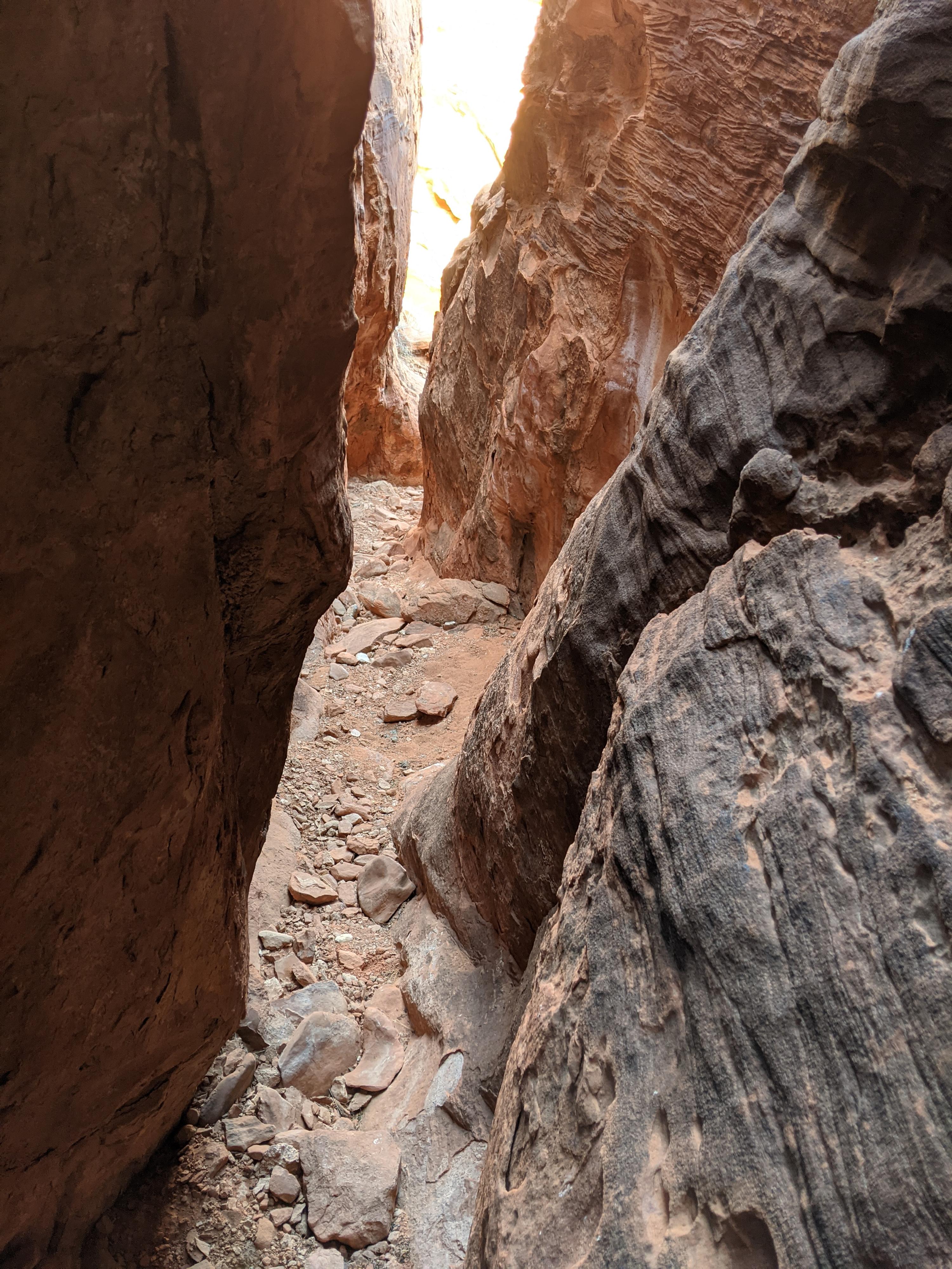
The grotto is small, but quite stunning. The trail forks shortly. Right ends at a small dryfall. Go left, as the canyons snakes through a narrow section and pops out. Right where it pops out of the sandstone labyrinth, another side canyon is on the right. This one is deeper, darker, and narrower than the grotto. It, unfortunately is blocked by a dryfall just up canyon.

Once out of the sandstone, go left to reach the old campsite/road and re-trace your steps back to the trailhead.


Maps

Route / 0.72 miles / Elevation Range 1,977 - 2,048 ft.
Printable Maps:
Grotto Trailhead

11S 750128mE 4036023mN

N36° 26' 13" W114° 12' 35"

Grotto Entrance

11S 750058mE 4035646mN

N36° 26' 01" W114° 12' 38"

Exit and Side Canyon

11S 750081mE 4035594mN

N36° 25' 59" W114° 12' 37"

Comments

Want to make a comment? Login and let yourself be heard.