 Hiking
Twin Rocks Wash
Hiking
Twin Rocks Wash
Capitol Reef
Overview
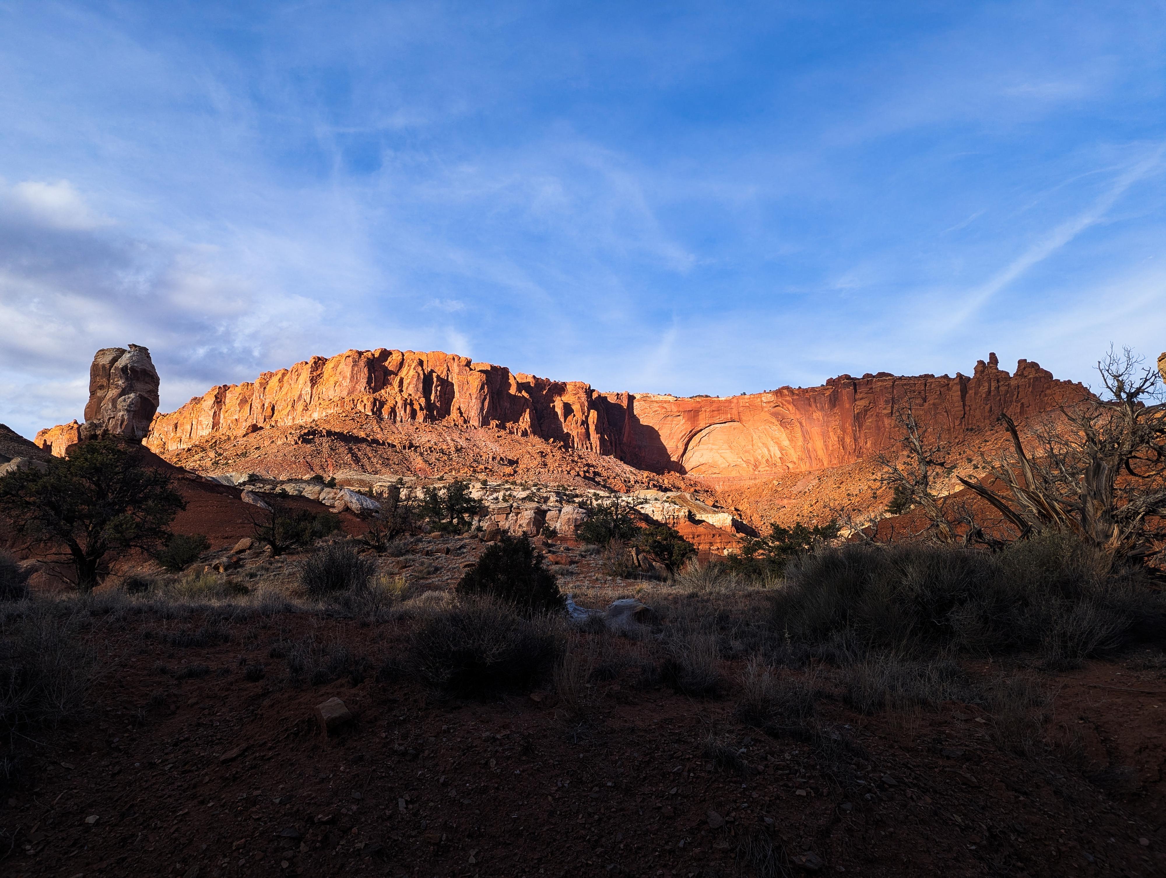
Twin Rocks is one of the prominent roadside formations in Capitol Reef National Park, located along Utah Highway 24, just west of the Visitor Center. It’s an easy-to-see landmark - no hike required - and gives a great example of the park’s classic sedimentary layering and erosional shapes.
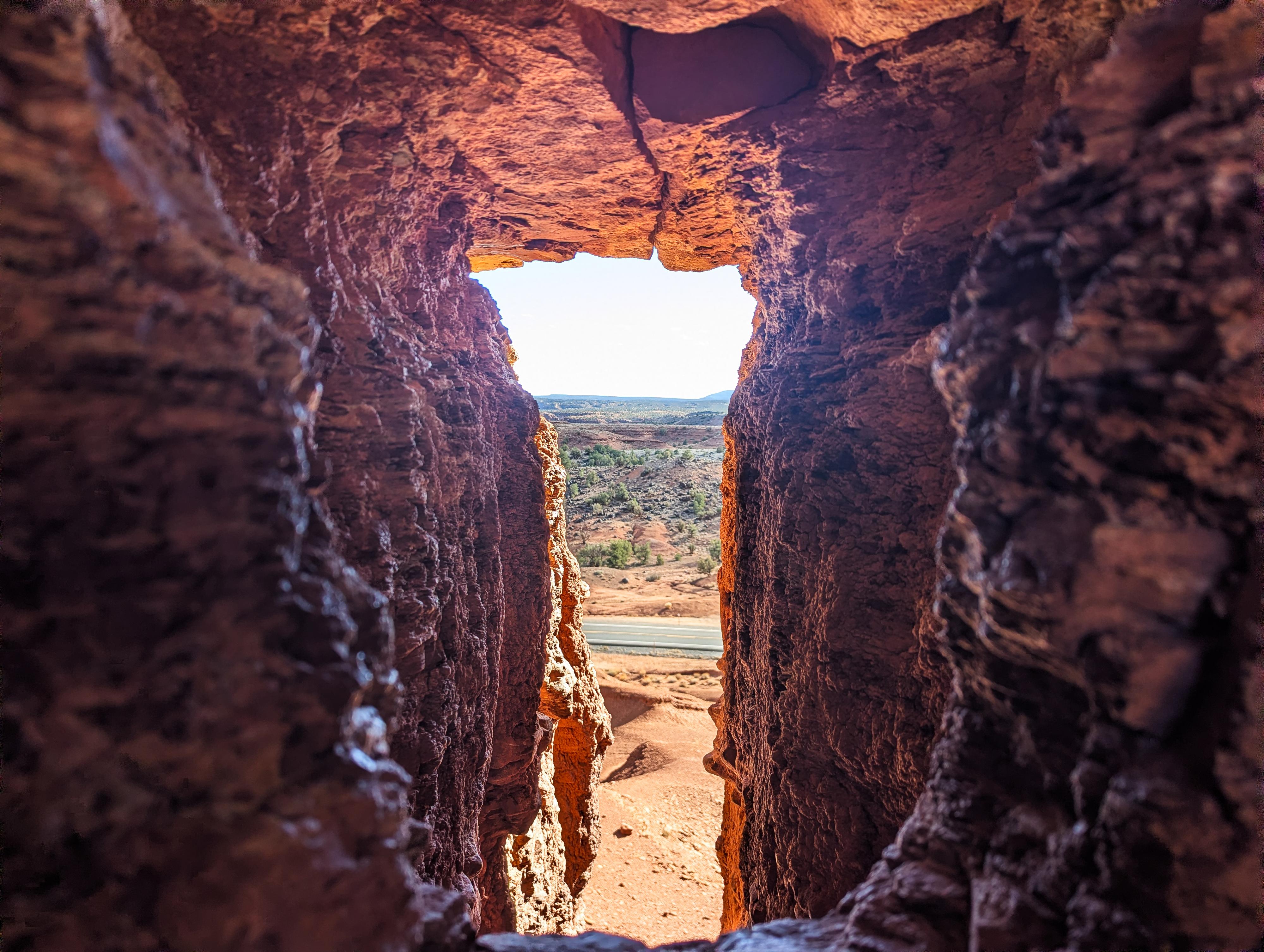
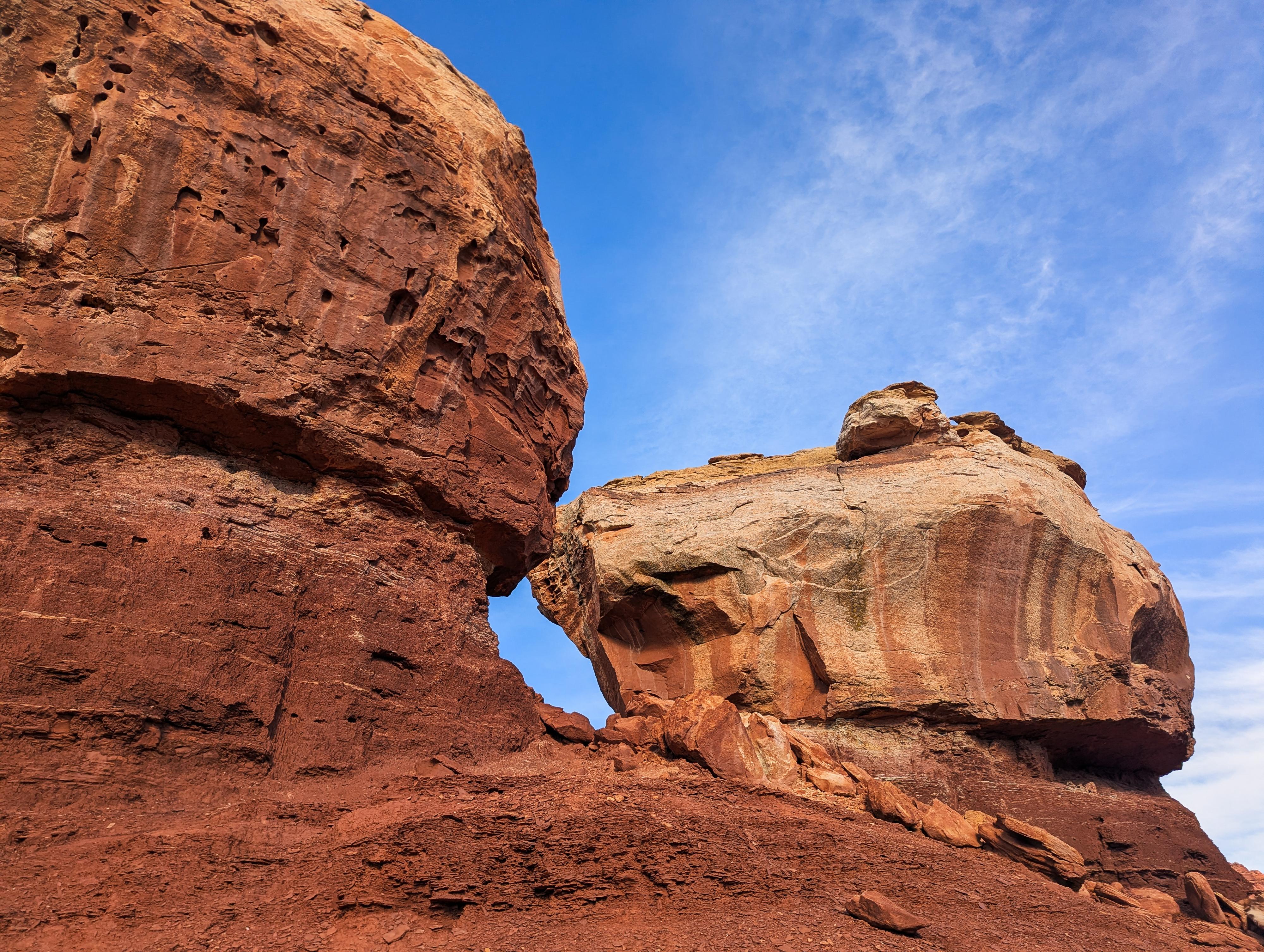
Many visitors make the road side stop to see and photograph the Twin Rocks. A small percentage of those wander up to the base of Twin Rocks to see it up close. I think wandering up and looking through the small "window" between the towers is a worthwhile short stroll.
Those looking for a longer hike can hike up the wash behind Twin Rocks. The wash parallels the road for a bit but is obscured from the road by low hills and has more solitude than you might expect. The wash meanders through interesting geology with a few towers and spires along the way, and the vibrant distant cliffs that make up Meeks Mesa. The wash ends and a dryfall in a layer cake of mud-like rock.
This hike will never be a classic Capitol Reef hike, but the off-the-beaten-path nature makes it great for those looking for a 1-2 hour outing with a high chance of solitude and interesting geology along the way.
Route Description
From the pullout, carefully cross UT-24 and hike up to the Twin Rocks. There is a small window at the base you can see between the rocks through. It is easiest to checkout from the back side.
If making the hike, the wash you want to hike up is directly behind Twin Rocks. Descend the slope to the wash, and head left, upstream. There are quite a few minor side washes that come in along the way, but stay in the widest, most prominent wash as you go. Though it parallels the road, the low hills soon block road noise.
About 1.5 miles from Twin Rocks, a junction is reached that might be a little difficult to discern which fork is the main fork. It is the right fork and heads north into a deepening mud-walled canyon. Follow this to its end about 1/2 mile from the junction. As you go, the walls deepen and become more enclosed. The dryfall seemed quite dramatic to me, with its high, striated walls.
Return the same way.
Photos
Maps

12S 470482E 4241631N
38°19'20"N 111°20'16"W
12S 469197E 4242436N
38°19'46"N 111°21'09"W
12S 469004E 4243083N
38°20'07"N 111°21'17"W