 Canyoneering
Motorcycle Canyon
Canyoneering
Motorcycle Canyon
Black Canyon
Overview
Everyone I have talked to about Motorcycle Canyon has had the same response, "it's OK, I guess, especially if you go to Gold Strike Hot Springs on the way out". I, somewhat reluctantly, would probably say the same thing.
Motorcycle Canyon has some lovely narrows, but they are short, and require a fair bit of hiking in a boulder filled wash to reach. I did still enjoy the canyon, though. It fit the bill for a short outing on a winter's day that didn't require a shuttle. A lovely outing if you don't mind more hiking than canyon.
I would agree that visiting the hot springs on the exit makes the day a fair bit sweeter.
Getting There
The trailhead is just of off highway 93, exit 2. This is the Hoover Dam exit, just before the bridge on the Nevada side. Take exit 2, and on the south side, go south out of the traffic circle. The trailhead is on the right a short ditance from the traffic circle and is well signed. It is fairly large, but does fill up on busy weekends.
Route Description
Approach (2.6 miles / 1-1.5 hours)
From the trailhead, follow the dirt road heading west. There are many side roads to power poles, but stay on the main dirt road. The road reaches a major junction just a few minutes from the trailhead, take the right side, which is signed Goldstrike Parallel road. The road meanders uphill for about a mile and half to a junction on the ridge.
Left is the Black Canyon Overlook road. If you happen to be using two vehicles to shuttle, park at this junction. There is no space for parking at the head of the canyon.
Go left onto Black Canyon Overlook road for about a mile. En route, the road meanders around several bends, then heads south with a hill on the left side of the road. At about 1 mile from the Overlook Junction, a culvert crosses under the road and a social trail leaves on the left side of the road down into the wash bottom. This is the top of Motorcycle Canyon.
Canyon
After leaving the road, follow the drainage down a minute or two to where it starts to become a narrow and brushy canyon. Go down this directly, or bypass the first brushy 50 foot long section on either side, entering at the first drop.
R1 - 25 m ( 83 ft. ) - On my visit, two large bolts on the right were the anchor. Beware of the cracks at the top when pulling. I almost stuck a rope here, move back to pull!
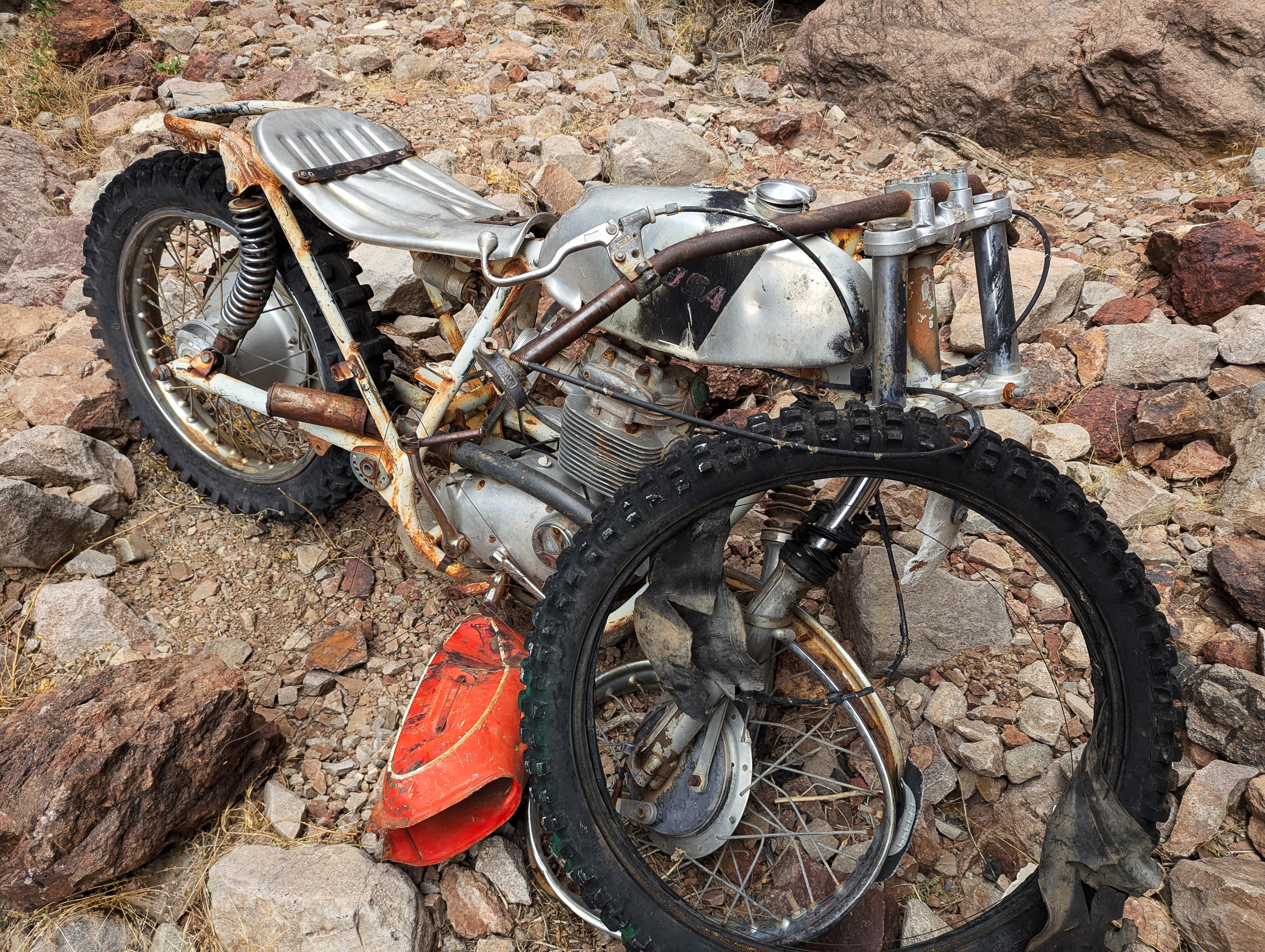
Below R1 is a downclimb to the namesake of the canyon, an old BSR motorcycle. I couldn't find a date or model on it, but it looks ancient!
R2 - 23 m ( 76 ft. ) - The second rappel is just below the motorcycle. There is a large horn that is usually slung high on the right. Use caution getting to it. I approached it by climbing upstream of it and traversing over.
Below R2, the canyon section opens into a wide boulder dotted wash. Head down it! The going is mostly easy, with a few obstacles in the way. Most are easy down climbs, or easy to find a route around. One particular nuisance drop is passed by climbing on the left of it, then following a social trail down to the bottom of the drop.
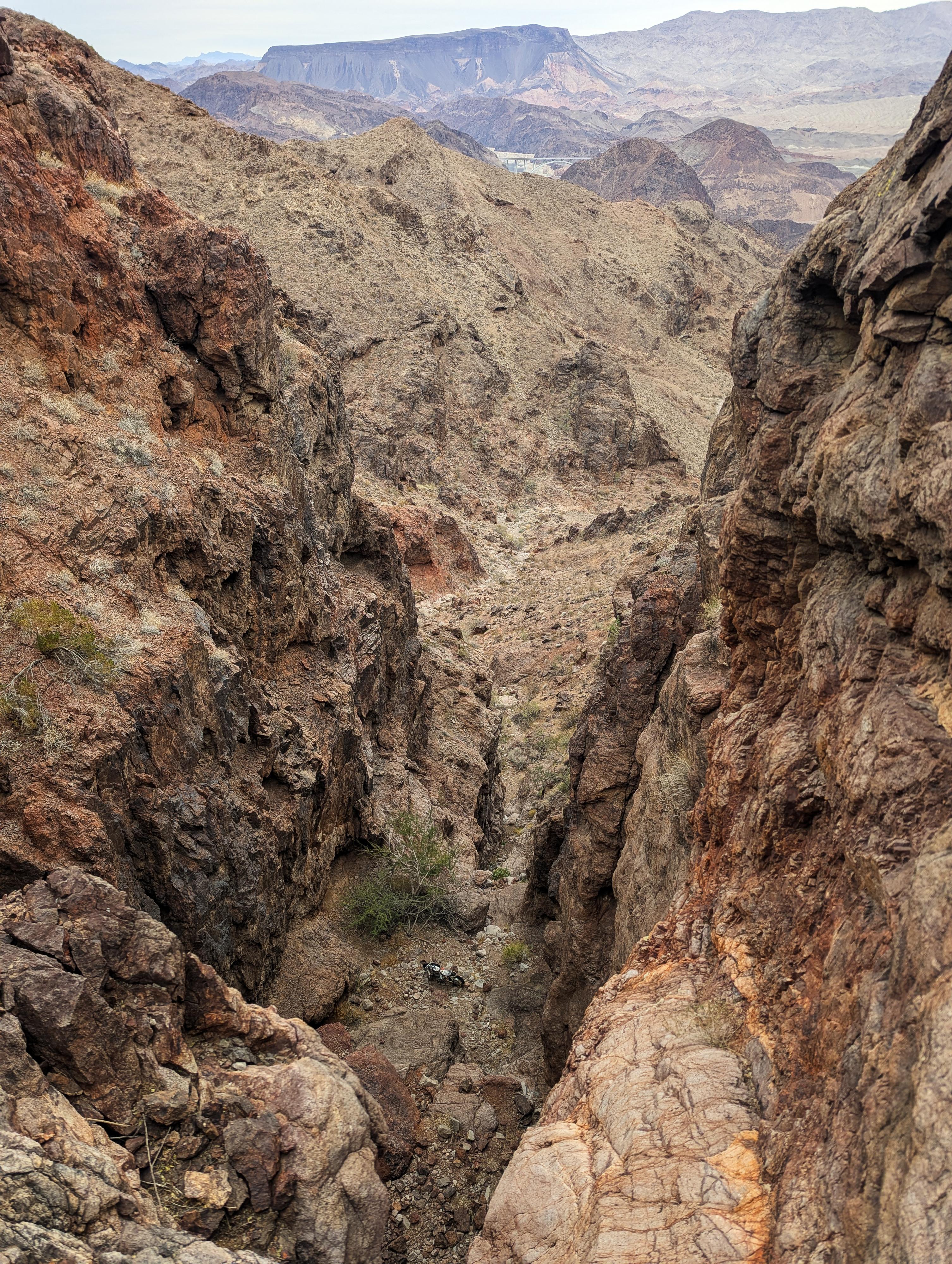
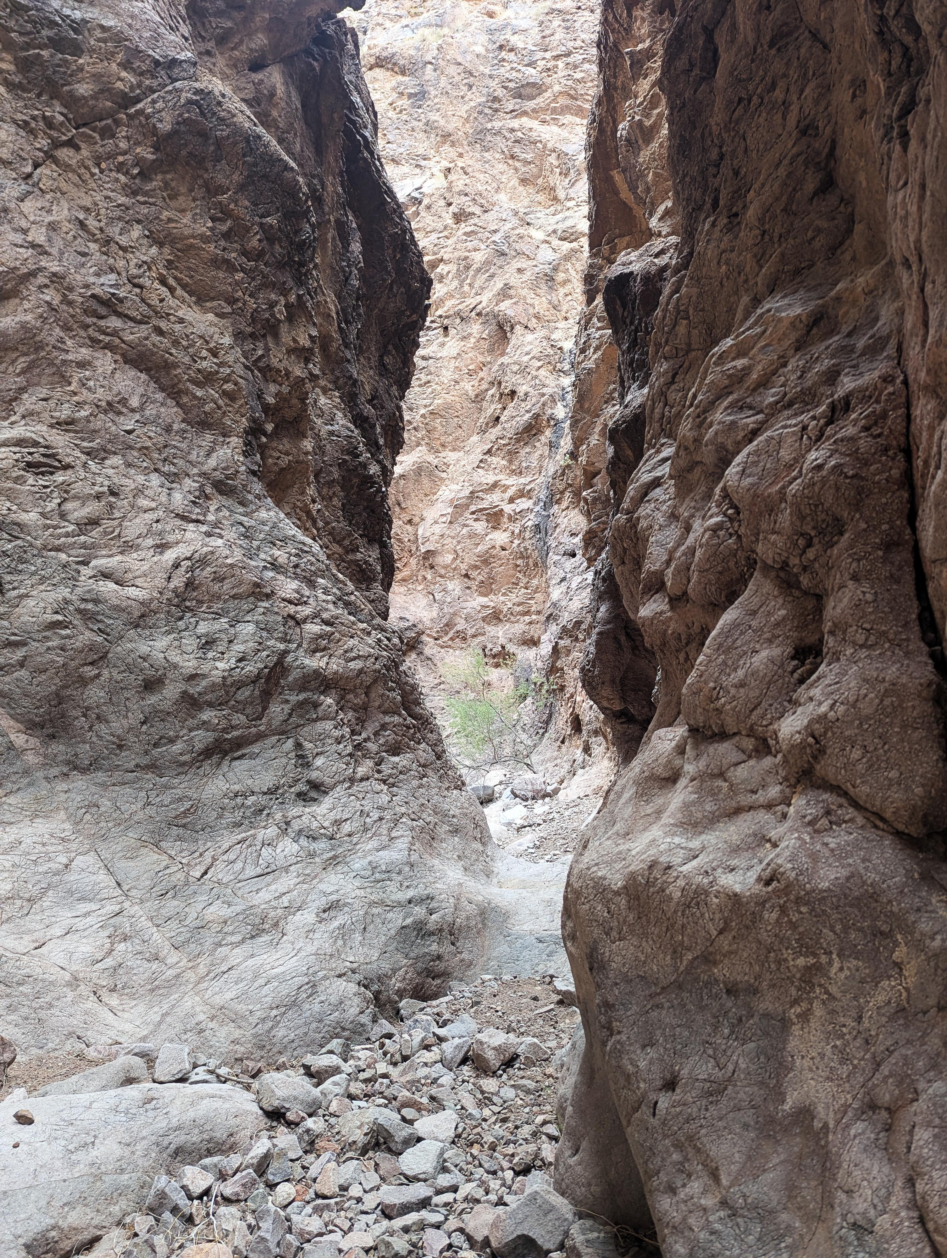
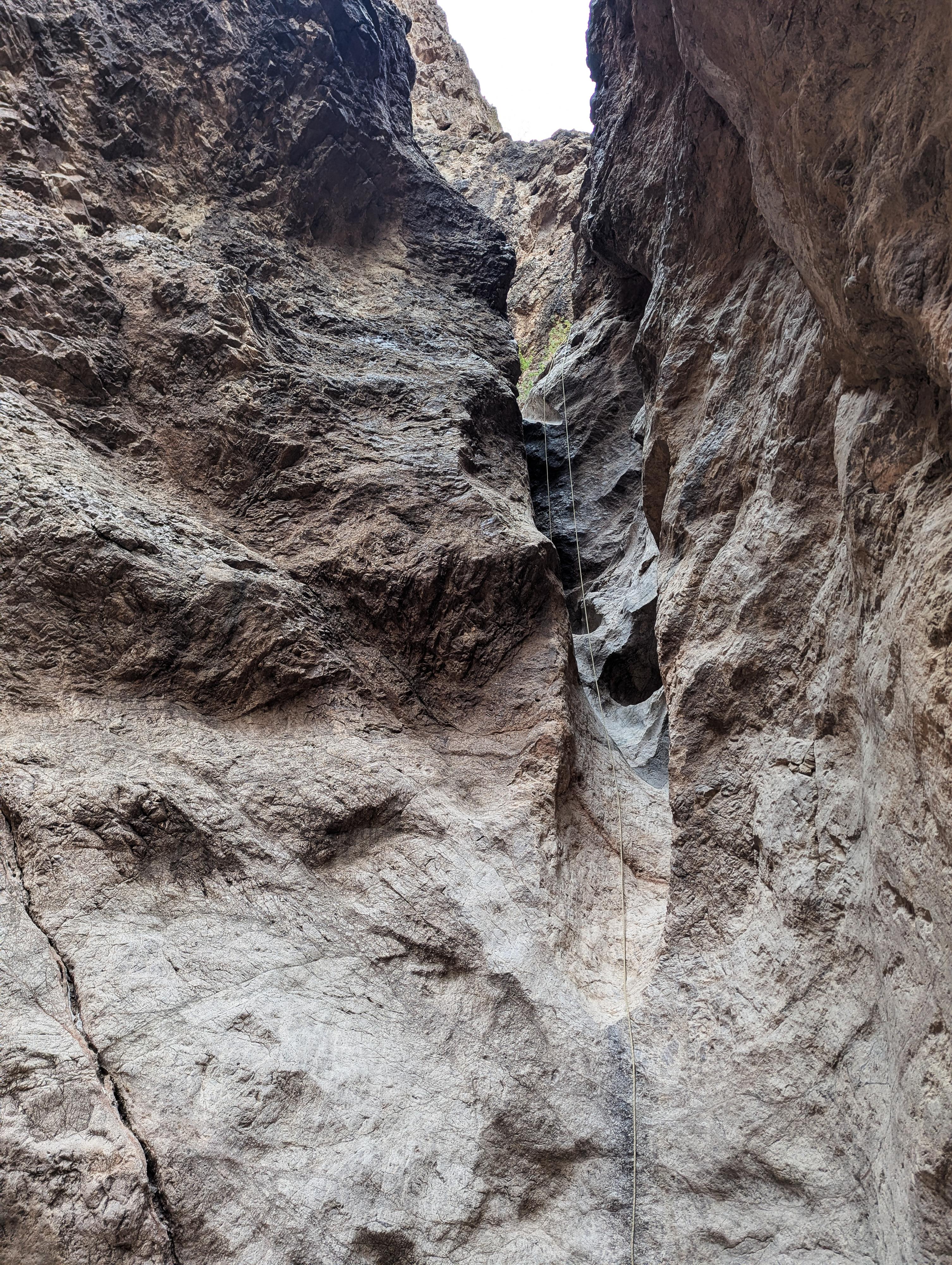
The second narrows section is pretty, but short. Once in them, you will reach a rappel soon.
R3 - 15 m ( 50 ft. ) - This looks just on the edge of being a down climb, but I was glad to have a rope!
R4 - 11 m ( 37 ft. ) - This was, on my visit, off a cairn anchor.
The second narrows soon open to more wash walking, The third and final narrows aren't too far, though.
The third narrows section is the longest, and I think, the most beautiful. Be sure to take your time once you get into them! There are 3 drops in this section that had anchors on my visit, indicating some rappel them. These can be down climbed by the skilled as well. They are about 8 m ( 27 ft. ), 8 m ( 27 ft. ), and 5 m ( 17 ft. ). Once you get to the first one, they come in fairly quick succession.
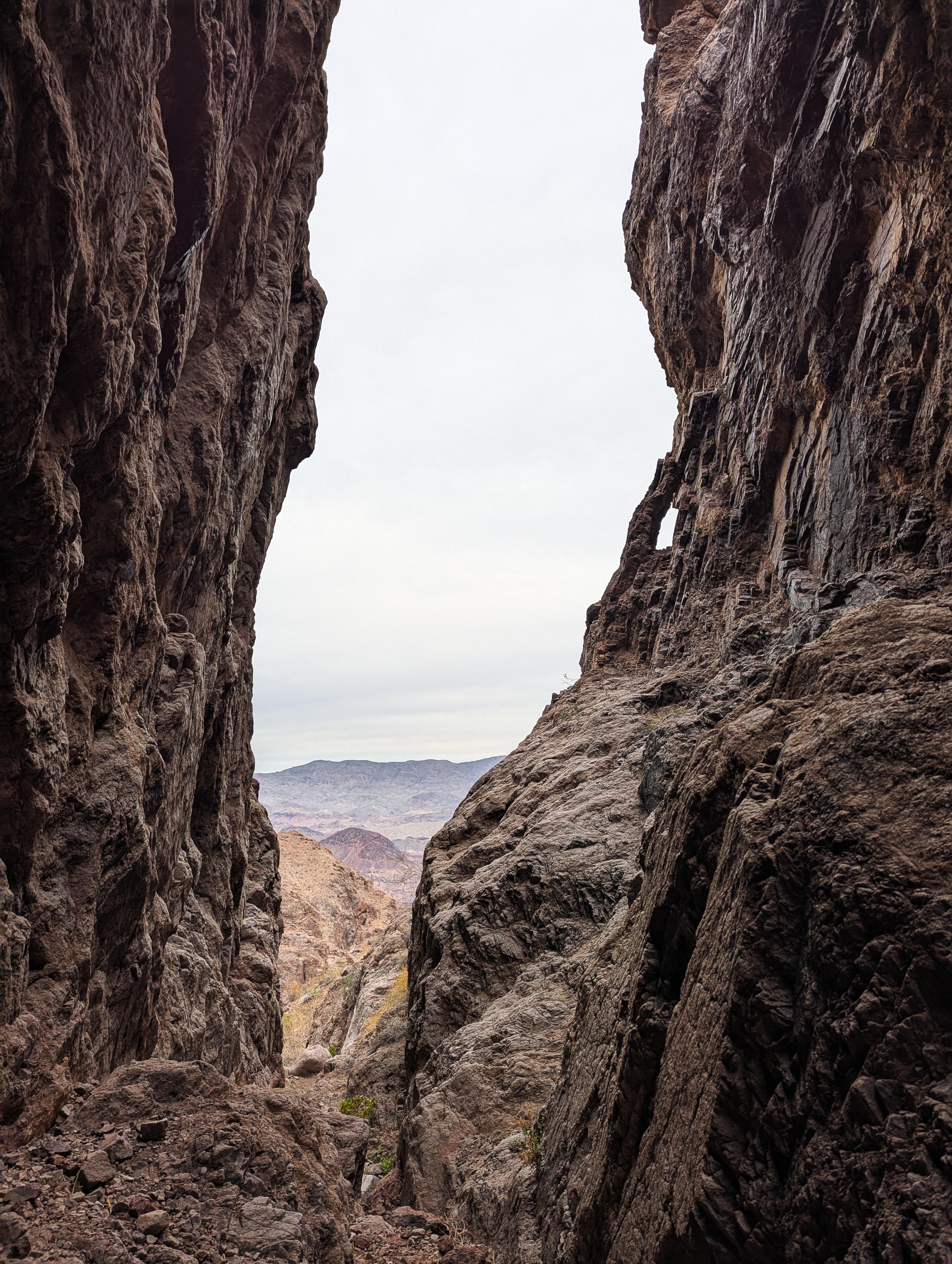
After the third major downclimb or rappel, the canyon begins to open, and you will see power poles that are near the Gold Strike Canyon/Motorcycle Canyon confluence. Continue to the confluence of the two canyons.
Hot Springs Side Trip (1+ hours roundtrip)
The confluence will Gold Strike Canyon brings a lot of foot traffic. If you have time for a side trip, go right here and follow Goldstrike Canyon down to the Colorado River. Goldstrike Hot Springs is right near the river. It is a popular destination. It is a little under a mile from the confluence to the river. Expect 20-30 minutes one way.
Return from Motorcycle Canyon/Gold Strike Canyon Confluence (about 1.9 miles)
Go left, heading up Gold Strike Canyon. A lovely section of narrows is soon encountered. There is an obstacle here, but carved steps and usually a fixed rope on the left make it easy. Most won't need the rope, which is often in dubious shape anyway!
Above the obstacle, follow the beaten path upstream.
The well-used trail meanders up on the right side (looking up canyon) in a few places to avoid large boulders. As it trail gets higher, the narrows subside and the canyon widens. When large highway bridge pillars begin to be visible, you are close to the exit. The trail turns into an old road just before reaching the trailhead.
Photos
Maps

11S 700570E 3987331N
36°00'35"N 114°46'28"W
11S 699410E 3985673N
35°59'43"N 114°47'16"W
11S 700344E 3985750N
35°59'44"N 114°46'39"W
11S 700441E 3985769N
35°59'45"N 114°46'35"W
11S 700467E 3985775N
35°59'45"N 114°46'34"W
11S 701118E 3985977N
35°59'51"N 114°46'08"W
11S 701653E 3986160N
35°59'57"N 114°45'46"W
11S 701683E 3986165N
35°59'57"N 114°45'45"W
11S 701692E 3986162N
35°59'57"N 114°45'44"W
11S 702124E 3986280N
36°00'00"N 114°45'27"W
11S 702405E 3986427N
36°00'05"N 114°45'16"W