 Hiking
Goldstrike Canyon
Hiking
Goldstrike Canyon
Black Canyon
Overview
Gold Strike Canyon, home to Gold Strike Hot Springs, and Nevada Hot Springs is just downstream from Hoover Dam in the Black Canyon of the Colorado River. Access is relatively easy, requiring about an hour or so hike down from the trailhead near the highway. Be warned, however, this hike is not recommended by the National Park Service in summer months due to heat and the high potential for encountering rattlesnakes. Also be aware, this is an incredible popular hike with locals. As such, expect to run into numerous groups and the occasional litter. Please pick up and errant trash and pack it out.
The hike itself has a bit of an adventurous feel to it. There are numerous small obstacles to overcome, most with fixed ropes in place. A little teamwork can easily defeat all of the obstacles, but be cautious if bringing dogs on the hike. They may require significant assistance getting up and down the many short drops.
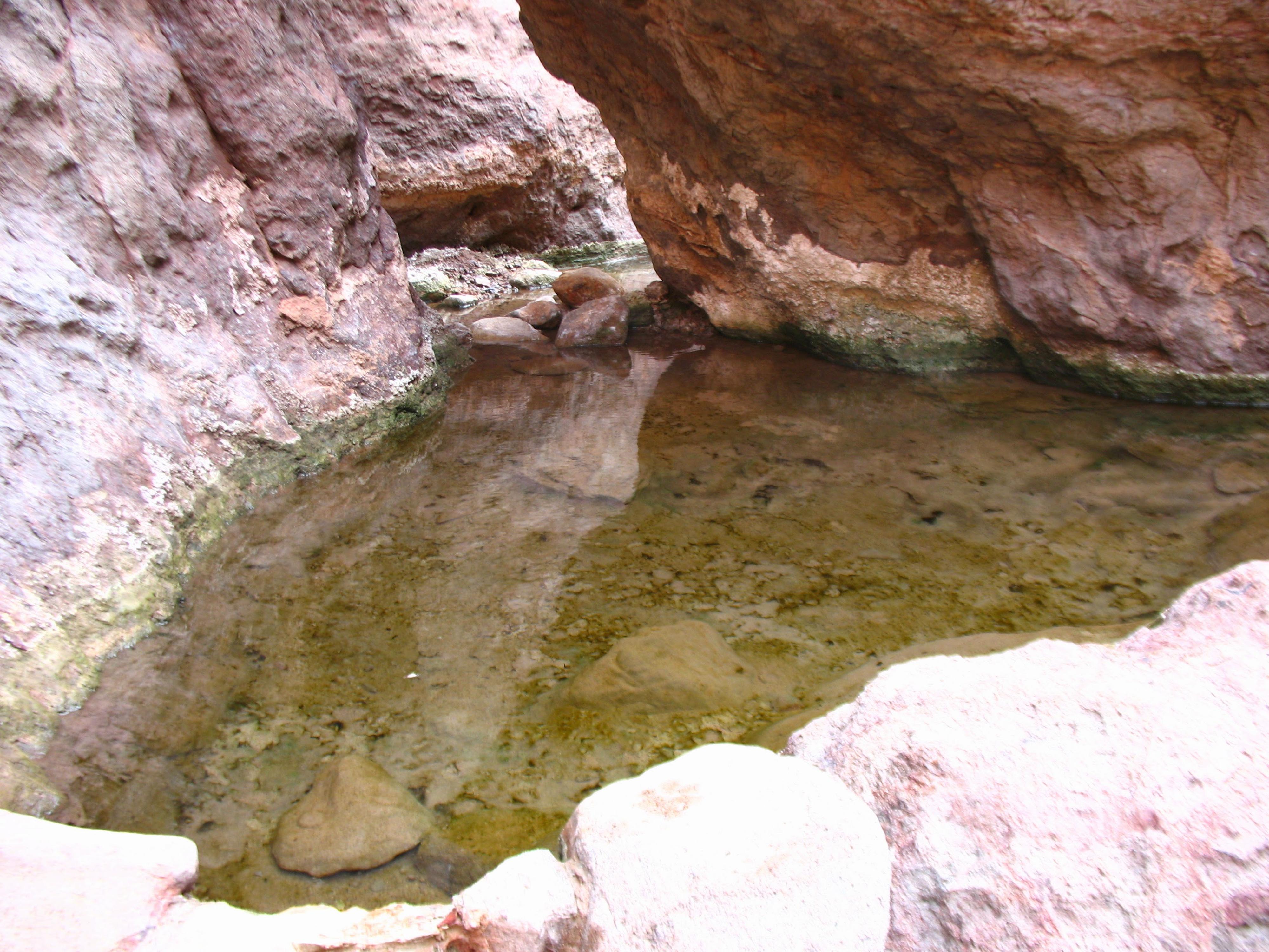
The hot springs themselves vary with recent floods. Many of the pools had been filled in by heavy rainfall in December 2010, but visitors could still find several nice soaking pools. The filled in pools are likely to re-emerge as people work on digging them out and re-building them.

Getting There
The trailhead is just of off highway 93, exit 2. This is the Hoover Dam exit, just before the bridge on the Nevada side. Take exit 2, and on the south side, go south out of the traffic circle. The trailhead is on the right a short ditance from the traffic circle and is well signed. It is fairly large, but does fill up on busy weekends.
Route Description
From the trailhead, walk back on the road a short dstance to the informational sign. Follow the old, now closed road, then down the sandy wash. In 5 minutes, you will pass the abutment of the highway bridge. Continuing down the canyon is easy passage to a small dryfall. Pass this on the left, following the obvious social trail. 5 minutes below the dryfall is the first major obstacle, a chockstone with a 5 m ( 17 ft. ) drop on the downstream side. There are carved steps to allow for downclimbing, but beginners and dogs will need a spot or hand-line.
The canyon opens, before narrowing and deepening again. As you head down from this point, there are numerous small boulder problems to work over and through. None are particularly difficult, especially if you look around for the most traveled path.
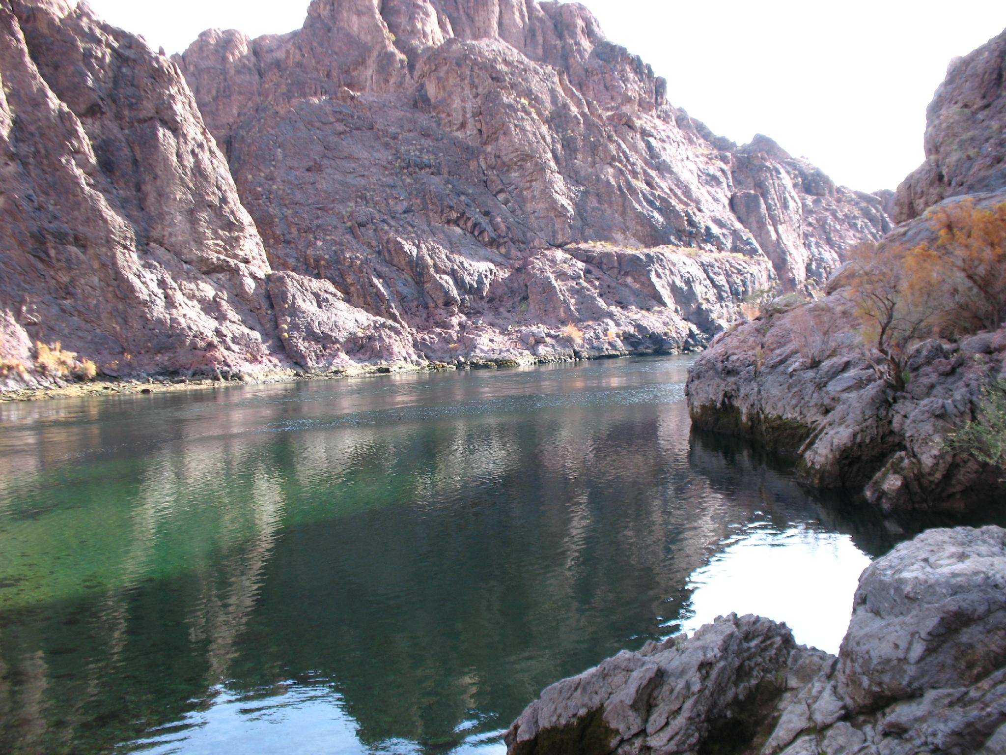
When the hot water begins flowing, you have reached Gold Strike hot springs. There are usually a couple of great pools in this section. Just below the canyon begins dropping steeply with more boulders to work through. Keep working down, enjoying the many small pools. The canyon opens on the Colorado River, offering great views up canyon of the new Hoover Dam bypass bridge.
Photos
Maps

11S 700562E 3987330N
36°00'35"N 114°46'28"W
11S 702337E 3986430N
36°00'05"N 114°45'18"W
11S 702855E 3986626N
36°00'11"N 114°44'58"W
11S 703378E 3986291N
35°59'60"N 114°44'37"W