 Hiking
Halls Creek Narrows
Hiking
Halls Creek Narrows
Waterpocket Fold
Overview

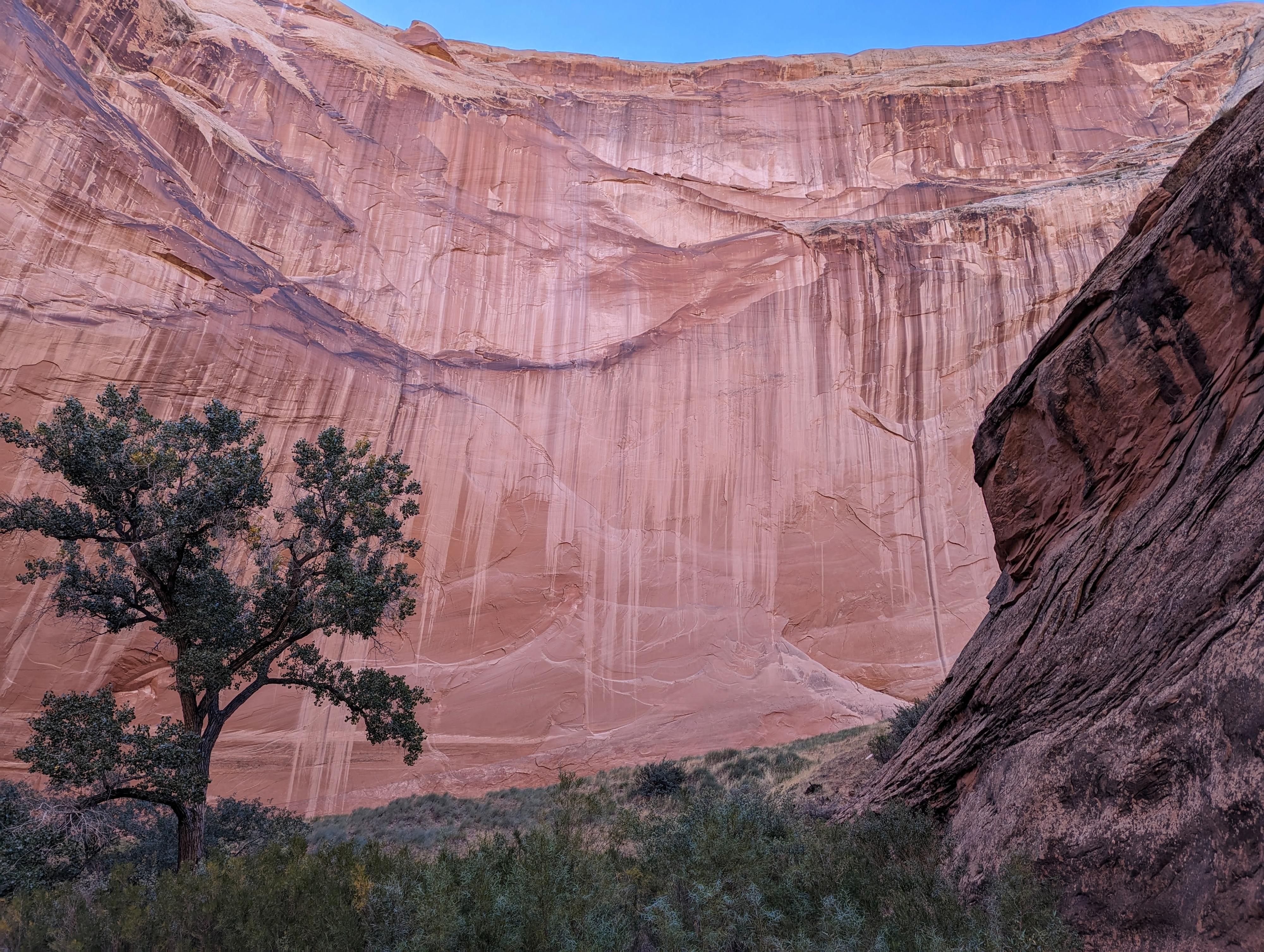
Tucked at the south end of Capitol Reef National Park, Halls Creek Narrows is a stunning, convoluted canyon that makes a meandering path through Navajo sandstone. The canyon has a bit of everything: deep alcoves, a spring feed stream, narrower sections, and towering walls. I would compare it a little in scale and experience to Coyote Gulch, but it is also quite different.
This is one of those hikes that has been on my list for literally decades. When I started going to the desert, a friend showed me photos and told me the story of his trip through the narrows. It looked and sounded like an incredibly magical place! Finally, in 2023, I made it a priority to visit. It did not disappoint!
Visiting is not an easy task. The shortcut route is about 15-16+ miles round-trip, depending on your twists and turns; the standard route is about 22-25 miles.
Which Route: The shortcut route requires route-finding and scrambling experience. This is not a route for beginners. The scrambling is generally low-exposure, but I would not recommend it with a heavy pack. Experienced desert backpackers with some scrambling experience would likely feel comfortable with a light overnight pack.
Are you new to the desert or don't have much scrambling experience? Opt for the standard route from Halls Creek Overlook. Though longer, it is more straightforward and doesn't require scrambling.
With either route, most groups do this as a 1-2 night backpack. If you are backpacking, you are required to get a permit from the park service in person at the visitor center. If you are fit and comfortable with the distance, doing it as a day hike via the shortcut route is a good option. With no permit needed and requiring only a light pack, this was the option I chose. At a pretty good pace with a few extended breaks, it took me 7 hours roundtrip on a 75 degree fall day.
Season: Spring and fall are the recommended seasons. Summer brings brutal heat on the fully exposed approach and exit hikes and the possibility of biting insects. Spring and fall bring moderate temperatures, but you will be spending much time in the stream and need to be prepared for cold water.
Water: Generally, you will find water to filter every 3-5 miles of the hike. Don't skip on a chance to fill up, especially if it is hot. Once in the narrows proper, you will have 2+ hours of constant wading in the stream. Floods change the water levels, but the deepest spots can be anywhere from knee-deep to swimming. The most common, and what I encountered, was a lot of mid-calf wading with a few short pools about waist deep. I would recommend a dry bag to keep food, an extra layer, etc. dry just in case of a deep pool or stumble.
Getting There
Travel east out of Capitol Reef National Park on highway 24. Just past the park, 0.25 miles, is the well signed Notom road.
Route Description
Halls Creek Overlook (Standard Route) to Shortcut Junction (about 5 miles):
From the Halls Creek Overlook trailhead, follow the signed Brimhall Arch trail. It is easy to follow as it descends a bit and heads north before making a quicker and steeper descent down to Halls Creek. There are some old cowboy signatures along the way. This must have been an incredibly isolated place to be passing though back in the early 1900s!
Once at Halls Creek, if you have time, consider taking the side trip up to Brimhall Arch. This is in the first side canyon on the right.
As you head down Halls Creek, you will mostly be passing along the base of the impressive sandstone reef, but at about 4 miles, it turns to a steep dirt hill known as Red Slide. The second side canyon after Red Slide, at about 4.5 miles from the Halls Creek Overlook trailhead, is Fountain Tanks, a spot that contains large pools of water. It is a reliable place to filter water if needed. You may need to scramble up and around a bit to find pools depending on conditions.
From Fountain Tanks, it is a short 0.5 miles to a steep side canyon coming in on the left (east). This is where the shortcut route comes down.
From the Shortcut Trailhead to Halls Creek (less than 1 mile):
From the parking area, head west off the cap rock. An emerging trail here works west down to the top of a very steep dropping rocky gully just a few minutes from the trailhead.
From the top of the gully, initially start on the left and down the first short (6') cliff band. A No Hunting sign post here is a good landmark to find a way down the initial section. Head down just a short distance, then traverse right across the drainage. There were cairns here on my trip, but require a sharp eye. You will lose just a little elevation before crossing back left across the drainage on slickrock. This, to me, was the crux of the route and required a few scrambling moves across and down with a little exposure to move back across to the left (south) side of the drainage.
Once back on the left side of the drainage, a social trail and sparse cairns moves generally down and left, away from the drainage. The trail splits in spots here, but a close eye for either a trail or cairns should keep you on track. Look to the very bottom of the slope, and you should spot the social trail heading away from the bottom of the slope and toward Halls Creek. This makes a good landmark to know where you are aiming for. If you find exposure or hard climbing, look around. Nothing in this lower section should be more difficult than a move or two of class 4 scrambling.
You will intersect the well-travelled standard route trail on the flats before reaching Halls Creek. Be sure to make a note of this spot and route, so you can recognize it on the way back. I ended up coming down a wash and joining the standard route right at a nice sized tree that makes a great landmark.
To the Narrows (3.5 miles from the shortcut/standard route junction):
Continue down from where the standard and shortcut routes join. During an extended dry period, I didn't find water for about 3 miles. The massive walls west of Halls Creek make this a dramatic hike. About where I found water there began to be many very nice campsite and large trees. If doing the trip as a backpack, I would consider camping here and doing the loop through the narrows with a lighter pack.
At about 3.5 miles from the standard/shortcut junction, just before Halls Creek turns west and clearly becomes a deep canyon, the trail splits to begin the loop.
The Loop
The trail that leaves Halls Creek proper and follows the old road was more difficult to spot at the start than I expected. Keep an eye on the map, and look for small cairns and a trail leaving the creek bed.
Halls Creek Divide (1.75 miles)
Once you have found the old Halls Creek Road, it is easy to follow. It meanders up. To the east (left) are some really dramatic red cliffs and smaller entrada sandstone cliffs lower down. The old road summits the divide, and begins descending.
It is about 1.75 miles (45 minutes) from when you leave the Halls Creek stream bed to when the old road re-enters the creek bottom. A few minutes before, there are several side trails that shortcut down to Halls Creek instead of following the old road. Take any that look appealing, it should be an easy walk to the bottom of the flowing willow lined creek. Or just stay on the old road until it reaches the creek bottom.
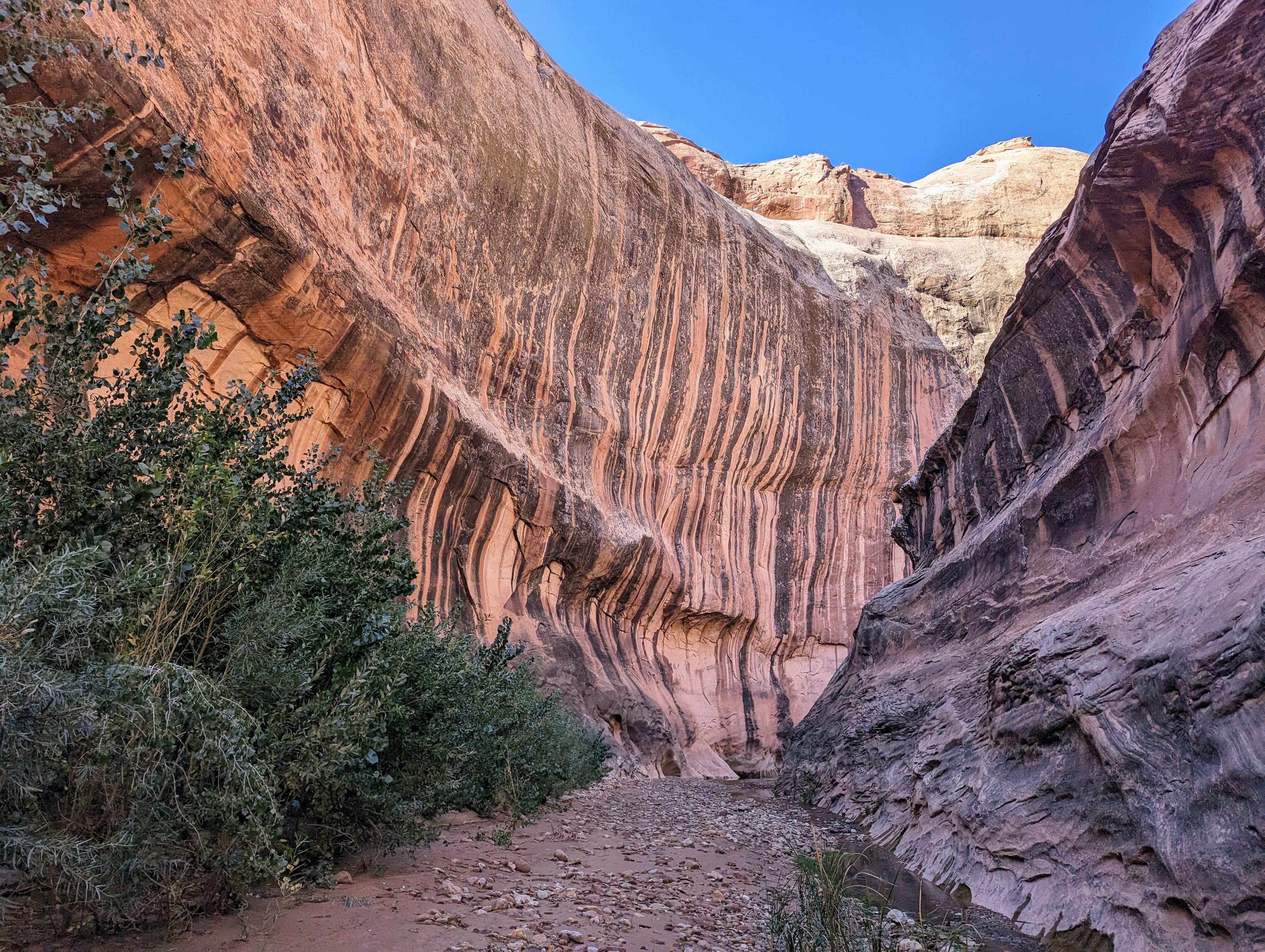
Up the Narrows (4-ish miles)
Ah, the main event! Head up the bottom of the creek and into the deep walled canyon that is Halls Creek Narrows. This lower part is very dramatic and, on my visit, held the most water of the day with several short sections of waist deep wading. It is sublime.
The next 4 miles settle into a rhythm of big, wide open bends, with narrower sections between them. Be sure on the bends to look up! I did not realize how deep many of the eroded bends were until looking up. Very impressive!
At about 4 miles, the walls fairly abruptly subside, the creek bends, and you find yourself back at the start of the loop. What a sublime 4 miles!
Retrace your approach route back up Halls Creek. Be sure to fill up on water here if needed before starting the long journey back.
Photos
Videos
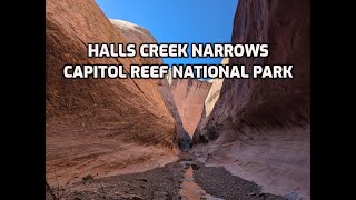
Halls Creek Narrows Video
Maps
 - Hiking Map")
 - Hiking Map")
12S 505314E 4174760N
37°43'12"N 110°56'23"W
12S 506482E 4170383N
37°40'50"N 110°55'35"W
12S 506164E 4174516N
37°43'04"N 110°55'48"W
12S 511238E 4163221N
37°36'58"N 110°52'22"W
12S 507535E 4170009N
37°40'38"N 110°54'52"W
12S 507343E 4169936N
37°40'36"N 110°55'00"W
12S 506975E 4169736N
37°40'29"N 110°55'15"W
12S 505825E 4175090N
37°43'23"N 110°56'02"W
12S 509934E 4165051N
37°37'57"N 110°53'15"W
12S 508938E 4165910N
37°38'25"N 110°53'55"W