 Hiking
Timpanogos Via Aspen Grove
Hiking
Timpanogos Via Aspen Grove
Mount Timpanogos
Overview
Rising majestically above Utah Valley, Mount Timpanogos is one of the most beloved and iconic peaks in the Wasatch Range. Standing at 11,752 feet, it draws hikers from across the state and beyond with its sweeping alpine meadows, cascading waterfalls, and panoramic summit views stretching from the Great Salt Lake to the Uinta Mountains. Though a big outing, “Timp” rewards the effort with unforgettable scenery and a true sense of mountain grandeur.
Two main trails lead to the summit, each offering a distinct experience. The Timpanooke Trail, beginning at the north side of the mountain near American Fork Canyon, winds through wildflower-filled meadows and gentle switchbacks, making it the more gradual - though still strenuous - route. On the other side, the Aspen Grove Trail, described here, starts near Sundance Resort and climbs steeply past waterfalls and up a glacial cirque on a 13-mile round trip, offering dramatic scenery but a more challenging ascent.
Hiking Mount Timpanogos is a rite of passage for Utah adventurers. Of the two routes, I, personally, think this route, the Aspen Grove route, is more spectacular. The scale of the mountain is experienced differently than on the Timpanooke trail. It is very strenuous, though!
Though the annual event no longer occurs, over the course of a summer, many thousands of people attempt to summit the peak. With those impacts spread over several months, the area is not trampled as it was when all that impact occurred at once. Do your part when visiting: pick up any trash you see, don't cut switchbacks, don't pick wildflowers, and give wildlife space.
Getting There
From Provo, take US-189 up Provo Canyon toward Heber Utah. From the mouth of Provo Canyon, travel up the canyon about 7 miles. After about 7 miles, turn left off of US-189 on the Alpine Loop Road/Sundance Resort. Follow the Alipe Loop Road for 4.8 miles to the trailhead on the left just after passing the forest service fee booth.
Route Description
To The Lower Falls (1.3 miles)
Getting started has caused a few people confusion. When you pull into the trailhead parking area, look for the trail on the right (west side of the lot) just after pulling into the parking area. This is the trail you want. There is also a trail leaving on the south side that goes to Stewart Falls. You do NOT want the Stewart Falls Trail.
Follow the trail as it heads west and soon passes a small building that is the Timpanogos Emergency Response Team (TERT) group. There is a trail register here to sign into. Continue past TERT, in a few minutes the trail crosses a bridge and comes to a junction. Stay left at the junction as the trail begins heading up the broad valley. In places, old pavement is visible from when the trail was partially paved.
A small falls is encountered, then the trail makes a short climb up to a second, more dramatic falls.
To Hidden Lakes (3.7 miles from Lower Falls)
From the second falls, the trail begins a few very long switchbacks to gain elevation before starting a long traverse up Primrose Cirque. After the trail crosses a stretch of talus, it begins a steep climb up many switchbacks, both long and short. At X miles, the trail finally eases a bit and meanders less steeply over the Hidden Lakes.
To Emerald Lake (3/4 of a mile from Hidden Lakes)
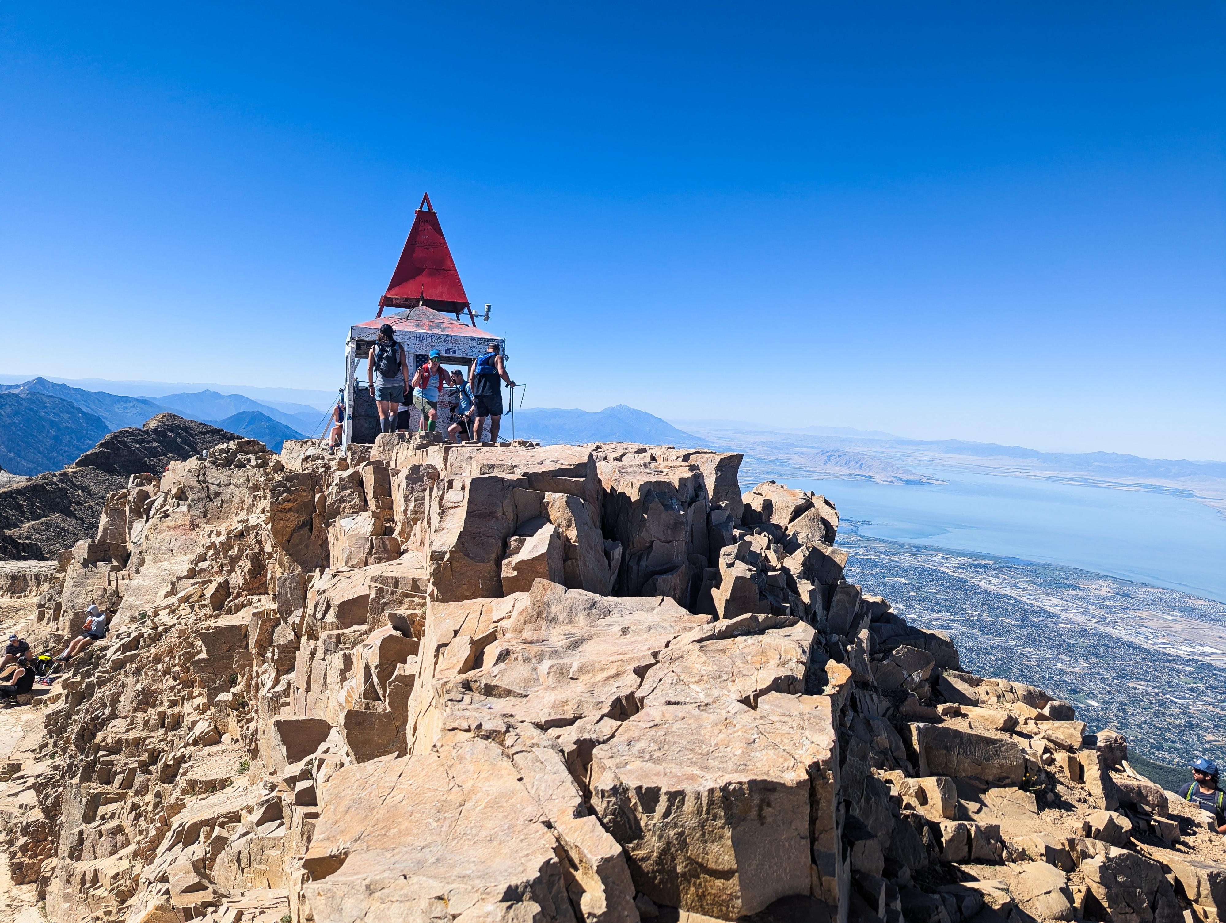
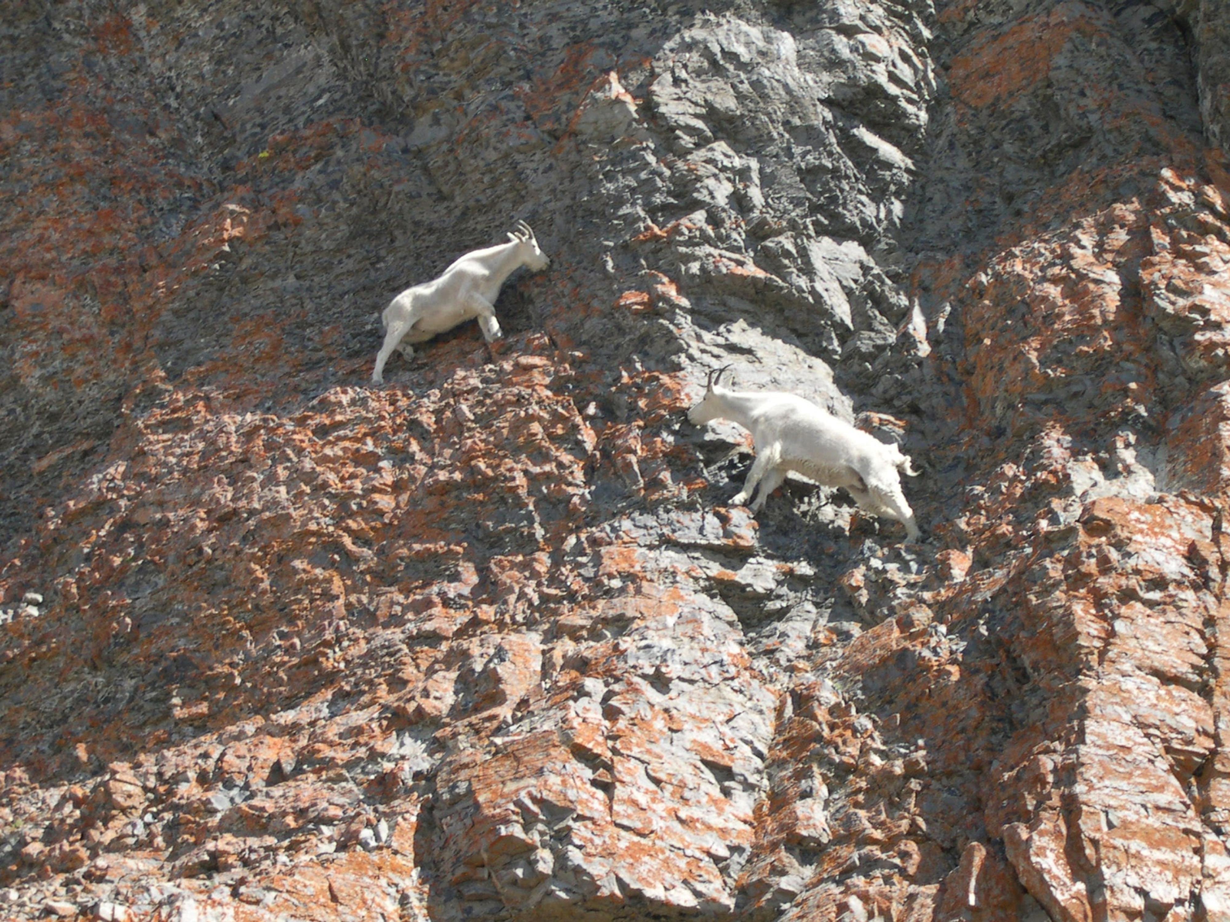
The trail gains a bit of elevation to Emerald Lake, but it is not nearly as steep as the climb up to Hidden Lakes. Mountain goats frequent the slopes around Emerald Lake and on up to the summit. Emerald Lake is the last chance for water, so if you need to filter, this is the last place. An old shelter here was heavily damaged in an avalanche in 2022, but its ruins are still visible. This is an excellent area to take a break and assess the time, weather, and your motivation. The summit, visible from near the lake, is still about 1,300 feet in elevation above, a fair bit of effort!
To the Summit (1.8 miles from Emerald Lake)
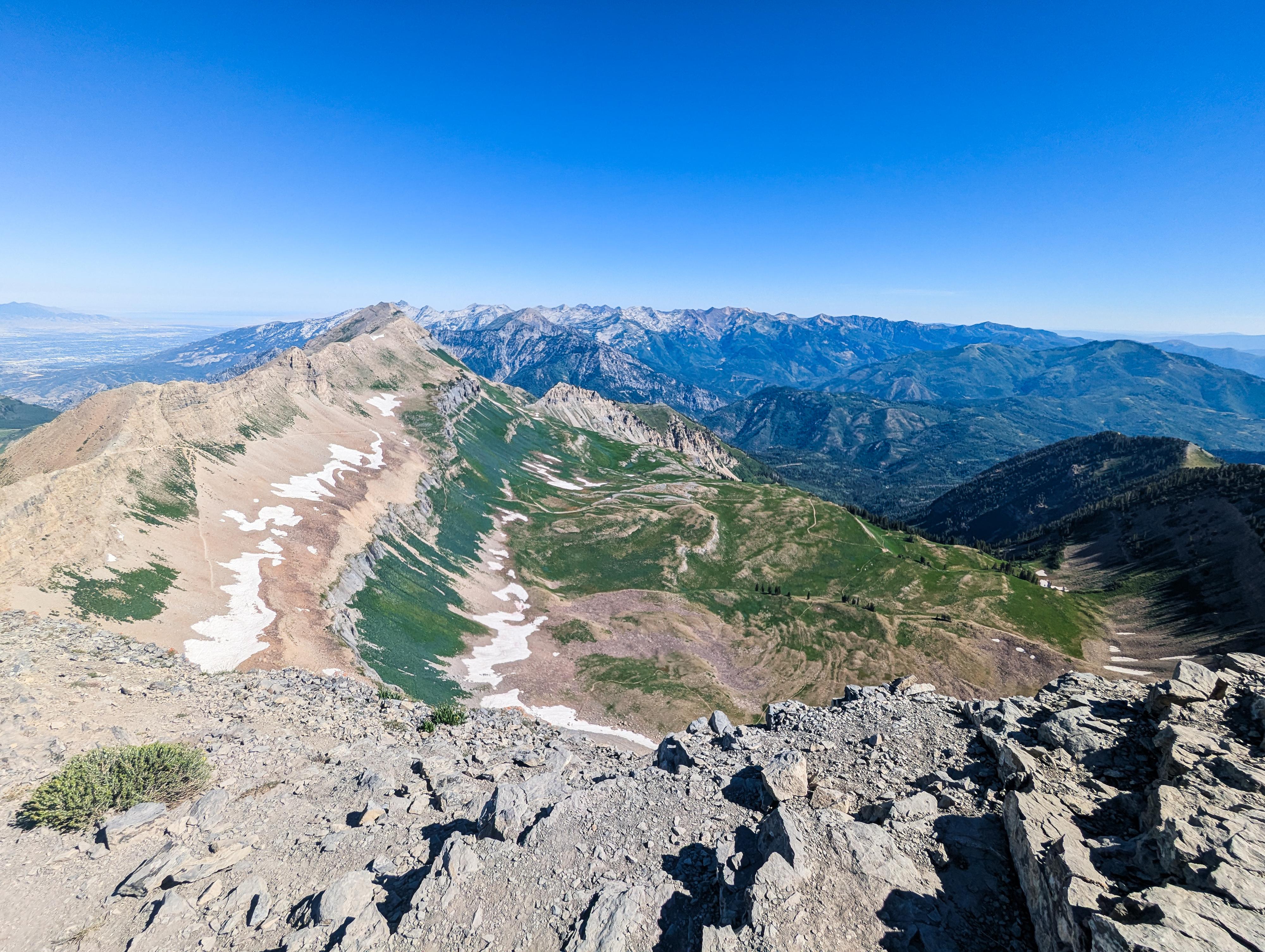
From the lake, continue on the trail. It reaches a rise with broad views down into Timpanogos Basin below and of the rugged Little Cottonwood Canyon ridge in the far distance. In a few minutes the trail splits. Stay left on the trail that you can see traversing the rocky slope over to the ridgeline. The ridgeline gives you the first views west into Utah Valley and is referred to as the Timpanogos Saddle.
From the saddle, head south on the trail that is now on the west side of the range, overlooking the busy valley below. The trail climbs to the summit with 2 steep switchback sections en route. These are rocky and can require a tiny bit of route finding. When you reach the old Glass House, you have reached the summit.
Photos
Maps

12T 448637E 4472846N
40°24'17"N 111°36'19"W
12T 448180E 4472957N
40°24'20"N 111°36'39"W
12T 447343E 4472829N
40°24'16"N 111°37'14"W
12T 447282E 4472758N
40°24'14"N 111°37'17"W
12T 446431E 4471692N
40°23'39"N 111°37'52"W
12T 445645E 4471679N
40°23'38"N 111°38'26"W
12T 445192E 4471730N
40°23'40"N 111°38'45"W
12T 444457E 4471916N
40°23'46"N 111°39'16"W
12T 445175E 4471339N
40°23'27"N 111°38'45"W