 Hiking
Mount Elbert
Hiking
Mount Elbert
Colorado High Point
Overview
At 14,440 ft., Mount Elbert is the highest point in Colorado and second highest point in the continental United States. If you are a peak bagger, this is one that has to be high on your list to do! There are a couple of common routes up the peak. Below, the North Ridge is described, the route I took. It is very straight forward, well signed, and accessible to most experienced peak baggers. The two big challenges on Mt Elbert are weather and weather!
The first weather challenge is snow pack. On even an average snow year, the trail can be snowed over well into mid-summer. On heavy snow years, the snow can last into August. Heavy snow on the trail makes it much trickier and will likely slow groups down. Avoid the route until later in the summer unless you have snow experience.
The second weather danger is thunderstorms. Like all peaks, you do not want to be caught up on the peak if afternoon thunderstorms come in. These storms are very common during most of the summer. Be sure to check the forecast and get a sunrise (or earlier) start to try and summit and be back to tree line before any afternoon thunderstorms can build.
Mount Elbert is just 12 feet higher than Mount Massive to the north. The slight difference created a rivalry between people that felt Massive was a better high point and purists that liked Mount Elbert. This rivalry grew to the point rocks were stacked on Massive to make it taller than Elbert. In the end, Elbert has stayed the true high point of Colorado.
It is also interesting to note the summit was reached in 1949 by a jeep when the area was being reviewed for a potential ski resort.
Getting There
The trailhead is reachable by most vehicles when it is snow free.
From Leadville, CO, go west/south on US-24.
About 3 miles from Leadville, US-24 makes a hard left and begins heading south. Turn onto CO-300 West here.
Just after crossing the river (0.8 miles from US-24), turn left onto Halfmoon Road.
After 1.3 miles, turn right to stay on Halfmoon Road. From this last junction, follow Halfmoon Road an additional 5 miles at it climbs into the mountains. The trailhead is signed on the left, across from the Elbert Creek Campground.
Route Description
From the trailhead, follow the trail a few minutes to the Continental Divide Trail. Go left on the Continental Divide trail.
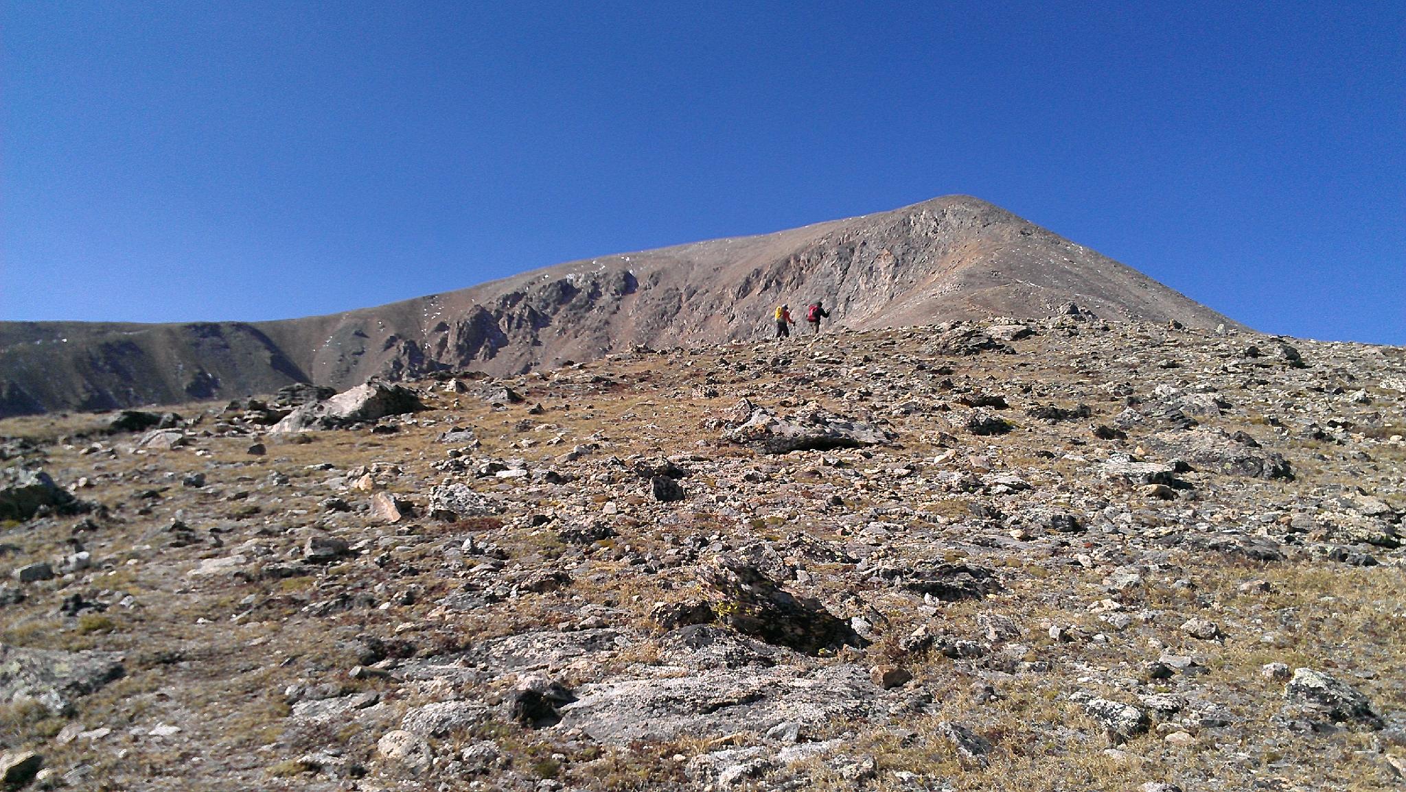
The Continental Divide zig-zags up, gaining elevation. About 1.25 miles from the trailhead, the North Ridge Junction is reached. It is signed and fairly obvious. Go right, heading up the North Ridge Trail. It is only about 3.4 miles from the junction to the summit, but the trail steepens and elevation begins taking its toll.
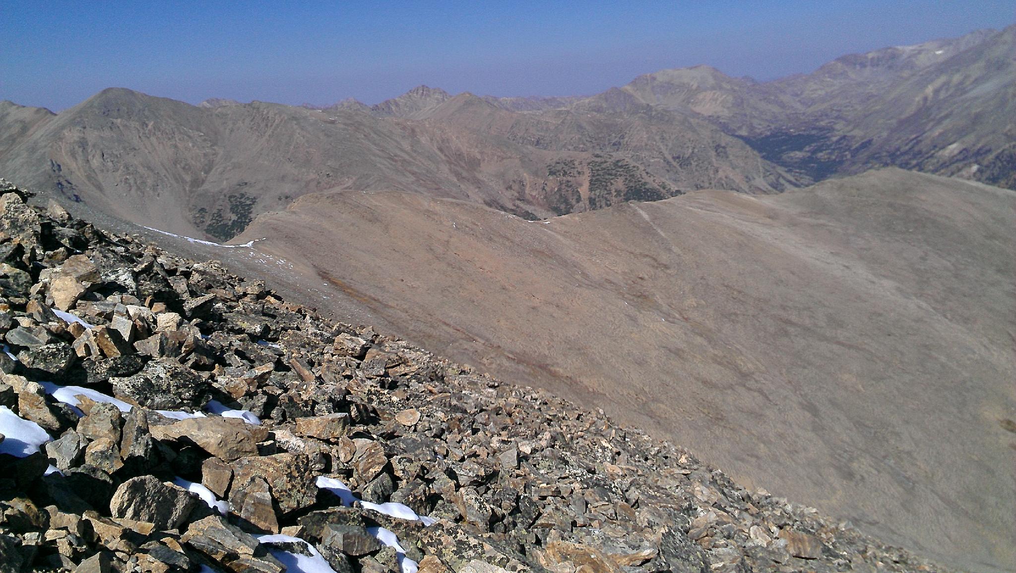
Just before reaching 12,000', the forest opens and you reach treeline. The true summit is not visible yet. Continue the ascent along the rocky ridge. Catch your breath at 13,400', before the route steepens before the final 1000' gain to the summit.
Just before the summit, the South Mount Elbert Trail comes in on the left. Stay right and (more importantly) stay left here on the way down!
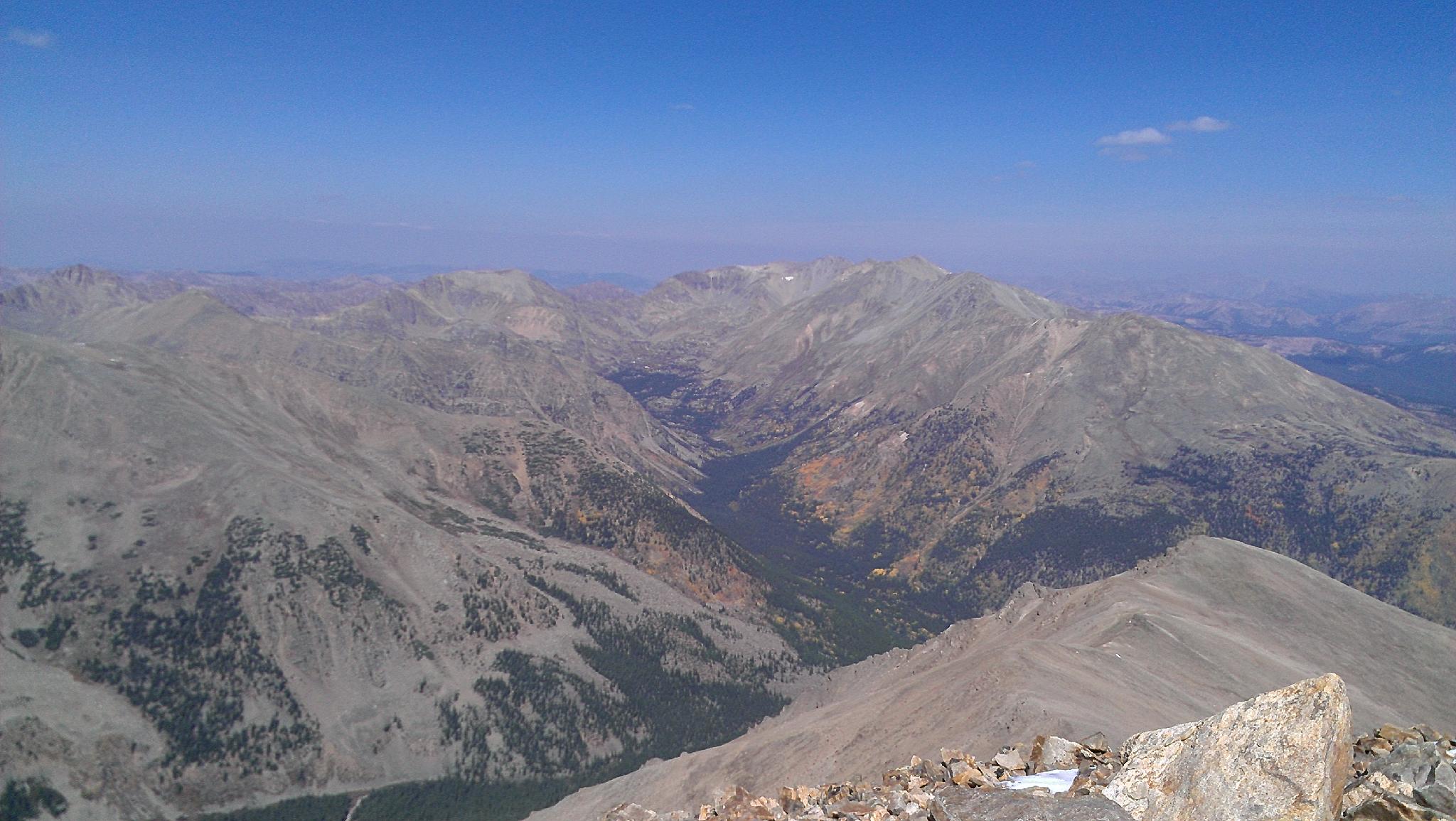
The summit offers outstanding views
Maps

13S 377957E 4334556N
39°09'06"N 106°24'45"W
13S 377847E 4334444N
39°09'02"N 106°24'49"W
13S 378316E 4333707N
39°08'39"N 106°24'29"W
13S 375083E 4330866N
39°07'05"N 106°26'42"W