 Roadside Attraction
Bruin Point
Roadside Attraction
Bruin Point
Sunnyside
Overview
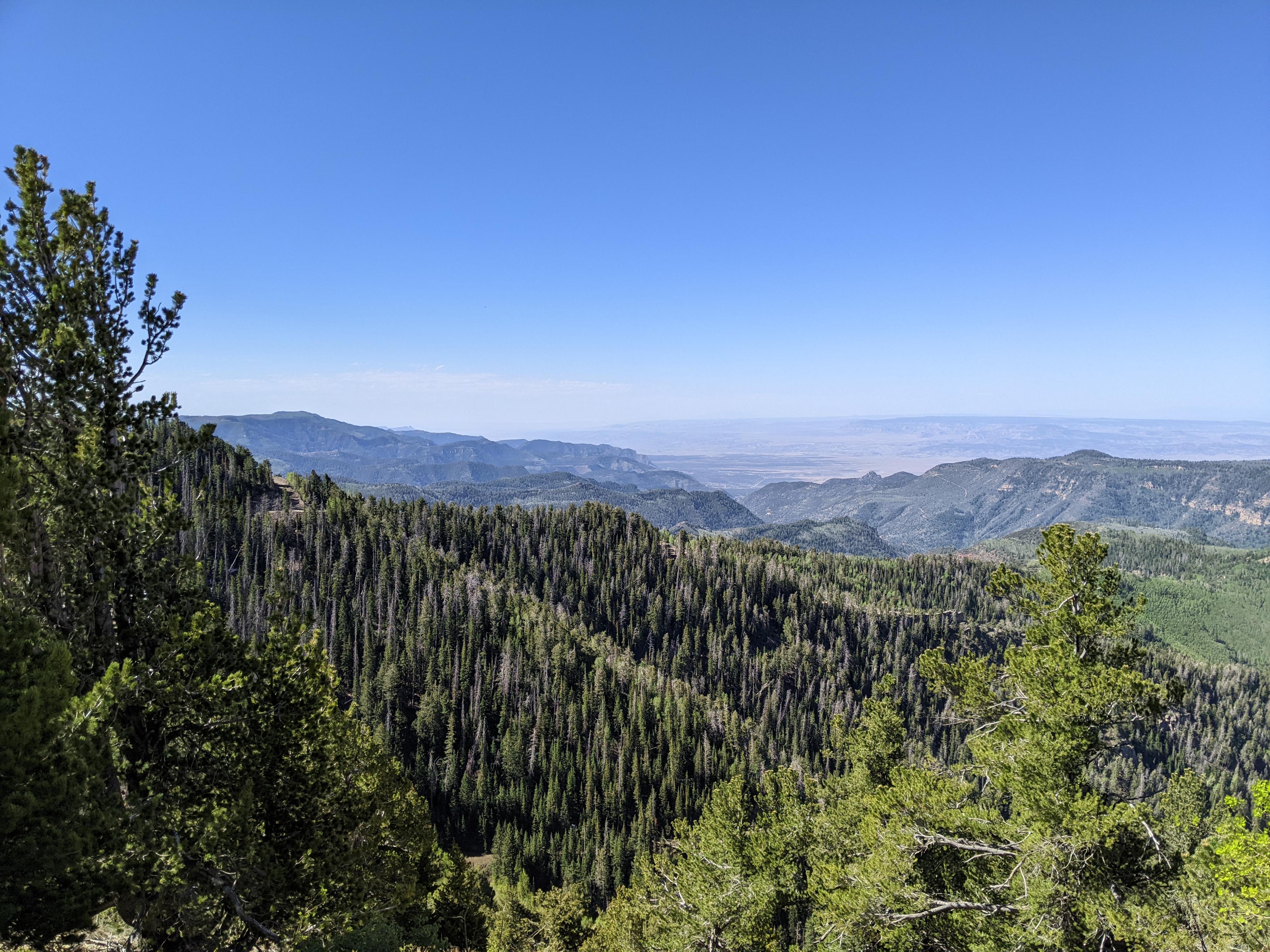
The Book Cliffs make up an imposing line of cliffs east of UT-6 between Wellington and Green River. Bruin Point, near the small towns of Sunnyside and East Carbon is one of the few easy to access routes to the top of the Book Cliffs.
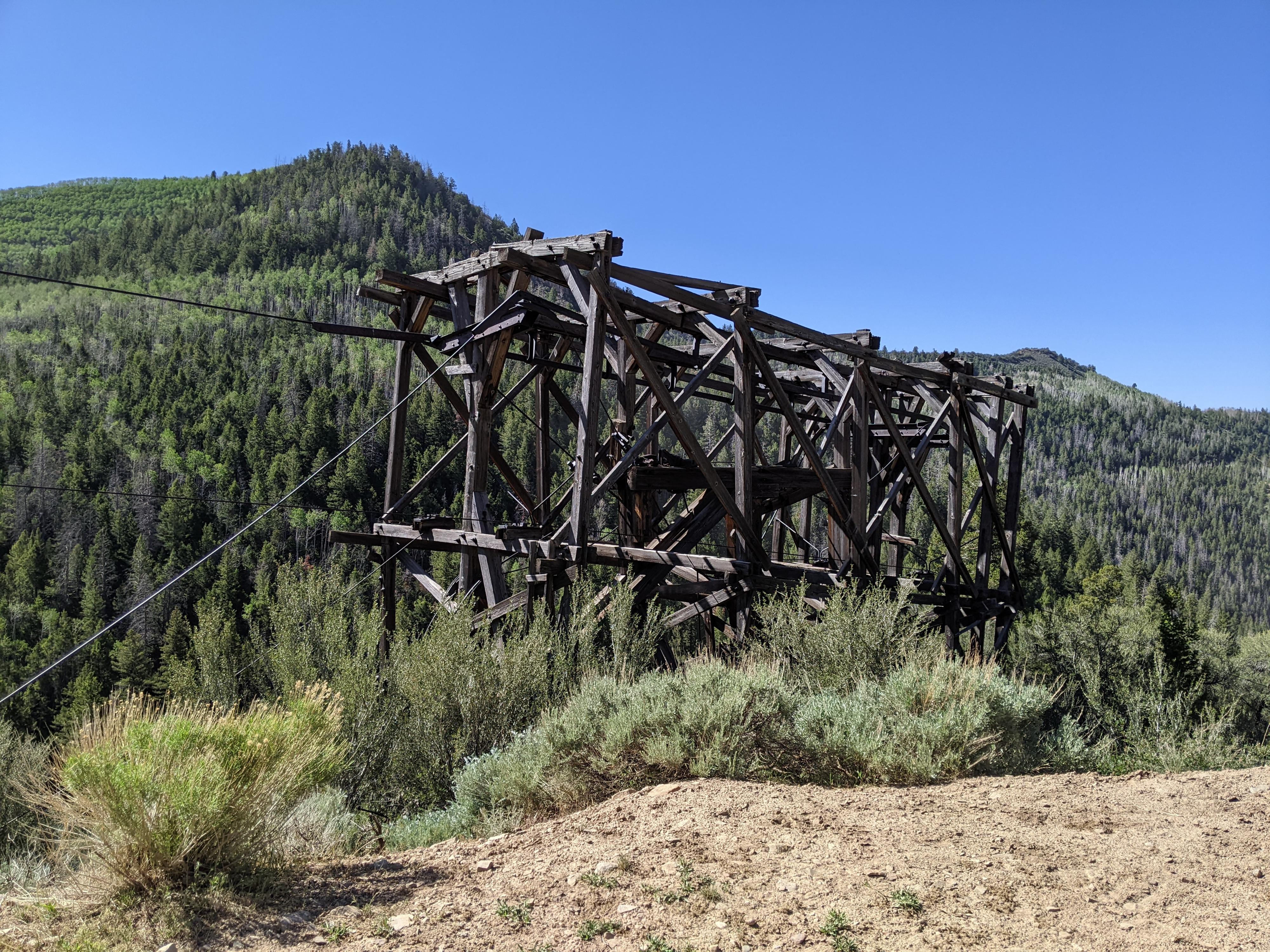
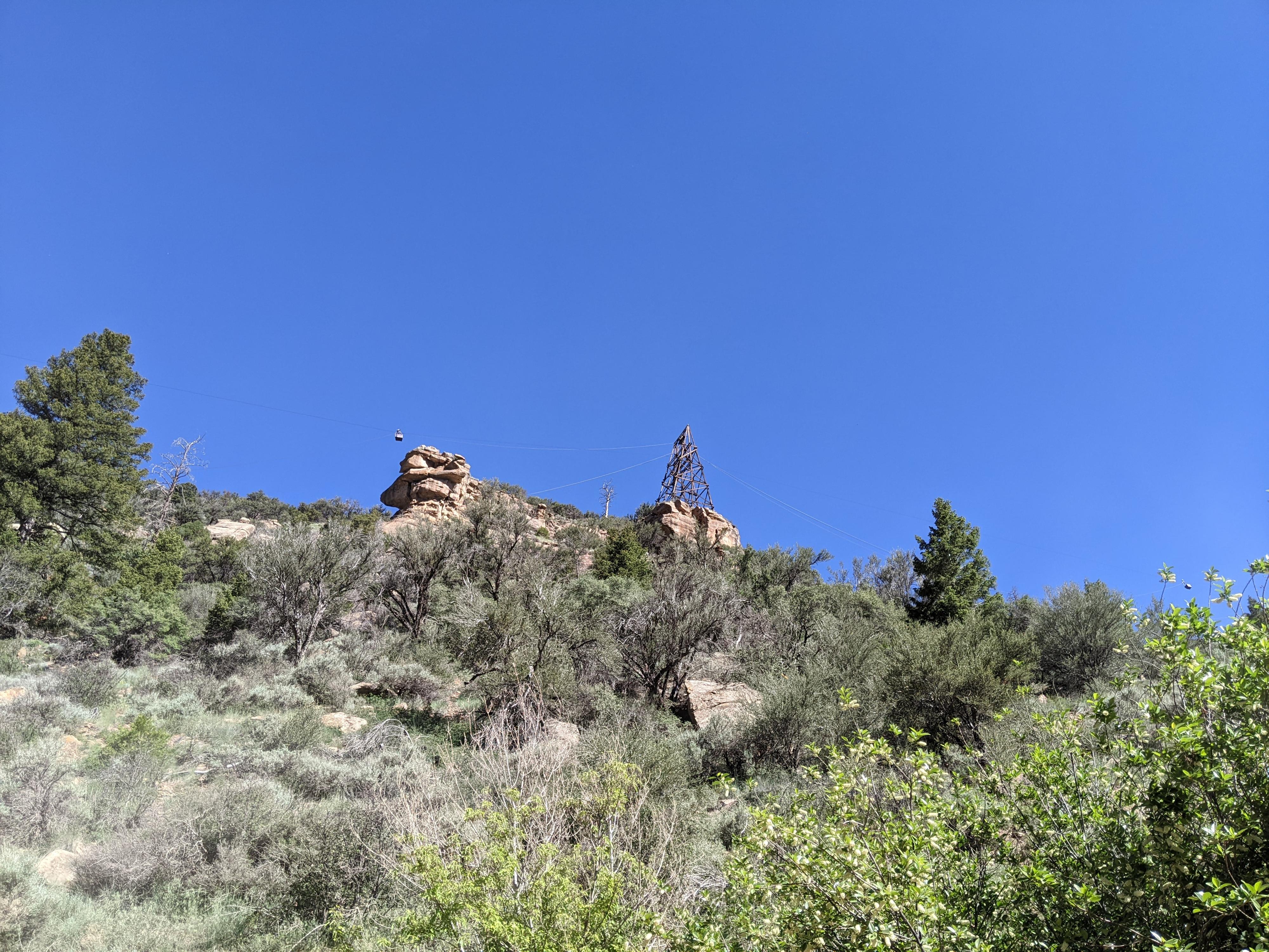
The road climbs up Whitmore Canyon, a popular area for viewing Big Horn Sheep. Part way up Whitmore Canyon, the road diverges from Whitemore and climbs the steep Water Canyon via a dirt and gravel road. The drive up Water Canyon is a road back through time. An old mining tram crosses the road, with many old mining trestles and ruins visible. It is both an interesting and very scenic drive. Views from Bruin Point of the vast Book Cliffs, and San Rafael Swell areas are excellent.
This is a great outing to escape the heat of lower elevations if visiting the area in the summer months. On our visit, it was 90 degrees in East Carbon, and a refreshing 65 degrees on Bruin Point. An excellent picnic spot when it is how in the lower elevations. Though a pretty drive anytime the road is open, this one is particularly spectacular during fall colors.
Rock asphalt was first mined at the top of Whitemore Canyon-15 mi. NE Of this location- in the early 1800s. The mine closed in 1898 & re-opened in 1903. It operated erratically until 1915 when it was forced to close due to the development of sheet asphalt. In 1927 another company, tried to develop a rock asphalt industry. They spent over 1/2 million dollars on equipment, including a 3 1/2 mile gravity powered aerial tramway. To promote the use of rock asphalt for paving, it was sold for $8.00/ton even though production costs exceeded $16.00/ton. The company went bankrupt in 1931 and the Rock Asphalt Company of Utah took over the mine in 1932. The mine operated only about 2 months out of the year & eventually closed. Interest was rekindled in the 1970s, but nothing ever developed.
- Matt Warner Chapter 1900, E Clampus Vitus
Getting There
Reaching Bruin Point starts from the small town of Sunnyside. From Price, head east on highway 6 toward I-70/Green River. About 14 miles from Price is the junction with UT-123, signed East Carbon/Sunnyside. Follow UT-123 east for about 10 miles to the small town of Sunnyside.
Route Description
Near the small utilities shed is the benchmark, surrounded by a few small rocks. I couldn’t find a register on my visit, but the benchmark is easy to locate.
If you continue a very short distance to the end of the road, there is a turnaround and an excellent place for a picnic. From this spot, on a clear day, you can see the Uinta Mountains in the far distance to the north. The canyons just north of the pullout drain down into the famous Nine Mile Canyon. Looking south is the vast flat area between the Book Cliffs and the San Rafael Swell to the southwest.
Photos
Maps

12S 553217E 4378664N
39°33'22"N 110°22'50"W
12S 553375E 4383569N
39°36'01"N 110°22'42"W
12S 556107E 4388078N
39°38'26"N 110°20'46"W
12S 556114E 4388116N
39°38'28"N 110°20'46"W
12S 555753E 4388549N
39°38'42"N 110°21'01"W
12S 555934E 4388468N
39°38'39"N 110°20'53"W