 Canyoneering
Spencer Canyon
Canyoneering
Spencer Canyon
Old Sheffield Road
Overview
Beginner canyoneer? Intermediate canyoneer? Spencer Canyon offers a route for either. The canyon is short, but with easy access and a relatively easy exit, it is a charmer in a very accessible part of Escalante. The beginner route poses no real issues, aside from a few down climbing challenges to reach the start, then requires only one short rappel into an amazingly deep and dark slot. Got game? The intermediate route adds an upper section to the day that allows for more rappels, beautiful colors, practicing route finding skills, and some fun anchor challenges. I would highly recommend the full route, as opposed to the shorter/easier route. As usual, a GPS tames the navigation challenges (and possibly takes away some of the fun...).
Though the technical and narrow section of Spencer is relatively short, the hike down to the confluence with the south fork and exit route offer big views of the amazing sandstone domes in the area. For the motivated, it is possibly to explore all the way down to the Escalante River and back. For the less motivated, poking around the many small side canyons near the exit will prove fun enough.
Getting There
Head east out of the town of Escalante about 9.5 miles on highway 12 until you reach mile post 70. The old Sheffield road goes off on the east side of the highway here, right on a bend.
Route Description
Full Route
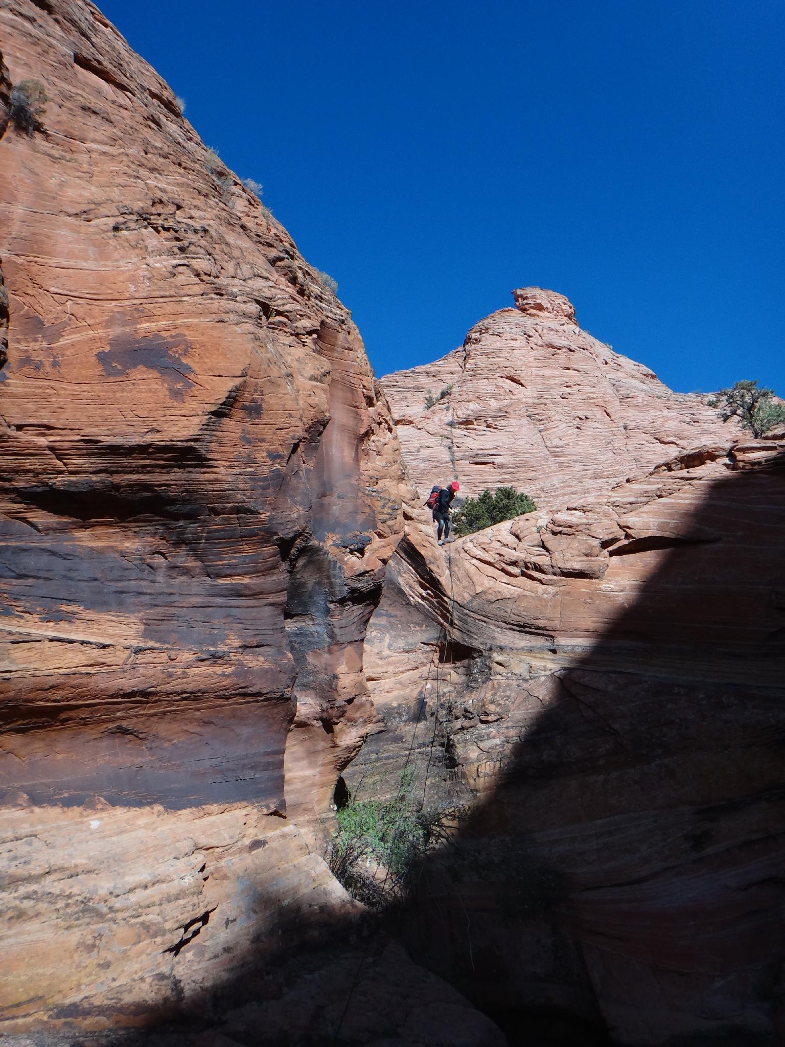
From the trailhead, follow the old Sheffield road about 2 minutes to where a VERY well worn cow trail cuts off on the left. Take this trail for about 2 minutes, then cut due north onto the slickrock. Trend north east on the slickrock, keeping an eye out on the right for the entrance canyon. It is fairly evident, as a side canyon going east with a couple of sharp bends that look like a W in it. The main part of Spencer is visible as it heads due east, to the left (north) of the W.
Start down the canyon. The first drop is easily avoided on the left (looking down canyon), which leads to some bush waking. Persevere, it is over shortly where the canyon enters a brief slot section with a couple of down climbs. The canyon then makes a hard left and becomes wider. At the next hard right, the canyon becomes technical at the first drop.
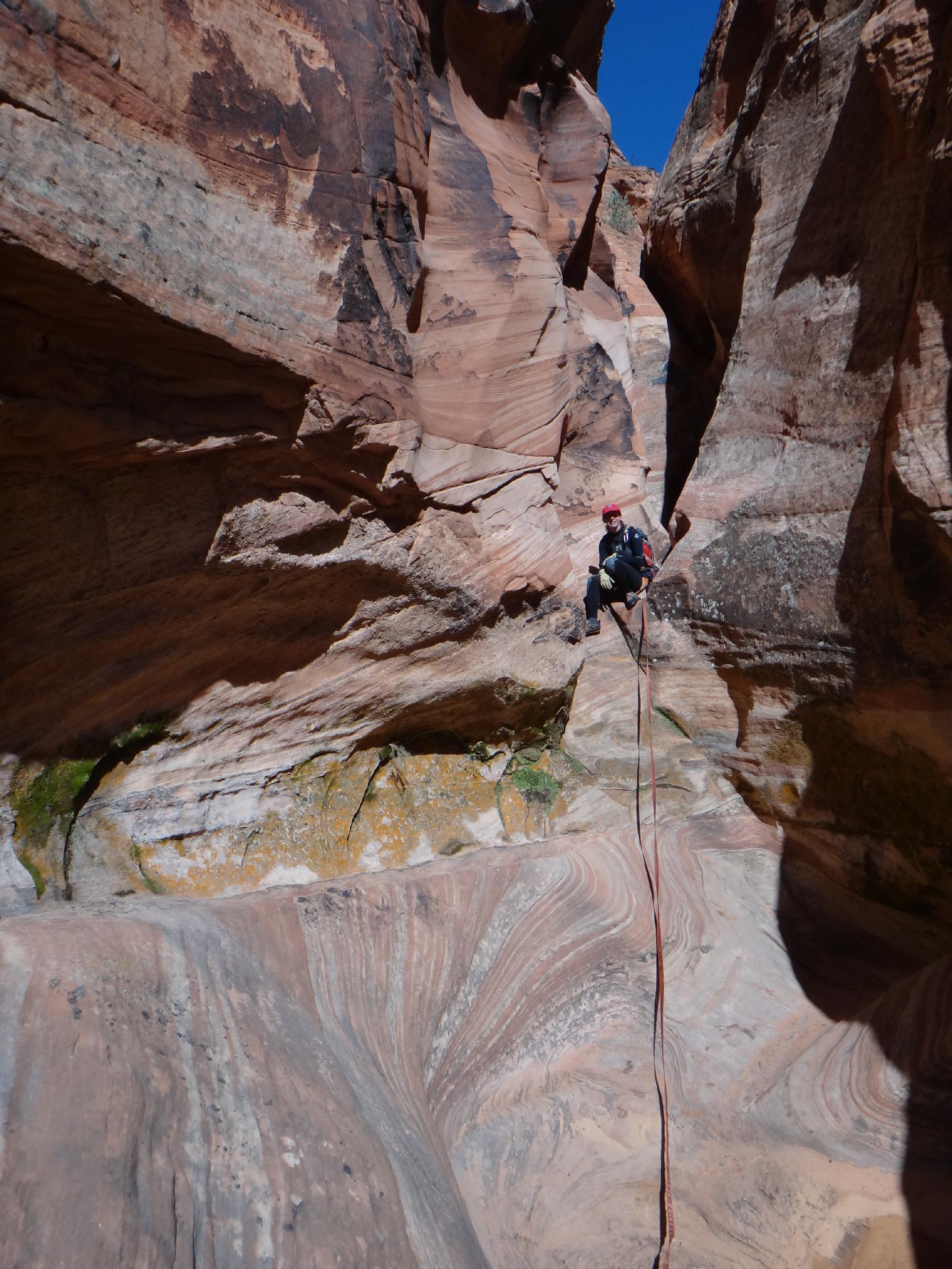
- R1 - 10 m ( 33 ft. ) down to a likely pool. (Can be bypassed on the left, but fun to rappel.)
- R2 - Right below R1 is R2, about 30 m ( 99 ft. ) over two stages. The anchor for this is high on the right.
- R3 - This is a short rappel around and down a narrow groove. 10 m ( 33 ft. ). Don't pull the rope until you are sure there is an anchor for the next rappel! If it is missing, you will need to move rocks from above the 3rd rappel to build an anchor (or use a Sandtrap type anchor.)
- R4 - 20 m ( 66 ft. ), be mindful to extend the webbing enough for a good pull. Rope grooves are developing.
The bottom of R4 is where the easy route comes in on the right, just before the canyon slots up and deepens.
Easy Route
From the trailhead, follow the old Sheffield road until the WSA boundary (signed, 0.75 miles / 20 minutes). From the WSA, cross the sandy plain, heading north east. This is pretty nondescript. If you happen upon a side canyon to the left (west) that has a big slick rock area at its head on the left, this is NOT the canyon you want. Continue north east to the next drainage.
Follow the drainage down, passing a few obstacles en route. It makes a right, then continues down. At the bottom, a slot goes off into the dark on the right. This is the main canyon, with the Full Route coming down the dryfall on the left here.
Both Routes
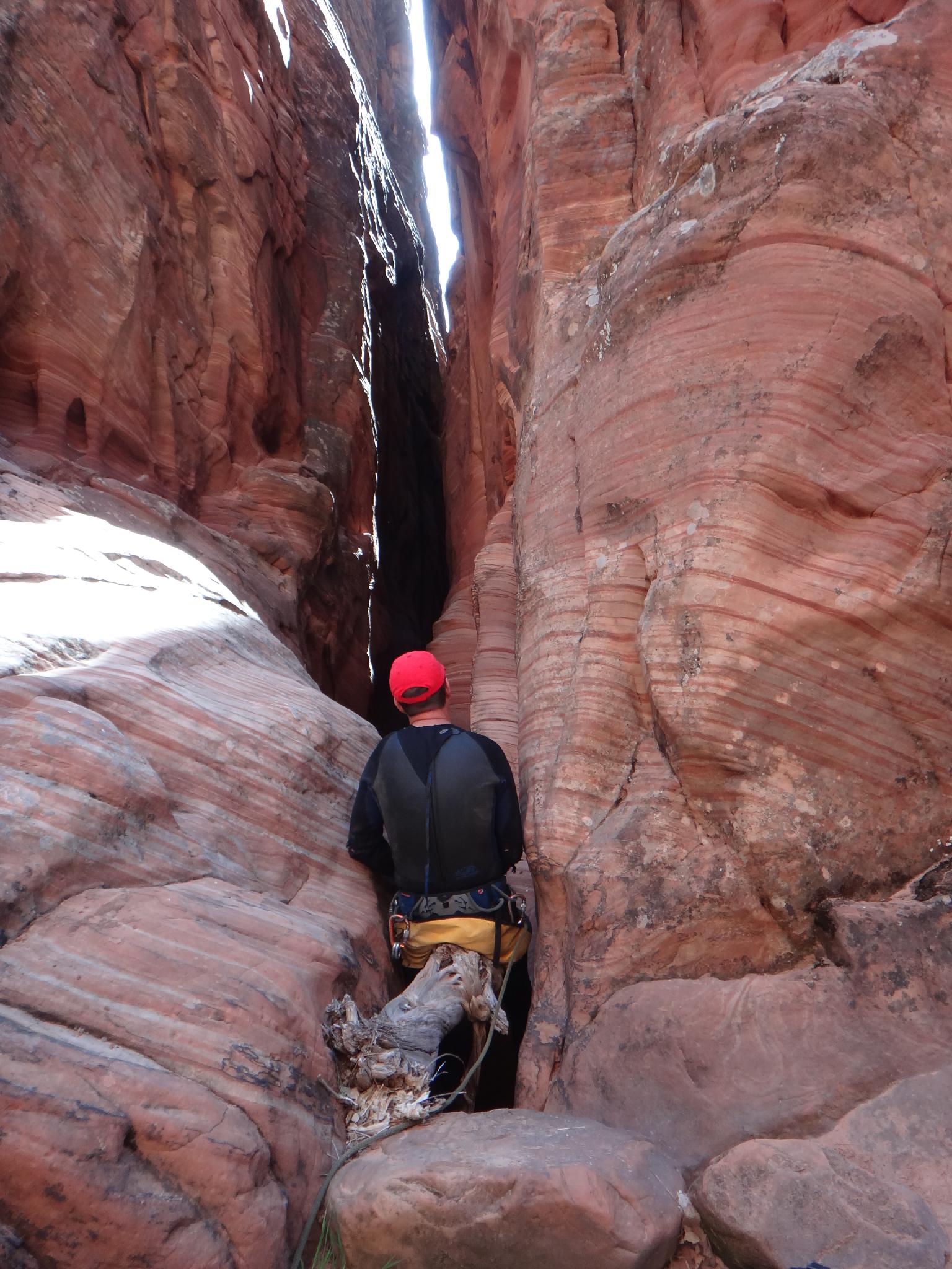
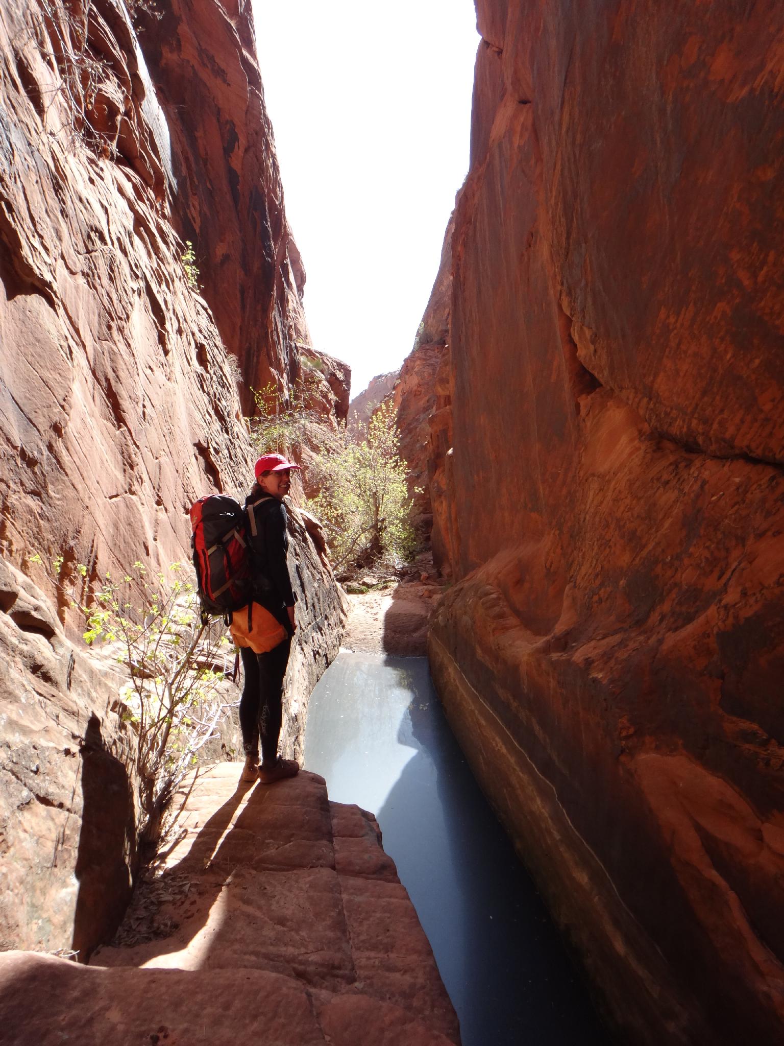
A 12 m ( 40 ft. ) drop is encountered to enter the deep slot. This COULD be down climbed, but the lower half can seep and be wet. Caution advised, and all-in-all, rappelling is recommended. Below the rappel, the canyon is dark and ominous, likely with a deep pool. Using ledges on each side of the pool might keep this from being a swimmer... but as you continue down, other pools are encountered that may require short stretches of swimming.
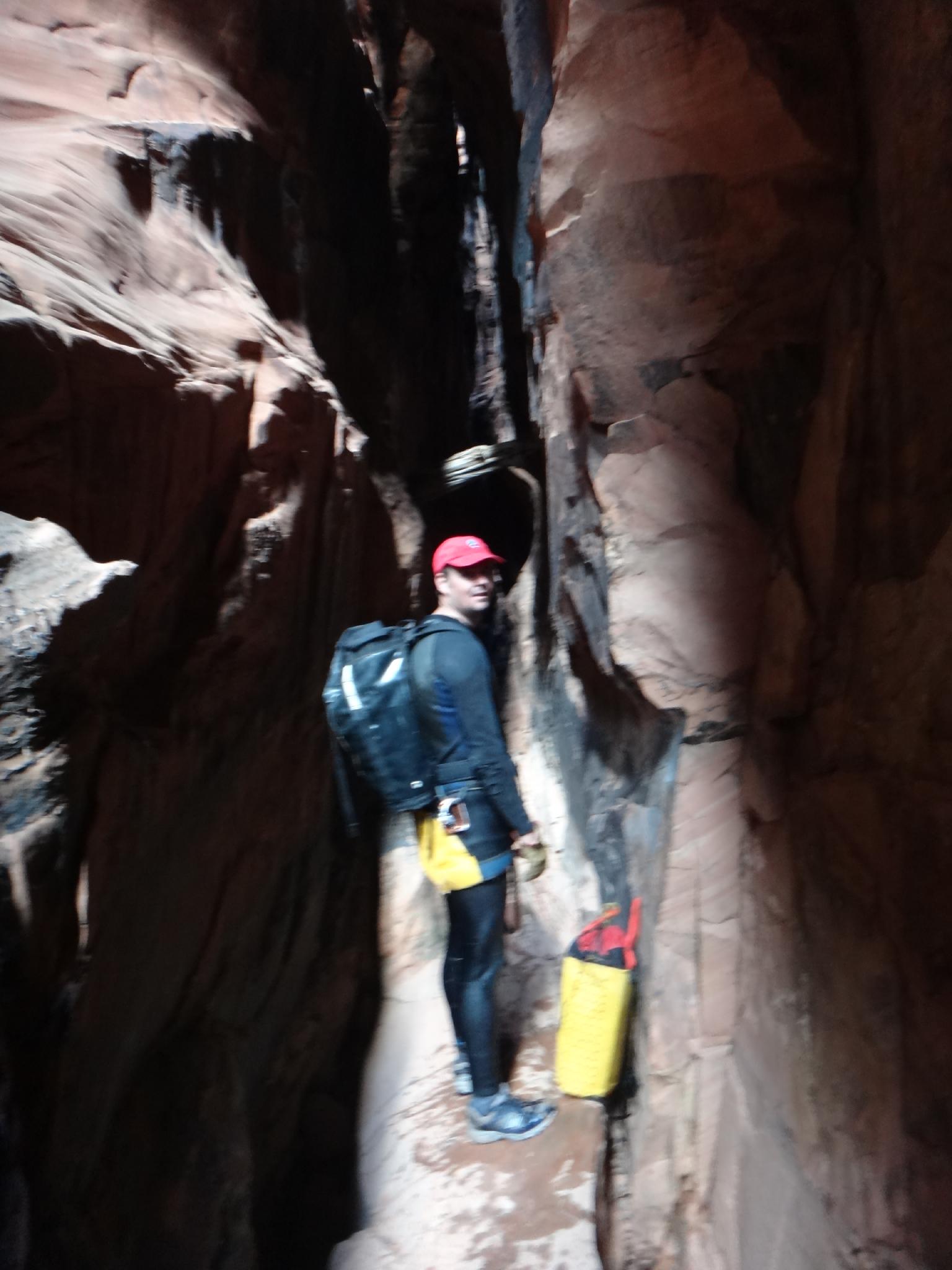
The slot quickly opens and gives way to (hopefully) some warmth from the sun. Continue down the now wider canyon, encountering the occasional pool or minor obstacle. The south fork comes in on the right after about a mile, and is very evident. This 4-way junction is a great spot to take off your wetsuit, have lunch, and generally enjoy the day before making the somewhat of a slog that is the exit.
Exit
From the 4-way junction, go right up the south fork a couple of minutes to a very small dryfall and area of slickrock on the canyon floor. This is just after a side canyon comes in on the right. Exit up the ridge on the right (looking up canyon) at this slickrock area. It is generally well cairned at the start.
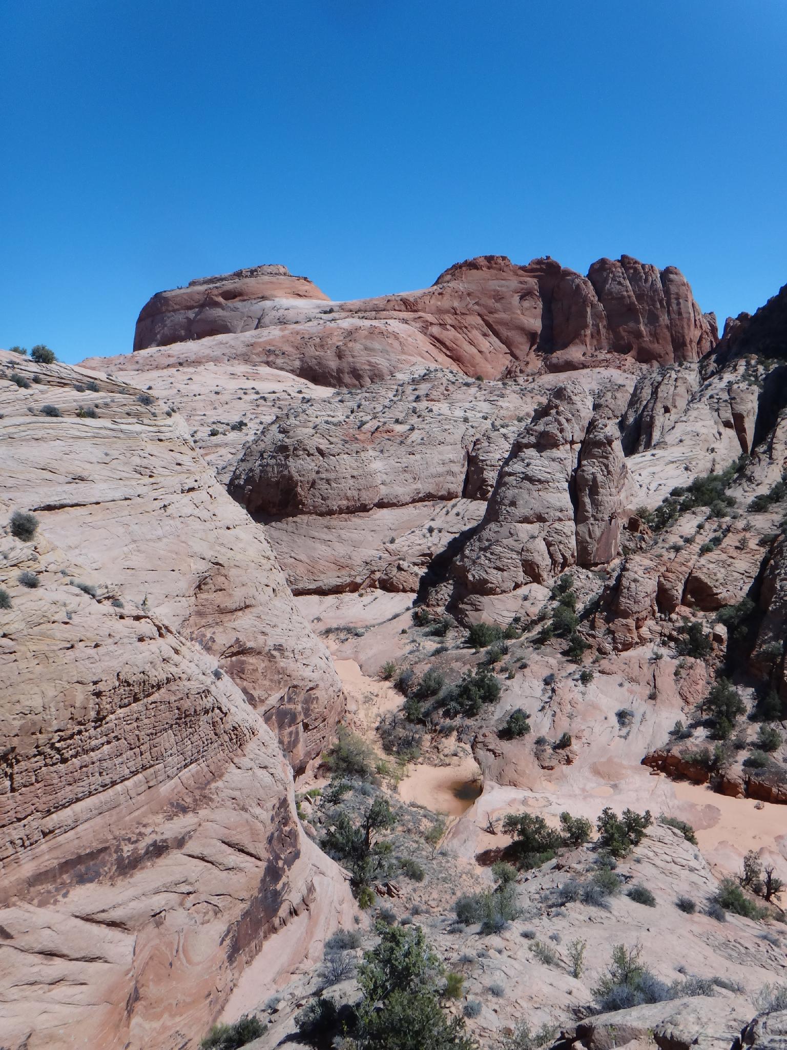
Work up the ridge on the emerging trail as high as possible until it becomes difficult, then traverse along the right side of a small cliff band, with a canyon on the right side. Follow this up and on slickrock, until out of the drainage and on the sandy plain above.
Ah, the sand slog begins! Head toward the ridgeline on the right (west) in the far distance. In a few minutes, a slickrock canyon is visible on the left with large ponderosa in it. Follow its rim west to the head, where an old road is found leaving the slick rock. Follow the old, and very sandy, road back to the trailhead.
Photos
Videos

Spencer Canyon
Maps

12S 468481E 4173735N
37°42'37"N 111°21'27"W
12S 468817E 4173627N
37°42'34"N 111°21'14"W
12S 469661E 4173615N
37°42'33"N 111°20'39"W
12S 469975E 4174105N
37°42'49"N 111°20'26"W
12S 469842E 4174564N
37°43'04"N 111°20'32"W
12S 470049E 4174548N
37°43'04"N 111°20'23"W
12S 471661E 4174365N
37°42'58"N 111°19'18"W
12S 471691E 4174166N
37°42'52"N 111°19'16"W
12S 470473E 4173767N
37°42'38"N 111°20'06"W