
 Athabasca Glacier
Jasper National Park
Overview
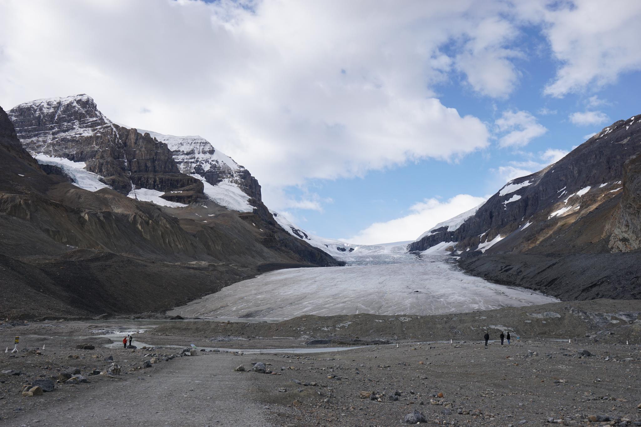
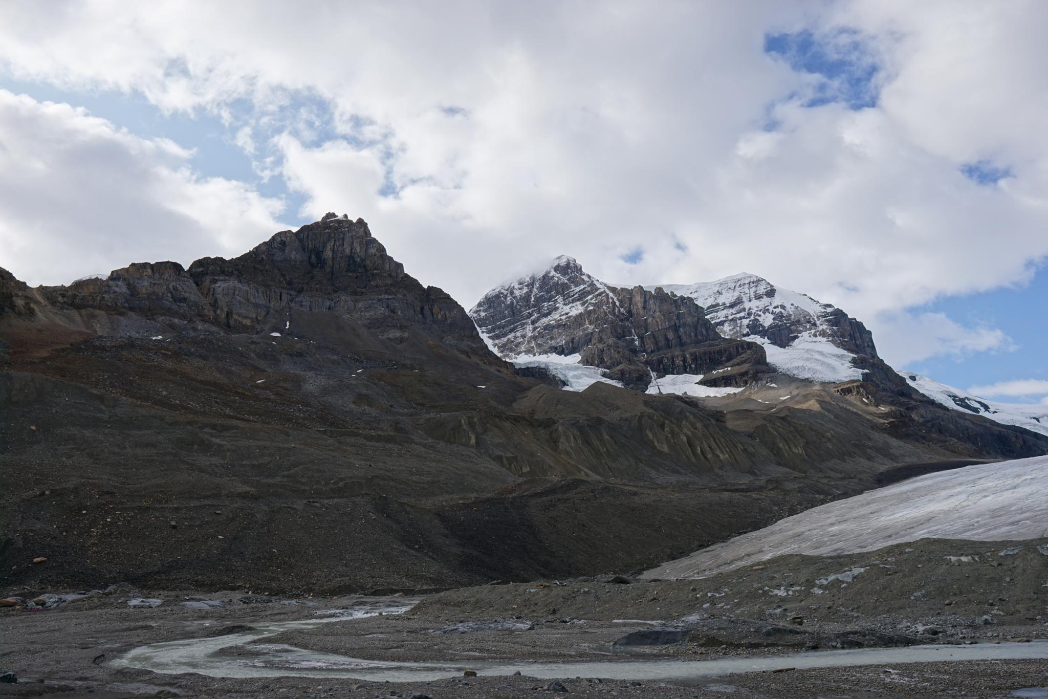
Athabasca Glacier is said to be the most-visited glacier in North America. A stone's throw from the Icefield Parkway, the glacier is accessible to most and gives a view into geological time. The glacier is about six kilometers long, and 90-100 meters (300-980 feet) thick.
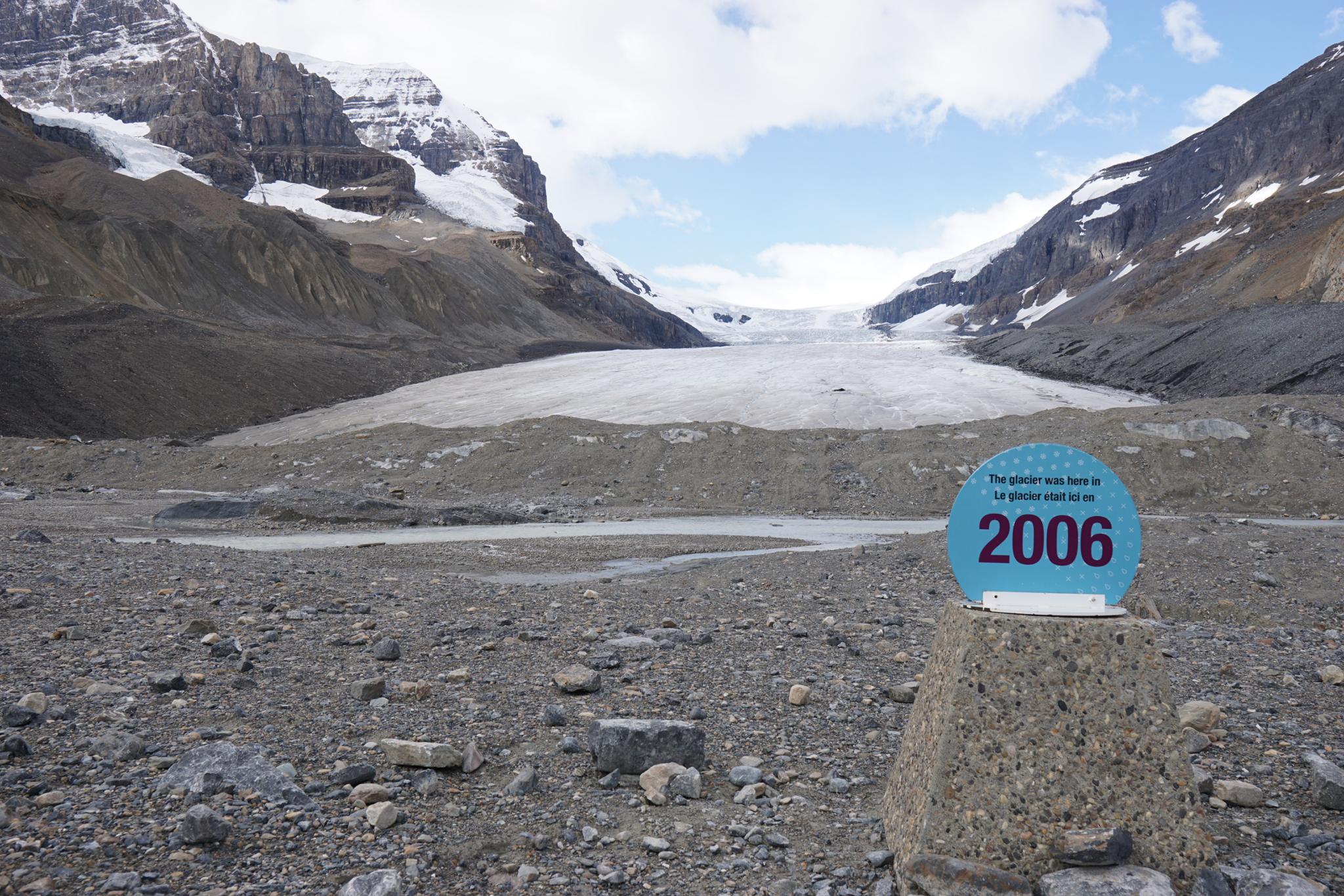
One of the most interesting aspects of visiting the glacier, in my opinion, is the short drive from the Icefield Parkway to the trailhead. Along the dirt road, signs show the edge of the glacier at different times over the last 100 or so years. It is incredible how far the glacier has retreated, and how accelerated the retreat has become in recent decades.
Getting There
From Banff
Travel north on the Trans Canada Highway for about 57km. Turn right onto AB93-N toward Jasper.
Follow AB93 North (Icefield Parkway) 125km to the well signed Athabasca Glacier road on the left side of the road. This is across from the Columbia Icefield Discover Center.
From Jasper
Follow AB93 South (Icefield Parkway) about 102 kilometers to the well signed Athabasca Glacier road on the right side of the road. This is across from the Columbia Icefield Discover Center.
Follow the dirt road several kilometers to its end at the trailhead/large parking area.
Route Description
From the trailhead, it is a short walk along the path to the bottom of the glacier. A restroom at the trailhead and stunning views make this an excellent place for a lunch break if passing through.
Photos
Maps

11U 484098E 5784675N
52°12'44"N 117°13'58"W