 Canyoneering
The Subway (From the Top)
Canyoneering
The Subway (From the Top)
Zion West Side
Overview
Intro
The Subway, also known as the Left Fork of Great West Canyon, is likely the second most sought after place to visit in Zion National Park after the Narrows. It often makes "Top Natural Wonders Of the World" lists, and on any given visit you are likely to run into international visitors. Why the attraction? The Subway offers stunning scenery and colors. The curved walls, crystal clear stream, and vibrant colors will leave an impression on most everyone that visits.
The popularity of the Subway has, unfortunately, led to more oversight and management of it that other areas of the park. No matter how you visit it, you must have a permit and visitation is limited. See the NPS site for current permit information. Getting a permit is difficult in the prime summer season. If you are a Zion Express account holder, I have had the best luck with the last minute lottery.
How to Visit The Subway
There are two ways to do the Subway:
Bottom Up
Visiting from the bottom up is about 9 miles round trip and sees the bottom end of the Subway before a waterfall blocks upstream progress. This is suitable for all hikers, though is a moderately strenuous day. It does not visit the icon spot with the log angling down into the Subway, but is an amazing hike and recommended if you do not have any technical canyoneering experience.
Top Down
Visiting the Subway from the top down sees much more of the canyon, but at a price. It requires a car shuttle (or hitchhike), and the route itself is technical, involving several short rappels. You must have technical experience to do the Subway from the top down safely. There have been many accidents, fatalities, and near misses by inexperienced hikers getting in over their heads in the top-down route. It is very easy for those with any technical canyoneering experience, but without technical experience, it can become dangerous very quickly. Wetsuits recommended in all but the very hottest conditions.
If you have technical experience, opt for the top-down route. It is by far the best way to see the Subway.
This description if for the top-down route.
Getting There
From the Zion Visitor center, head west on UT-9 for about 12 miles until you reach the town of Virgin. The Kolob Reservoir Road goes off on the right as you enter town. Follow the Kolob Reservoir for 8.2 miles to the Left Fork Trailhead on the right hand side of the road. This is the exit trailhead, leave a car here.
To reach the trailhead, continue on the Kolob road another 7.2 miles (15.4 total from Virigin) to the Wildcat Trailhead on the right. It is right on a curve, and has a pit toilet. Be sure not to park on any vegetation, as I have seen cars ticketed for this.
Route Description
Follow the Wildcat trail about 15-20 minutes to its junction with Northgate Peaks. Go right, on the Northgate Peaks trail for several minutes until the signed junction with the Subway trail going off to the left.
Follow the Subway trail, and cairns, along the slickrock on the right for 5 minutes or so until it drops off slickrock and onto dirt. The trail is now easy to follow as it makes its way down to and crosses Russell Gulch. After crossing Russell Gulch, it climbs slickrock to a small pass, then descends the other side. Social trails here can be confusing. Stay on the most used trail to a point with Left Fork ahead of you and Russell Gulch on the right. Here the social trails coalesce, and a single trail descends steeply into Russell Gulch. At the bottom, you may have a pool to cross, and then it is 2 minutes down to Left Fork.
Head down Left Fork, soon coming to a boulder pile and your first obstacle. Rappel this on the right, or highly skilled can downclimb it though it is a bit wide at the bottom.
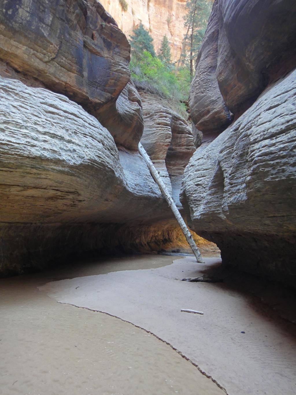
The canyon becomes more of a slot, and you will likely encounter your first swims. The first of these can be avoided on the right, but not for long. When the canyon turns left, and you reach a 5 m ( 17 ft. ) drop, you are at the Subway. Rappel the drop, and find the iconic Subway log at the next bend.
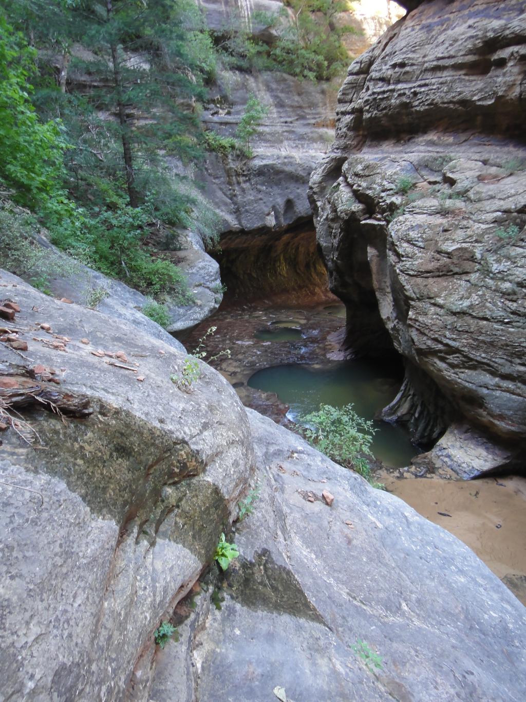
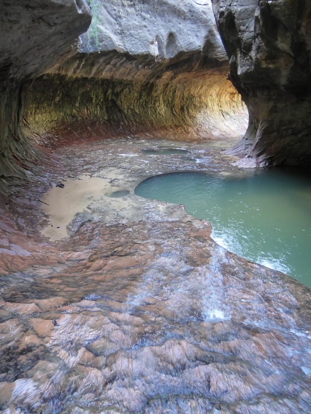
Below the log, it is an easy 5 minutes to the final obstacle, a waterfall into a slot. Carefully traverse over the head of the waterfall on the left side, and walk the slickrock ledge a short distance to an anchor that allows for a 15 m ( 50 ft. ) rappel below the slot section.
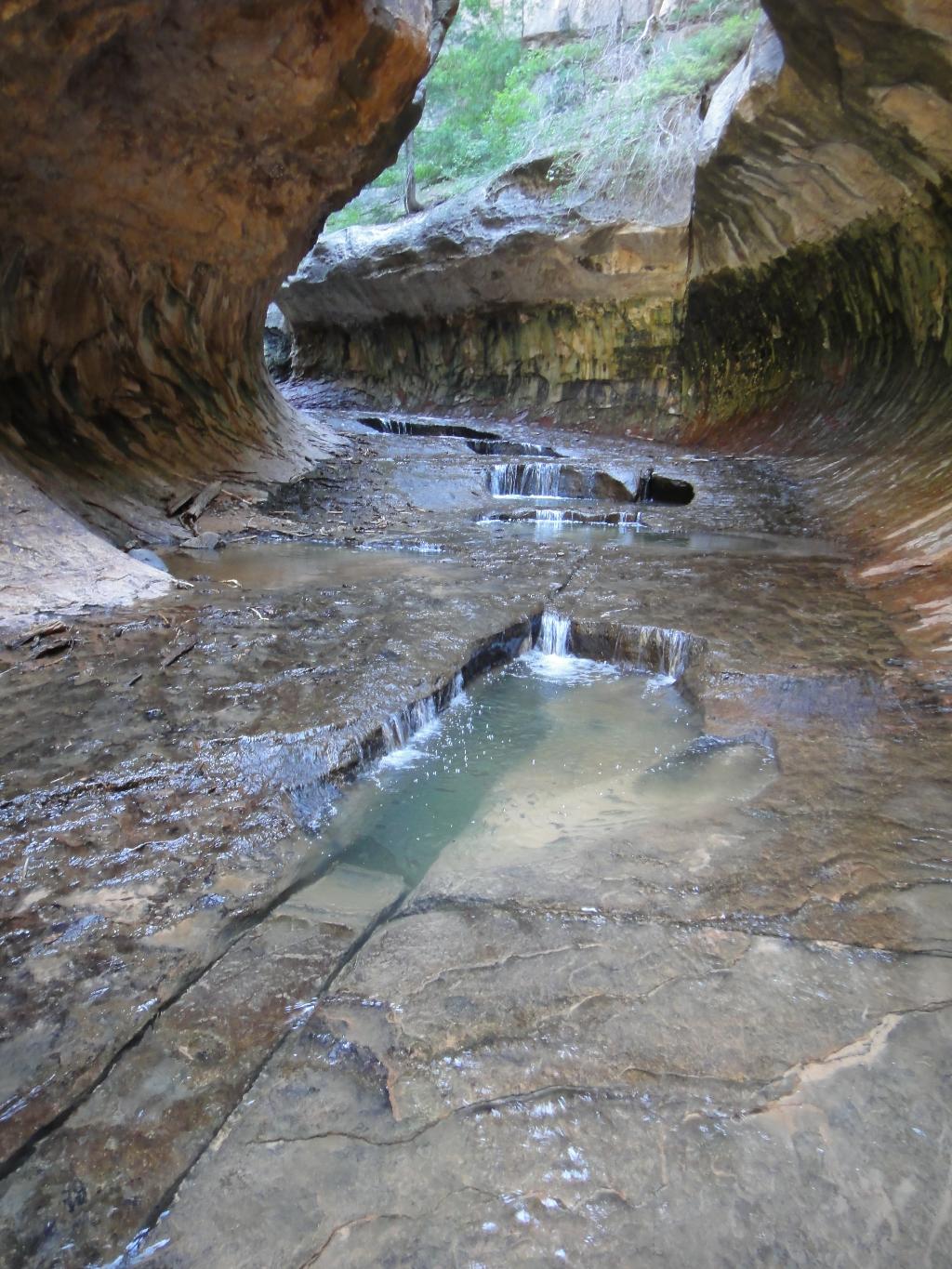
Once down, the technical difficulties are over, and you will likely see many hikers who have hiked up from the bottom. Hiking up the water filled slot to the waterfall is worthwhile, and makes for great pictures.
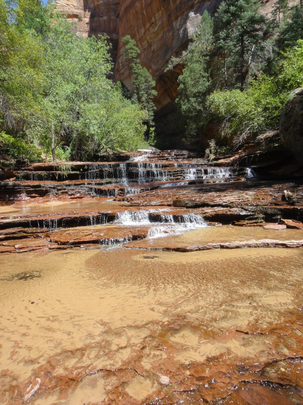
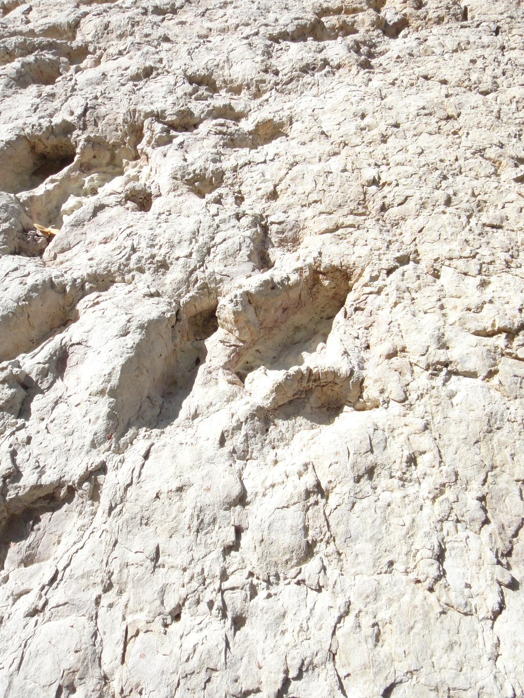
As you leave the Subway, the canyon opens quickly with fantastic red sandstone cascades. Criss-cross the canyon on social trails trying to find the easiest path. From the end of the red falls, it is about 30-45 minutes to a large boulder on the right with dino prints. A good landmark.
The exit can be hard to find, especially if you are not paying attention, or it is running late. Keep an eye out on the right. Two side canyons come in about an hour or 90 minutes from the last red cascades. The exit is just past the prominent side canyon, about 5 minutes and usually marked with cairns. Find it, and climb it steeply to the mesa top, and then a few minutes across the mesa to the exit trailhead.
Photos
Videos

Subway - June 2018

Subway Top Down
The Subway - June 2023

Canyoneering The Subway Top Down
Maps
 Canyoneering Map")
12S 316118E 4134611N
37°20'24"N 113°04'33"W
12S 317570E 4134479N
37°20'21"N 113°03'34"W
12S 319191E 4132060N
37°19'03"N 113°02'26"W
12S 318085E 4131288N
37°18'38"N 113°03'10"W
12S 317867E 4131100N
37°18'31"N 113°03'19"W
12S 316528E 4130113N
37°17'58"N 113°04'12"W
12S 315186E 4128994N
37°17'21"N 113°05'06"W
12S 314214E 4128530N
37°17'05"N 113°05'45"W