
 Sevenmile Canyon and Intestine Man
Moab
Overview
Just off the road on the way to Deadhorse State Park and the Island In the Sky region of Canyonlands National Park lies Sevenmile Canyon. Right next to the road is a fascinating roadside attraction, a pictograph panel called Intestine Man, as well as several petroglyphs. Those with a little more motivation can wander up the South Fork of Sevenmile Canyon to visit several more petroglyph panels and at least one more pictograph panel.
Surprisingly, given the proximity to the busy road, the hike has a bit of a remote feel to it and tends to be quiet. The hike presented here follows a very sandy wash bottom and road. The wash bottom is sandy enough, and the hike enjoyable enough, that I would recommend walking the route and not trying to drive it.
Getting There
From Moab, head north on US-191 toward I-70. About 11 miles north of town is the junction with SR-313. This is also the road to Canyonlands. Follow SR-313 for 2.7 miles to where it begins to enter a narrow canyon. Park on the right side of the road here. This is mile post 19.85.
Route Description
Rock art and historic sites are fragile, non-renewable cultural resources that, once damaged, can never be replaced. To ensure they are protected, please:
- Avoid Touching the Petroglyphs: Look and observe, BUT DO NOT TOUCH!
- Stay on the Trails: Stay on the most used trails when visiting sites, and don't create new trails or trample vegetation.
- Photography and Sketching is Allowed: Do not introduce any foreign substance to enhance the carved and pecked images for photographic or drawing purposes. Altering, defacing, or damaging the petroglyphs is against the law -- even if the damage is unintentional.
- Pets: Keep pets on a leash and clean up after them.
- Artifacts: If you happen to come across sherds (broken pottery) or lithics (flakes of stone tools), leave them where you see them. Once they are moved or removed, a piece of the past is forever lost.
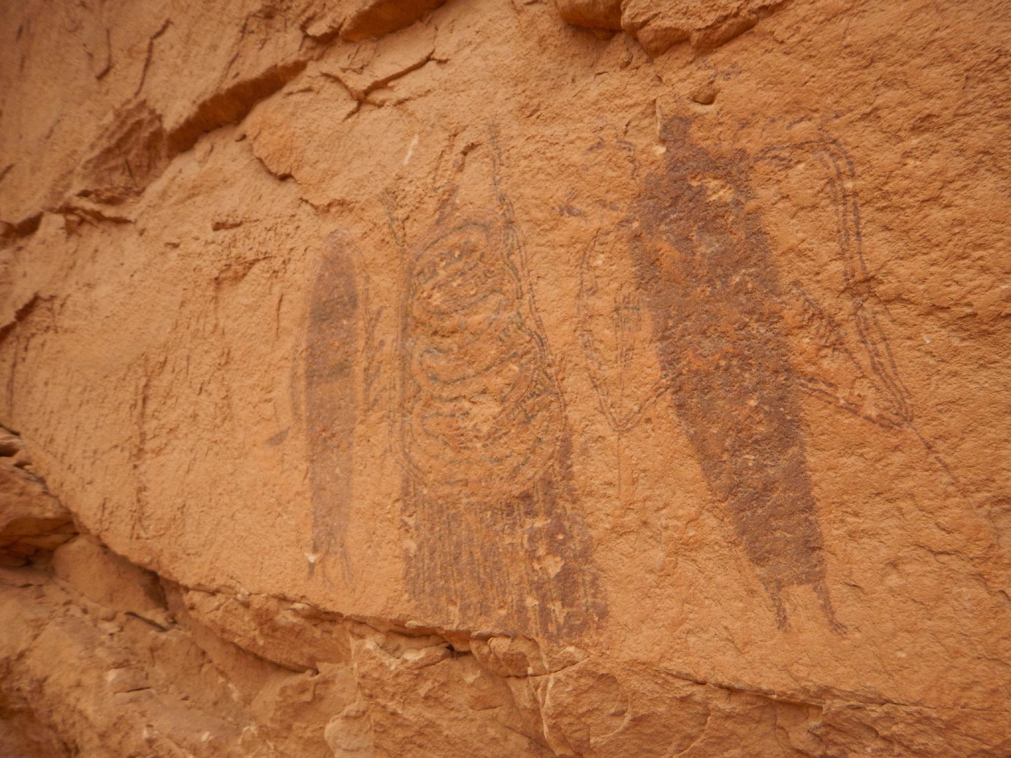
Roadside Panels and Intestine Man
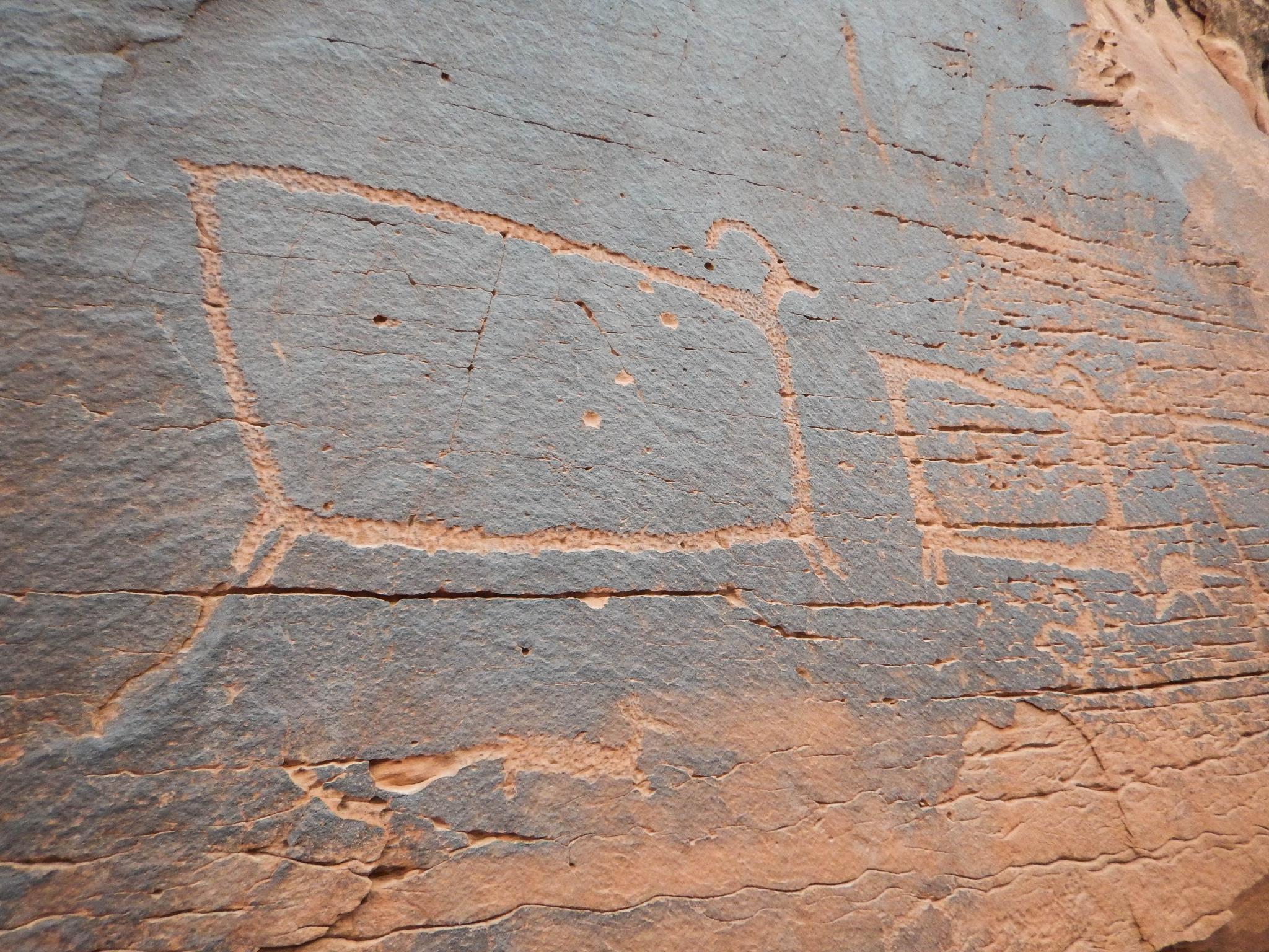
From the trailhead, the petroglyph panel is visible to the north (right) side of the road. A 2-minute walk reaches the panel of several large bighorn sheep. From the sheep, walk west (left when facing the cliff) along the base of the cliff. You’ll reach a fascinating pictorgraph after about two minutes walking along the cliff and passing an alcove. Though small, it is very interesting and unique compared to others I have visited in this area.
Hike
The hike is an out and back, visiting several panels along the way. The full out and back is about 5 miles round trip, but can easily be shortened as motivation dictates.
From the trailhead, cross the highway and follow a social trail down to a gate. Once through the gate, follow the social trail up to the cliff band directly to the west. Less than 5 minutes from the car brings you to a good panel of petroglyphs on the point.
After visiting the panel, the social trail descends down to the sandy wash that is the South Fork of Sevenmile Canyon. Follow the sand wash and road up South Fork. The panels are tricky to find, so keep an eye on the map. Hike up the sandy wash, passing a side canyon coming in on the left. After the side canyon, keep an eye out on the left for a big overhang with a pour off to the left. Stickman Panel is up here, on a ledge to the left of the pour off (0.7 miles from the trailhead).
Continuing up the sandy canyon bottom, a very evident fake pictograph is passed on the left where another side canyon comes in on the left. One bend above the side canyon, look for a sizeable alcove on the left. There are a few pictographs in the alcove, and it makes a great shady rest stop.
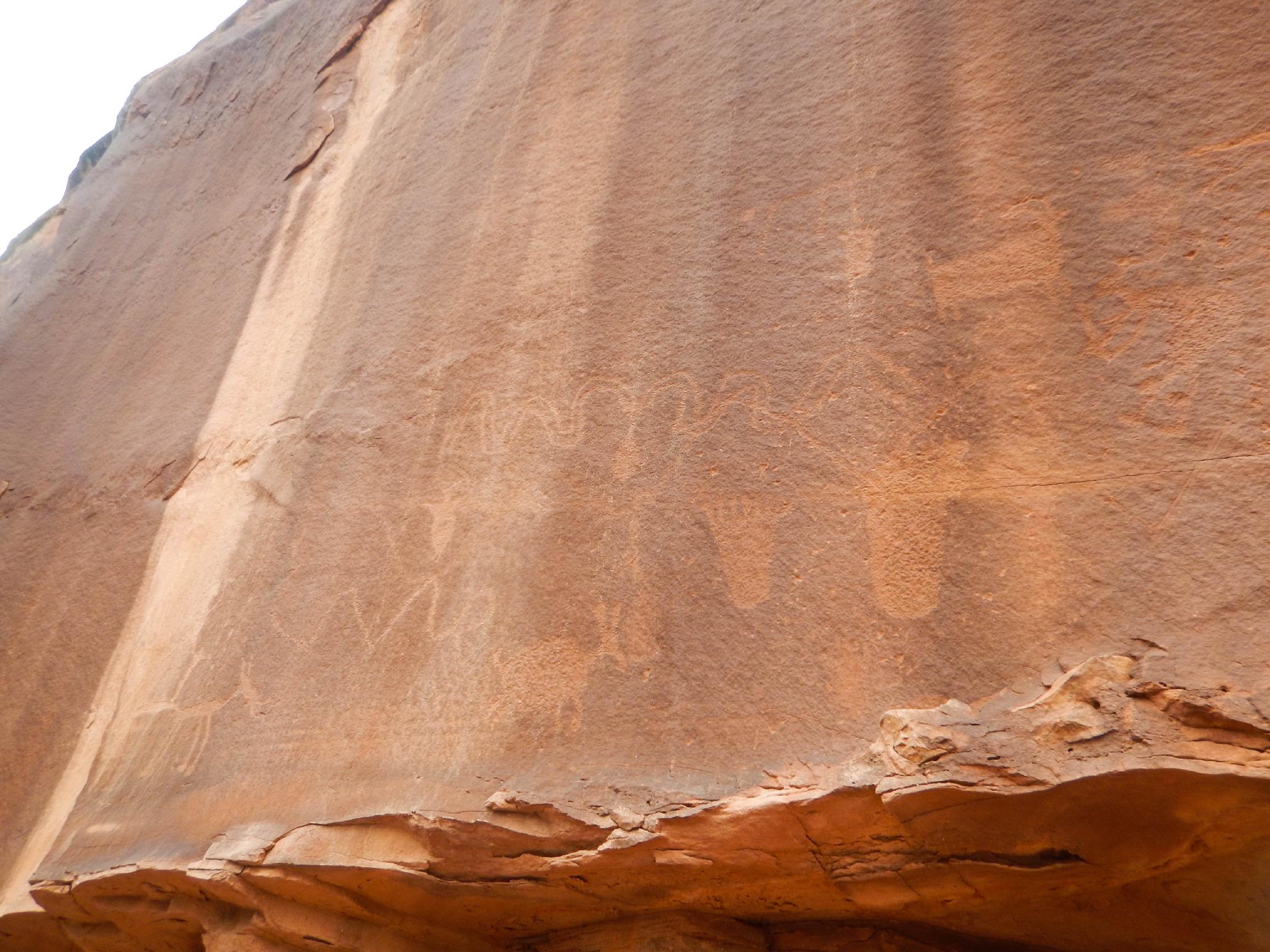
From the alcove, another 0.75 miles takes you to the end of the road and a cable marking its closure to motor vehicles. To the left there is a large pictograph panel that is similar in design (albeit much smaller) to the Great Gallery in Horseshoe Canyon.
Return the same way.
Maps

12S 610980E 4278548N
38°38'55"N 109°43'29"W
12S 610997E 4278564N
38°38'55"N 109°43'28"W
12S 611017E 4278382N
38°38'49"N 109°43'27"W
12S 610648E 4277590N
38°38'24"N 109°43'43"W
12S 610379E 4277122N
38°38'09"N 109°43'54"W
12S 610005E 4276870N
38°38'01"N 109°44'10"W
12S 609418E 4276429N
38°37'47"N 109°44'35"W
12S 609443E 4276455N
38°37'48"N 109°44'34"W