 Hiking
Crack Canyon
Hiking
Crack Canyon
San Rafael Swell
Overview
Crack Canyon, as it cuts a deep path through the reef, is a great adventure and not to be missed if you are in the Southern Swell area. It's easy access, striking scenery, and ease make it a great choice for a family hike. The hike is best in the Fall, Winter, or Spring, and can be blistering hot in the summer. It is a dog-friendly hike if you use the bypasses for the most difficult sections.
Getting There
Reach the trailhead by going west from Green River Utah on I-70 to the junction with highway 24 that goes to Hanksville. Go toward Hanksville for about 25 miles to Mile Post 135.
Route Description
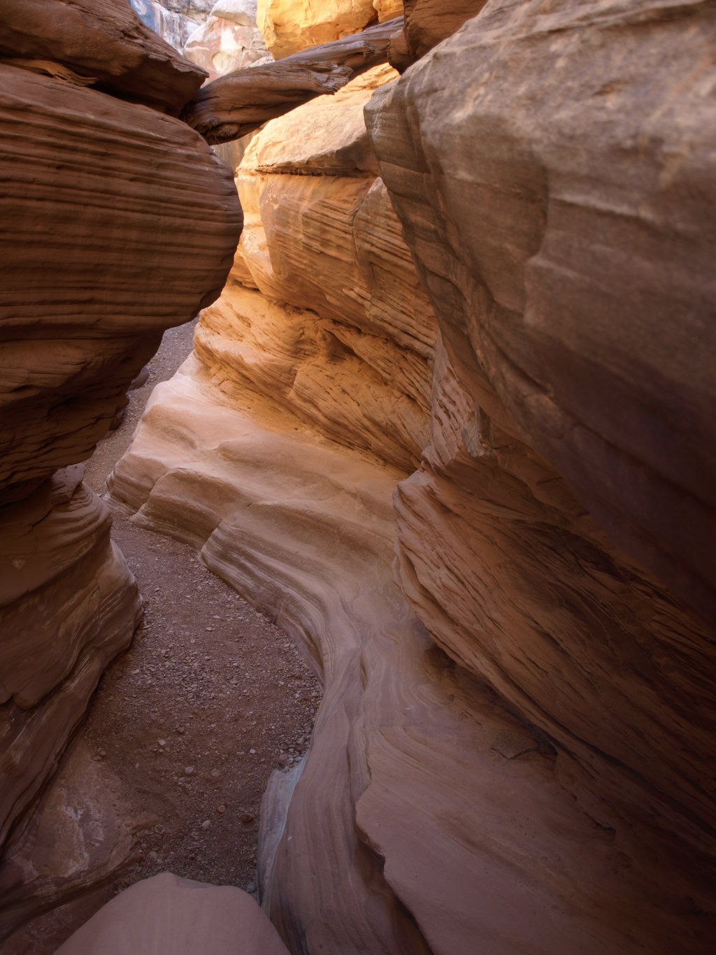
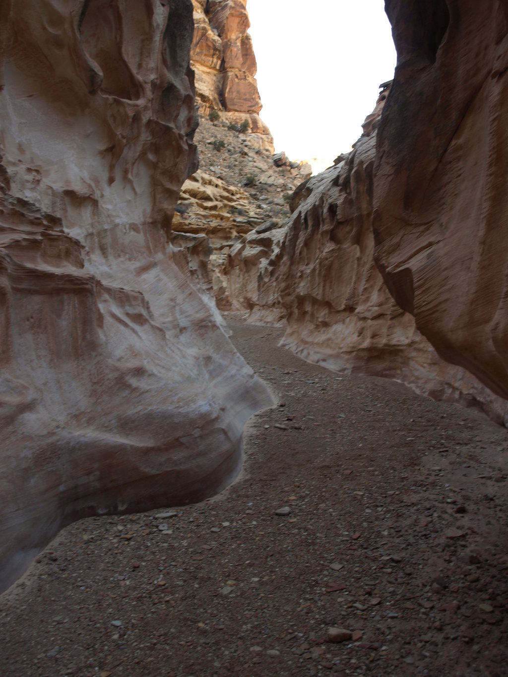
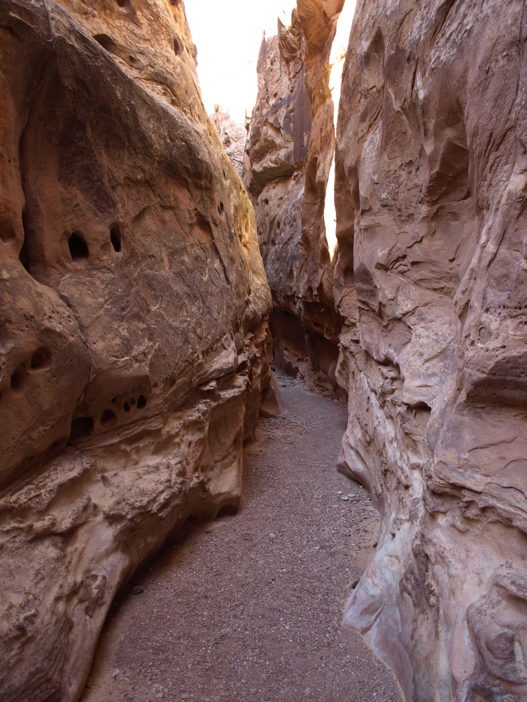
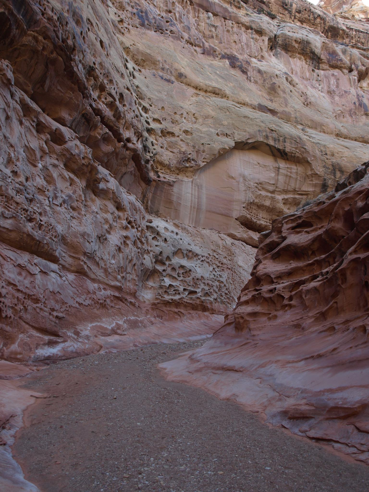
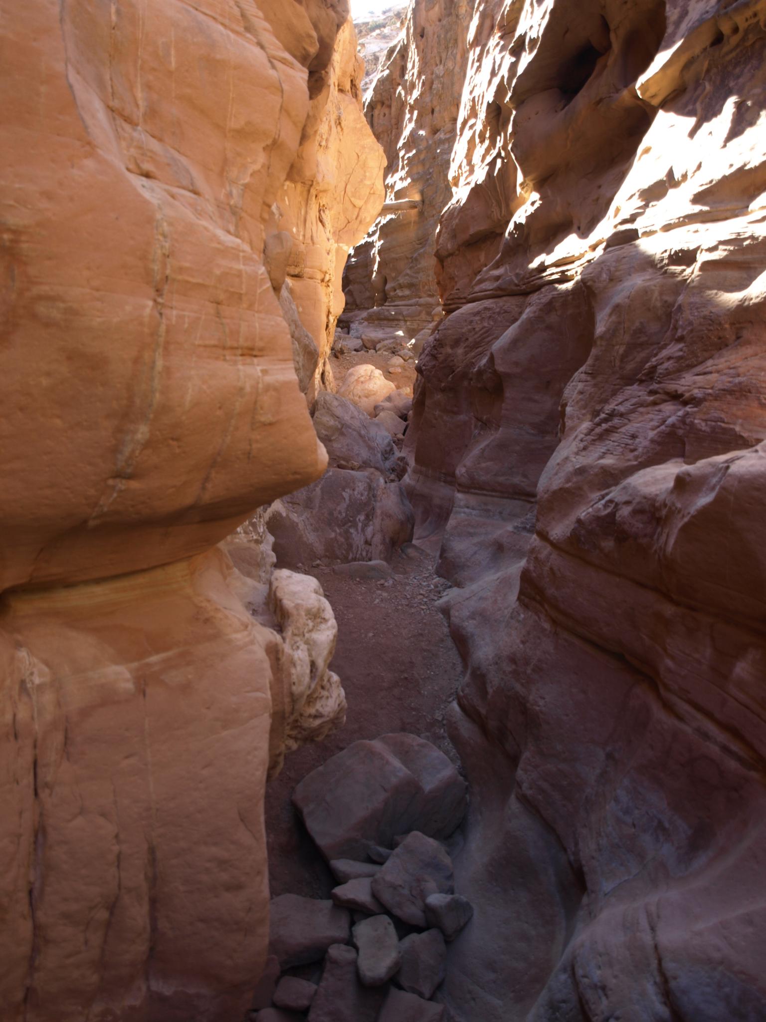
From the signed trailhead, follow an old road as it heads down the wash. It gets progressively worse as you follow it toward Crack Canyon. As you near the reef, where the canyon deepens, the road ceases to exist, and a wooden fence marks the end of motor vehicle travel. Follow the canyon as it cuts deeply into the reef. This first section of the canyon is impressively deep with fascinating solution pocket marred walls. 10-15 minutes past the fence a short narrows section is encountered. It has a couple of easy downclimbs, or can be bypassed on the right (looking down canyon).
Five minutes past this first small narrows is an impressively undercut section that is very photogenic in the right light. The canyon opens briefly before another short narrow section is encountered. This section has a couple of minor downclimbs, but nothing difficult.
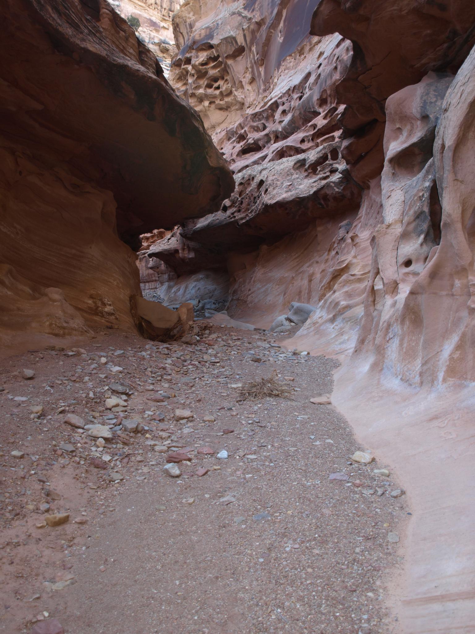
The pattern repeats itself, as the canyon opens and then begins to narrow again. This narrow section, however, begins with a 2 m ( 7 ft. ) downclimb that can be a little tricky for some. If this seems too difficult, go back up canyon about 3-5 minutes, watching on your right (looking up canyon) for a boulder filled crack. You can ascend this crack a level, and then follow a cairned trail down canyon bypassing the difficulties. The bypass is a good route to take if you have dogs with you.
Continue down canyon through more open and narrow sections. Near the end, a very deep narrow section is encountered and marks the spot where the canyon begins getting shallow as it exits the reef. 20 minutes or so after the deepest section, you exit the slickrock walled canyon and enter the dirt and rock lined wash on the other side of the reef. For most, this is a good turn around spot. Return the way you came.
Photos
Videos

Crack Canyon
Maps

12S 522178E 4277216N
38°38'36"N 110°44'43"W
12S 522781E 4275272N
38°37'32"N 110°44'18"W
12S 523006E 4275102N
38°37'27"N 110°44'09"W
12S 523008E 4274946N
38°37'22"N 110°44'08"W
12S 523312E 4274483N
38°37'07"N 110°43'56"W
12S 523915E 4273236N
38°36'26"N 110°43'31"W