 Hiking
Tumbleweed Canyon
Hiking
Tumbleweed Canyon
Henry Mountains
Overview
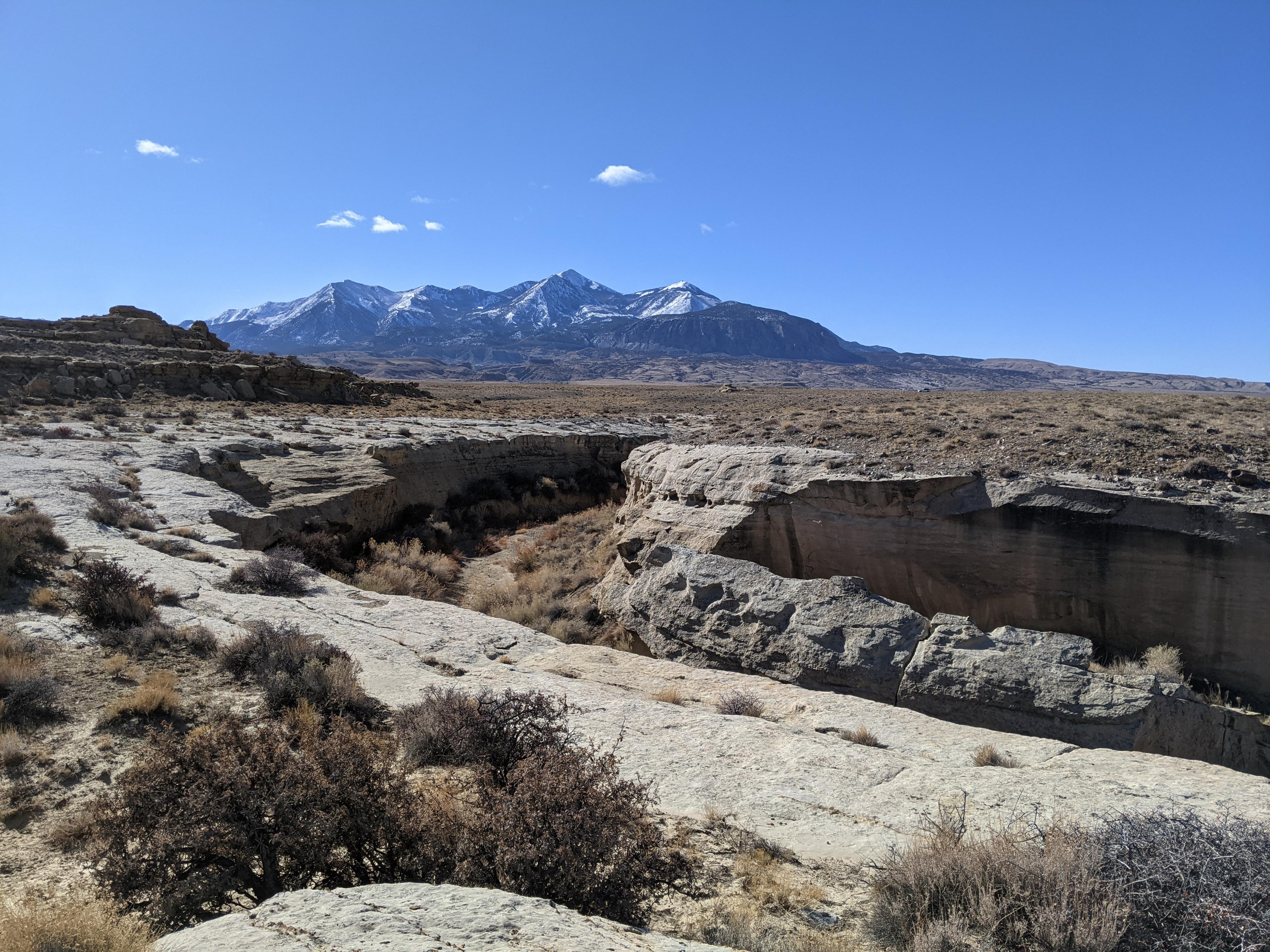
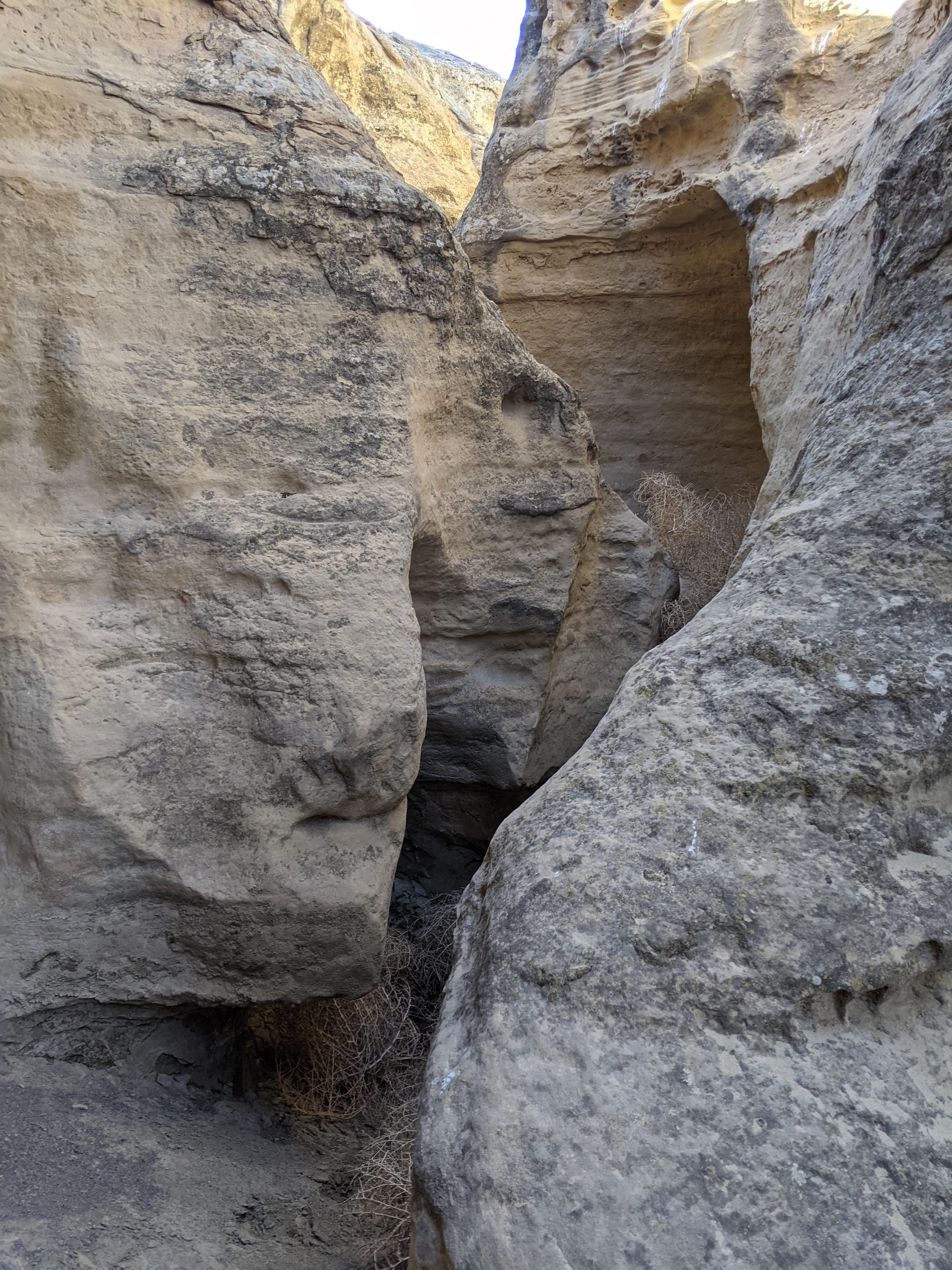
Between the Henry Mountains and Fremont River lays a barren landscape of Mancos shale. The grey scenery is reminiscent of a lunar landscape. As water tumbles down from the Henries through the badlands, it cuts through a Ferrone Sandstone layer. The white sandstone is hard and erodes into very sculpted walls. When Diane, Ruby and I headed out to check out the one small canyon in that area, I was intrigued at what we might find.
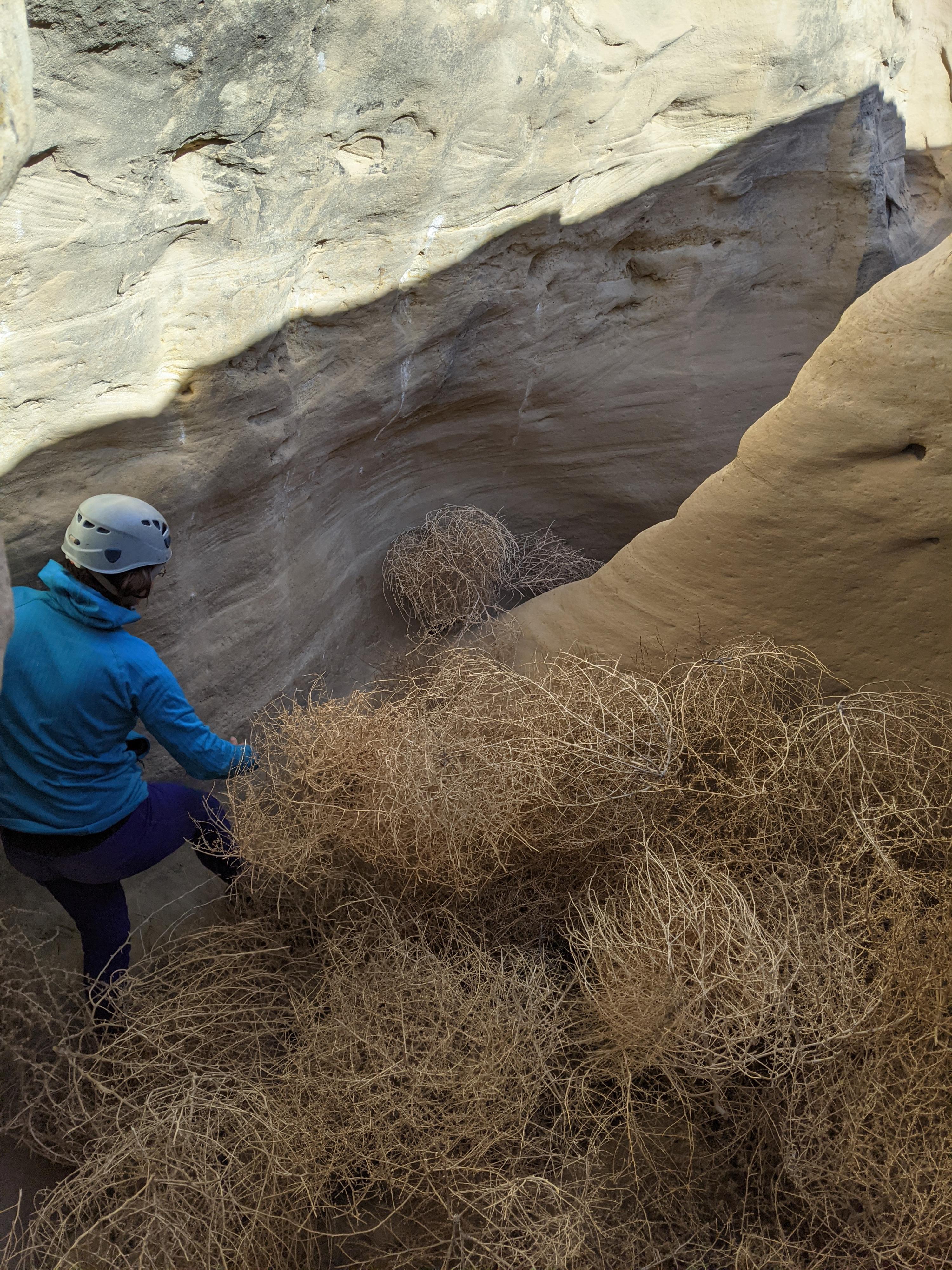
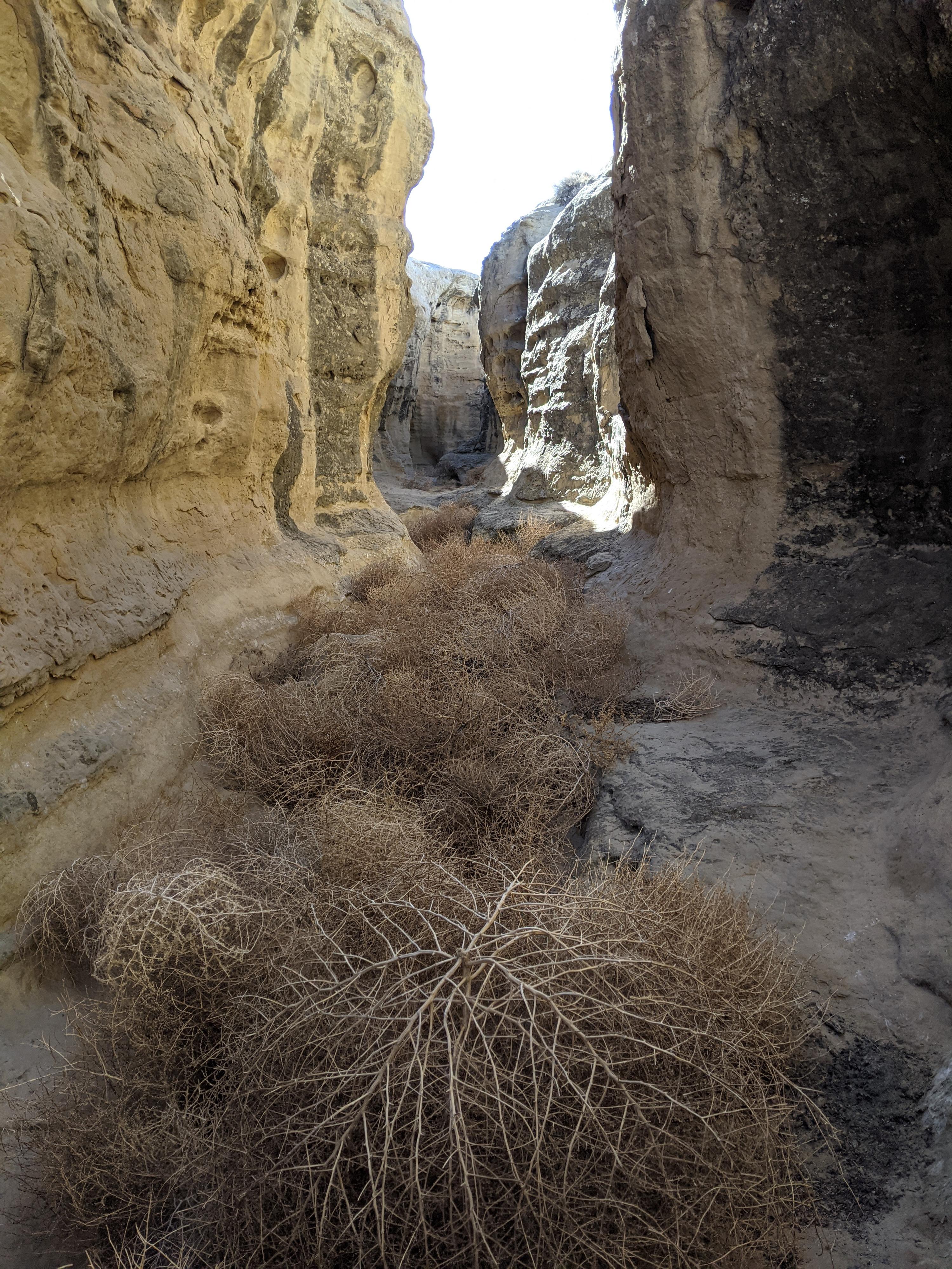
The canyon is short, but interestingly sculpted. I would have really enjoyed it except for one feature. The canyon was utterly FULL of tumbleweeds! I have never seen quantities of tumbleweed like that in a canyon. Fortunately, the canyon is short, and after the first couple of downclimbs, it was possible to avoid the worst of the thorny beasts. I suspect heavy summer rains flush the canyon out, while long, windy dry spells cause it to re-fill with tumbleweeds.
This is not a destination canyon but is a lovely place to wander if you want to get away from the world. We saw cows, but not much else in the area. The first major downclimb in the canyon is tricky and will likely require teamwork. A drop of 2 or 3 meters (7-8 ft) yields well to a partner assist. If it is too intimidating, it is easy enough to loop around and visit the canyon from the bottom.
Getting There
Access requires driving across the Fremont River, which is generally quite low. After recent heavy rains or for a brief time during spring run-off, the crossing may be impossible. Current flow is available at USGS ( https://waterdata.usgs.gov/monitoring-location/09330000/#parameterCode=00065 ) At 80 CFS, it was easily passable in Subaru type vehicles. Likely passable up to 100 CFS or a bit more depending on the vehicle.
Reaching the trailhead starts in the ghost town of Giles. This is about 7.5 miles west of Hanksville on UT-24, or about 40 miles east of Torrey on UT-24. At milepost 106.9 is the turn off on the south side of UT-24. This is signed Giles/Blue Valley.
Route Description
From the trailhead, walk east dropping down into the obvious drainage. Once in the drainage bottom, it is just a minute or two down the wash to where the sandstone layer is exposed and the start of the canyon.
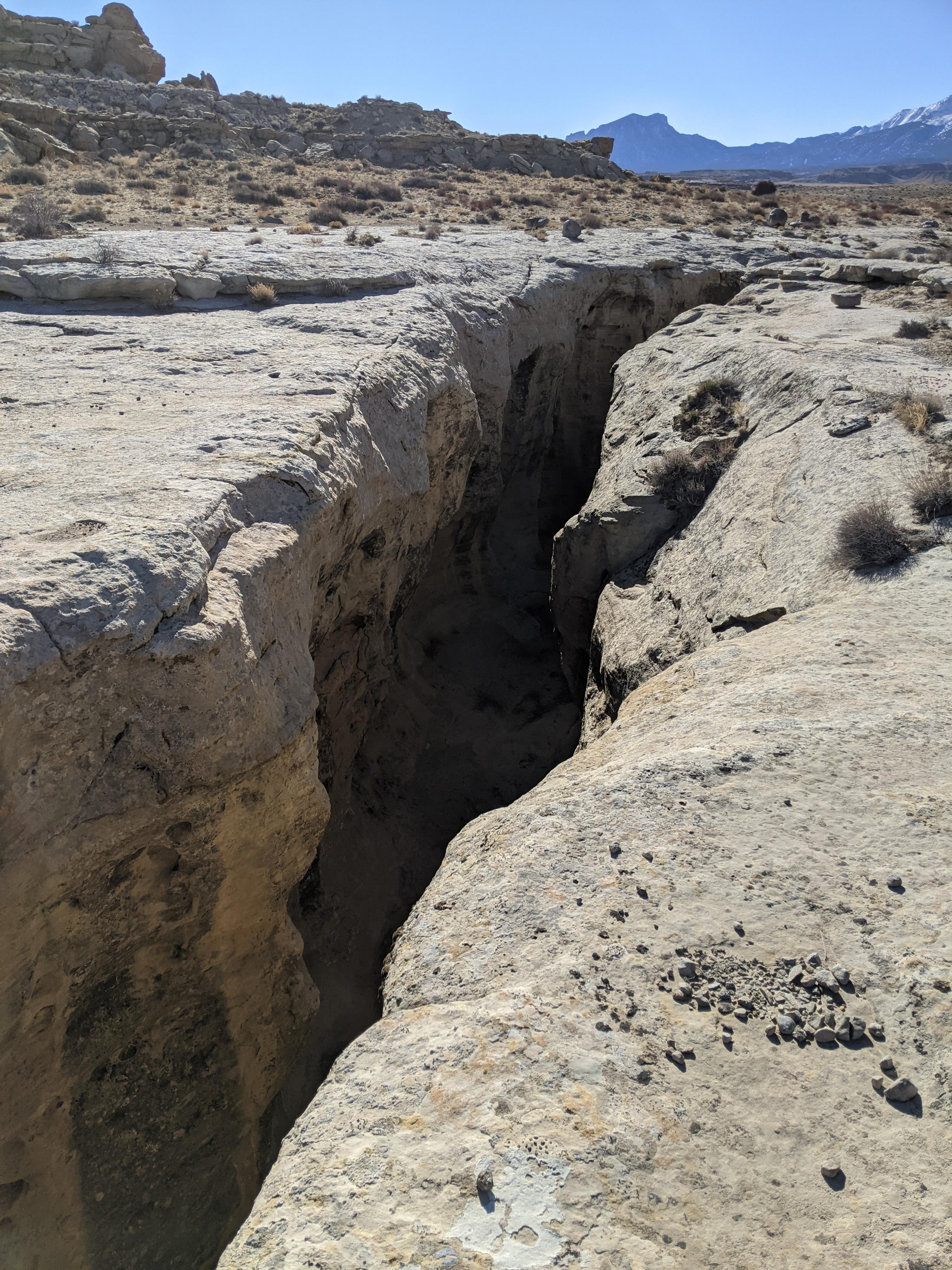
The canyon starts quickly with a sizeable downclimb into a shallow rocky pothole. This is the toughest downclimb of the day, by far. Teamwork can help. Going down feet first on your belly with a hand from above is likely the easiest for those that want help. One down the first obstacle, the canyon cuts a sinuous path into the sandstone with a few more minor downclimbs. You may find small pools here after recent rains.
All-to-soon the canyon begins to widen. Follow it down. A short spur comes in on the left. This makes a quick exit. Continuing down canyon work around and through some boulders to a rubble filled slope on the right that makes the best exit in my opinion. From the top of the exit, it is easy to rim walk back up to the head of the slot. Those with more motivation may want to wander down canyon a bit. There is a final exit on the left, then easier walking in a more wide-open canyon.
Photos
Maps

12S 515170E 4233686N
38°15'04"N 110°49'36"W
12S 515280E 4233854N
38°15'09"N 110°49'31"W
12S 515252E 4233945N
38°15'12"N 110°49'32"W
12S 515261E 4234095N
38°15'17"N 110°49'32"W
12S 515180E 4234053N
38°15'16"N 110°49'35"W