
 Grimes Point and Hidden Cave
Fallon Nevada
Overview
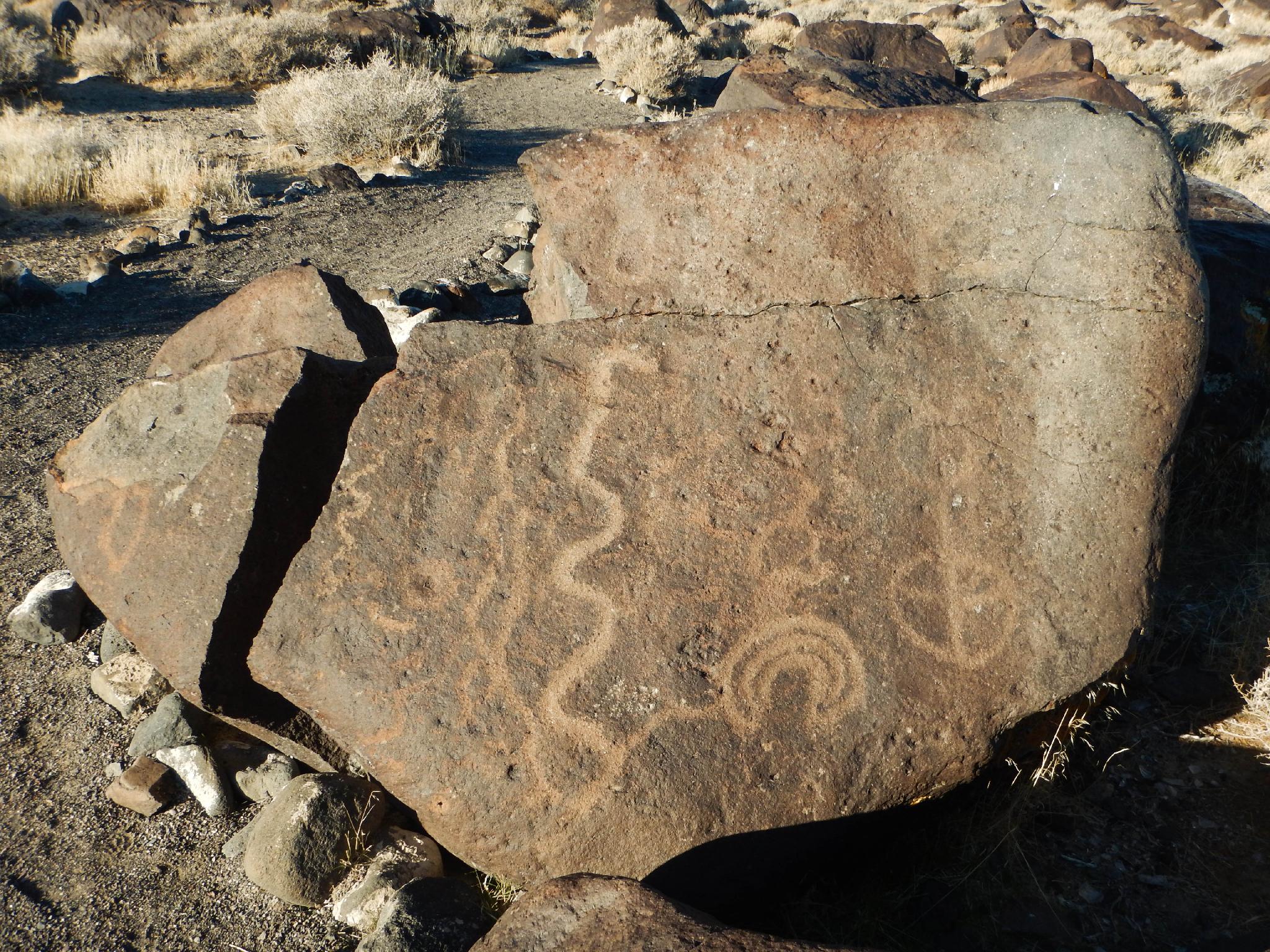
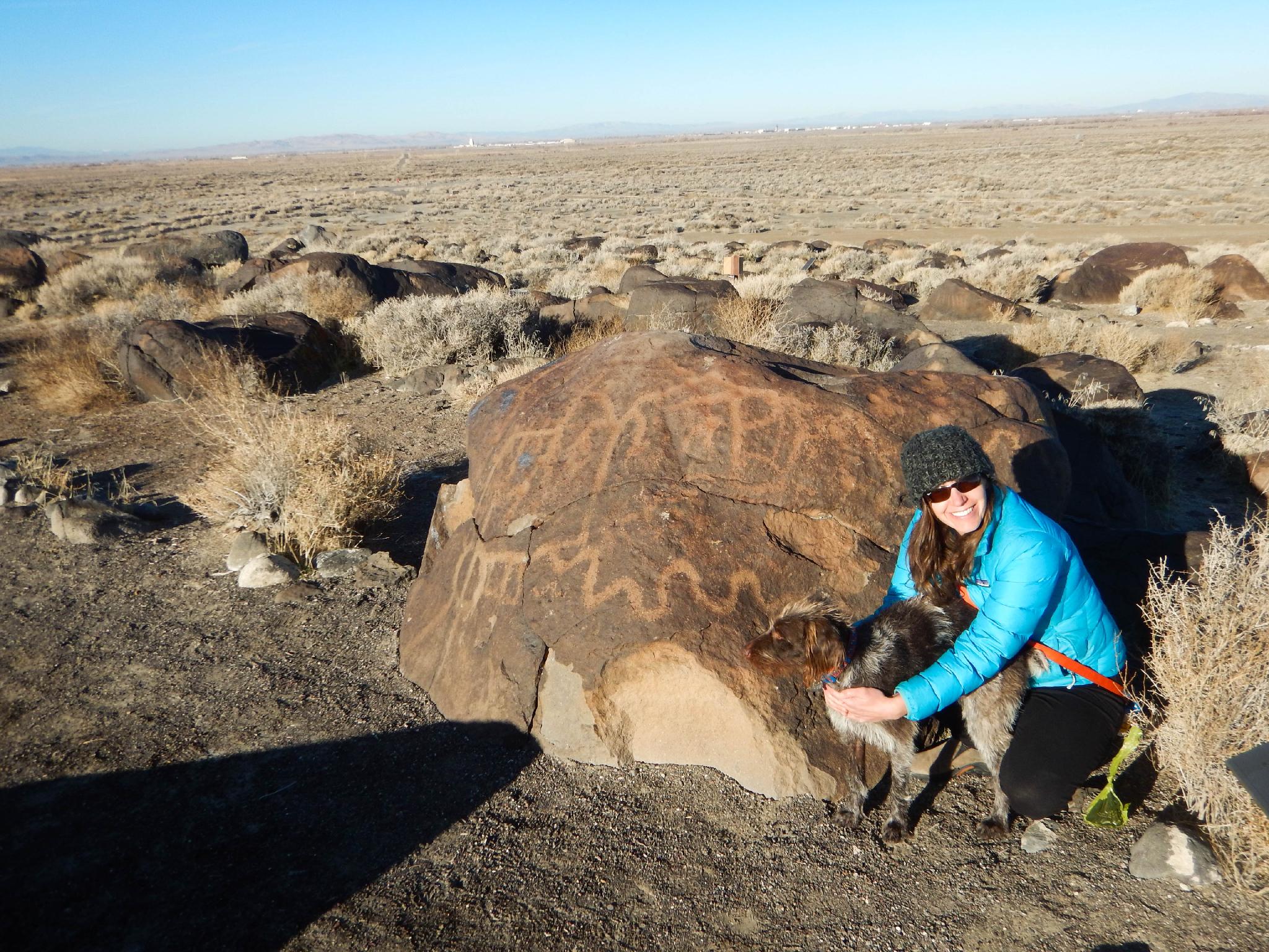
Grimes Point has a long history of human habitation, dating back 8000 years or more. An ancient lake, Lake Lahontan, likely provided an excellent hunting grounds, water, and marsh lands. Currently, the area is a dry, high desert region. The signs of early habitation are clear, however, in a large concentration of ancient petroglyphs at Grimes Point. This is one of the larger and older rock art sites I have seen and predates many rock art sites found in Utah and surrounding areas.
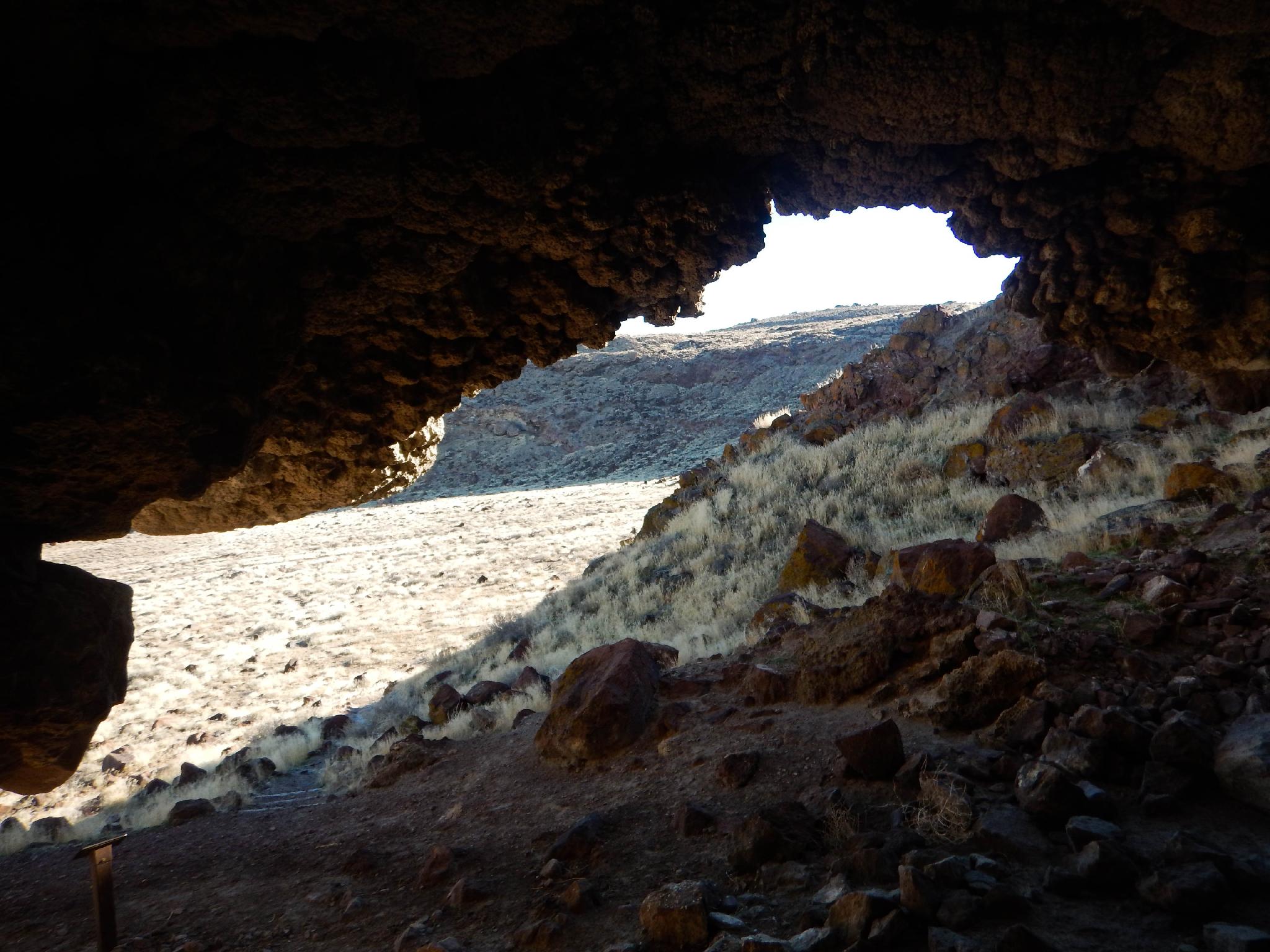
Just around the corner from Grimes Point is Hidden Cave. The cave was "discovered" by modern man in the 1920's, and has been excavated 3 times since then, most recently in 1979/80. The findings from the excavations show that between 3500 and 3800 years ago, inhabitants likely used the cave as a cache and stored goods and artifacts inside it.
The BLM offers tours of the cave:
If you cannot make a tour, hiking the trail around and past Hidden Cave is well worth the short side trip and highly recommended, especially when combined with a visit to Grimes Point.
Getting There
From Fallon, NV travel east on US-50. About 10 miles east of downtown Fallon is the well signed Grimes Point area on the left. Just before this is the signed road to Hidden Cave. Follow the dirt road 1.3 miles to the signed trailhead and parking area for Hidden Cave. The road the Hidden Cave is dirt, but well graded and should be passable to most.
Route Description
Rock art and historic sites are fragile, non-renewable cultural resources that, once damaged, can never be replaced. To ensure they are protected, please:
- Avoid Touching the Petroglyphs: Look and observe, BUT DO NOT TOUCH!
- Stay on the Trails: Stay on the most used trails when visiting sites, and don't create new trails or trample vegetation.
- Photography and Sketching is Allowed: Do not introduce any foreign substance to enhance the carved and pecked images for photographic or drawing purposes. Altering, defacing, or damaging the petroglyphs is against the law -- even if the damage is unintentional.
- Pets: Keep pets on a leash and clean up after them.
- Artifacts: If you happen to come across sherds (broken pottery) or lithics (flakes of stone tools), leave them where you see them. Once they are moved or removed, a piece of the past is forever lost.
Grimes Point
From the parking area, a short signed trail meanders through the many boulders that have petroglyphs on them. This hike, less than 1/2 mile in total, makes a great family-friendly walk that is suitable for most. The hike visits many petroglyphs and is my top recommendation for the area. Interpretive signs along the way provide more information about the area.
Want to stretch your legs a little more? From the Grimes Point parking area, a longer trail visits Grimes Point and has great views of the surrounding area. The Grimes Point trail is a bit under 1.5 miles round trip.
Hidden Cave
When we couldn't make the tour, we were tempted to pass on visiting Hidden Cave. I'm glad we didn't!
From the parking area, a well-signed trail makes a 1-mile loop visiting Picnic Cave, Hidden Cave (the outside of the cave, the cave is locked except during tours) and Burnt Cave.
For my money, I'd recommend going counterclockwise, starting with Picnic Cave and ending with Burnt Cave. The caves are interesting, and the views along the way very nice. Highly recommended. Interpretive signs along the way provide more information about the area.
Photos
Maps

11S 358172E 4362589N
39°24'04"N 118°38'50"W
11S 358722E 4362710N
39°24'08"N 118°38'27"W
11S 359755E 4363438N
39°24'33"N 118°37'44"W
11S 359700E 4363297N
39°24'28"N 118°37'47"W
11S 359924E 4363169N
39°24'24"N 118°37'37"W
11S 360089E 4363375N
39°24'31"N 118°37'30"W