Jennys Trail | Snow Canyon

Hiking Jennys Trail - Snow Canyon Hiking Jennys Trail

Snow Canyon

Overview

Wed Sunny, with a high near 79. South southeast wind around 2 mph.
79° | 50°
Thu Mostly sunny, with a high near 80. North northeast wind 2 to 6 mph.
80° | 54°
Fri Sunny, with a high near 82.
82° | 52°
Sat Sunny, with a high near 86.
86° | 53°
Sun Mostly sunny, with a high near 89.
89° | 57°
RATING: Easy Hike
MAPS: SANTA CLARA, UT
SEASON: Any, though summers can be hot.
GEAR: Standard Hiking Gear
WATER: None
Wed Sunny, with a high near 79. South southeast wind around 2 mph.
79° | 50°
Thu Mostly sunny, with a high near 80. North northeast wind 2 to 6 mph.
80° | 54°
Fri Sunny, with a high near 82.
82° | 52°
Sat Sunny, with a high near 86.
86° | 53°
Sun Mostly sunny, with a high near 89.
89° | 57°
Views from the overlook

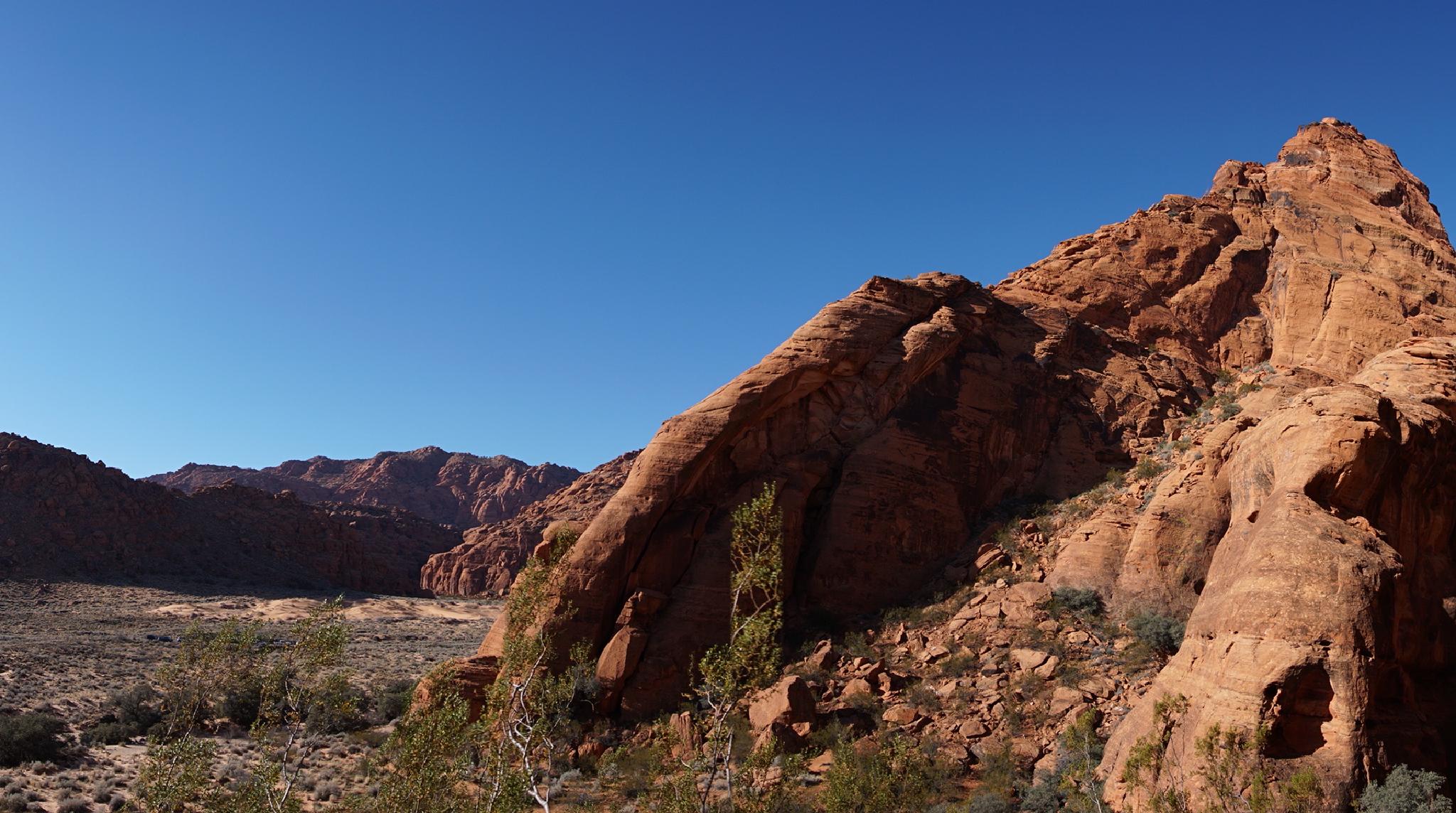
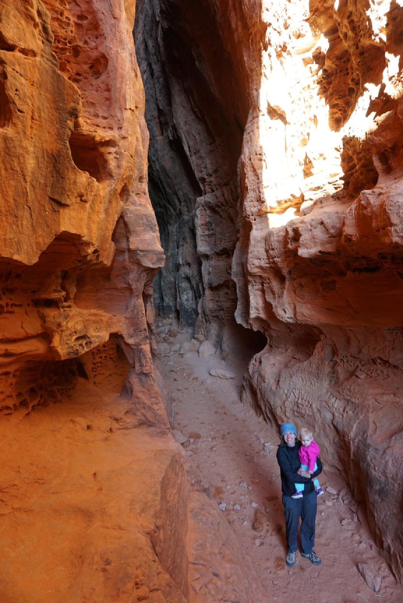
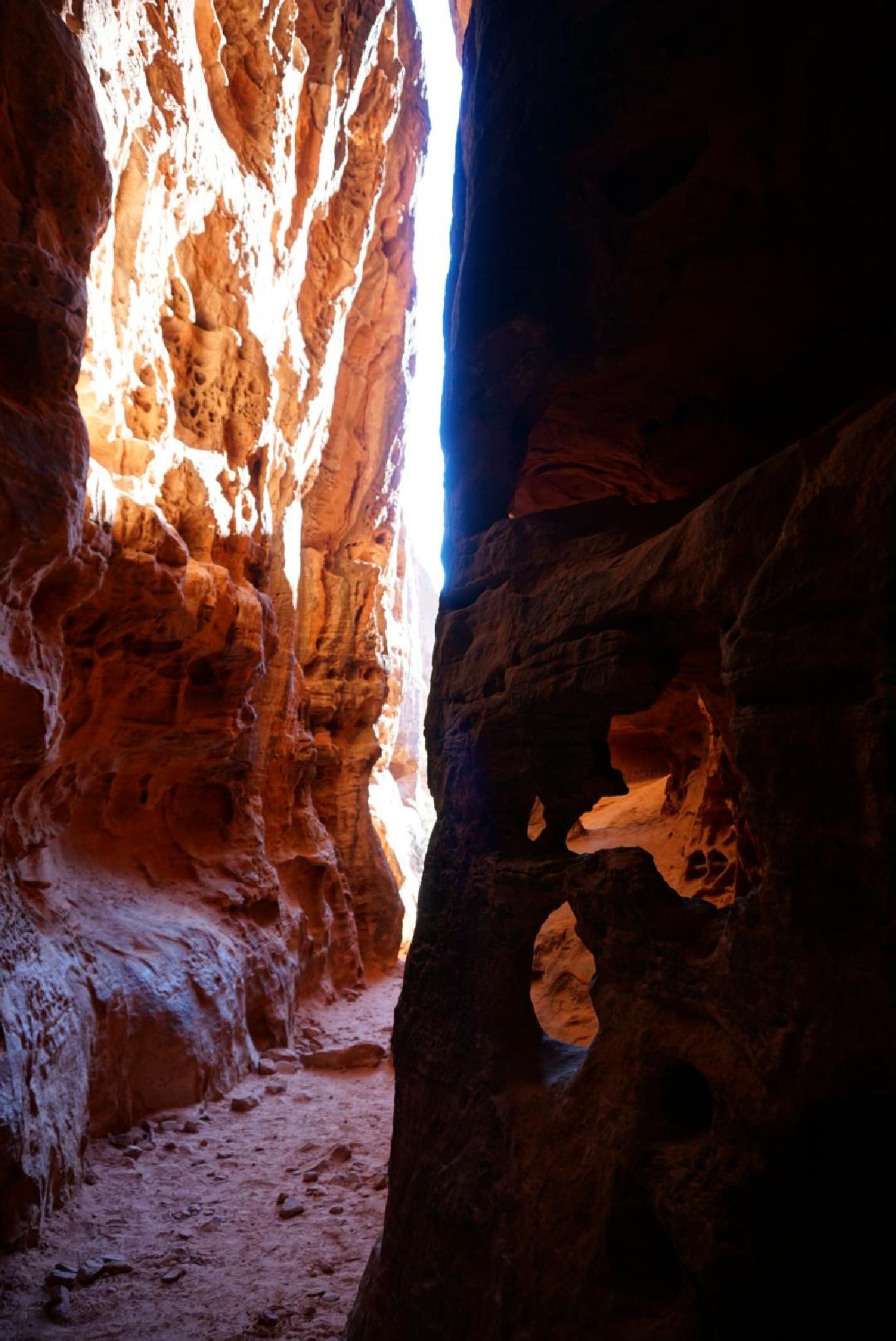
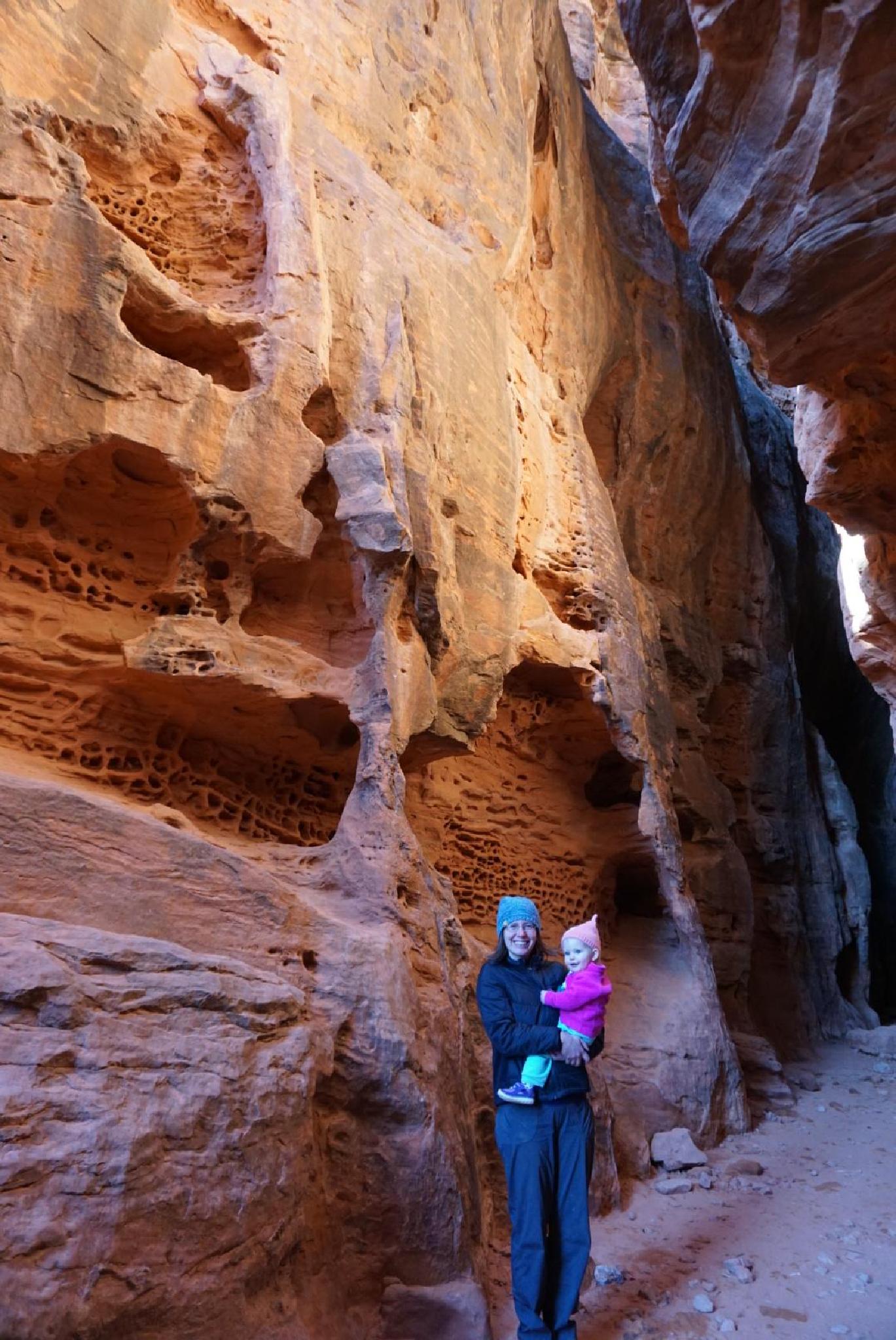
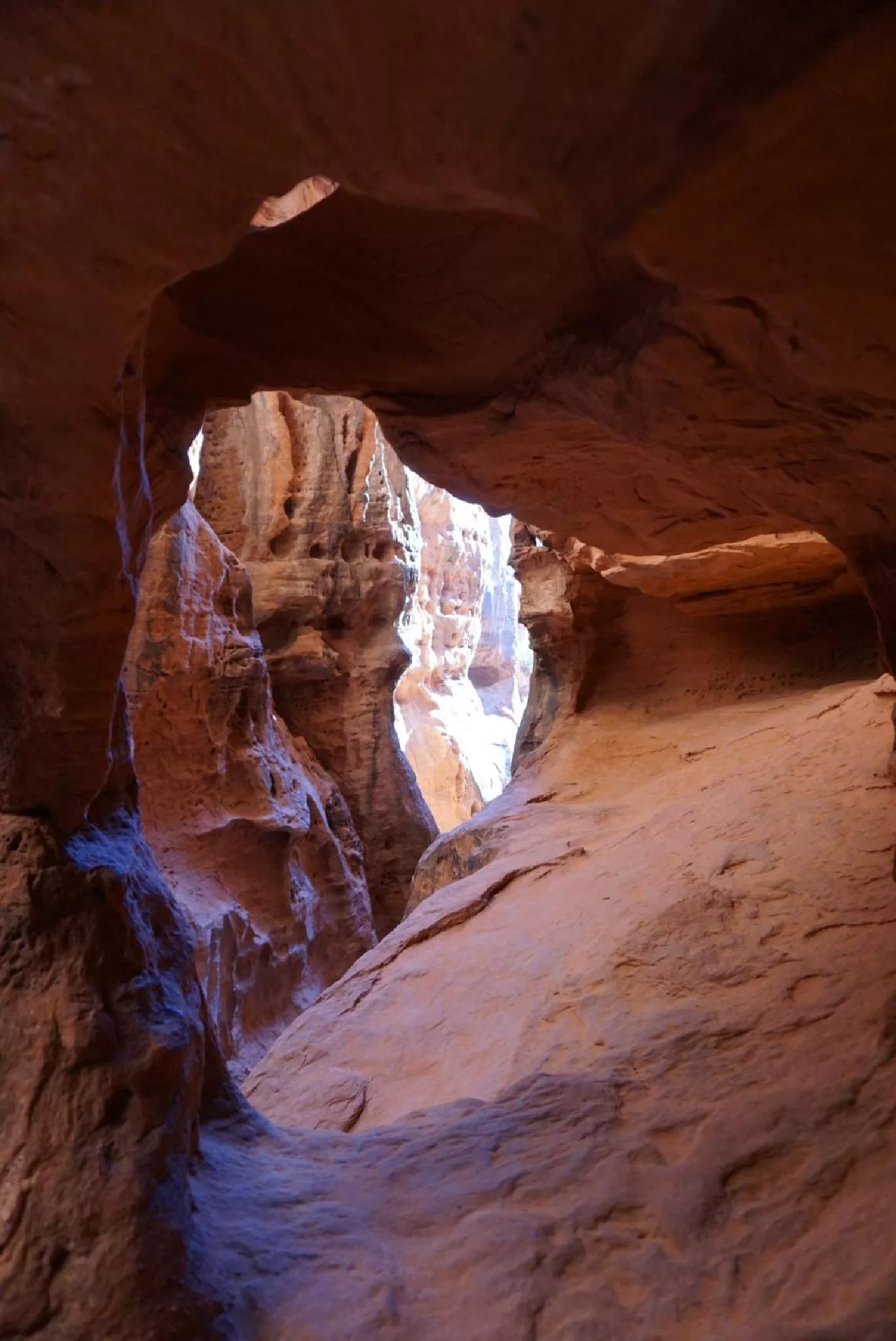
My personal favorite in Snow Canyon State Park, Jenny's Canyon trail is a short, family-friendly outing to a short slot canyon. This is a hike the whole family is likely to enjoy, especially children when they see the deep dark slot. It is short enough, even fairly young children can making the outing on their own. Unfortunately, I have been unable to find the history of the name. I would love to know the story of Jenny, and how she got this amazing short canyon named after her.

Note: We visited mid-afternoon on a winters day. The lighting that time of day was particularly stunning and made for great photos. Morning lighting is lightly not as good.
Ruby and Diane enjoying Jennys Canyon
Glowing walls.
Glowing walls.

Getting There

From the south entrance of the park on Snow Canyon Road, reset your odometer as you enter the park. At 0.6 miles the Jenny's Canyon Trail is on the right.

Ruby and Diane
Ruby and Diane
Jenny's Canyon
Jenny's Canyon

Route Description

From the trailhead, the short trail descends to and crosses the sandy wash before making a small uphill climb to Jenny's Canyon. Just before entering the canyon is a junction, with an overlook to the right a short distance, and the canyon on the left.


Photos

Maps

Route / 0.64 miles / Elevation Range 2,979 - 3,209 ft.
Printable Maps:

Trailhead
12S 265273E 4119032N 37°11'18"N 113°38'40"W
Canyon
12S 265517E 4119051N 37°11'19"N 113°38'30"W
Overlook
12S 265510E 4119022N 37°11'18"N 113°38'30"W

Comments