 Hiking
Peekaboo-Spooky-Brimstone Canyons
Hiking
Peekaboo-Spooky-Brimstone Canyons
Hole In The Rock
Overview
Peekaboo and Spooky are the quintessential first slot canyon experience for many. Relatively easy access, incredible slot canyons, and a relatively short day make this a hike to bring the family on. These canyons are popular for good reason. It was one of my first slot canyons long ago and once I have re-visited many times over the years.
Though the canyons are popular, there are a couple of minor obstacles. The most difficult obstacle is a climb to get into Peek-a-boo that some may want a hand-line for, or use some teamwork. The canyons are narrow and not suitable for dogs. Leave them at home for this one.
Getting There
Head east out of the town of Escalante about 5 miles on highway 12 until the well signed Hole in the Rock road.
Route Description
From the Upper Dry Fork trailhead, follow the marked trail as it heads across the open desert north. It comes to a junction with the rim return trail just before reaching Dry Fork. Continue into Dry Fork and follow it down canyon. Narrows are reached about 0.8 miles from the trailhead.
Continue down through the narrows. Peek-a-boo Canyon comes in on the left about 1.6 miles from the trailhead. This is just after the Dry Fork narrows open, and a side canyon comes in on the right.
Peek-a-boo Canyon:
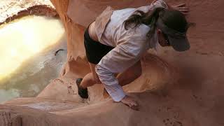
About 4 minutes down the canyon from the side canyon on the right is Peek-a-boo on the left. A 6 m up-climb guards the entrance to Peek-a-boo. The climb has carved steps, but is still a little tricky. A short rope for a hand-line may be useful for beginners. This up climb is the biggest obstacle of the hike.
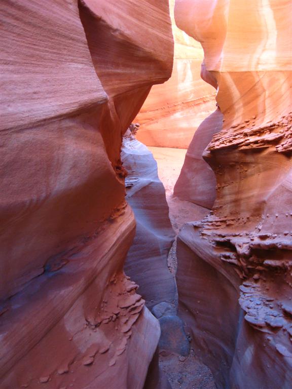
Once in Peek-a-boo, enjoy the many arches and narrows. What a gem! Continue up the canyon until the canyon opens into a wide open wash. Here a cairned trail takes off on the right. Follow this trail about 10 minutes over the open country to where it drops into Spooky, a large open wash at this point.
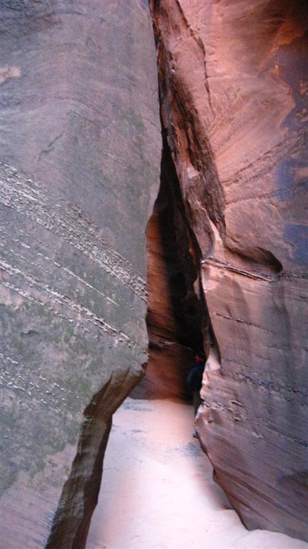
Spooky Canyon:
Head down Spooky! It gets deep and dark quickly. Several spots are narrow enough you have to turn sideways. Spooky is a fantastic canyon, and a lot of fun to descend. A couple of minor down climbs occur in the upper section, but if you look around, an easy path over or under the obstacle can be found. Once Spooky opens up, follow it down to its junction with Dry Fork in about 5 minutes.
Brimstone Canyon:
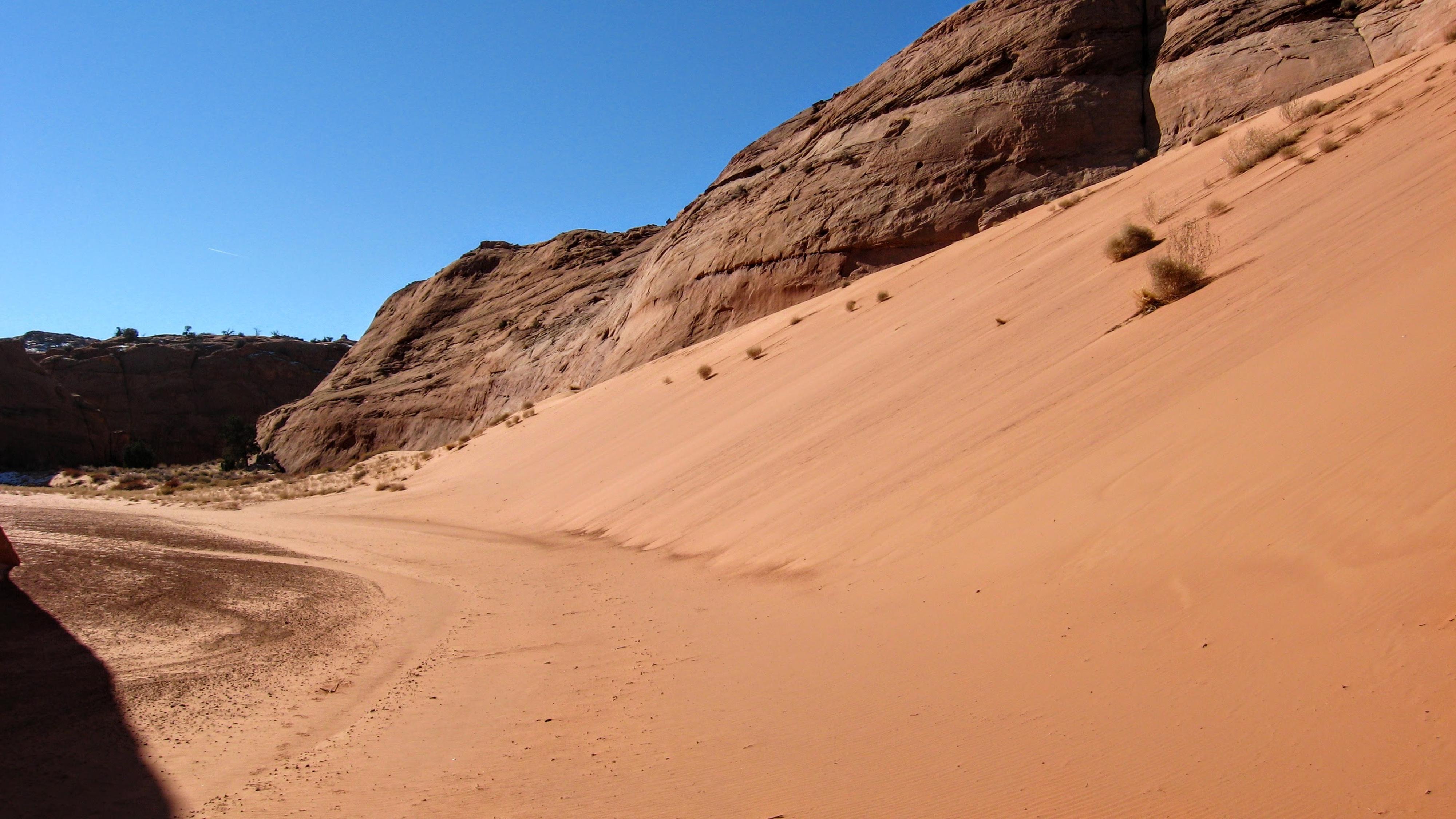
Last on the list is Brimstone. From the junction of Spooky and Dry Fork, hike down Dry Fork to the first major canyon coming in on the left. This section can change with each flood, but is usually an easy walk.
About 30 minutes down from Spooky Canyon, a wide side canyon comes in on the left with impressive sand slides on the west side. This canyon is Brimstone. Hike up the wide wash 10-15 minutes to where it suddenly narrows to an incredibly deep and dark slot. Work your way up as far as you comfortably can, but be careful, at least one person has gotten stuck in Brimstone. Return up Dry Fork to Peek-a-boo.
I recommend taking the rim trail return, which goes up the side canyon 4 minutes west of Peek-a-boo that comes in on the left (lookup up Dry Fork). Follow this trail up to a junction, then go right at the junction to head back to the Upper Dry Fork trail you started on. It is well-worn and easy to follow.
Photos
Videos
Peek-a-boo & Spooky

Peekaboo and spooky - spring 2026
Maps

12S 478653E 4148024N
37°28'44"N 111°14'29"W
12S 480200E 4146667N
37°28'00"N 111°13'26"W
12S 481176E 4147130N
37°28'15"N 111°12'46"W
12S 480846E 4148320N
37°28'54"N 111°12'60"W
12S 480844E 4148761N
37°29'08"N 111°13'00"W
12S 481475E 4148710N
37°29'06"N 111°12'34"W
12S 481500E 4148302N
37°28'53"N 111°12'33"W
12S 482593E 4147762N
37°28'36"N 111°11'49"W
12S 482847E 4148900N
37°29'13"N 111°11'38"W