 Canyoneering
Benign Canyon
Canyoneering
Benign Canyon
Dirty Devil
Overview
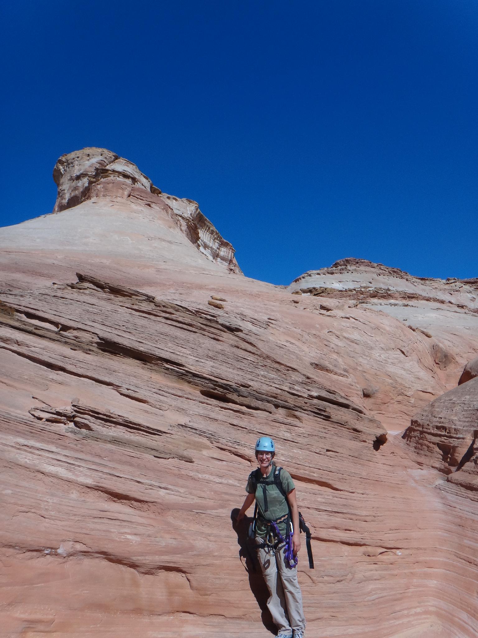
Possibly my favorite of the mini-slots in the area, Benign offers a ton of down climbing and partner assist fun. There are a couple of potholes as well, keeping things interesting. This is a good one for intermediate canyoneers looking to practice team work and creative anchors. Many (most) of the small drops can be downclimbed, but the ones that can't will require good and creative natural anchor building. Very fun!
Getting There
From Hanksville, travel south on Highway 95. 10.1 miles south of Hanksville, at mile post 10.1, turn east (left) off the highway on the signed Angel Point Trail Road #0100.
Route Description
Approach (10-15 minutes)
From the trailhead, follow the nearest wash as it heads northwest. It soon joins the main wash. This is Benign Canyon, in a quick 10 minutes or so it narrows and drops at a steep chimney downclimb. The anchor for the first rappel is visible just down canyon.
Canyon
Downclimb and do a 7 m ( 23 ft. ) first rappel.
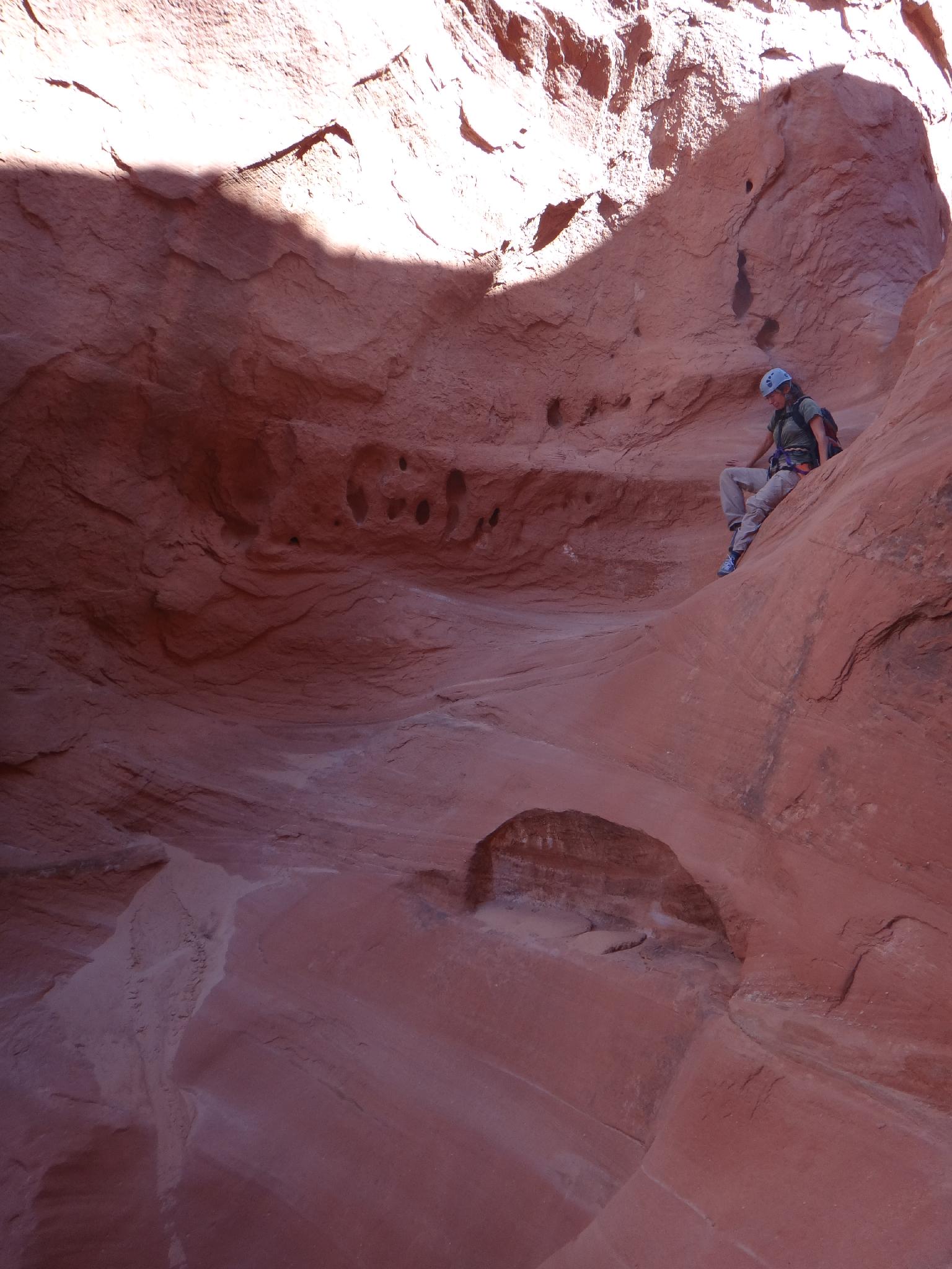
The canyon is open and easy going until a low angle slab (12 m ( 40 ft. )). Many may wish to avoid this on the right, but it is not as hard of a downclimb as it appears.
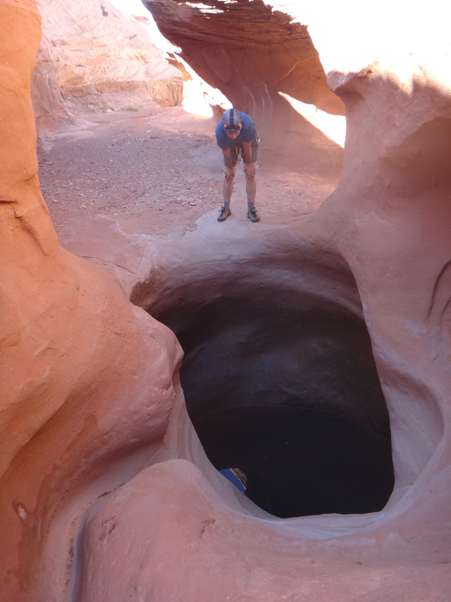
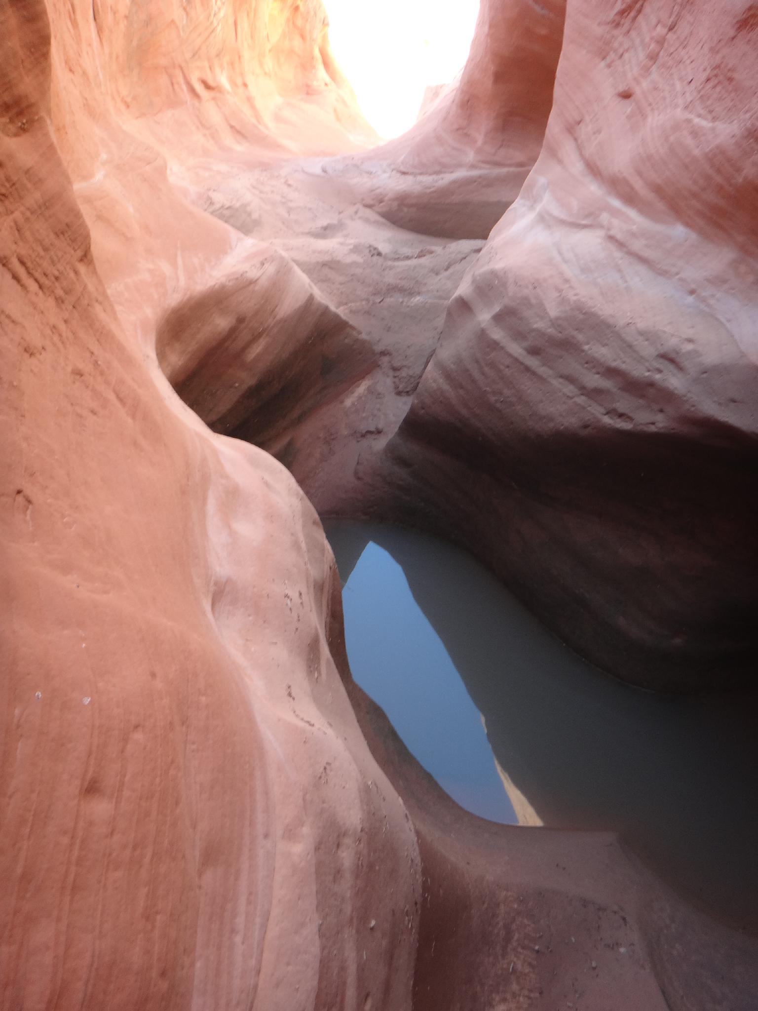
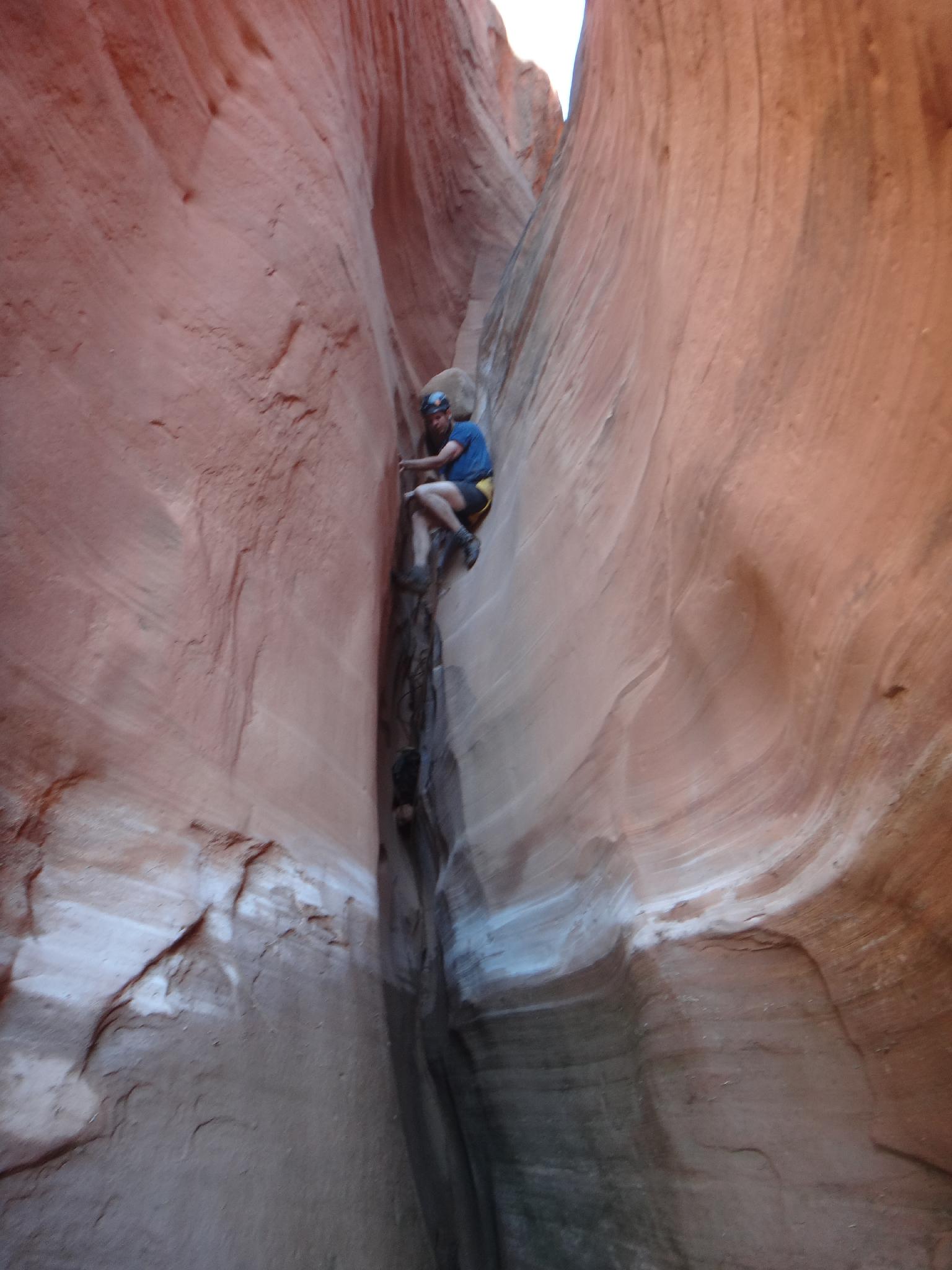
The canyon now settles into a rhythm. Short, staircase drops that yield well to teamwork. In one of these sections, a keeper pothole presents itself. This one is fairly ominous. A step around on the left is the best option, but be careful, it is exposed. Some are tackling the pothole directly, or backing up and scrambling around/rappelling in from the right looking down canyon.
A few more minor obstacles, and the canyon gets harder as it deepens before Beaver Creek. This final section has a few short drops that many will want to rappel. (we rappelled 3 to about 8 m ( 27 ft. ))
Anchors in this section are generally wedged rocks or deadmen, and can require some skill to place. Teamwork is the best option when possible. Also, a keeper pothole in this section is likely to require a boost, but is not particularly hard.
The final drop is a chimney most will downclimb, but can be rappelled if needed. Very similar in size and height to the last drop in Zero-G.
Exit
Fun is over! Thrash down to the confluence with Beaver canyon. There appeared no easy path through the thick brush. At Beaver, turn left and go upstream a few minutes to where a side canyon comes in steeply on the left. Climb slickrock on the left of the drainage, cross the drainage at the top, then head back across and east to overlook Benign. Stay following Benign up stream until it is possible to climb to the canyon rim and go cross country to the trailhead.
Photos
Videos

Benign Canyon
2025 Benign Canyon - A Fun Sand-Trapping Day!
Maps

12S 540225E 4234081N
38°15'14"N 110°32'25"W
12S 538952E 4235014N
38°15'44"N 110°33'17"W
12S 539595E 4234637N
38°15'32"N 110°32'51"W