Del Monte (Delmonte) Mine |

Southern Henry Mountains

Hiking Del Monte (Delmonte) Mine - Southern Henry Mountains Hiking Del Monte (Delmonte) Mine

Southern Henry Mountains

Overview

RATING: Easy / Short Hike
MAPS: COPPER CREEK BENCHES, UT

Sun

Sunny, with a high near 62. Northwest wind 6 to 10 mph.

62 | 42

Mon

Sunny, with a high near 70.

70 | 46

Tue

Sunny, with a high near 75.

75 | 50

Wed

Sunny, with a high near 71.

71 | 51

Thu

Sunny, with a high near 73.

73 | 49

View Full Weather Details
SEASON: Any, hot in the summer
GEAR: Standard Hiking Gear
WATER: None

Sun

Sunny, with a high near 62. Northwest wind 6 to 10 mph.

62 | 42

Mon

Sunny, with a high near 70.

70 | 46

Tue

Sunny, with a high near 75.

75 | 50

Wed

Sunny, with a high near 71.

71 | 51

Thu

Sunny, with a high near 73.

73 | 49

View Full Weather Details
The Del Monte (Delmonte) Mine near Ticaboo

The Del Monte (Delmonte) Mine near Ticaboo

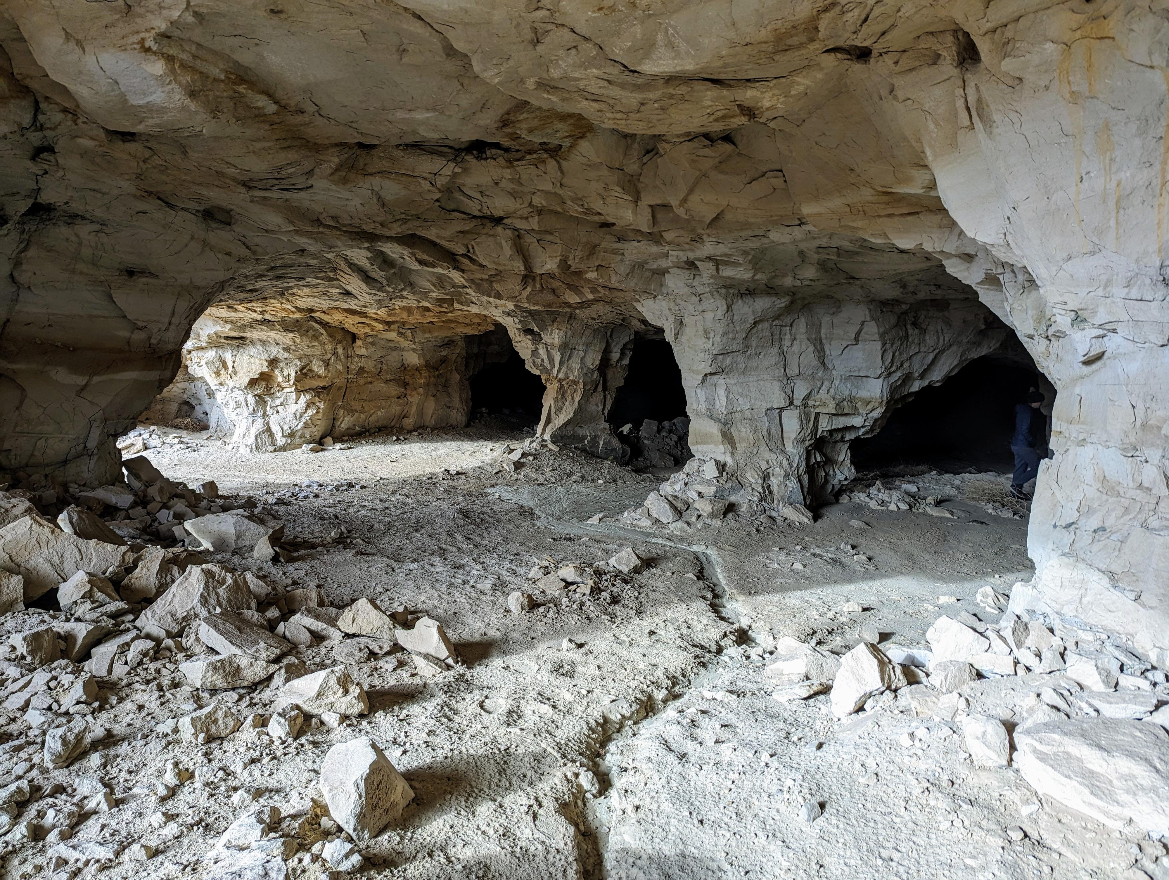
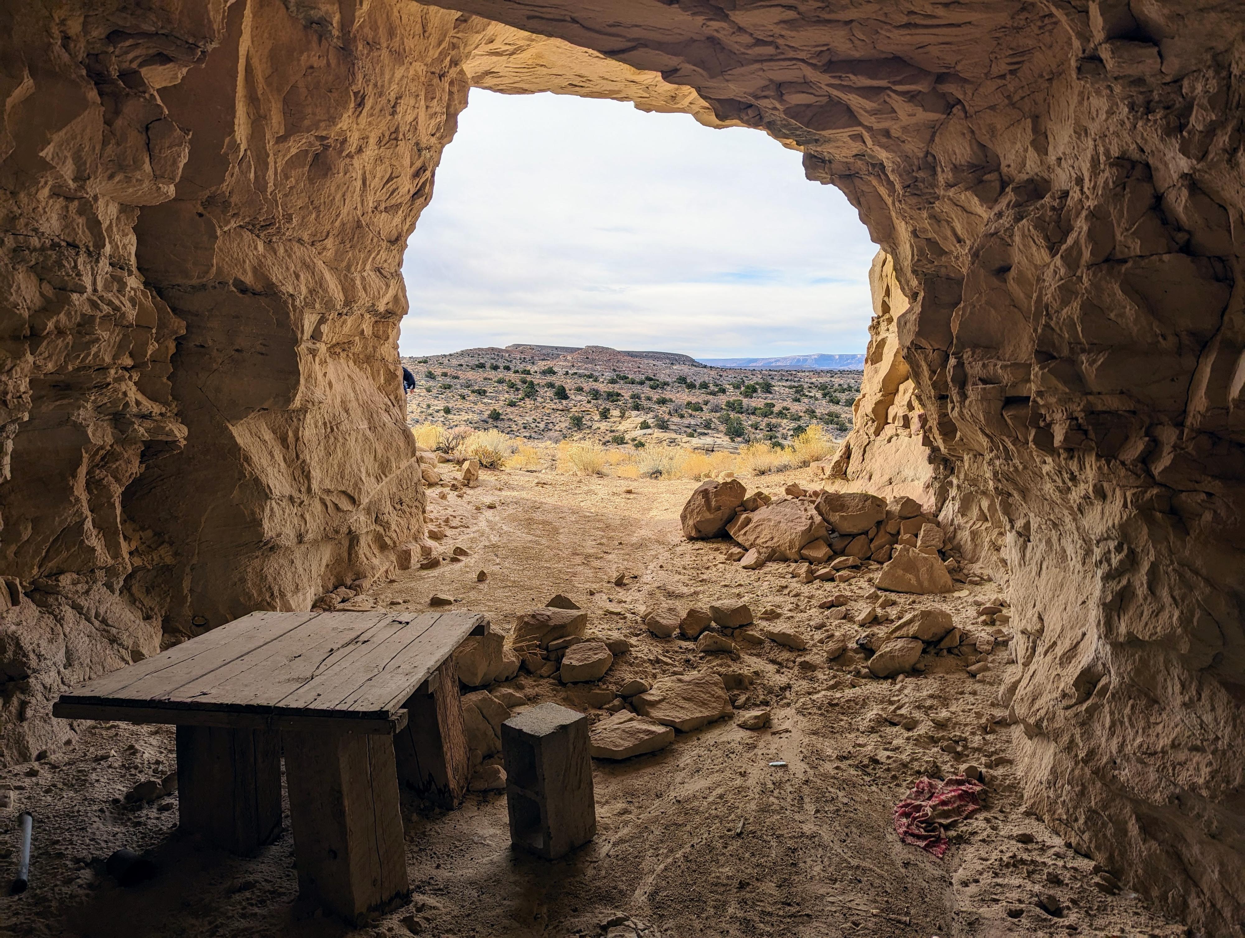
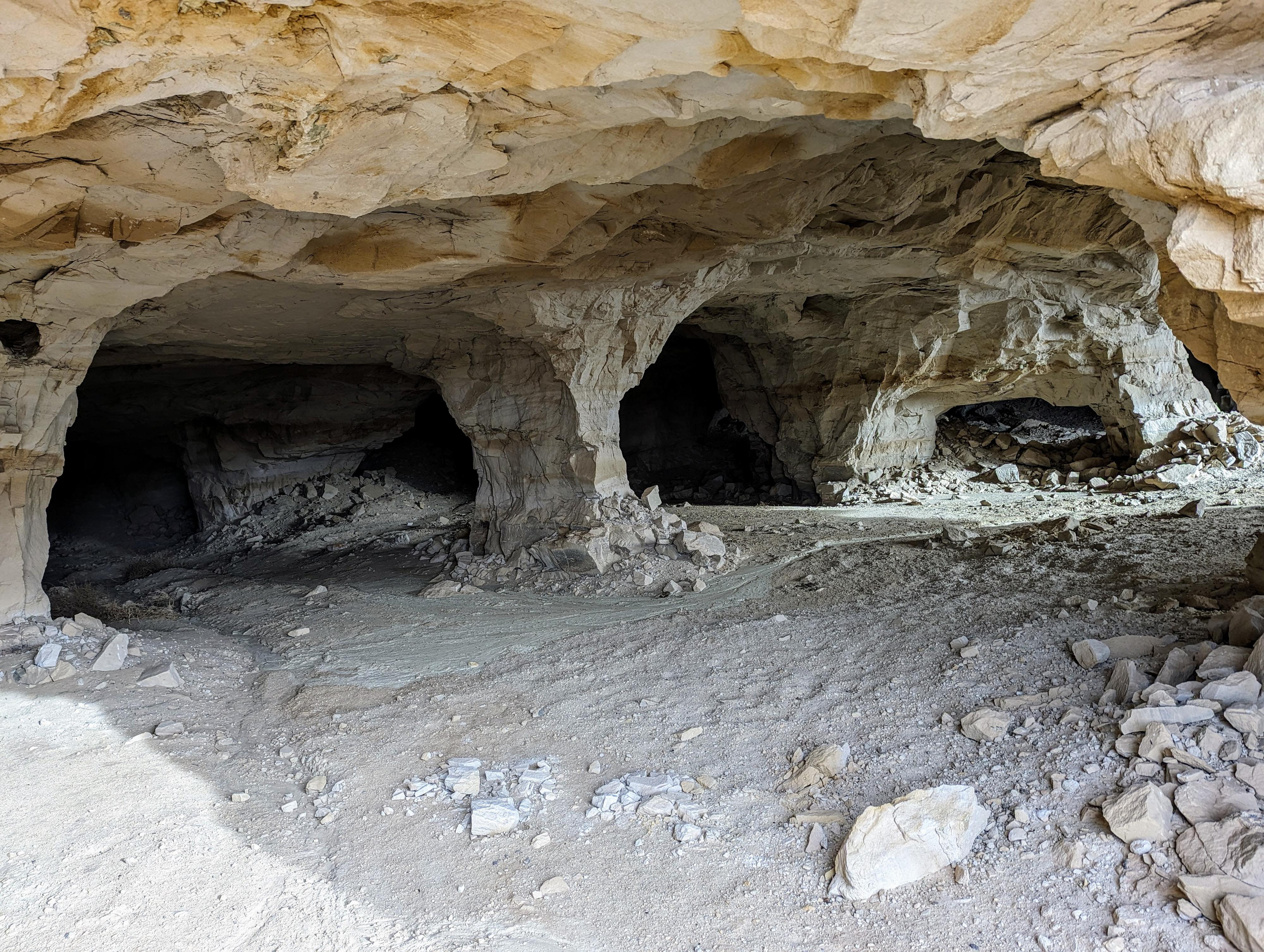
This site is fascinating! The mine consists of large tunnels going into the Salt Wash Member of the Morrison rock formation. The tunnels go back less than 200 feet, but are honeycombed, leaving open areas held up by pillars of rock. It is quite a site to see. Though visible from the highway, it is not frequently visited up close, but well worth the short hike to visit it in my opinion.

Visiting requires a true 4-wheel drive vehicle in most conditions, but walking from the paved highway is very reasonable and only adds a bit more than a mile to an already short hike.

History: The Henry Mountains, though the last mapped mountain range in the continental United States, has a long history of mining. Shortly after the discovery of radium in 1898, mining for the radium began, including in the Del Monte mine area. Over time, mining shifted to vanadium before and during World War II, and then on to uranium after World War II. The uranium boom peaked in 1954, but some mining has continued after. The Del Monte mine site seems, from signatures at the site, to have also been mined actively from 1960 to at least 1975.
Warning: All mines are dangerous, and going inside a mine is not recommended due to bad air, rock fall, and many other dangers. It is best to peek in from the entrance. Moreover, artifacts are protected under the antiquities act. Do not remove any of the mining artifacts from the site.
Del Monte Mine Break Room?

Del Monte Mine Break Room?

Getting There

From Hanksville, head south on UT-95 for about 27 miles to the junction of UT-95 and UT-276. Go right on UT-276 toward Bullfrog/Ticaboo for 19.9 miles to where a small dirt road leaves the highway on the right, just after UT-276 goes through a road cut.

The dirt road is rough, and will likely require true 4-wheel drive in a couple of spots. Follow it for 0.6 miles to where it passes a pond. Park where the road becomes a washed out track climbing the hill on the right, just past the pond. The road essentially ends here.

Another view of the Del Monte Mine interior. There are many areas like this.

Another view of the Del Monte Mine interior. There are many areas like this.

Route

From the trailhead, follow the old, washed out road as it angles north and west up the hill. It is just a few minutes from the trailhead to the cliff band and first mine. Heading east along the base of the cliff, on the old mining road, there are quite a few mine entrances to look in.

Return the same way.


Maps

From Trailhead / 0.42 miles / Elevation Range 5,246 - 5,372 ft.
From Highway / 1.69 miles / Elevation Range 5,244 - 5,394 ft.
Printable Maps:
MIle 19.9

12S 531256mE 4180710mN

N37° 46' 24" W110° 38' 42"

Trailhead

12S 530340mE 4181007mN

N37° 46' 33" W110° 39' 20"

Del Monte Mine

12S 530324mE 4181061mN

N37° 46' 35" W110° 39' 20"

Comments

Want to make a comment? Login and let yourself be heard.