 Hiking
Kane Gulch to Bullet Canyon
Hiking
Kane Gulch to Bullet Canyon
Grand Gulch
Overview
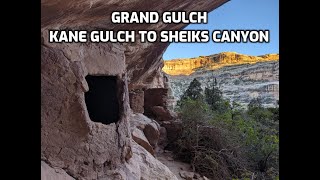
Grand Gulch feels like visiting an outdoor museum. It is a fascinating canyon dotted with Native American rock art, granaries, and dwellings. If you like Native American history, it is a place you have to visit! It is also stunningly beautiful scenery.
Grand Gulch is a long drainage. When talking about hiking and backpacking, generally people are referring to about a 50 mile stretch from Kane Gulch Ranger Station, down Kane Gulch to the confluence with Grand Gulch, then down Grand Gulch to the San Juan River. Few hike the entire length in one trip. The upper section, described here, is one of the most popular sections to visit. It has fairly easy access and many sites to visit.
Logistics
Permits: Permits are now required for day hiking or overnight backpacking in Grand Gulch and its tributaries. Day hiking permits do not have a limit, but there is a limit on the number of backpacking permits available. As of the fall of 2025, these seemed fairly easy to get. See the BLM site listed in the permits section for current availability and details.
Route Options: We started from Kane Gulch Ranger Station and exited Sheiks Canyon over 3 days / 2 nights. For two adults and an 8-year-old, this was a good length, though climbing out of Sheiks Canyon is strenuous. If you are a bit more ambitious, I would recommend going from Kane Gulch Ranger Station to Bullet Canyon and out Bullet Canyon. This could be done in 3 days by most groups, or 4 if you want a casual pace. Any route you do, unless it is out and back, will require a car shuttle. For our trip I used a mountain bike. It took about an hour to set up the shuttle at Sheiks Canyon trailhead and bike back to the ranger station (9 miles of biking). Bullet Canyon would probably be similar or a little longer.
Distance Note: We found distances, with side trips and route finding, to be longer than the cleaned-up map. Expect days to feel a bit longer than the mileage may indicate.
Water: WATER TO FILTER FOR DRINKING IS A BIG CONCERN IN GRAND GULCH! You should talk to a ranger about current conditions before you start your trip. Spring and fall GENERALLY see springs flowing. There are a few springs that are typically more reliable than others: Junction Spring, Todie Spring, Coyote Spring, Green Mask Site Spring, Bullet Canyon Junction Spring, and Jailhouse Spring. We carried at least 2 quarts each between water sources and camped near a water source every night. Be sure to treat all water.
Season: Generally spring or fall. Summers can be very hot, and water can be very difficult to find. I have been in Grand Gulch in the winter. Snow and ice made for slow going, so be cautious about setting out if there is snow on the ground.
Camping: BLM asks that you use existing campsites to minimize impacts in the canyon. These are typically near springs. On our October visit, we were surprised to only run into 2 other groups the entire 3 days and had no problem finding campsites near springs. No fires are allowed. No pets are allowed.
Site Etiquette: Visit sites responsibly.
- Treat all cultural sites as sacred places.
- These are not just “ruins” - they are the heritage of living Indigenous peoples.
- Approach sites quietly and thoughtfully.
- Oils from your hands can damage rock art or fragile plaster. Don't touch!
- Don’t lean, sit, or climb on walls - they can crumble easily.
- Never remove or move artifacts (like pottery shards, corn cobs, or tools).
- Use existing paths when possible.
The map and description show the many sites I thought were particularly interesting or popular, but with some exploring and/or binoculars, there are other sites to be seen. Keep an eye out as you hike.
Basketmaker II Period (ca. 500 BCE – 500 CE):
The earliest known farmers in the area. They grew corn and squash, lived in pithouses, and made finely woven baskets instead of pottery.
Basketmaker III Period (ca. 500 – 750 CE):
This period saw the introduction of pottery and the bow and arrow. Small villages began to appear, and people increasingly relied on agriculture.
Pueblo I to Pueblo III Periods (ca. 750 – 1300 CE):
The Basketmaker peoples evolved into the Ancestral Puebloans. They built aboveground stone and adobe structures, developed complex communities, and created the cliff dwellings and kivas seen in Grand Gulch.
After about 1300 CE, many of these ancestral communities migrated southward toward the Hopi Mesas, Zuni lands, and the Rio Grande Valley, likely due to prolonged drought and changing social dynamics. Yet, their descendants - the Hopi, Zuni, Acoma, and other Pueblo peoples - maintain a living connection to this sacred region, as do the Diné (Navajo) and Ute Mountain Ute, who later made the canyons part of their homelands.
Getting There
Kane Gulch Ranger Station
From Blanding, head south on US-191. In about 4 miles, turn right onto UT-95 North toward Hanksville. Follow UT-95N for about 28.4 miles to it's junction with UT-261. Head south on UT-261 toward Bluff/Mexican Hat for about 3.9 miles to where the ranger station is on the left (east) side of the road. There is a restroom at the ranger station, but no water available (as of 2025). This is at about mile post 28.7.
Sheiks Canyon Trailhead
From the ranger station, continue south about 4.6 miles to mile post 24.1.
- Reset your odometer as you leave the highway. ( 12S 596058E 4146688N / 37°27'44"N 109°54'50"W )
- Follow the road, County Road 250, for 3.1 miles to a junction. Go right at this junction. ( 12S 592559E 4145402N / 37°27'03"N 109°57'13"W )
- Continue an additional 1.4 miles to the Sheiks Canyon trailhead. The road is generally passable by all vehicles. Just past the trailhead, the road becomes impassable and should be walked. There is good camping near the trailhead. ( 12S 590409E 4145079N / 37°26'53"N 109°58'40"W )
Bullet Canyon Trailhead
From the ranger station, continue south about 6.9 miles to milepost 21.75, go west and reset your odometer in the good dirt road.
About 1.1 miles from the pavement is the Bullet Canyon trailhead. This road should be passable by all vehicles most of the time. There are several decent primitive camping spots near the trailhead and a pit toilet at the trailhead.
Route Description
Rock art and historic sites are fragile, non-renewable cultural resources that, once damaged, can never be replaced. To ensure they are protected, please:
- Avoid Touching the Petroglyphs: Look and observe, BUT DO NOT TOUCH!
- Stay on the Trails: Stay on the most used trails when visiting sites, and don't create new trails or trample vegetation.
- Photography and Sketching is Allowed: Do not introduce any foreign substance to enhance the carved and pecked images for photographic or drawing purposes. Altering, defacing, or damaging the petroglyphs is against the law -- even if the damage is unintentional.
- Pets: Keep pets on a leash and clean up after them.
- Artifacts: If you happen to come across sherds (broken pottery) or lithics (flakes of stone tools), leave them where you see them. Once they are moved or removed, a piece of the past is forever lost.
To Grand Gulch (about 4 miles)
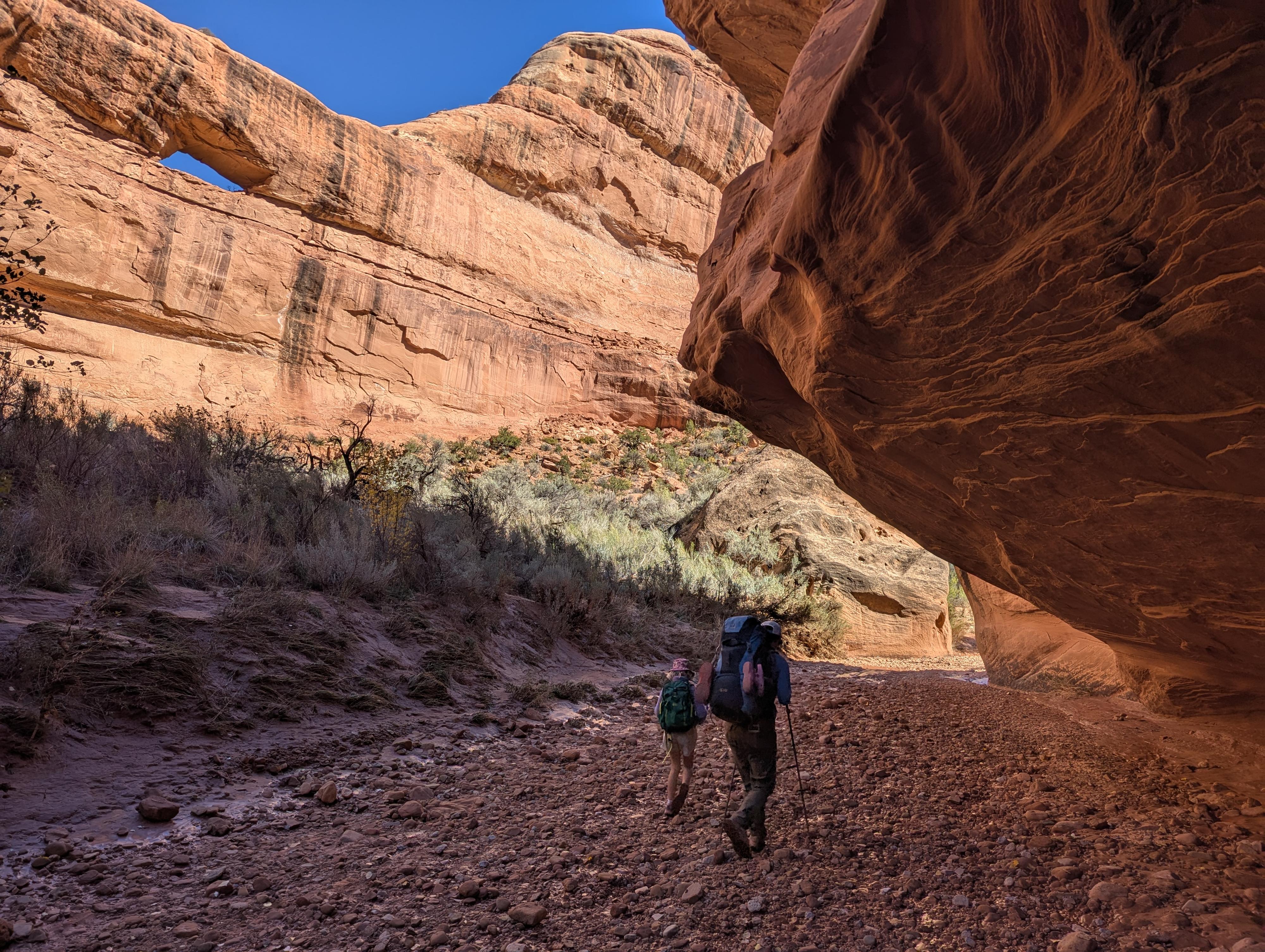
From the ranger station, cross the highway and begin following the trail down Kane Gulch. It is well-defined and easy to follow as long as you keep an eye out. Initially in the bottom of the canyon in a fairly wide and shallow canyon.
A little under a mile from the Kane Gulch Ranger Station, the trail hugs the right wall through a narrow passage between a boulder and canyon wall. It is a neat spot!
Below the narrow passage, the canyon slowly deepens. From here, keep an eye out as the trail often leaves on the right to bypass obstacles.
It is about 4 miles from the ranger station to the confluence with Grand Gulch. There is usually a spring at the confluence.
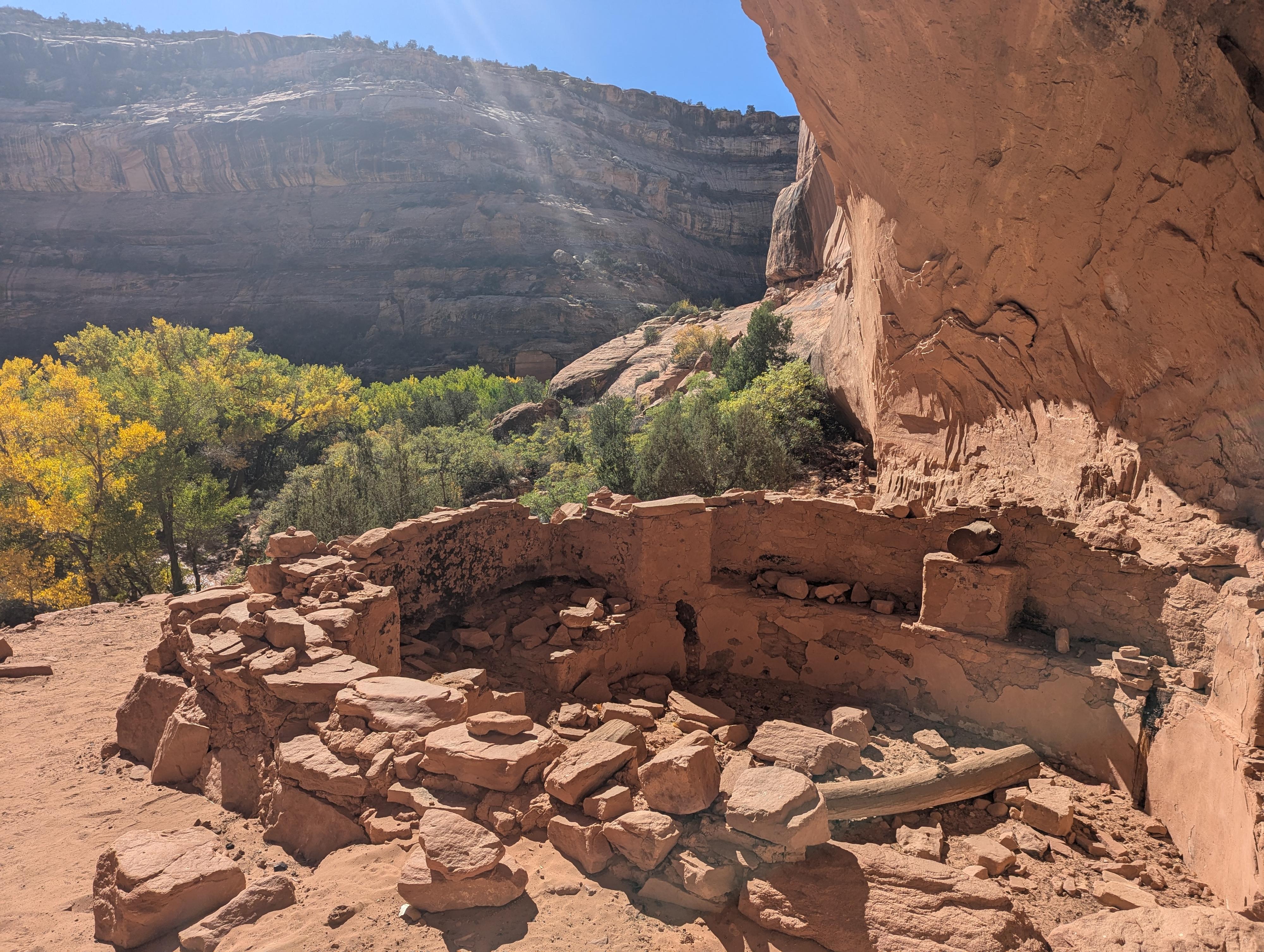
Part of Junction Ruin
Stimper Arch
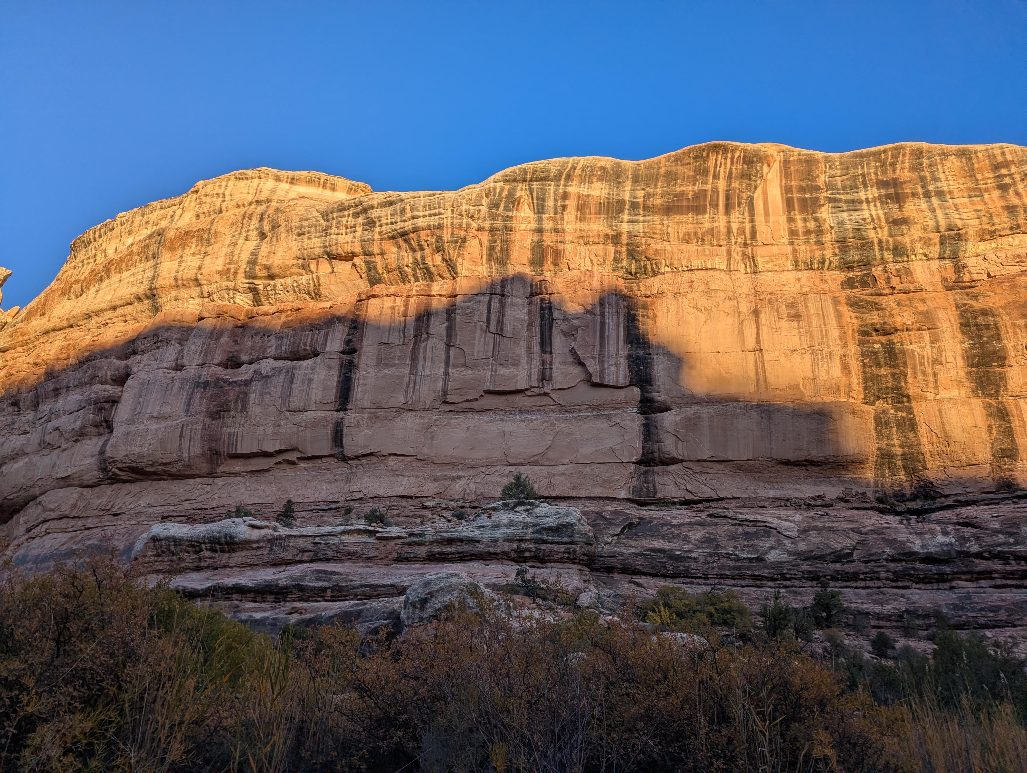
Sunrise in Todie Canyon
Split Level Ruin
Ruins the second bend down from Todie
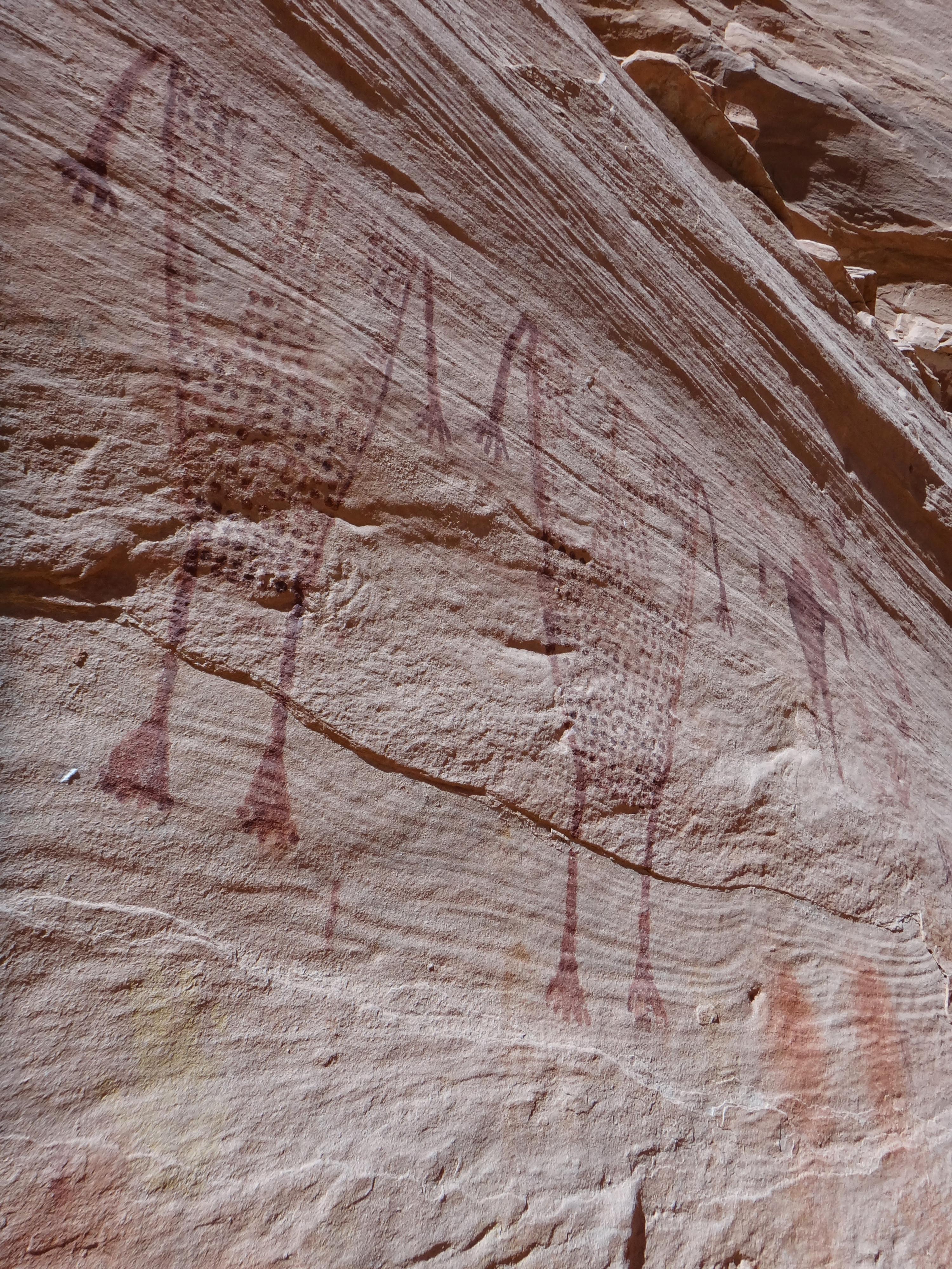
Ruins near the Bushwhack Rock Art
Petroglyphs near The Thumb
Some of the Bushwhack pictographs.
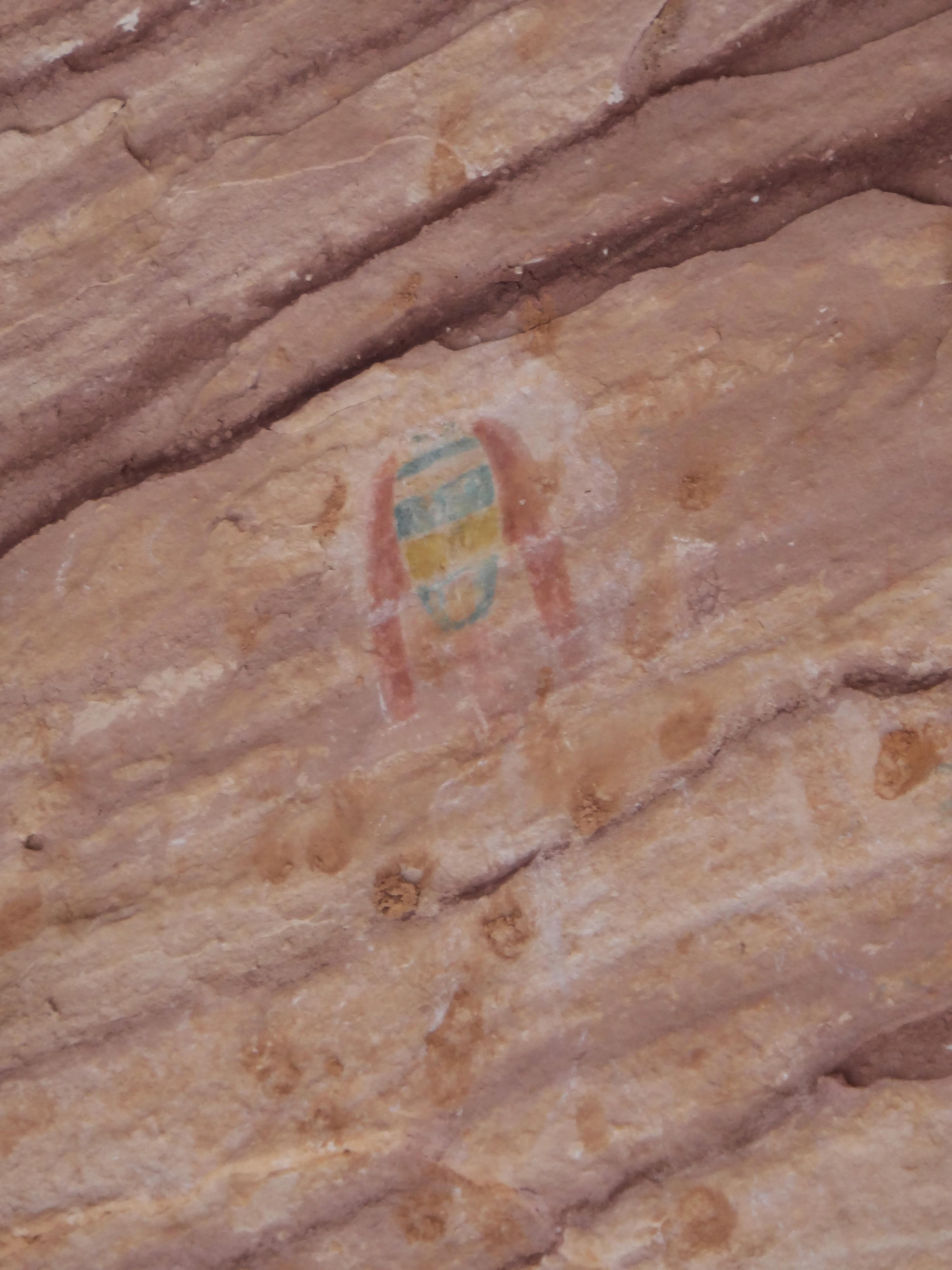
The Green Mask at the Green Mask site in Sheiks Canyon
Pictographs at Green Mask Site
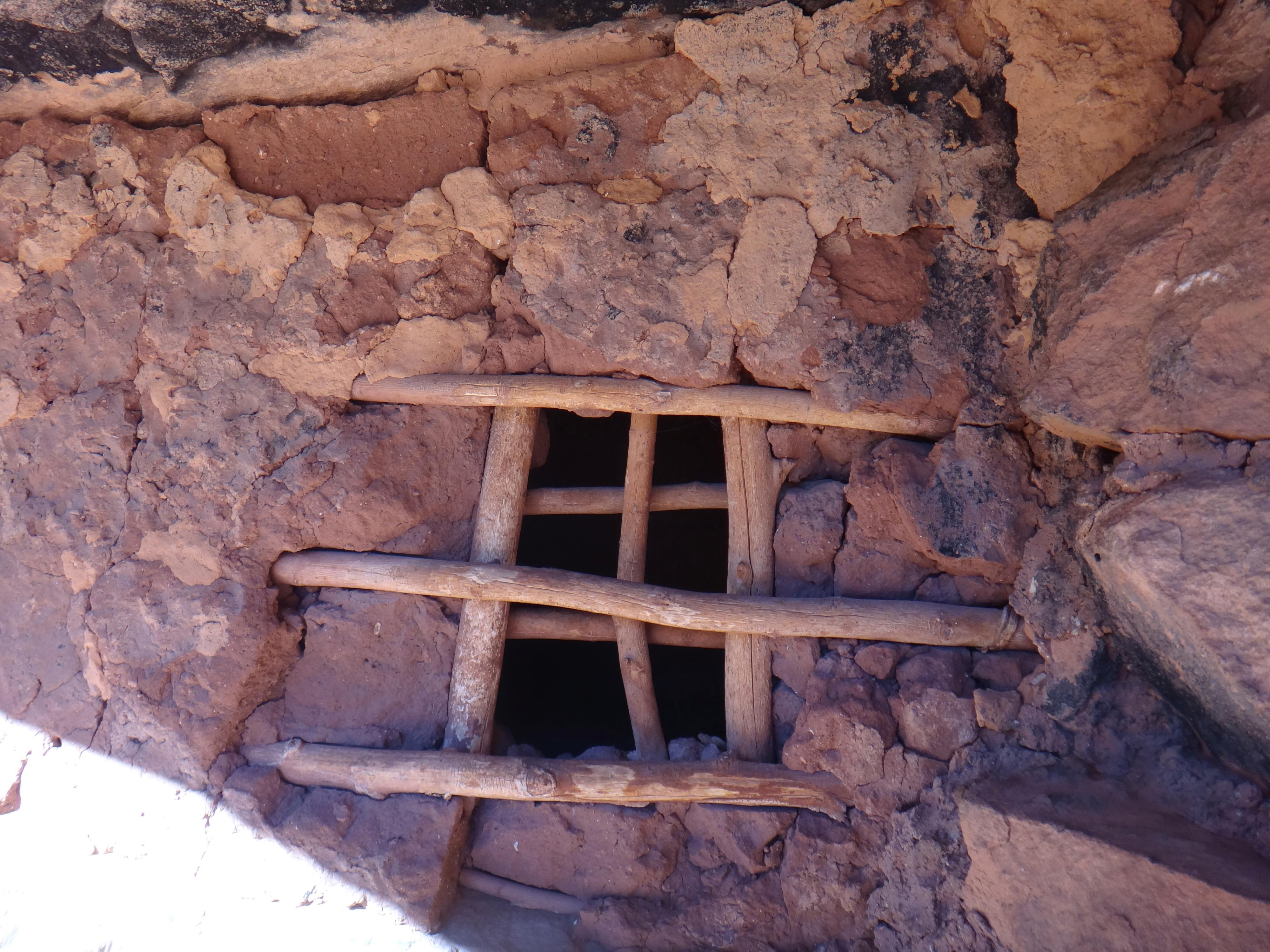
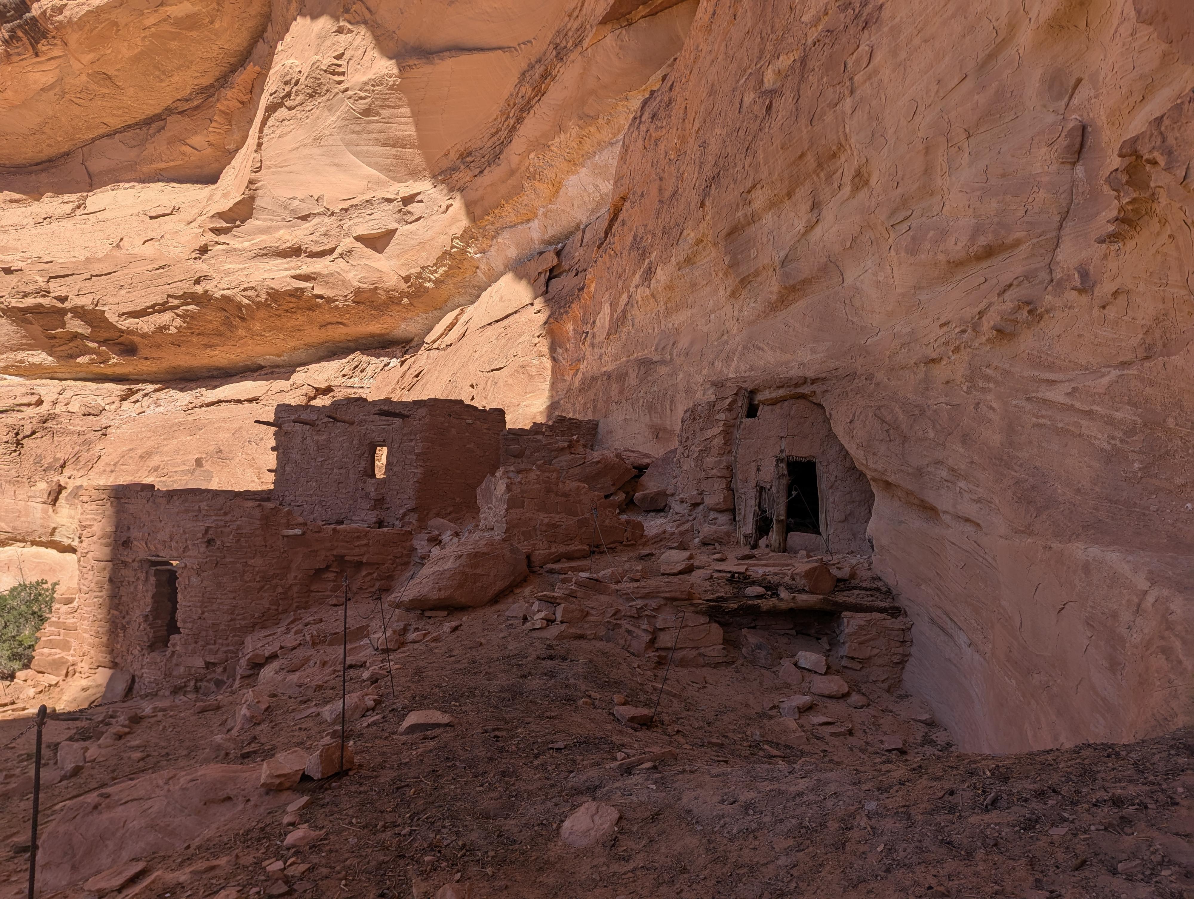
Jailhouse Ruin in Bullet Canyon
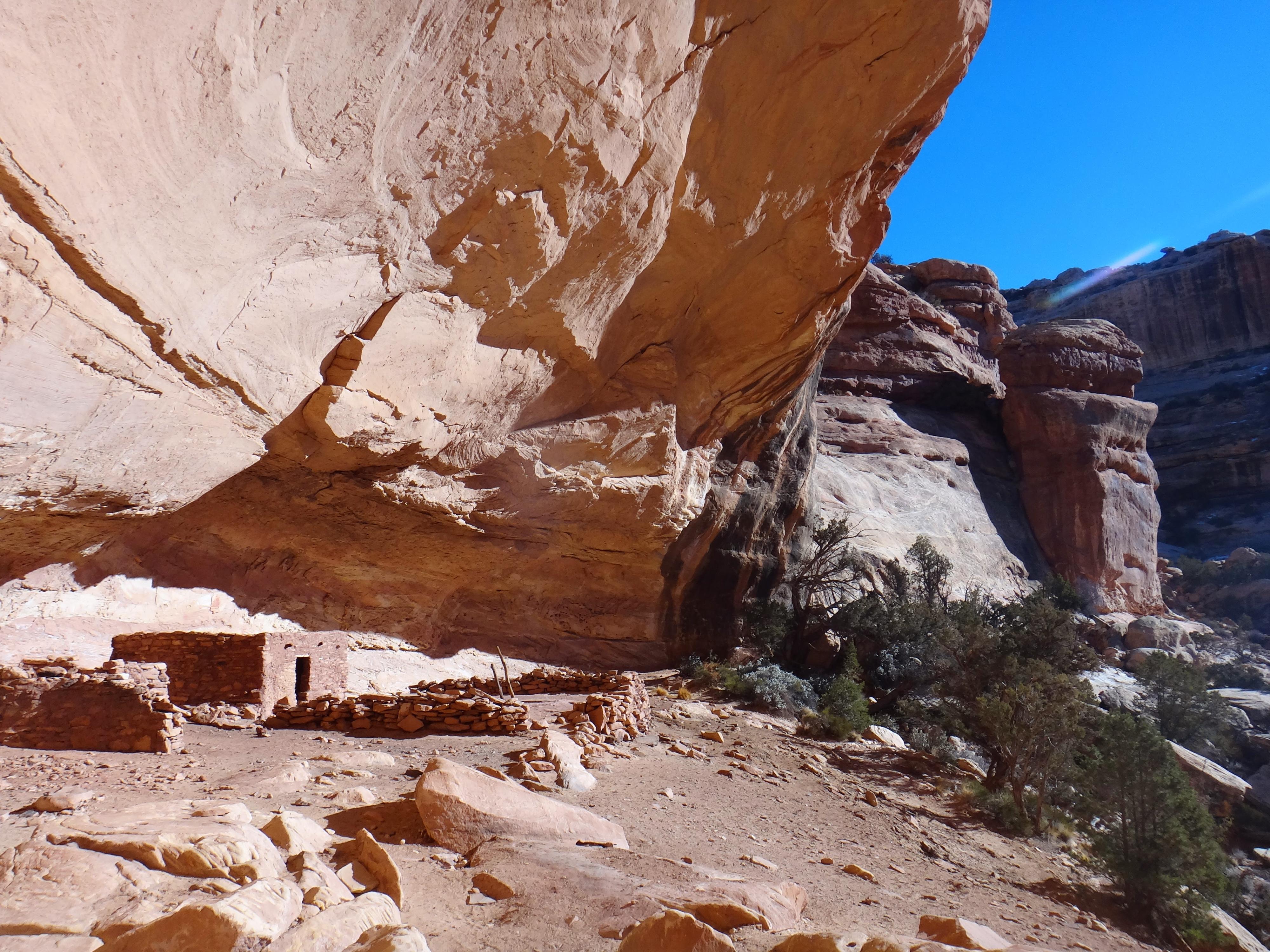
Perfect Kiva Ruin in Bullet Canyon
Photos
Videos
Backpacking Kane Gulch to Bullet Canyon - Grand Gulch
Maps
")
")
")
")
")
")
")
")
12S 597570E 4153623N
37°31'28"N 109°53'45"W
12S 597291E 4153544N
37°31'25"N 109°53'56"W
12S 596464E 4153102N
37°31'11"N 109°54'30"W
12S 593871E 4152249N
37°30'45"N 109°56'16"W
12S 593855E 4152358N
37°30'48"N 109°56'17"W
12S 593054E 4151962N
37°30'36"N 109°56'50"W
12S 593293E 4151738N
37°30'28"N 109°56'40"W
12S 592903E 4151629N
37°30'25"N 109°56'56"W
12S 592154E 4149630N
37°29'20"N 109°57'27"W
12S 592198E 4149619N
37°29'20"N 109°57'25"W
12S 592499E 4149801N
37°29'26"N 109°57'13"W
12S 594719E 4148877N
37°28'55"N 109°55'43"W
12S 592519E 4149949N
37°29'31"N 109°57'12"W
12S 593413E 4149781N
37°29'25"N 109°56'36"W
12S 591994E 4149465N
37°29'15"N 109°57'34"W
12S 591931E 4149582N
37°29'19"N 109°57'36"W
12S 591455E 4149163N
37°29'05"N 109°57'56"W
12S 590970E 4148866N
37°28'56"N 109°58'16"W
12S 590949E 4148942N
37°28'58"N 109°58'17"W
12S 590552E 4149017N
37°29'01"N 109°58'33"W
12S 590348E 4148623N
37°28'48"N 109°58'41"W
12S 590103E 4148724N
37°28'52"N 109°58'51"W
12S 589208E 4148229N
37°28'36"N 109°59'28"W
12S 588184E 4148044N
37°28'30"N 110°00'10"W
12S 588018E 4147851N
37°28'24"N 110°00'16"W
12S 587401E 4147527N
37°28'14"N 110°00'42"W
12S 587130E 4146747N
37°27'49"N 110°00'53"W
12S 587756E 4146950N
37°27'55"N 110°00'28"W
12S 586883E 4146643N
37°27'45"N 110°01'03"W
12S 586949E 4146629N
37°27'45"N 110°01'00"W
12S 586832E 4146500N
37°27'41"N 110°01'05"W
12S 586655E 4146130N
37°27'29"N 110°01'13"W
12S 586716E 4146066N
37°27'27"N 110°01'10"W
12S 586715E 4145889N
37°27'21"N 110°01'10"W
12S 592920E 4143192N
37°25'51"N 109°56'59"W
12S 592107E 4142862N
37°25'41"N 109°57'32"W
12S 587734E 4143712N
37°26'10"N 110°00'30"W
12S 587299E 4143895N
37°26'16"N 110°00'47"W
12S 587033E 4143751N
37°26'11"N 110°00'58"W
12S 585743E 4144053N
37°26'22"N 110°01'51"W
12S 585250E 4144868N
37°26'48"N 110°02'10"W
12S 585692E 4145077N
37°26'55"N 110°01'52"W
12S 585873E 4145485N
37°27'08"N 110°01'45"W
12S 586493E 4145564N
37°27'10"N 110°01'19"W
12S 586947E 4145633N
37°27'13"N 110°01'01"W
12S 586927E 4145674N
37°27'14"N 110°01'02"W
12S 588579E 4145672N
37°27'13"N 109°59'55"W
12S 588679E 4145645N
37°27'12"N 109°59'50"W
12S 589130E 4145714N
37°27'14"N 109°59'32"W
12S 589445E 4145443N
37°27'06"N 109°59'19"W
12S 589930E 4145184N
37°26'57"N 109°58'60"W
12S 590408E 4145079N
37°26'53"N 109°58'40"W