 Hiking
Little Sand Flat
Hiking
Little Sand Flat
Cathedral Valley
Overview
When looking for a long, off-the-beaten-path loop in Capitol Reef National Park, Little Sand Flat caught my eye. The attraction, for me, was an old and overgrown track that had been used at one time to drill an exploratory well. The track provides an easy-to-follow path from the Cathedral Valley road deep into an obscure and seldom visited northern area of the park. The hike did not disappoint! Diverse geology, stunning views, the historic road, and seemingly endless solitude made for an excellent day out.
Though I had hoped this might turn out to be a good route for a family backpack in the future, after an extended dry period, I found NO WATER on the hike. I encountered numerous deep potholes and places I would expect water, but nothing more than slightly damp sand on my visit. If you can time it to visit after known precipitation, or don't mind carrying all the water needed for a backpack, this would be an exceptional place to spend a night and explore more.
Getting There
The trailhead is reached via the Cathedral Valley road. From the visitor center, head east on UT-24 for about 12 miles to mile post 91 where a dirt road leaves on the left (north) side signed River Ford. Reset your odometer as you turn off the highway.
Route Description
To Little Sand Flat
From the trailhead, follow the trail west. It follows the old track and is heavily used at the start. The track descends steeply down to the floor of the South Desert near Jailhouse Rock. On my visit, the old track had seen a lot of foot traffic for the first 2.5-ish miles as it heads to a scenic spot with views of a tower named Temple Rock, and a spot where the volcanic black dike passes through the area. Keep a close eye on the map and terrain to stay on the old track. It can be hard to spot in areas, especially if it hasn't seen recent traffic.
About 3 miles from the trailhead, Deep Creek comes in from the west, and Polk Creek from the north. The track, to me, was hard to stay on here, but the goal is to start heading west up the bottom of Deep Creek. Less than 1 mile up Deep Creek the old track leaves on the left and is easily visible as an old road cut if you are looking for it.
Take the old road up and out of Deep Creek. It gains elevation as it heads southwest, soon showing a large switchback going up the steeper section of hillside. The effort to put this road in is impressive to me.
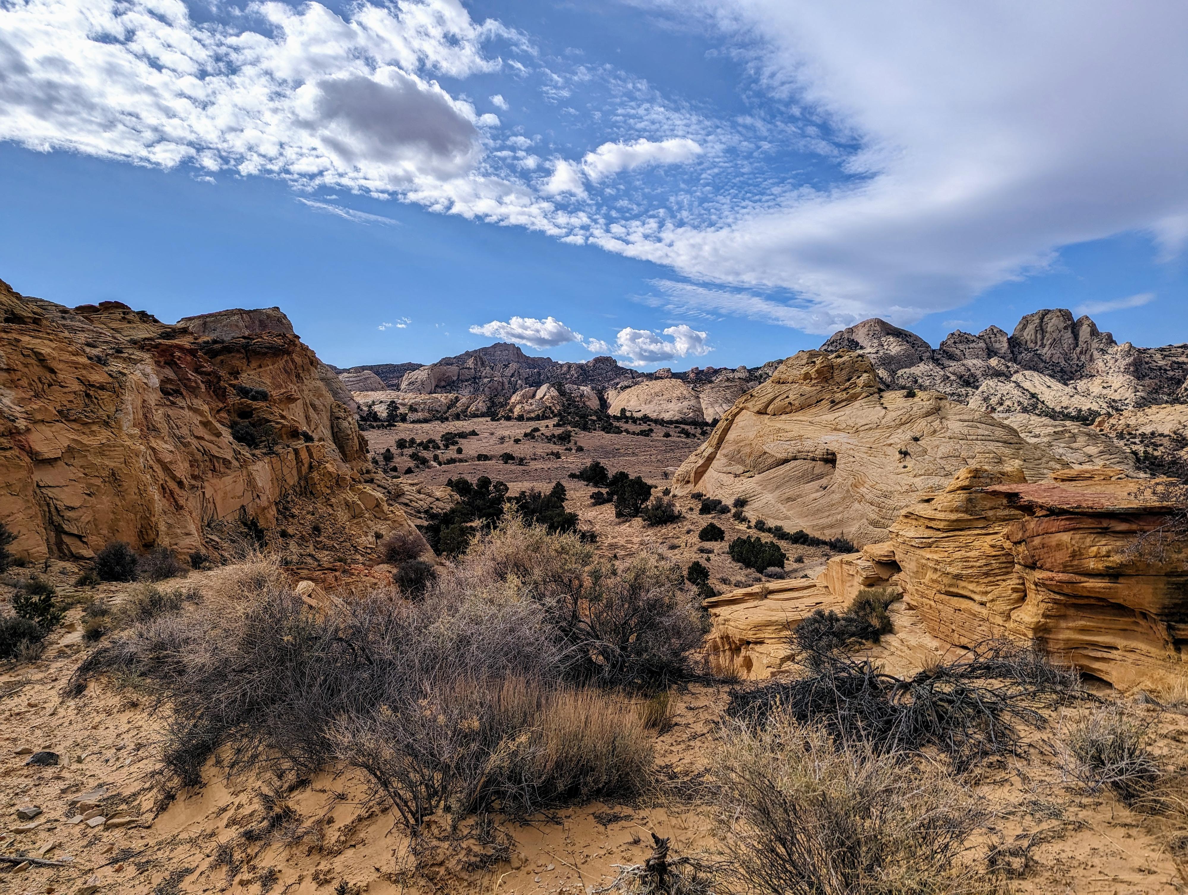
After the switchback, the road finally flattens a bit before turning south and descending into Little Sand Flat. The scenery here changes to towering domes and big views to the west of Thousand Lake Mountain and Water Canyon below.
The track heads southwest across the flat. It can be a little hard to spot in places, but aim for the widest wash coming in on the southwest corner of Little Sand Flat. Start up the wash. I did not see the track again until a few minutes up the wash where the old track leaves on the left through a notch.
The old track passes up through a canyon and meanders around a point, continuing up to the high point of the track. Amazing views! The track descends left from this high point, but instead, go right. A short slot is visible a minute or so from the track, and worth a few minutes to explore. Then head south and west to re-join the track that is visible along the way. This cuts off a loop of the track, making the distance a little shorter and more scenic.
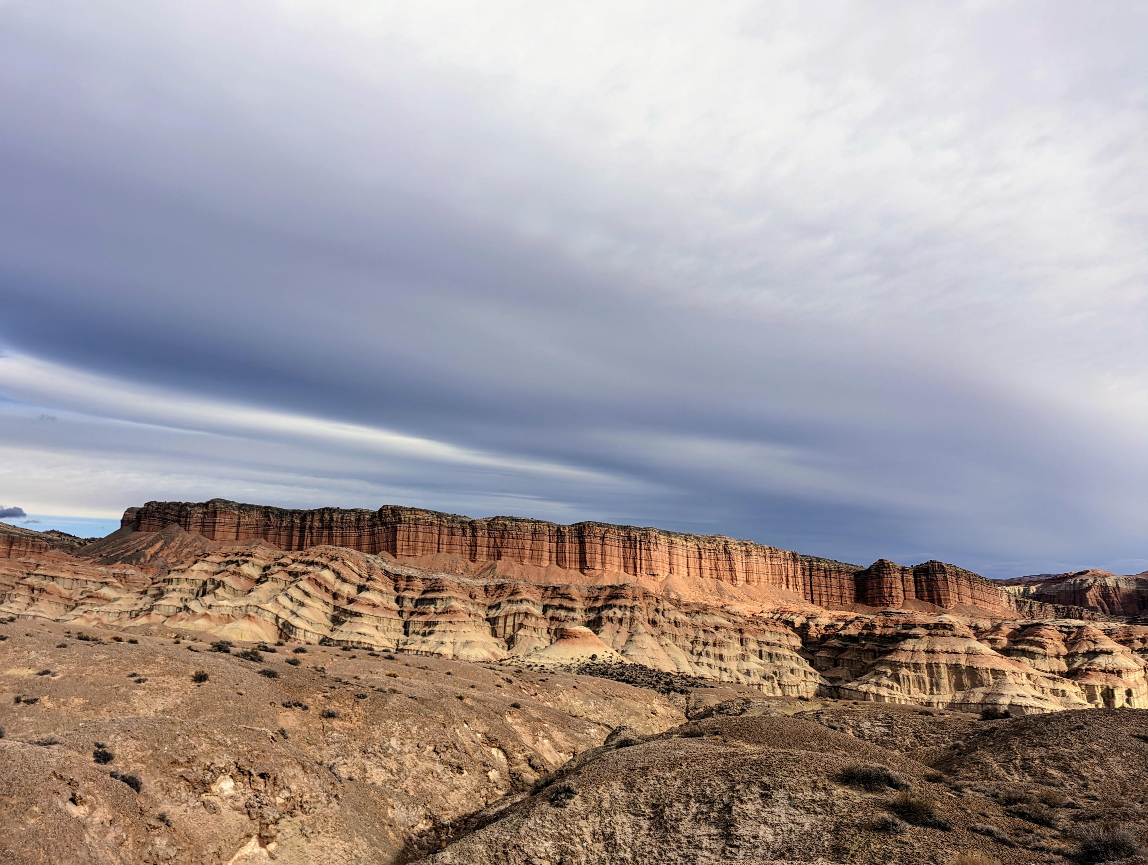
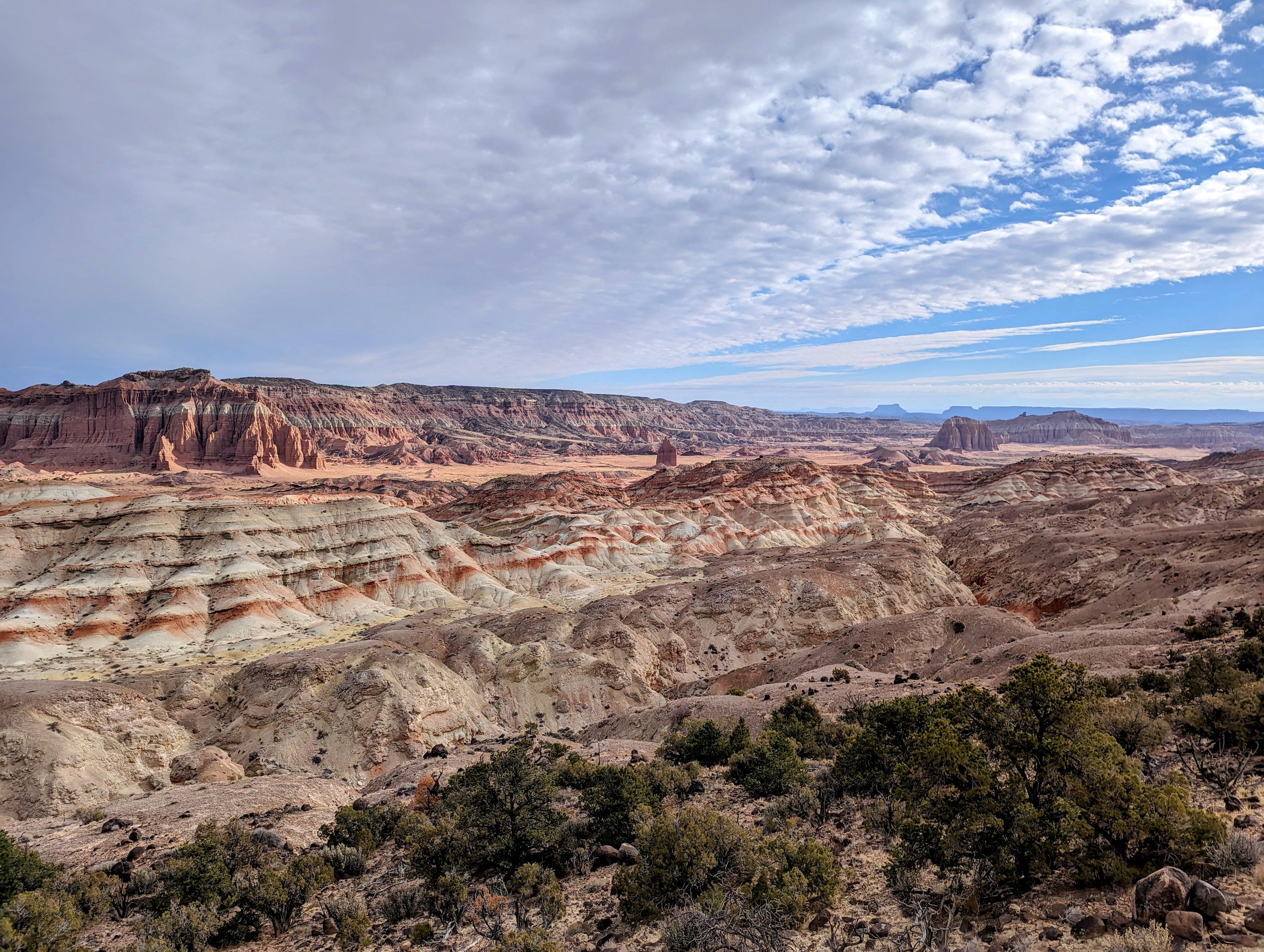
The geology of this area is very different from before. Follow the track a few more minutes to where it begins descending to a canyon bottom. Looking southwest from here, you may notice two arches in the distance. The canyon it crosses is the return canyon for those hiking the full loop.
Return Canyon
If you still feel up for the full loop, head down the canyon. It is mostly fairly wide, and dotted with small obstacles and dryfalls. All dryfalls I passed on the right. All seemed fairly straightforward except two. The first comes about a 1/2 mile down canyon. It appears to be easily passable on the far right, but instead, go right just a minute or so until you can lose a little elevation, then work back left to right under the dryfall and down. An animal trail made this easier to find on my visit.
The canyon is mostly easy walking with great views of domes and towers dotting the skyline. The volcanic dike that is prominent through much of this region and in the western San Rafael Swell makes a dramatic intrusion across the canyon at one point.
The second major dryfall is reached about 3.5 miles down the canyon, just when I thought the canyon was about done! The dryfall, from the top, has a natural bridge visible part way down it. Go right (south), staying on the upstream side of the ridge for a couple of minutes until it is easy to reach the ridge. You should see a few easy descent options down the dirt and rock slope. The dryfall has a huge pool area at the bottom that was dry on my visit, but in most wet times would hold a lot of water.
After the second major dryfall, the Navajo Sandstone walls begin to subside and change to dirt slopes.
In about a mile, a fairly major wash enters from the left. Head up the wash a couple of minutes, looking for an animal trail up to the right (east) side. Work up to the rim, being careful to avoid the crypto biotic soil that is everywhere. Once on the rim, you can see Jailhouse Rock off in the distance. On my visit, there was a pretty well-worn animal path along the rim. I followed it north briefly, until washes and animal tracks began heading down toward Jailhouse Rock. This will require some patience and persistence to avoid the crypto biotic crust. I assume most washes would work, but the path I took shown on the map worked well. It descends though a lovely, colorful deep wash before reaching the main drainage (Deep Creek). Follow it downstream until you can easily get to Jailhouse Rock and re-trace the approach route.
Photos
Maps
12S 482196E 4250686N
38°24'15"N 111°12'14"W
12S 481791E 4250547N
38°24'11"N 111°12'31"W
12S 481795E 4250573N
38°24'12"N 111°12'31"W
12S 476934E 4250958N
38°24'24"N 111°15'51"W
12S 474899E 4249382N
38°23'32"N 111°17'15"W
12S 473976E 4248804N
38°23'13"N 111°17'53"W
12S 473397E 4248050N
38°22'49"N 111°18'16"W
12S 472980E 4247722N
38°22'38"N 111°18'34"W
12S 473053E 4247703N
38°22'38"N 111°18'31"W
12S 473628E 4247751N
38°22'39"N 111°18'07"W
12S 474849E 4247967N
38°22'46"N 111°17'17"W
12S 476747E 4248793N
38°23'13"N 111°15'58"W
12S 477900E 4248890N
38°23'17"N 111°15'11"W