 Hiking
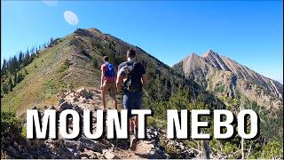
Mount Nebo
Hiking
Mount Nebo
Utah County Highpoint
Overview
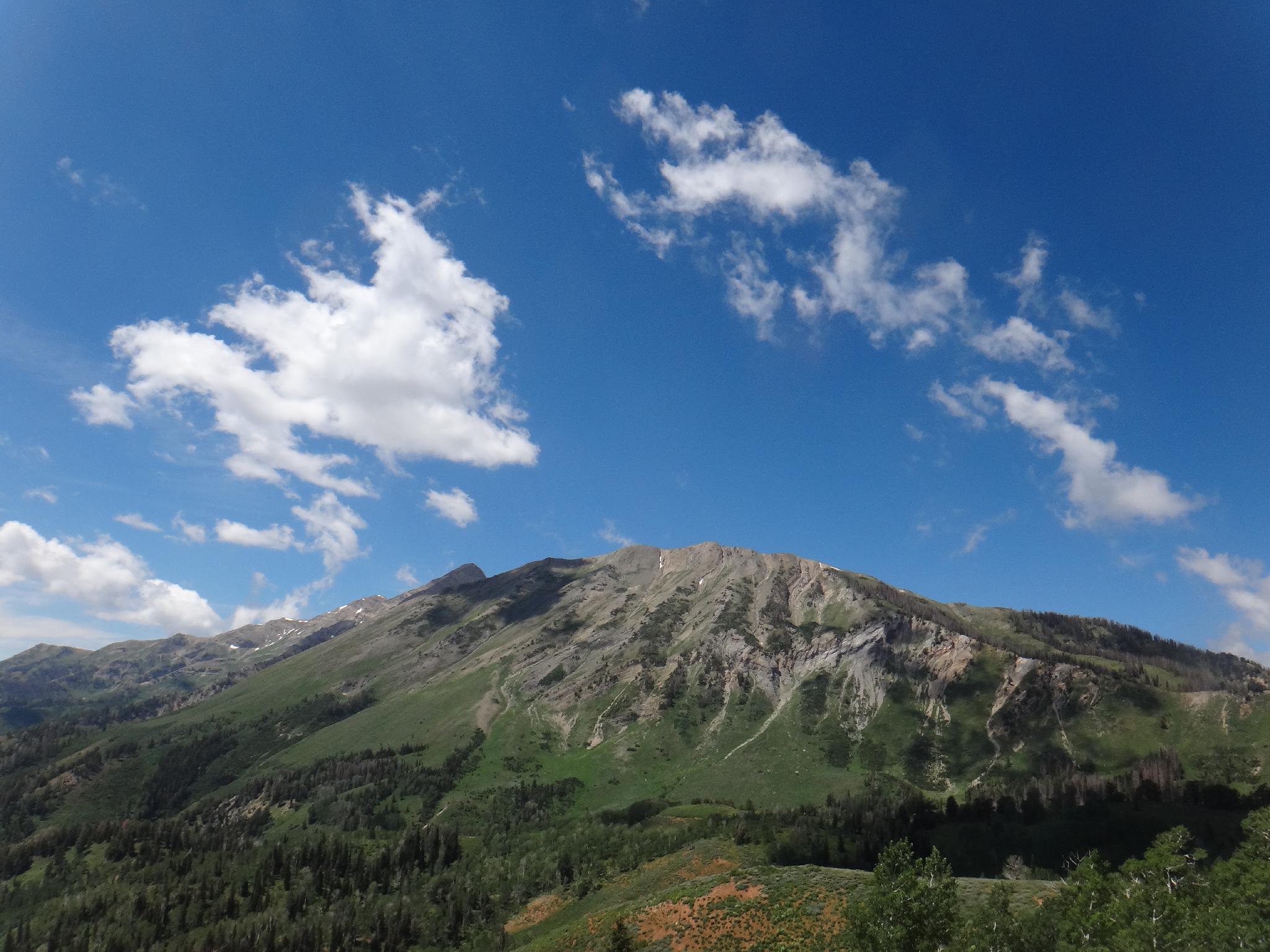
Many people think Mt. Timpanogas is the highest peak in the Wasatch range, however Mount Nebo is 179 feet higher, making it the highest peak in the Wasatch as well as the Utah County highpoint. This is one of my favorite peaks in the Wasatch. The peak is close enough to the Wasatch front to make for a day trip, but is far enough off the beaten path to not feel terribly crowded and has absolutely stunning views both on the hike and from the summit. This one is highly recommended, especially in the fall when the leafs are changing and the Nebo Loop road is in prime foliage ogling season. The name likely comes from the Old Testament.
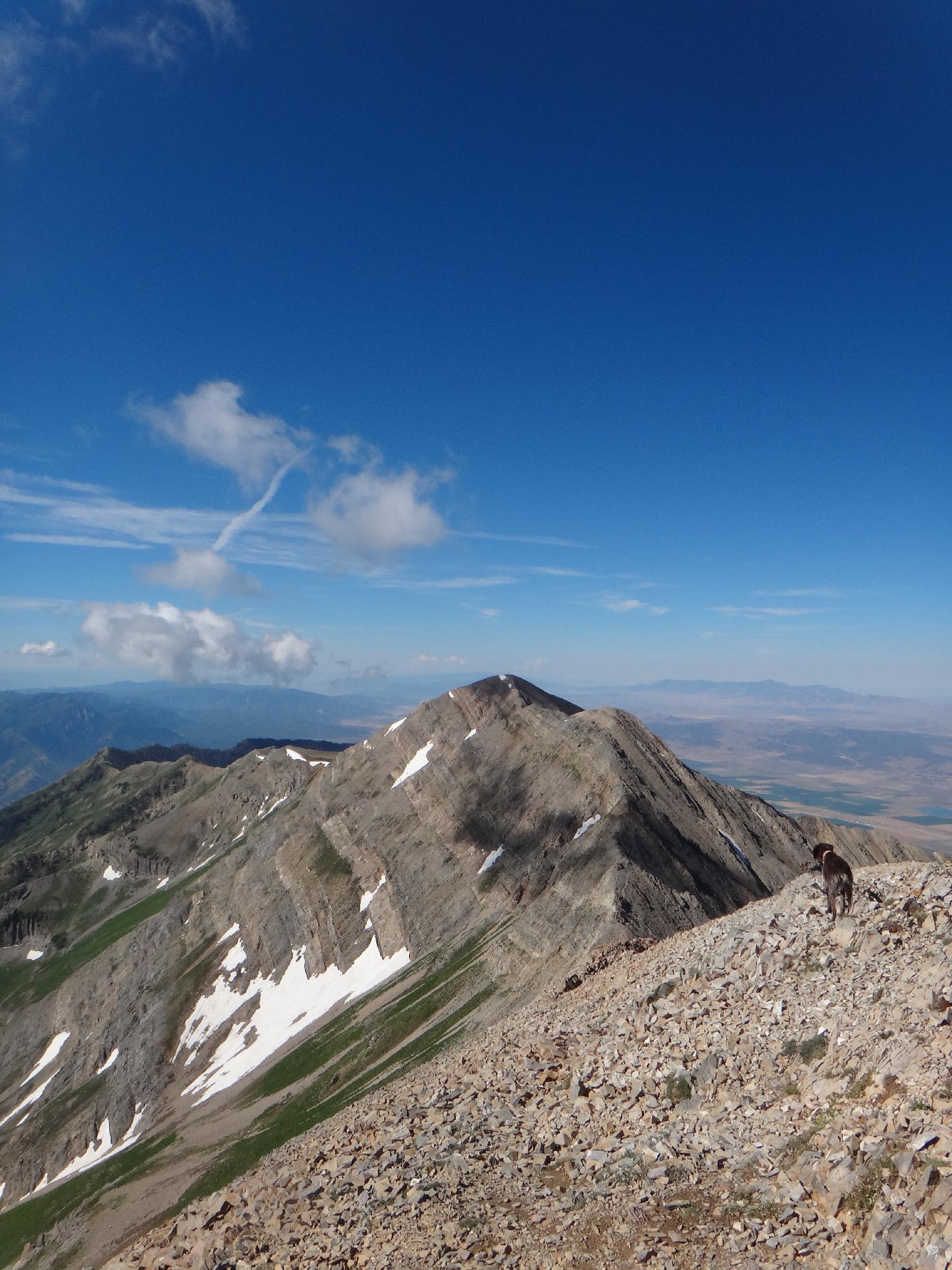
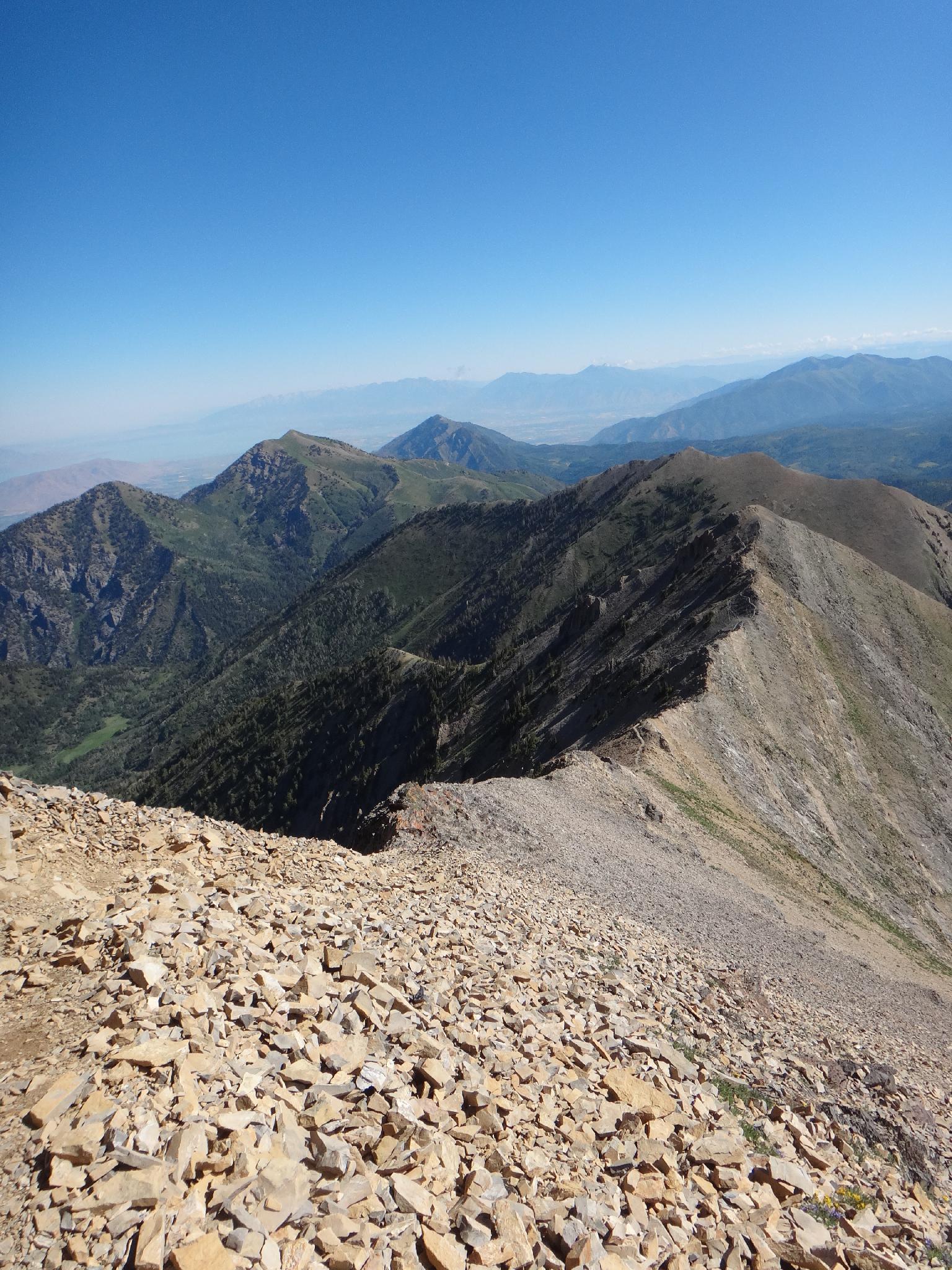
At 11,928 feet, with over 3000 feet of gain, this is likely considered a moderate+ or difficult hike by most. The distance (8-9 miles) and elevation gain wouldn't be too terrible, except the elevation gain seems to come all at once in two short sections, making this a thigh buster. The second of these steep sections being up a rocky ridge-line. Though only class 3, the final ridge-line offers nice exposure and views. The bold will stay on the rocky ridge the entire way, while the more timid can follow trails off of either side of the ridge-line proper.
Getting There
From the north:
- Take exit 250 for I-15 toward Payson
- Go south on Main street for 0.8 miles, then left on 100 North
- Follow 100 North for about 0.5 miles and turn right on 600 East
- Go about 24 miles on the Nebo Loop road to the Nebo Bench / Monument Trail on the right
- Instead of pulling into the Monument Trailhead, follow the Mona Pole Road 0.4 miles to trailhead on the left.
There is a sign at the trailhead and a decent camping spot right across the road.
Route Description
Summit: 3636 m ( 11930 ft. )
Trailhead: 2822 m ( 9259 ft. )
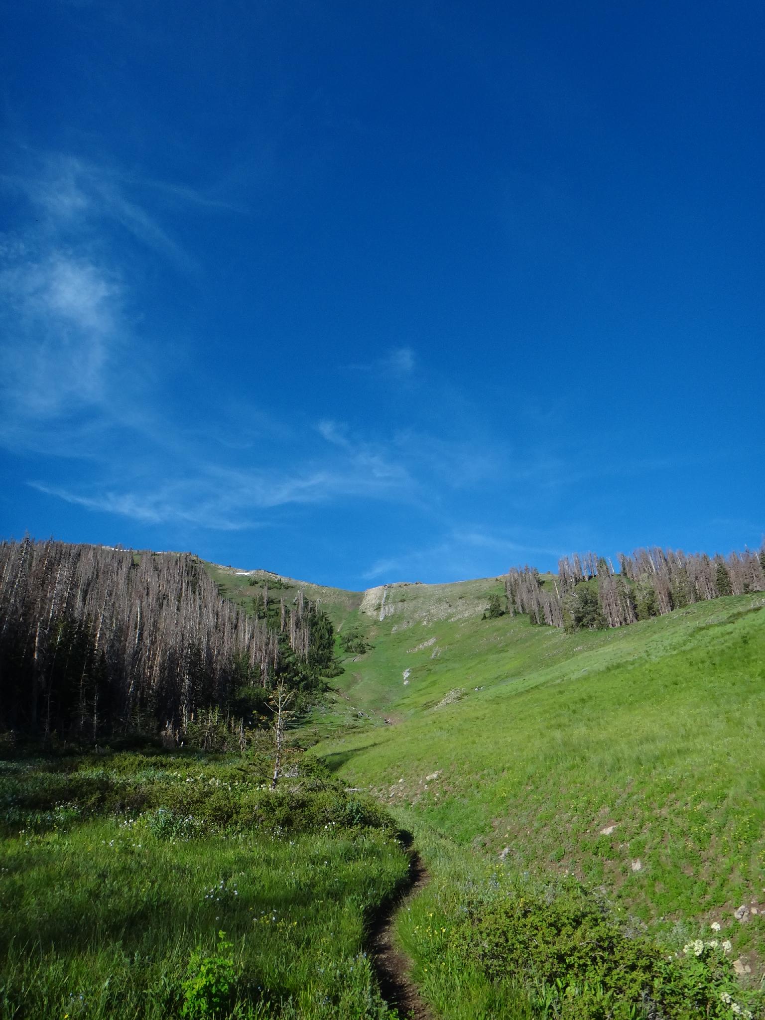
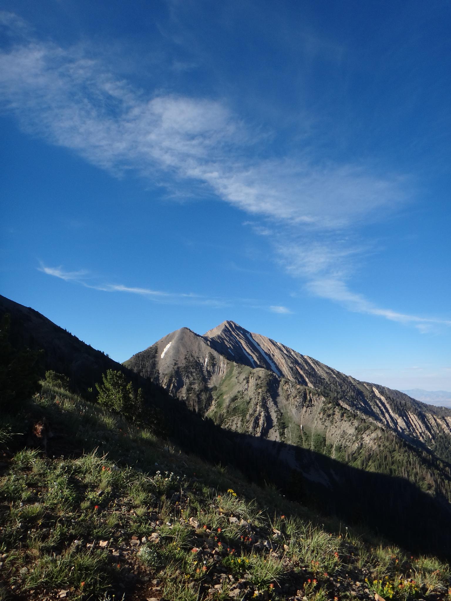
From the trailhead, follow trail 089 as it follows the fence line. North Peak is visible to the west, and the first objective. The trail meanders up, then looses a little elevation before beginning to climb again and leaving the fence. Soon the first steep section is encountered as the trail steeply climbs to the ridge of North Peak. The ridge to Mount Nebo is visible one you ridge the top of the climb, and can seem a bit daunting for this vantage point.
The trail heads south along the North Peak ridge briefly before contouring off to the west to Wolf Pass. Some stay on the ridge and bag North Peak on the way to Wolf Pass, however the trail is easier, though a little bit longer. Wolf Pass offers stunning views toward Ephraim, and a good place to catch your breath before the final big up.
The trail climbs the ridge steeply to a small false summit, where the ridge traverse begins. A use trail just off the west (right) side of the ridge offers easy passage, but staying on the ridge proper offers a bit more scrambling fun to the summit.
Most will return the same way, though some may want to continue south to back the middle and south summits before returning.
Maps

12S 438239E 4411185N
39°50'54"N 111°43'19"W
12S 434923E 4408258N
39°49'19"N 111°45'37"W