 Canyoneering
Laughing Baboon Canyon
Canyoneering
Laughing Baboon Canyon
Waterpocket Fold
Overview
Most do Happy Dog after doing Smiling Cricket. All of the groups I had talked to had recommended Happy Dog over Laughing Baboon. Even so, our group opted for Laughing Baboon after doing Smiling Cricket, partly due to energy levels, partly due to gear issues. I was definitely not disappointed!
Laughing Baboon Canyon is quite straightforward and easy, but also diverse with some excellent sections and some so-so sections, and in my opinion makes for an overall fun day. Maybe the low expectations others had put on the canyon made it a pleasant surprise. We played the "who can stay dry the longest game" on our trip, which added a bit of fun. The canyon CAN hold a fair bit of water. Wetsuits not needed on hot days, but in cooler seasons I would recommend one.
Getting There
The trailhead is off the Burr Trail road. Reach it by going to Ticaboo, Utah near Bullfrog.
From Ticaboo, go south toward Bullfrog on UT-276 for about 7 miles to the signed junction with the Burr Trail / Notom Road. Go right on the Bull Trail/Notom Road, reset your odometer.
- 5.0 miles, the road crosses a wash.
- 6.8 miles, pullout on the left (west) side of the road. This is the trailhead. ( 12S 517759mE 4163249mN )
Route Description
The route described here is the shortest overland approach. The area can also be approached from Halls Creek proper, or from the Lake. The Halls Creek approach is longer but more scenic. The Lake Powell approach requires a boat, and simply hikes up Halls Creek from Lake Powell. I would recommend the approach described here unless it is hot, and then I would recommend the Halls Creek approach. If you have a boat, the Lake Powell approach would be the shortest/fastest.
To Millers Creek (5.5 miles / 3-5 hours)
The route from the Burr Trail road is about 5 miles to Halls Creek. En route, there isn't much shade, and the terrain is difficult to navigate. GPS or excellent map and compass skills required to find the top of the Rubble Pile. Though only 5 miles, expect 3-5 hours for the approach/exit. In full heat of the summer, our group suffered mightily! Start early if it's hot!
From the trailhead, hike due west, descending into Long Canyon. Route find out of Long Canyon and continue west to the low point on the ridge above and a large mushroom shaped rock. There are many options here, but crossing Long Canyon may require a bit of route finding. The route marked on the map seemed easiest.
From the ridge, the Waterpocket Fold is visible to the west. The route finding gets a bit trickier here. From the ridge, go in a west/southwest direction and down a shallow drainage that soon coalesces with a more major drainage at a tamarisk surrounded seep. Go down the more major drainage to a small dryfall where the wash changes layers.
At the top of the dryfall, leave the wash and head due west. The route will cross over a ridge, and descend into another drainage, hopefully right across from another drainage with a few trees near the bottom. Go up the drainage and climb out on the left at a reasonable spot. Once out, continue west/southwest to the top of the rubble pile. Two cairns, one on each side of the small saddle, made finding the top of the rubble pile easy once within proximity of it.
From the top of the rubble pile, follow a cairned and emerging trail down. It traverses right (north), descends steeply through a band, then cuts left (south) along a shelf until an easy low angle path is found down to the Halls Creek social trail below. There are no difficult spots, so if you end up finding climbing problems, look around for an easier path.
Once on the Halls Creek social trail, go left (south) to the first major slickrock dome just right of the trail. Leave the trail, skirt around the dome on the west side, and find an easy descent route into Halls Creek. Once in the creek, it is a short distance to Millers Creek coming in on the right.
Approach (1 hour or less)
From Millers Creek, hike down Halls Creek 10-15 minutes past Happy Dog. Just before Halls Creek cuts through a layer of sandstone, work west and up the sandstone slab. Trend left (south) as you ascend the slab. There are many options. At the high point, Laughing Baboon is on the left (south). A minute or two west a side drainage dumps into Laughing Baboon. Work down the right side of this drainage (looking down the drainage.) A bit of easy scrambling and loose dirt reach a bowl and the first rappel.
Canyon
The bowl requires a low angle 30 m ( 99 ft. ) rappel. Don't pull your rope! Once down, walk to the edge to make sure there is a good anchor for the next rappel. On our trip, this was two equalized bushes. The second rappel is about 50 m ( 165 ft. ) and ends in a gully above the canyon floor. A short scramble down the gully leads to a final 40 m ( 132 ft. ) rappel off an old bolt (or one of the many chock stones) to the canyon floor of Baboon.
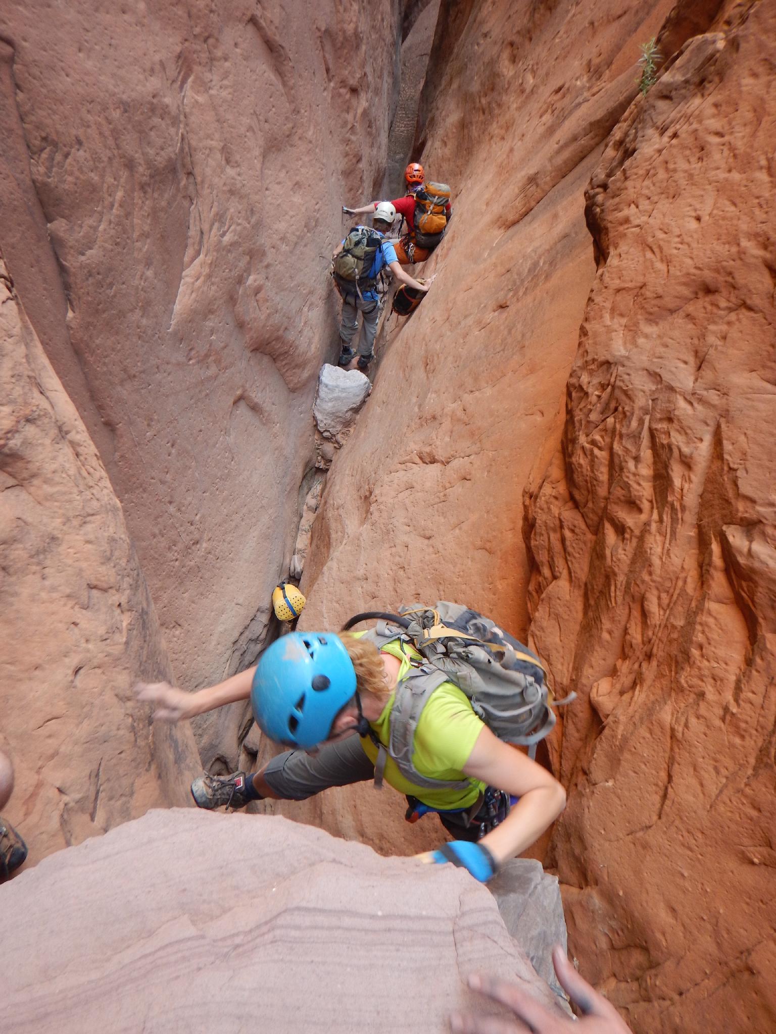
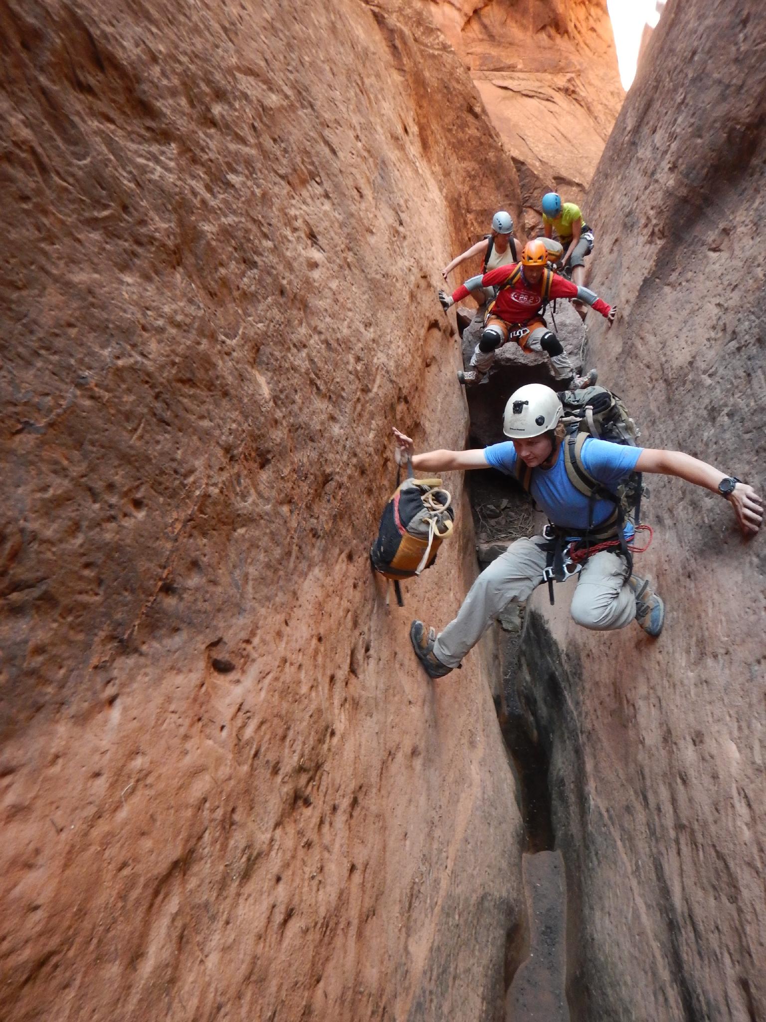
Let the canyon begin! Continuing down Baboon, the canyon is deep and straight walled. A few down climbs in this section may require some team work, but nothing is particularly difficult. One 5 m ( 17 ft. ) drop will likely need to be rappelled as it goes over a large chockstone and is difficult to squeeze down. Consider dropping the rope over the boulder and using counter weight as an anchor. Shortly down canyon is a bigger 7 m ( 23 ft. ) drop that will need to be rappelled as well.
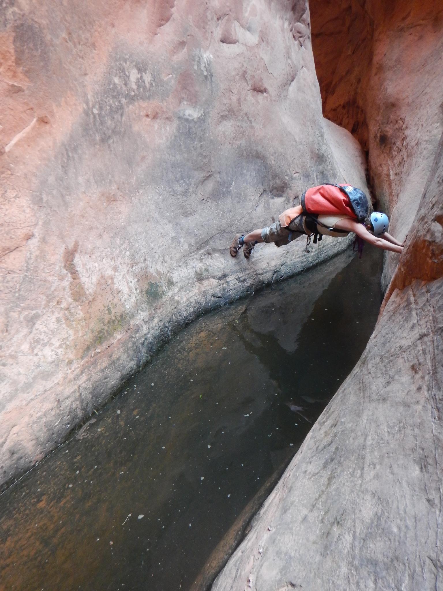
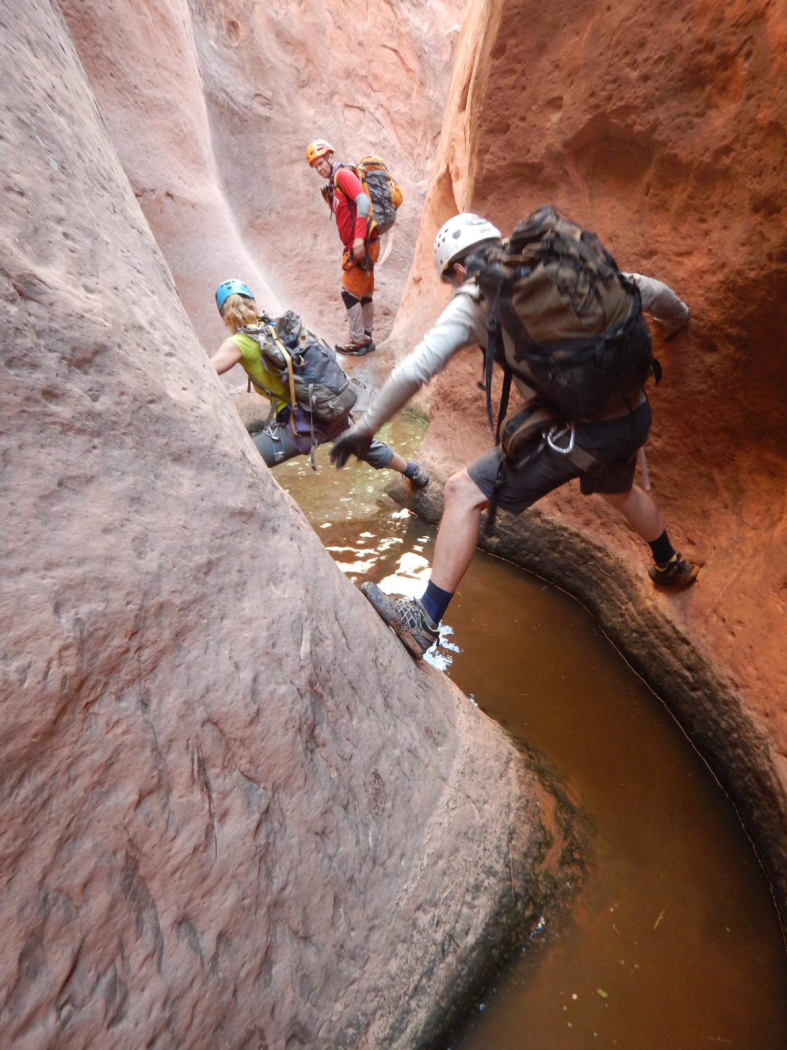
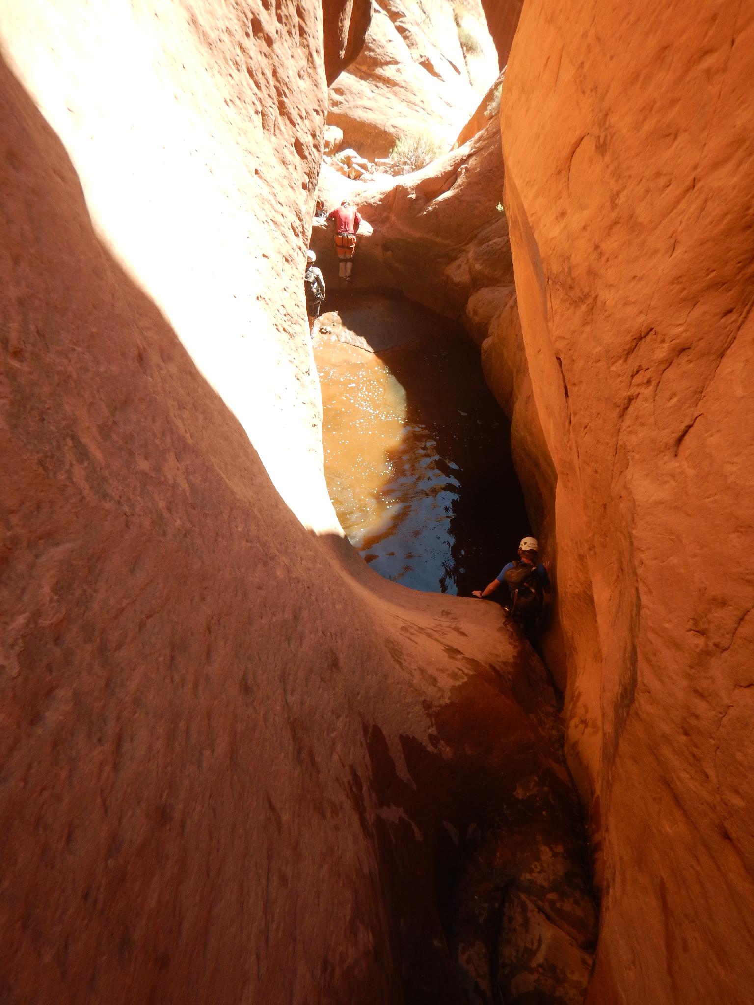
The canyon suddenly narrows and begins curving downward, getting more interesting and more visually stunning. There is one pool in this section that may require a partner assist to get out of. The canyon soon opens.
As the canyon opens and you think it is done, it drops and cuts through another section of Navajo Sandstone. The first drop is about 5 m ( 17 ft. ) into what looks like a gigantic keeper pothole. This, on our trip, turned to be an easy exit. Given the slickrock ramp out, it would likely take exceptionally low water to become a keeper.
Just below the first rappel is another short 5 m ( 17 ft. ) rappel into a pool. Swim around the corner to find? An easy exit. This section of slot is beautiful and well sculpted. Just below the rappel is a low angle downclimb into a large pothole. This one is difficult enough to require a partner assist for some, or big jump and mantle for the taller members of the group.
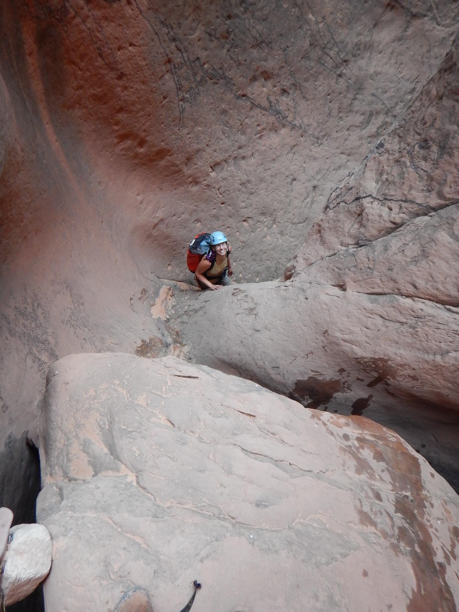
Another big downclimb (or rappel for some) leads to another large pool. Just after this pool, the canyon opens as the walls come down. Foliage begins choking the canyon bottom. Stay left here, and escape out where easy to avoid too much bushwhacking. There is a spring and pool at the end of Baboon that make for a great respite from the heat.
Turn left at Halls Creek to get back to Millers Creek.
Maps
")
")
12S 517759E 4163248N
37°36'58"N 110°47'56"W
12S 515805E 4162262N
37°36'26"N 110°49'15"W
12S 514933E 4161875N
37°36'14"N 110°49'51"W
12S 513644E 4161025N
37°35'46"N 110°50'44"W
12S 512131E 4160207N
37°35'20"N 110°51'45"W
12S 512080E 4160298N
37°35'23"N 110°51'47"W
12S 512016E 4160304N
37°35'23"N 110°51'50"W
12S 511992E 4159968N
37°35'12"N 110°51'51"W
12S 511826E 4159911N
37°35'10"N 110°51'58"W
12S 511536E 4158844N
37°34'36"N 110°52'10"W
12S 511335E 4158564N
37°34'27"N 110°52'18"W
12S 511412E 4157673N
37°33'58"N 110°52'15"W
12S 510256E 4158200N
37°34'15"N 110°53'02"W