
 Ferron Box Panels
Western Swell
Overview
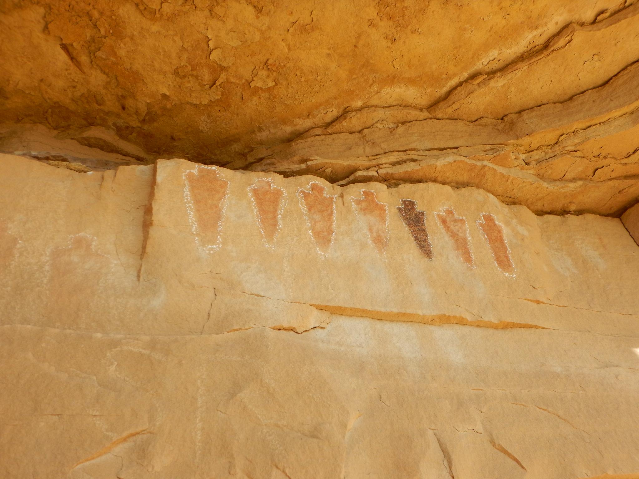
Home of the Segregation Panel and Rainbow Panel, Ferron Box contains two of the most unique panels in the San Rafael Swell. Segregation Panel has 4 red figures, a black figure, and 2 more red figures, all in a line. Very unique! Rainbow Panel is a true work of art, with a rainbow type depiction that contains figures underneath it. The location of the Rainbow Panel, in particular, makes it difficult to photograph and also difficult to vandalize.
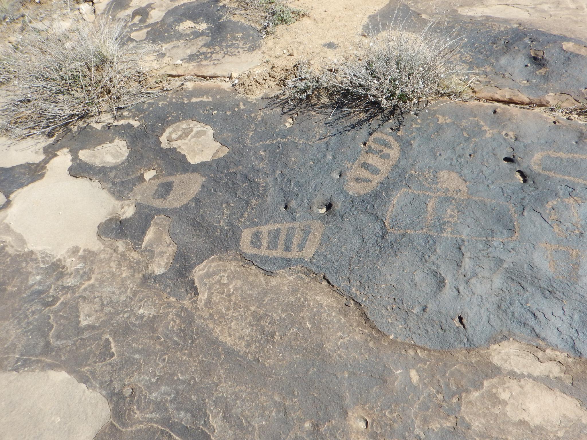
Though Segregation Panel and Rainbow Panel are the main draws, there are several other panels and petroglyphs in the area, including several sets of moccasin petroglyphs which I have never seen anywhere else.
Getting There
From Ferron, UT, head east on 100 S (Molen Road). This is across the road from the Millsite Recreation Sign. Reset your odometer as you turn off main street and onto 100 S.
- 3.0 - 4 way junction. Go right, toward Dutch Flat Desert.
- 3.3 - Road turns to dirt.
- 4.3 - Stay straight on main road through 4 way junction. The road begins heading east.
- 5.6 - Stay straight (don't take the lesser right)
- 7.5 - A side road goes off on the left up a steep hill. Take it, and reset your odometer.
- 0.2 - Top of hill, and junction with roads going off in all directions.
Option 1: Go right, then immediate left and follow this road 1.2 miles to the Loop Junction on the map. Stay on the most traveled road. It has a couple of rough spots, with a VERY rough and steep hill just before the Loop Junction.
Option 2: Go left, then immediate right. Stay on the most travelled. At 0.7 from the main road, go right. 1.4 miles from the main road is the Loop Junction at the bottom of the steep rocky hill from Option 1. This road also has some rough spots, but is likely better than the steep rocky hill on option 1.
The description below uses the Loop Junction as the starting point. This road can be driven or walked.
Route Description
Rock art and historic sites are fragile, non-renewable cultural resources that, once damaged, can never be replaced. To ensure they are protected, please:
- Avoid Touching the Petroglyphs: Look and observe, BUT DO NOT TOUCH!
- Stay on the Trails: Stay on the most used trails when visiting sites, and don't create new trails or trample vegetation.
- Photography and Sketching is Allowed: Do not introduce any foreign substance to enhance the carved and pecked images for photographic or drawing purposes. Altering, defacing, or damaging the petroglyphs is against the law -- even if the damage is unintentional.
- Pets: Keep pets on a leash and clean up after them.
- Artifacts: If you happen to come across sherds (broken pottery) or lithics (flakes of stone tools), leave them where you see them. Once they are moved or removed, a piece of the past is forever lost.
To The Moccasin Tracks
From the loop junction, follow the road due west as it begins descending. After 0.5 miles, the road makes a right at a small grey hill. The Moccasin Tracks are off the road on the left here, in the obvious dark patina sandstone, laying flat on the ground.
To The Main Panels
From the first Moccasin Tracks, follow the road north for an additional 0.5 miles to a log fence and parking area. There are two moccasin tracks about 100' before reaching the log fence on the right, marked by a couple of cairns.
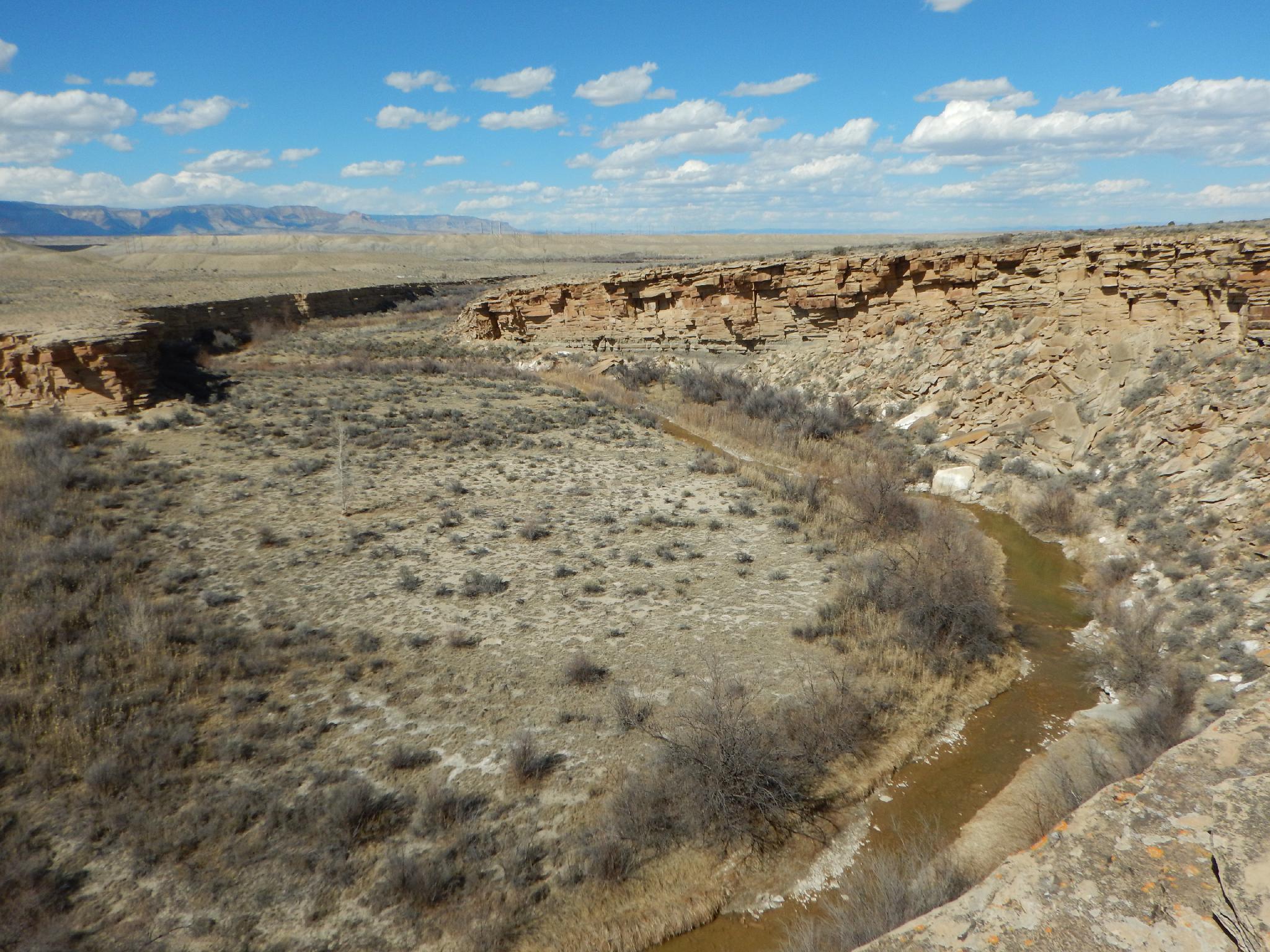
From the parking area, overlooking Ferron Box, hike along the rim and descend to the creek as soon as possible to avoid crossing private land. There is an emerging trail near the bottom. With binoculars, you can see several panels across the creek on private land from here. They are on the up stream side of the bend, where the river is directly under the cliff.
Follow the social trail on the east side of the creek. On the downstream side of the bend, the Segregation Panel and other panels come in to view. Rainbow Panel is just down canyon from Segregation Panel, but is high off the canyon floor. You may need to step back to near the creek to be able to see it.
To return to the parking area, follow the social trail to where the cliffs subside and it is easy to exit on the right, then follow the rim back to the parking area.
Return
From the log fence parking area, follow the road south 0.7 miles (staying on the most used road) to get back to the Loop Junction.
Final Panel
There is one more small panel to see near the Loop Junction. To see it, go south on road 2 minutes to a junction. Go left for a minute to a parking/camping area. There is a small panel in the boulders above this parking area with a social trail going up to it.
Maps

12S 497643E 4326152N
39°05'04"N 111°01'38"W
12S 496742E 4326335N
39°05'10"N 111°02'16"W
12S 497204E 4326979N
39°05'31"N 111°01'56"W
12S 497238E 4326994N
39°05'31"N 111°01'55"W
12S 497239E 4327108N
39°05'35"N 111°01'55"W
12S 497243E 4327116N
39°05'35"N 111°01'55"W
12S 497204E 4327142N
39°05'36"N 111°01'56"W
12S 497175E 4327240N
39°05'39"N 111°01'58"W